Sheridan, Wyoming
| Sheridan, Wyoming | |
|---|---|
| City | |
|
View of south Sheridan from I-90
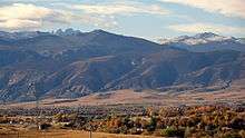 Sheridan looking west towards the Bighorn Mountains | |
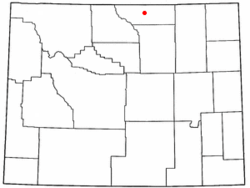 Location of Sheridan, Wyoming | |
 Sheridan, Wyoming Location in the United States | |
| Coordinates: 44°47′48″N 106°57′32″W / 44.79667°N 106.95889°WCoordinates: 44°47′48″N 106°57′32″W / 44.79667°N 106.95889°W | |
| Country | United States |
| State | Wyoming |
| County | Sheridan |
| Government | |
| • Mayor | John Heath |
| Area[1] | |
| • Total | 10.95 sq mi (28.36 km2) |
| • Land | 10.93 sq mi (28.31 km2) |
| • Water | 0.02 sq mi (0.05 km2) |
| Elevation | 3,743 ft (1,141 m) |
| Population (2010)[2] | |
| • Total | 17,444 |
| • Estimate (2012[3]) | 17,698 |
| • Density | 1,596.0/sq mi (616.2/km2) |
| Time zone | Mountain (MST) (UTC-7) |
| • Summer (DST) | MDT (UTC-6) |
| ZIP code | 82801 |
| Area code(s) | 307 |
| FIPS code | 56-69845[4] |
| GNIS feature ID | 1594251[5] |
| Website | www.city-sheridan-wy.com |

Sheridan is a city in Sheridan County, Wyoming, United States. The 2010 census put the population at 17,444 and a Micropolitan Statistical Area of 29,116.[6] It is the county seat of Sheridan County.
History
The city was named after General Philip Sheridan, Union cavalry leader in the American Civil War.[7] Travel book information describe Sheridan as the scene of many fierce battles between US Cavalry and the Sioux, Cheyenne and Crow Indian tribes.
Geography and climate
Sheridan is located at 44°47′48″N 106°57′32″W / 44.79667°N 106.95889°W (44.796720, −106.958970).[8]
According to the United States Census Bureau, the city has a total area of 10.95 square miles (28.36 km2), of which, 10.93 square miles (28.31 km2) is land and 0.02 square miles (0.05 km2) is water.[1]
Climate
Sheridan experiences a semi-arid climate (Köppen BSk),[9] with cold, dry winters and hot, wet summers, though Summers in recent years have been trending more dry.
| Climate data for Sheridan, Wyoming (1981–2010 normals) | |||||||||||||
|---|---|---|---|---|---|---|---|---|---|---|---|---|---|
| Month | Jan | Feb | Mar | Apr | May | Jun | Jul | Aug | Sep | Oct | Nov | Dec | Year |
| Record high °F (°C) | 71 (22) |
76 (24) |
80 (27) |
87 (31) |
95 (35) |
106 (41) |
107 (42) |
106 (41) |
103 (39) |
93 (34) |
81 (27) |
77 (25) |
107 (42) |
| Average high °F (°C) | 36.2 (2.3) |
39.0 (3.9) |
48.4 (9.1) |
57.4 (14.1) |
66.7 (19.3) |
76.7 (24.8) |
87.1 (30.6) |
86.3 (30.2) |
74.2 (23.4) |
60.1 (15.6) |
45.9 (7.7) |
35.2 (1.8) |
59.43 (15.23) |
| Average low °F (°C) | 11.4 (−11.4) |
14.2 (−9.9) |
22.0 (−5.6) |
29.8 (−1.2) |
38.2 (3.4) |
46.4 (8) |
53.0 (11.7) |
51.6 (10.9) |
41.6 (5.3) |
30.9 (−0.6) |
19.4 (−7) |
10.6 (−11.9) |
30.76 (−0.69) |
| Record low °F (°C) | −36 (−38) |
−38 (−39) |
−23 (−31) |
−10 (−23) |
13 (−11) |
27 (−3) |
35 (2) |
26 (−3) |
6 (−14) |
−12 (−24) |
−27 (−33) |
−41 (−41) |
−41 (−41) |
| Average precipitation inches (mm) | .56 (14.2) |
.54 (13.7) |
.97 (24.6) |
1.60 (40.6) |
2.35 (59.7) |
2.12 (53.8) |
1.17 (29.7) |
.71 (18) |
1.43 (36.3) |
1.37 (34.8) |
.70 (17.8) |
.56 (14.2) |
14.08 (357.4) |
| Average snowfall inches (cm) | 9.4 (23.9) |
9.1 (23.1) |
10.4 (26.4) |
9.0 (22.9) |
1.5 (3.8) |
0 (0) |
0 (0) |
0 (0) |
2.8 (7.1) |
5.4 (13.7) |
8.2 (20.8) |
11.7 (29.7) |
67.5 (171.4) |
| Average precipitation days (≥ 0.01 in) | 7.1 | 7.2 | 10.2 | 10.4 | 11.9 | 10.3 | 7.6 | 6.3 | 7.0 | 8.2 | 7.2 | 7.4 | 100.8 |
| Average snowy days (≥ 0.1 in) | 6.8 | 7.8 | 8.0 | 5.0 | .8 | .1 | 0 | 0 | 1.0 | 3.1 | 6.4 | 8.0 | 46.7 |
| Mean monthly sunshine hours | 155.0 | 172.3 | 229.4 | 243.0 | 279.0 | 312.0 | 350.3 | 322.4 | 255.0 | 204.6 | 147.0 | 148.8 | 2,818.8 |
| Source: NOAA (extremes 1907–present), [10] HKO (sun, 1961−1990)[11] | |||||||||||||
Economy
Like many towns in the western United States, Sheridan's early industries included cattle ranching, logging, coal mining, railroading, agriculture, and small factories including a flour mill, brewery, and sugarbeet refinery. Residents today find employment in many fields including nearby coal mines; education; coal bed methane extraction; health care; retailing; banking; law firms; city, county, and state government; National Forest; home construction; and a large number of small businesses; farming; and ranching.
Transportation
Bus service is available in Sheridan through Arrow/Blackhills Stage Lines. Local service is provided by the Sheridan Mini-Bus and the Sheridan Trolley runs from Memorial Day through Labor Day.
Sheridan is served by Sheridan County Airport, located southwest of town. Bighorn Airways offers airplane and helicopter air charter service, as well as an aircraft repair and installation center. Key Lime Air flying as the Denver Air Connection operates scheduled passenger service with Fairchild Dornier 328JET regional jets nonstop to Denver, Colorado.
Education
Public education in the city of Sheridan is provided by Sheridan County School District #2. There are six elementary, two junior (or middle) schools-Sheridan Junior High and The Wright Place, and two high schools-Sheridan High School and Ft. Mackenzie High Schools. The Wright Place and Ft. Mackenzie High School are considered alternative education programs.[12] In addition the district supports home schooling. Private and parochial schools are operated by Normative Services, Holy Name Parish (Holy Name School), and several religion-based organizations. The Northern Wyoming Community College District offers post-secondary education with Sheridan College.
In 2008, Sheridan High School was named #1,348 of the 1,355 best public high schools by Newsweek magazine.[13]
Demographics
| Historical population | |||
|---|---|---|---|
| Census | Pop. | %± | |
| 1890 | 281 | — | |
| 1900 | 1,559 | 454.8% | |
| 1910 | 8,408 | 439.3% | |
| 1920 | 9,175 | 9.1% | |
| 1930 | 8,538 | −6.9% | |
| 1940 | 10,529 | 23.3% | |
| 1950 | 11,500 | 9.2% | |
| 1960 | 11,651 | 1.3% | |
| 1970 | 10,856 | −6.8% | |
| 1980 | 15,146 | 39.5% | |
| 1990 | 13,900 | −8.2% | |
| 2000 | 15,804 | 13.7% | |
| 2010 | 17,444 | 10.4% | |
| Est. 2015 | 17,873 | [14] | 2.5% |
| [6] | |||
2010 census
As of the census[2] of 2010, there were 17,444 people, 7,680 households, and 4,296 families residing in the city. The population density was 1,596.0 inhabitants per square mile (616.2/km2). There were 8,253 housing units at an average density of 755.1 per square mile (291.5/km2). The racial makeup of the city was 94.9% White, 0.4% African American, 1.0% Native American, 0.9% Asian, 0.1% Pacific Islander, 0.9% from other races, and 1.8% from two or more races. Hispanic or Latino of any race were 4.3% of the population.
There were 7,680 households of which 26.9% had children under the age of 18 living with them, 42.0% were married couples living together, 9.6% had a female householder with no husband present, 4.3% had a male householder with no wife present, and 44.1% were non-families. 36.9% of all households were made up of individuals and 13.7% had someone living alone who was 65 years of age or older. The average household size was 2.17 and the average family size was 2.86.
The median age in the city was 39.2 years. 22% of residents were under the age of 18; 9.7% were between the ages of 18 and 24; 25% were from 25 to 44; 27.5% were from 45 to 64; and 15.8% were 65 years of age or older. The gender makeup of the city was 49.6% male and 50.4% female.
2000 census
As of the census[4] of 2000, there were 15,804 people, 7,005 households, and 4,062 families residing in the city. The population density was 1,862.4 people per square mile (718.7/km²). There were 7,413 housing units at an average density of 873.6 per square mile (337.1/km²). The racial makeup of the city was 95.93% White, 0.22% African American, 0.97% Native American, 0.46% Asian, 0.20% Pacific Islander, 0.85% from other races, and 1.37% from two or more races. Hispanic or Latino of any race were 2.64% of the population. 24.0% were of German, 12.5% English, 10.3% Irish, 7.6% United States or American, 5.9% Norwegian and 5.3% Polish ancestry according to Census 2000.
There were 7,005 households out of which 26.7% had children under the age of 18 living with them, 45.0% were married couples living together, 9.7% had a female householder with no husband present, and 42.0% were non-families. 35.8% of all households were made up of individuals and 14.8% had someone living alone who was 65 years of age or older. The average household size was 2.21 and the average family size was 2.88.
In the city the population was spread out with 23.1% under the age of 18, 9.5% from 18 to 24, 26.3% from 25 to 44, 24.2% from 45 to 64, and 16.9% who were 65 years of age or older. The median age was 39 years. For every 100 females there were 92.7 males. For every 100 females age 18 and over, there were 89.0 males.
The median income for a household in the city was $31,420, and the median income for a family was $40,106. Males had a median income of $30,829 versus $19,783 for females. The per capita income for the city was $18,500. About 8.6% of families and 11.2% of the population were below the poverty line, including 16.1% of those under age 18 and 6.5% of those age 65 or over.
Government and infrastructure
Sheridan is governed via the mayor-council system. The city council consists of six members elected from one of three wards with each ward electing two members. The mayor is elected in a citywide vote. The city has its own police department.
The United States Postal Service operates the Sheridan Post Office.[15]
The Wyoming Department of Family Services Juvenile Services Division operates the Wyoming Girls' School, located in unincorporated Sheridan County, near Sheridan.[16][17] The facility was operated by the Wyoming Board of Charities and Reform until that agency was dissolved as a result of a state constitutional amendment passed in November 1990.[18]
Local media
- Radio
- KROE AM 930
- KWYO AM 1410
- KHRW FM 92.7
- KYTI FM 93.7
- KZWY FM 94.9
- KLGT FM 96.5
- KZZS FM 98.3
- KOWY FM 102.3
- KLQQ FM 104.9
Two stations are public radio stations; KSUW FM 91.3, is a Wyoming Public Radio station and KPRQ FM 88.1, via translator from Montana State University - Billings in Billings.
- Television
Five television stations are available in Sheridan:
- KTVQ (CBS) (Billings)
- KSWY (NBC) (Casper)
- KSGW-TV (ABC) (simulcasts KHME in Rapid City)
- translator for PBS affiliate KCWC-DT in Lander
- translator for KTWO (ABC) from Casper
- Newspapers
The Sheridan Press is the local newspaper. The Billings Gazette and Casper Star Tribune are regional newspapers available in Sheridan.
Representation in media
Several scenes of the 2006 film Flicka were filmed on location in Sheridan. It was based on the novel, My Friend Flicka.
In the film K-PAX, Sheridan is the first stickpin location on a map of cattle slaughter companies. Movies filmed in the area include Wild Horses and Endangered Species.
Sheridan is mentioned briefly in Douglas Adams' final sci-fi work, The Salmon of Doubt.
Sheridan is frequently mentioned in the Colonial Radio serial of the Old West, Powder River.
Sheridan is frequently mentioned in a series of fictional novels by author C. J. Box.
In 1986, MTV hosted the world premiere of Prince's movie Under The Cherry Moon in the city.[19]
Season 6 Episode 12 of Yahoo show Community, refers to Garret and Stacey's Mi Ma or Grandmother as coming from Sheridan Wyoming
Tourism
Sheridan was ranked number one by the True West Magazine in 2006 among the Top Western Towns. It was ranked sixth in 2007.,[20] It is a vacation destination as well as a travel stop, due to its proximity to Interstate 90 and U.S. Route 14.
Top Sheridan area destinations include The Brinton Museum in Big Horn, Wyoming, which exhibits iconic 19th, 20th and 21st century Western and American Indian art in the new 25,000 square-foot Forrest E. Mars, Jr. building and in its historic ranch house on the 620-acre Quarter Circle A Ranch. The museum was established in 1961 by Bradford Brinton's sister Helen Brinton, who wanted to make his historic collection of art available to the public. Exhibits include pieces by Charles M. Russell, Frederic Remington, Edward Borein, Winold Reiss, Thomas Moran, and Hans Kleiber, to name just a few. The Brinton Museum draws visitors from all 50 states and more than 30 foreign countries annually.
Another top destination is The Sheridan WYO Rodeo, which began in 1931 and is widely regarded as one of the top rodeos in the nation. It draws 25,000 guests to its annual, weeklong western celebration and performance each July at the Sheridan County Fairgrounds. The Sheridan WYO Rodeo recently launched a new Labor Day Weekend destination event called the Cowboy State Elite Rodeo, the only ERA League of Champions Rodeo event in an outdoor arena in the U.S.
Additionally, in 2009, Sheridan appeared on Newsmax magazine's list of the "Top 25 Most Uniquely American Cities and Towns," a piece written by current CBS News travel editor Peter Greenberg. In the cover story, Greenberg called Sheridan "the real deal" and praised it for preserving "its rich American history."[21]
Ten sites in and near Sheridan are listed on the National Register of Historic Places, including:

- Trail End State Historic Site - 400 Clarendon Avenue - A mansion finished in 1913 that was the home of John Benjamin Kendrick (1857–1933). Kendrick was a cattle rancher who served as governor of Wyoming before being elected to three terms as a United States senator. Trail End is now a state-operated museum and is known locally as the Kendrick Mansion. Most of the contents of the museum are original to the Kendrick family. The mansion and carriage house were designed by Glenn Charles McAlister, a self-taught architect from Billings, Montana. In 1979 the mansion's carriage house was converted into a small theater for the performing arts, dubbed The Carriage House Theater.
- Quarter Circle A Ranch in Big Horn, Wyoming - just 12 miles south of Sheridan. This historic, 620-acre gentleman's working ranch is home to The Brinton Museum, one of the nation's top western and American Indian Museums.
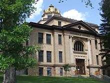
- Sheridan County Courthouse (Wyoming) - 224 South Main Street.[22]
- Fort Mackenzie - 1898 Fort Road - Currently a hospital administered by the Veterans Administration.
- Holy Name Catholic School – 260 East Loucks Street - Oldest Catholic school building remaining in the state of Wyoming.[23]
- St. Peter's Episcopal Church - 1 South Tschirgi Street - Noted for its Gothic Revival architecture and stained glass windows.[24]
- The historic Sheridan Inn (1893) - 856 Broadway Street - It has had a rich history of notable guests.
- Sheridan Main Street Historic District - Main Street from Burkitt to Mandel streets.
- Sheridan Railroad Historic District - 201-841 Broadway, 508-955 N. Gould
- Sheridan Flouring Mills, Inc. - 2161 Coffeen Avenue. The prominent smokestack is a United States Geological Survey map reference station.
Museums in Sheridan include the Sheridan County Museum and King's Saddlery Museum. The latter's exhibits display Western leather work (especially saddles) and cover Western history.[25]
The City of Sheridan maintains nine parks. Kendrick Park, at the corner of Badger and Beaver Streets, includes a children's play area, a seasonal ice cream shop, a swimming pool, chainsaw carvings,[26] and a buffalo and elk conservatory.
Every summer in the second week of July, Sheridan hosts the WYO Rodeo. Rodeo Week events include a parade, the "Sneakers and Spurs" run, a rubber duck race on Big Goose Creek in Kendrick Park, a carnival at the fairgrounds, and a golf tournament at the country club. On the final day of Rodeo Week, a tailgate party and polo game are held in nearby Big Horn, Wyoming.
Notable people
- Brad Anderson, former CEO of Best Buy
- Jerry Andrus (1918-2007) magician, optical illusionist
- Jim Benepe, professional golfer, won 1988 Beatrice Western Open[27]
- Buffalo Bill Cody, who auditioned talent for his Wild West Show off the front porch of the Sheridan Inn
- William Henry Harrison, U.S. Representative from Wyoming[28]
- John B. Kendrick, Governor of Wyoming (1915–1917) and U.S. Senator (1917–1933)[29]
- Zarif Khan, restaurant owner and investor who lived in Sheridan
- T. Allen Lawson, American artist
- Leonard McEwan, former Sheridan College trustee and member of the Wyoming Supreme Court and the Fourth Judicial District Court in Sheridan
- Clint Oldenburg, was born in Sheridan and played football for the Washington Redskins[30]
- Romaine Patterson, Sirius Satellite Radio talk show host, activist
- John Pilch, former NBA player[31]
- Mathew Pitsch, member of the Arkansas House of Representatives from Fort Smith, former resident of Sheridan
- John Howard Pyle, governor of Arizona, 1951–1955[32]
- Pete Simpson, state representative from Sheridan County from 1981 to 1984; later administrator at the University of Wyoming
- Oliver Wallop, 8th Earl of Portsmouth, Wyoming state legislator, rancher, and British noble
- Cris Williamson, singer and songwriter
- Dan M. "Buck" Brannaman, "horse whisperer" and star of film Buck.
- Constantine Scollen the famous missionary priest, was pastor of the Catholic Church during 1893 - 1894
- Queen Elizabeth II of England visited Sheridan, Wyoming in October 1984[33]
References
- 1 2 "US Gazetteer files 2010". United States Census Bureau. Retrieved 2012-12-14.
- 1 2 "American FactFinder". United States Census Bureau. Retrieved 2012-12-14.
- ↑ "Population Estimates". United States Census Bureau. Retrieved 2013-06-01.
- 1 2 "American FactFinder". United States Census Bureau. Retrieved 2008-01-31.
- ↑ "US Board on Geographic Names". United States Geological Survey. 2007-10-25. Retrieved 2008-01-31.
- 1 2 "Historical Decennial Census Population for Wyoming Counties, Cities, and Towns". Wyoming Department of State / U.S. Census Bureau. Retrieved 2011-09-01.
- ↑ "Profile for Sheridan, Wyoming". ePodunk. Retrieved 2010-05-28.
- ↑ "US Gazetteer files: 2010, 2000, and 1990". United States Census Bureau. 2011-02-12. Retrieved 2011-04-23.
- ↑ Peel, M. C., Finlayson, B. L., and McMahon, T. A.: Updated world map of the Köppen-Geiger climate classification, Hydrol. Earth Syst. Sci., 11, 1633–1644, 2007.
- ↑ "NowData - NOAA Online Weather Data". National Oceanic and Atmospheric Administration. Retrieved 2013-07-05.
- ↑ "Climatological Information for Sheridan, United States". Hong Kong Observatory. Retrieved 2011-01-26.
- ↑ Fort Mackenzie High School Student Handbook, Sheridan County School District #2.
- ↑ "Top Public High Schools". Newsweek. Archived from the original on July 2, 2008. Retrieved December 30, 2008.
- ↑ "Annual Estimates of the Resident Population for Incorporated Places: April 1, 2010 to July 1, 2015". Retrieved July 2, 2016.
- ↑ "Post Office Location - SHERIDAN." United States Postal Service. Retrieved on December 12, 2010.
- ↑ "Wyoming Girls’ School." Wyoming Department of Family Services. Retrieved on August 22, 2010. "Wyoming Girls’ School 3500 Big Horn Ave Sheridan, WY 82801"
- ↑ "Sheridan city, Wyoming." U.S. Census Bureau. Retrieved on December 12, 2010.
- ↑ "About the Department of Corrections." Wyoming Department of Corrections. Retrieved on August 22, 2010.
- ↑ Friendly, David (3 July 1986). "Prince For A Day In Wyoming". The Los Angeles Times. Retrieved 3 March 2014.
- ↑ True West Magazine, January/February 2007 issue, p. 28.
- ↑ Greenberg, Peter. "Newsmax Magazine Rates the Top 25 Most Uniquely American Cities And Towns". Retrieved 18 January 2014.
- ↑ SheridanMedia Website. Blair, Pat. (2014, March 23). Original courthouse still stands. (Retrieved 2014-03-24.)
- ↑ SheridanMedia Website. Blair, Pat. (2014, April 6). Holy Name school among newest on National Register. (Retrieved 2014-04-06.)
- ↑ SheridanMedia Website. Blair, Pat. (2014, March 30). Gothic Revival architecture earns listing for church. (Retrieved 2014-04-01.)
- ↑ Wyoming State Historical Society.
- ↑ The Sheridan Press Website. Sheely, Justin. (2013, May 25, p. C1). Carving art with a chainsaw. (Retrieved 2014-03-19.)
- ↑ "Jim Benepe". PGA Tour. Retrieved November 18, 2012.
- ↑ "HARRISON, William Henry, (1896 - 1990)". Biographical Directory of the United States Congress. Retrieved November 18, 2012.
- ↑ "KENDRICK, John Benjamin, (1857 - 1933)". Biographical Directory of the United States Congress. Retrieved November 18, 2012.
- ↑ "68 Clint Oldenburg, T". CBSSports.com. Retrieved November 18, 2012.
- ↑ "John Pilch NBA statistics". basketball-reference.com. Retrieved 4 August 2012.
- ↑ "Arizona Governor John Howard Pyle". National Governors Association. Retrieved November 18, 2012.
- ↑ Associated Press (13 October 1984). "Ranch's Royal Guest Arrives for Weekend". The New York Times. Retrieved 3 March 2014.
Further reading
- Georgen, Cynde. In the Shadow of the Bighorns: A history of early Sheridan and the Goose Creek valley of northern Wyoming. Sheridan, Wyoming: Sheridan County Historical Society, 2010. ISBN 978-0-9792871-7-6
- Georgen, Cynde. Snippets of Sheridan County History: 366 Newsy Little Stories from the First 125 Years of Sheridan County, Wyoming, 1888–2013. Sheridan, Wyoming: Sheridan County Historical Society, 2013. ISBN 978-0-9792871-8-3
- Georgen, Cynde A. One cowboy's dream: John B. Kendrick, his family, home, and ranching empire. 2nd edition, revised. Virginia Beach, Virginia: The Donning Company Publishers, 2004. ISBN 1-57864-239-6
- Morton, Sam. Where the rivers run north. Sheridan County Historical Society Press, 2007. ISBN 0-9790841-0-5
- Popovich, Charles W. Sheridan, Wyoming, and area historical sites: easy reading. 2004.
- Sagebrush scholars of Sagebrush Elementary School, Sheridan, Wyoming. Our Wyoming heritage: as seen through the eyes of the young. 1990. ISBN 0-932707-20-3
External links
- City website
- Sheridan County Chamber of Commerce
- Sheridan Travel and Tourism
- The Sheridan Press
- Trail End State Historic Site (Kendrick Mansion)
- Sheridan County School District #2.
- Sheridan Wyoming
- Sheridan, Wyoming Police Department
Municipalities and communities of Sheridan County, Wyoming, United States | ||
|---|---|---|
| City |  | |
| Towns | ||
| CDPs | ||
| Unincorporated communities | ||
Cheyenne (capital) | |
| Topics |
|
| Society |
|
| Regions | |
| Cities | |
| Counties | |