National Register of Historic Places listings in Marion County, Arkansas

Location of Marion County in Arkansas
This is a list of the National Register of Historic Places listings in Marion County, Arkansas.
This is intended to be a complete list of the properties and districts on the National Register of Historic Places in Marion County, Arkansas, United States. The locations of National Register properties and districts for which the latitude and longitude coordinates are included below, may be seen in a map.[1]
There are 22 properties and districts listed on the National Register in the county.
Contents: Counties in Arkansas
|
|
- This National Park Service list is complete through NPS recent listings posted December 16, 2016.[2]
Current listings
| [3] |
Name on the Register[4] |
Image |
Date listed[5] |
Location |
City or town |
Description |
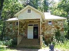
|---|
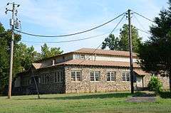
| 1 |
Aggie Hall |
|
000000001992-09-04-0000September 4, 1992
(#92001115) |
County Road 9
36°08′30″N 92°46′51″W / 36.141667°N 92.780833°W / 36.141667; -92.780833 (Aggie Hall) |
Bruno |
|
| 2 |
Aggie Workshop |
|
000000001992-09-04-0000September 4, 1992
(#92001113) |
Highway 235S
36°08′32″N 92°46′51″W / 36.142222°N 92.780833°W / 36.142222; -92.780833 (Aggie Workshop) |
Bruno |
|
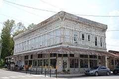
| 3 |
J.C. Berry's Dry Goods Store |
|
000000002003-05-30-0000May 30, 2003
(#03000468) |
331 Old South Main St.
36°13′29″N 92°40′53″W / 36.224722°N 92.681389°W / 36.224722; -92.681389 (J.C. Berry's Dry Goods Store) |
Yellville |
|
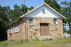
| 4 |
Bruno School Building |
Upload image |
000000001992-09-04-0000September 4, 1992
(#92001112) |
County Road 9
36°08′32″N 92°46′49″W / 36.142222°N 92.780278°W / 36.142222; -92.780278 (Bruno School Building) |
Bruno |
|
| 5 |
Buffalo River State Park |
|
000000001988-10-20-0000October 20, 1988
(#78003461) |
Buffalo National River
36°04′41″N 92°34′06″W / 36.078056°N 92.568333°W / 36.078056; -92.568333 (Buffalo River State Park) |
Yellville |
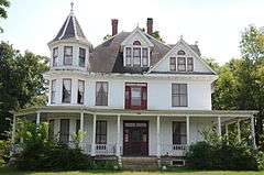
|
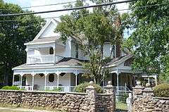
| 6 |
Carter-Jones House |
|
000000001987-07-21-0000July 21, 1987
(#87000979) |
30 Carter St.
36°13′37″N 92°41′00″W / 36.226944°N 92.683333°W / 36.226944; -92.683333 (Carter-Jones House) |
Yellville |
|
| 7 |
Cold Springs School |
|
000000001992-10-29-0000October 29, 1992
(#92001494) |
Cold Spring Hollow, just east of the Buffalo National River
36°04′53″N 92°28′01″W / 36.081389°N 92.466944°W / 36.081389; -92.466944 (Cold Springs School) |
Big Flat |
|
| 8 |
Cotter Tunnel |
Upload image |
000000002007-09-19-0000September 19, 2007
(#07000961) |
Under U.S. Route 62 east of County Road 724
36°16′41″N 92°32′53″W / 36.278056°N 92.548056°W / 36.278056; -92.548056 (Cotter Tunnel) |
Cotter |
|
| 9 |
Cowdrey House |
|
000000001978-07-20-0000July 20, 1978
(#78000609) |
1 Valley St.
36°13′27″N 92°40′48″W / 36.224167°N 92.68°W / 36.224167; -92.68 (Cowdrey House) |
Yellville |
|
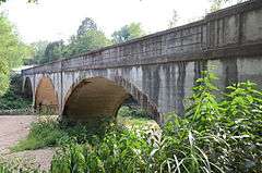
| 10 |
Crooked Creek Bridge |
|
000000002010-01-21-0000January 21, 2010
(#09001253) |
U.S. Route 62S over Crooked Creek
36°14′53″N 92°50′38″W / 36.248019°N 92.843964°W / 36.248019; -92.843964 (Crooked Creek Bridge) |
Pyatt |
|
| 11 |
Eros School Building |
|
000000001992-09-04-0000September 4, 1992
(#92001110) |
County Road 9
36°10′58″N 92°51′00″W / 36.182778°N 92.85°W / 36.182778; -92.85 (Eros School Building) |
Eros |
|
| 12 |
Estes-Williams American Legion Hut #61 |
Upload image |
000000002001-02-16-0000February 16, 2001
(#01000111) |
U.S. Highways 62/412
36°13′34″N 92°40′49″W / 36.226111°N 92.680278°W / 36.226111; -92.680278 (Estes-Williams American Legion Hut #61) |
Yellville |
|
| 13 |
Fairview School Building |
|
000000001992-09-04-0000September 4, 1992
(#92001116) |
County Road 203
36°20′02″N 92°36′20″W / 36.333889°N 92.605556°W / 36.333889; -92.605556 (Fairview School Building) |
Fairview |
|
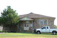
| 14 |
Hirst-Mathew Hall |
|
000000001992-09-04-0000September 4, 1992
(#92001114) |
Highway 235S
36°08′31″N 92°46′53″W / 36.141944°N 92.781389°W / 36.141944; -92.781389 (Hirst-Mathew Hall) |
Bruno |
|
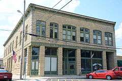
| 15 |
Layton Building |
|
000000001978-04-26-0000April 26, 1978
(#78000610) |
1110 Mill St.
36°13′32″N 92°40′57″W / 36.225556°N 92.6825°W / 36.225556; -92.6825 (Layton Building) |
Yellville |
|
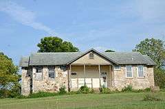
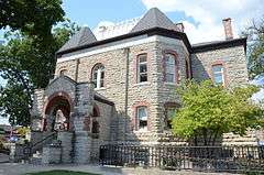
| 16 |
Marion County Courthouse |
|
000000001994-05-19-0000May 19, 1994
(#94000471) |
Courthouse Square
36°13′33″N 92°40′55″W / 36.225833°N 92.681944°W / 36.225833; -92.681944 (Marion County Courthouse) |
Yellville |
|
| 17 |
Pea Ridge School Building |
|
000000001993-06-08-0000June 8, 1993
(#93000486) |
East of County Road 6, approximately 4 miles south of Bruno
36°05′41″N 92°45′24″W / 36.094722°N 92.756667°W / 36.094722; -92.756667 (Pea Ridge School Building) |
Bruno |
|
| 18 |
Pyatt School Building |
|
000000001992-09-04-0000September 4, 1992
(#92001111) |
County Road 12
36°14′38″N 92°50′42″W / 36.243889°N 92.845°W / 36.243889; -92.845 (Pyatt School Building) |
Pyatt |
|
| 19 |
Pyatt Tunnel |
Upload image |
000000002007-09-19-0000September 19, 2007
(#07000953) |
Underneath MC 4008 approximately 1 mile south of U.S. Route 62
36°14′31″N 92°49′17″W / 36.241944°N 92.821389°W / 36.241944; -92.821389 (Pyatt Tunnel) |
Pyatt |
|
| 20 |
Rush Historic District |
|
000000001987-02-27-0000February 27, 1987
(#87000105) |
Rush Rd.
36°07′37″N 92°33′10″W / 36.126944°N 92.552778°W / 36.126944; -92.552778 (Rush Historic District) |
Yellville |
|
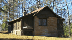
| 21 |
Sunburst Shelter |
Upload image |
000000001982-05-04-0000May 4, 1982
(#82002123) |
Address Restricted
|
Summit |
|
| 22 |
US 62 Bridge over Crooked Creek |
Upload image |
000000002000-06-09-0000June 9, 2000
(#00000632) |
U.S. Route 62
36°14′45″N 92°50′04″W / 36.245833°N 92.834444°W / 36.245833; -92.834444 (US 62 Bridge over Crooked Creek) |
Pyatt |
|
See also
References
- ↑ The latitude and longitude information provided in this table was derived originally from the National Register Information System, which has been found to be fairly accurate for about 99% of listings. For about 1% of NRIS original coordinates, experience has shown that one or both coordinates are typos or otherwise extremely far off; some corrections may have been made. A more subtle problem causes many locations to be off by up to 150 yards, depending on location in the country: most NRIS coordinates were derived from tracing out latitude and longitudes off of USGS topographical quadrant maps created under the North American Datum of 1927, which differs from the current, highly accurate WGS84 GPS system used by most on-line maps. Chicago is about right, but NRIS longitudes in Washington are higher by about 4.5 seconds, and are lower by about 2.0 seconds in Maine. Latitudes differ by about 1.0 second in Florida. Some locations in this table may have been corrected to current GPS standards.
- ↑ "National Register of Historic Places: Weekly List Actions". National Park Service, United States Department of the Interior. Retrieved on December 16, 2016.
- ↑ Numbers represent an ordering by significant words. Various colorings, defined here, differentiate National Historic Landmarks and historic districts from other NRHP buildings, structures, sites or objects.
- ↑ National Park Service (2009-03-13). "National Register Information System". National Register of Historic Places. National Park Service.
- ↑ The eight-digit number below each date is the number assigned to each location in the National Register Information System database, which can be viewed by clicking the number.
|
|---|
|
| Topics | |
|---|
|
| Lists by states | |
|---|
|
| Lists by insular areas | |
|---|
|
| Lists by associated states | |
|---|
|
| Other areas | |
|---|
|
-
 Portal Portal
-
 WikiProject WikiProject
|