National Register of Historic Places listings in Montana
This is a list of properties and historic districts in Montana that are listed on the National Register of Historic Places. The state's more than 1,100 listings are distributed across all of its 56 counties.
The locations of National Register properties and districts (at least for all showing latitude and longitude coordinates below), may be seen in an online map by clicking on "Map of all coordinates".[1]
- This National Park Service list is complete through NPS recent listings posted December 2, 2016.[2]
Current listings by county
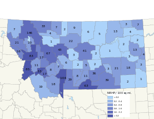
The following are approximate tallies of current listings by county.[3]
.jpg)
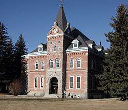
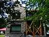
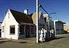
Chief Plenty Coups (Alek-Chea-Ahoosh) House, in Big Horn County

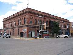
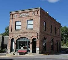
Yucca Theatre, in Treasure County
| County | # of Sites | |
|---|---|---|
| 1 | Beaverhead | 19 |
| 2 | Big Horn | 39 |
| 3 | Blaine | 7 |
| 4 | Broadwater | 7 |
| 5 | Carbon | 64 |
| 6 | Carter | 1 |
| 7 | Cascade | 46 |
| 8 | Chouteau | 21 |
| 9 | Custer | 18 |
| 10 | Daniels | 3 |
| 11 | Dawson | 13 |
| 12 | Deer Lodge | 33 |
| 13 | Fallon | 3 |
| 14 | Fergus | 42 |
| 15 | Flathead | 146 |
| 16 | Gallatin | 105 |
| 17 | Garfield | 1 |
| 18 | Glacier | 34 |
| 19 | Golden Valley | 5 |
| 20 | Granite | 11 |
| 21 | Hill | 9 |
| 22 | Jefferson | 8 |
| 23 | Judith Basin | 3 |
| 24 | Lake | 10 |
| 25 | Lewis and Clark | 68 |
| 26 | Liberty | 2 |
| 27 | Lincoln | 7 |
| 28 | Madison | 18 |
| 29 | McCone | 2 |
| 30 | Meagher | 6 |
| 31 | Mineral | 16 |
| 32 | Missoula | 83 |
| 33 | Musselshell | 2 |
| 34 | Park | 29 |
| 35 | Petroleum | 3 |
| 36 | Phillips | 5 |
| 37 | Pondera | 4 |
| 38 | Powder River | 2 |
| 39 | Powell | 17 |
| 40 | Prairie | 3 |
| 41 | Ravalli | 85 |
| 42 | Richland | 3 |
| 43 | Roosevelt | 4 |
| 44 | Rosebud | 21 |
| 45 | Sanders | 21 |
| 46 | Sheridan | 7 |
| 47 | Silver Bow | 17 |
| 48 | Stillwater | 11 |
| 49 | Sweet Grass | 8 |
| 50 | Teton | 1 |
| 51 | Toole | 7 |
| 52 | Treasure | 3 |
| 53 | Valley | 13 |
| 54 | Wheatland | 2 |
| 55 | Wibaux | 4 |
| 56 | Yellowstone | 36 |
| (less duplicates) | (9)[4] | |
| TOTAL | 1,149 | |
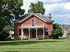
Beaverhead County
Big Horn County
Blaine County
_-_Blaine_County%2C_Montana.png)
Broadwater County
_-_Broadwater_County%2C_Montana.png)
_-_Broadwater_County%2C_Montana.png)
Carbon County
Carter County
| [5] | Name on the Register | Image | Date listed[6] | Location | City or town | Description |
|---|---|---|---|---|---|---|
| 1 | First National Bank of Ekalaka and Rickard Hardware Store Building | Upload image | (#15000815) |
103 & 105 N. Main St. 45°53′25″N 104°32′54″W / 45.890378°N 104.548431°W |
Ekalaka |
Cascade County
Chouteau County
Custer County
Daniels County
| [5] | Name on the Register | Image | Date listed[6] | Location | City or town | Description |
|---|---|---|---|---|---|---|
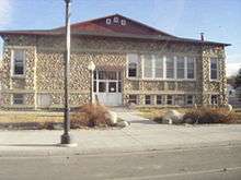
| 1 | Daniels County Courthouse | 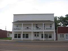 |
(#95000535) |
213 Main St. 48°47′27″N 105°25′12″W / 48.790833°N 105.42°W |
Scobey | |
| 2 | Mansfield A. Daniels House | Upload image | (#97000503) |
Approximately 2 miles west of Montana Highway 13 and 2 miles southwest of Scobey 48°46′23″N 105°27′51″W / 48.773056°N 105.464167°W |
Scobey | |
| 3 | LaPierre Barn | Upload image | (#05000279) |
Approximately 3.5 miles northwest of Scobey on Tande Ranch Rd. 48°50′41″N 105°28′42″W / 48.844722°N 105.478333°W |
Scobey |
Dawson County
Deer Lodge County
Fallon County
| [5] | Name on the Register | Image | Date listed[6] | Location | City or town | Description |
|---|---|---|---|---|---|---|
| 1 | Baker Hotel | _(destroyed)_-_Fallon_County%2C_Montana.png) |
(#04001435) |
4 S. Main St. 46°22′07″N 104°16′28″W / 46.368611°N 104.274444°W |
Baker | |
| 2 | Cottonwood Creek Bridge | _-_Fallon_County%2C_Montana.png) |
(#14000079) |
Mi. 2.2 Ismay Rd. 46°27′24″N 104°47′19″W / 46.456637°N 104.788596°W |
Ismay | |
| 3 | Fallon County Jail | _-_Fallon_County%2C_Montana.png) |
(#98000946) |
723 S. Main St. 46°21′37″N 104°16′31″W / 46.360278°N 104.275278°W |
Baker |
Fergus County
Flathead County
Gallatin County
Garfield County
| [5] | Name on the Register | Image | Date listed[6] | Location | City or town | Description |
|---|---|---|---|---|---|---|
| 1 | Hornaday Camp | Upload image | (#91000298) |
10 miles south of Montana Highway 200 46°58′11″N 107°23′58″W / 46.969722°N 107.399444°W |
Sand Springs |
Glacier County
Golden Valley County
| [5] | Name on the Register | Image | Date listed[6] | Location | City or town | Description |
|---|---|---|---|---|---|---|
| 1 | Adams Hotel | 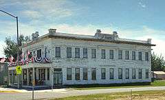 |
(#05001377) |
1 Main St. 46°17′43″N 108°56′16″W / 46.295278°N 108.937778°W |
Lavina | |
| 2 | Grace Lutheran Church of Barber |  |
(#82003171) |
West of Ryegate 46°18′51″N 109°23′04″W / 46.314167°N 109.384444°W |
Ryegate | |
| 3 | Lavina State Bank |  |
(#07001293) |
101 Main St. 46°17′40″N 108°56′15″W / 46.294444°N 108.9375°W |
Lavina | |
| 4 | Sims-Garfield Ranch | Upload image | (#80002419) |
East of Ryegate Coordinates missing |
Ryegate | |
| 5 | Slayton Mercantile Co. | 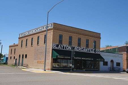 |
(#00001567) |
23 Main St. 46°17′47″N 108°56′17″W / 46.296389°N 108.938056°W |
Lavina |
Granite County
Hill County
_-_Hill_County%2C_Montana.png)

Jefferson County
_-_Jefferson_County%2C_Montana.png)

_-_Jefferson_County%2C_Montana.png)
Judith Basin County
| [5] | Name on the Register | Image | Date listed[6] | Location | City or town | Description |
|---|---|---|---|---|---|---|
| 1 | Judith River Ranger Station |  |
(#92000333) |
Along the Middle Fork of the Judith River, southwest of Utica in Lewis and Clark National Forest 46°50′51″N 110°17′25″W / 46.8475°N 110.290278°W |
Utica | |
| 2 | Meadowbrook Stock Farm | Upload image | (#91001938) |
U.S. Route 87 47°01′35″N 109°50′57″W / 47.026389°N 109.849167°W |
Hobson | |
| 3 | Wood Lawn Farm | Upload image | (#92001762) |
5 miles west of Hobson on Utica Road 239 46°59′17″N 109°58′36″W / 46.988056°N 109.976667°W |
Hobson |
Lake County
_2002-05.jpg)
Lewis and Clark County
Liberty County
| [5] | Name on the Register | Image | Date listed[6] | Location | City or town | Description |
|---|---|---|---|---|---|---|
| 1 | First Episcopal Methodist Church of Chester | Upload image | (#97000974) |
Junction of 2nd St. and Madison 48°30′39″N 110°57′44″W / 48.510833°N 110.962222°W |
Chester | |
| 2 | First State Bank of Chester |  |
(#97000975) |
Junction of Washington Ave. and 1st St., E. 48°30′47″N 110°57′52″W / 48.513056°N 110.964444°W |
Chester |
Lincoln County
.jpg)
Madison County
McCone County
| [5] | Name on the Register | Image | Date listed[6] | Location | City or town | Description |
|---|---|---|---|---|---|---|
| 1 | Gladstone Hotel | .jpg) |
(#80004592) |
101 Main St. 47°25′02″N 105°35′15″W / 47.417306°N 105.587472°W |
Circle | |
| 2 | Lewis and Clark Bridge | 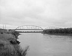 |
(#97001451) |
Montana Highway 13 over the Missouri River 48°04′02″N 105°32′06″W / 48.067222°N 105.535°W |
Wolf Point | Extends into Roosevelt County |
Meagher County
| [5] | Name on the Register | Image | Date listed[6] | Location | City or town | Description |
|---|---|---|---|---|---|---|
| 1 | Fort Logan and Blockhouse | 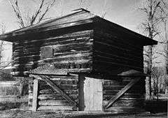 |
(#70000360) |
17 miles northwest of White Sulphur Springs 46°40′48″N 111°10′03″W / 46.68°N 111.1675°W |
White Sulphur Springs | |
| 2 | Parberry Block East | Upload image | (#09000237) |
18–20 East Main Street 46°32′53″N 110°54′11″W / 46.548056°N 110.902917°W |
White Sulphur Springs | |
| 3 | Byron R. Sherman House |  |
(#77000820) |
310 2nd Ave., NE. 46°33′03″N 110°54′00″W / 46.550833°N 110.9°W |
White Sulphur Springs | |
| 4 | Stockmen's Bank of Martinsdale | _-_Meagher_County%2C_Montana.png) |
(#13000224) |
9 Main St. 46°27′31″N 110°18′54″W / 46.458629°N 110.315095°W |
Martinsdale | |
| 5 | Union League of America Hall | Upload image | (#98001084) |
Crawford St. at Central Ave., S. 46°32′42″N 110°54′08″W / 46.545°N 110.902222°W |
White Sulphur Springs | |
| 6 | Wellman Block | Upload image | (#94000140) |
206 E. Main St. 46°32′52″N 110°54′04″W / 46.547778°N 110.901111°W |
White Sulphur Springs |
Mineral County
Missoula County
Musselshell County
| [5] | Name on the Register | Image | Date listed[6] | Location | City or town | Description |
|---|---|---|---|---|---|---|
| 1 | Roundup Central School |  |
(#07001243) |
600 1st St., W. 46°26′50″N 108°32′37″W / 46.447222°N 108.543611°W |
Roundup | |
| 2 | St. Benedict's Catholic School | 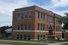 |
(#88001120) |
524 1st St., W. 46°26′47″N 108°32′33″W / 46.446389°N 108.5425°W |
Roundup |
Park County
Petroleum County
| [5] | Name on the Register | Image | Date listed[6] | Location | City or town | Description |
|---|---|---|---|---|---|---|
| 1 | Cat Creek Oil Field Sign | 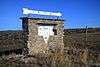 |
(#14001127) |
Mi. 150, MT 200 Coordinates missing |
Mosby vicinity | |
| 2 | Winnett Block | 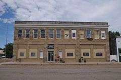 |
(#09000815) |
301 E. Main St. Coordinates missing |
Winnett | |
| 3 | Winnett School | Upload image | (#95000383) |
Junction of Moulton Ave. and Rowley St. 47°00′07″N 108°21′12″W / 47.00206°N 108.35343°W |
Winnett | Possibly replaced by new building |
Phillips County
| [5] | Name on the Register | Image | Date listed[6] | Location | City or town | Description |
|---|---|---|---|---|---|---|
| 1 | H. Earl Clack Service Station | _-_Phillips_County%2C_Montana.png) |
(#94000863) |
Southern side of U.S. Route 2 48°27′23″N 107°20′37″W / 48.456389°N 107.343611°W |
Saco | |
| 2 | Phillips County Carnegie Library | _-_Phillips_County%2C_Montana.png) |
(#80002428) |
S. 1st St. 48°21′35″N 107°52′34″W / 48.359722°N 107.876111°W |
Malta | |
| 3 | Fred Robinson Bridge | Upload image | (#12000171) |
Milepost 88, US 191, 51 miles (82 km) north of Lewistown 47°37′51″N 108°41′06″W / 47.630723°N 108.684937°W |
Lewistown vicinity | Montana's Steel Stringer and Steel Girder Bridges Multiple Property Submission; extends into Fergus County |
| 4 | Saco Mercantile | _-_Phillips_County%2C_Montana.png) |
(#97001452) |
201 Taylor St. 48°27′22″N 107°20′30″W / 48.456111°N 107.341667°W |
Saco | |
| 5 | Sleeping Buffalo Rock | _-_Phillips_County%2C_Montana.png) |
(#96000548) |
Junction of U.S. Route 2 and Montana Highway 243 48°28′10″N 107°32′56″W / 48.469444°N 107.548889°W |
Saco |
Pondera County
| [5] | Name on the Register | Image | Date listed[6] | Location | City or town | Description |
|---|---|---|---|---|---|---|
| 1 | Conrad City Hall | 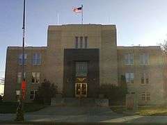 |
(#80002429) |
15 4th Ave., SW. 48°10′10″N 111°56′49″W / 48.169444°N 111.946944°W |
Conrad | |
| 2 | Froggie's Stopping Place on the Whoop-Up Trail | Upload image | (#93000277) |
Address Restricted |
Conrad | |
| 3 | Two Medicine Fight Site | Upload image | (#70000361) |
About 25 miles southeast of Browning 48°28′N 112°28′W / 48.46°N 112.46°W |
Browning | |
| 4 | Valier Public School | Upload image | (#85000646) |
820 3rd St. 48°18′16″N 112°15′21″W / 48.304444°N 112.255833°W |
Valier |
Powder River County
| [5] | Name on the Register | Image | Date listed[6] | Location | City or town | Description |
|---|---|---|---|---|---|---|
| 1 | Cheever-Cain Ranch | Upload image | (#10000184) |
8 Trails End Rd. 45°36′47″N 105°55′19″W / 45.613083°N 105.921958°W |
Volborg | |
| 2 | Cross Ranch Headquarters | Upload image | (#96000118) |
East of Montana Highway 59, roughly 26 miles south of Broadus 45°05′44″N 105°19′10″W / 45.095556°N 105.319444°W |
Broadus |
Powell County
Prairie County
| [5] | Name on the Register | Image | Date listed[6] | Location | City or town | Description |
|---|---|---|---|---|---|---|
| 1 | Grandey Elementary School | Upload image | (#78001689) |
Off U.S. Route 10 46°47′29″N 105°18′30″W / 46.791389°N 105.308333°W |
Terry | |
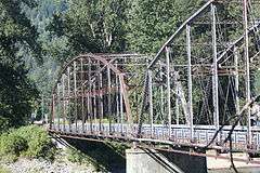
| 2 | Powder River Bridge | Upload image | (#09001186) |
Milepost 6 on Interstate 94 (Old U.S. Route 10) 46°44′14″N 105°25′43″W / 46.737228°N 105.428603°W |
Terry | |
| 3 | Yellowstone River Bridge | 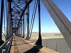 |
(#09001187) |
Milepost 1 on Interstate 94 (Old U.S. Route 10) 46°51′20″N 105°06′59″W / 46.855564°N 105.116367°W |
Fallon |
Ravalli County
Richland County
| [5] | Name on the Register | Image | Date listed[6] | Location | City or town | Description |
|---|---|---|---|---|---|---|
| 1 | Burgess Garage | Upload image | (#04001434) |
Corner of 3rd and Main 47°41′06″N 104°37′15″W / 47.685°N 104.620833°W |
Fox Lake | |
| 2 | Fort Union Trading Post National Historic Site | 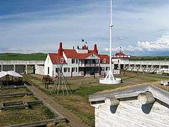 |
(#66000103) |
15550 Highway 1804 47°59′58″N 104°02′13″W / 47.999444°N 104.036944°W |
Williston, North Dakota, vicinity | |
| 3 | Peoples' Congregational Church | Upload image | (#82003179) |
203 2nd Ave., SW. 47°42′53″N 104°09′33″W / 47.714722°N 104.159167°W |
Sidney |
Roosevelt County
| [5] | Name on the Register | Image | Date listed[6] | Location | City or town | Description |
|---|---|---|---|---|---|---|
| 1 | Fort Peck Agency |  |
(#70000365) |
In Poplar 48°06′51″N 105°11′36″W / 48.114167°N 105.193333°W |
Poplar | |
| 2 | Fort Union Trading Post National Historic Site | |
(#66000103) |
15550 Highway 1804 47°59′58″N 104°02′13″W / 47.999444°N 104.036944°W |
Williston, North Dakota, vicinity | |
| 3 | Hale's Filling Station and Grocery | Upload image | (#94000864) |
Lanark Townsite 48°08′34″N 104°21′26″W / 48.142778°N 104.357222°W |
Bainville | |
| 4 | Lewis and Clark Bridge | |
(#97001451) |
Montana Highway 13 over the Missouri River 48°04′02″N 105°32′06″W / 48.067222°N 105.535°W |
Wolf Point | Extends into McCone County |
Rosebud County
Sanders County
Sheridan County
| [5] | Name on the Register | Image | Date listed[6] | Location | City or town | Description |
|---|---|---|---|---|---|---|
| 1 | Comertown Historic District | Upload image | (#93001149) |
Roughly the entire community of Comertown, west of Westby 48°53′49″N 104°15′00″W / 48.896944°N 104.25°W |
Comertown | |
| 2 | Aage and Kristine Larsen Homestead | Upload image | (#93001146) |
County Highway 516 north of Dagmar 48°37′46″N 104°11′14″W / 48.629444°N 104.187222°W |
Dagmar | |
| 3 | Outlook Depot | Upload image | (#93001144) |
South of the western edge of Marr St., south of Block 10 48°53′08″N 104°46′37″W / 48.885556°N 104.776944°W |
Outlook | |
| 4 | Raymond Grain Elevators Historic District | Upload image | (#93001148) |
Unnamed county road east of Montana Highway 16, northeast of Raymond 48°52′43″N 104°34′39″W / 48.878611°N 104.5775°W |
Raymond | |
| 5 | Rocky Valley Lutheran Church | Upload image | (#93001145) |
Junction of Ueland St. and an unnamed county road 48°52′54″N 104°23′18″W / 48.881667°N 104.388333°W |
Dooley | |
| 6 | Thornwood School | Upload image | (#93001147) |
Unnamed county road approximately 17 miles west of Reserve 48°36′06″N 104°47′55″W / 48.601667°N 104.798611°W |
Reserve | |
| 7 | Tipi Hills | Upload image | (#75001085) |
Address Restricted |
Medicine Lake |
Silver Bow County
Stillwater County
Sweet Grass County
| [5] | Name on the Register | Image | Date listed[6] | Location | City or town | Description |
|---|---|---|---|---|---|---|
| 1 | Big Timber Town Hall | 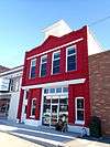 |
(#98000125) |
225 McLeod St. 45°50′02″N 109°57′11″W / 45.833889°N 109.953056°W |
Big Timber | |
| 2 | Brannin Ranch | Upload image | (#88003142) |
West of Melville on Sweet Grass Creek 46°07′27″N 110°11′53″W / 46.124167°N 110.198056°W |
Melville | |
| 3 | Carnegie Public Library | 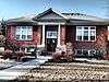 |
(#02000725) |
314 McLeod St. 45°49′57″N 109°57′07″W / 45.8325°N 109.951944°W |
Big Timber | |
| 4 | Grand Hotel | 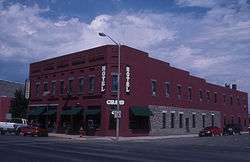 |
(#85002424) |
139 McLeod St. 45°50′04″N 109°57′14″W / 45.834444°N 109.953889°W |
Big Timber | |
| 5 | Waborn (Wabe) and Sarah E. Harrison Ranch House | Upload image | (#98001111) |
Roughly located at the confluence of the Sweet Grass Creek and the Yellowstone River 45°47′16″N 109°46′57″W / 45.787778°N 109.7825°W |
Greycliff | |
| 6 | John Otto Spannring Family Farm | Upload image | (#95000145) |
7 miles east of Big Timber 45°48′50″N 109°50′48″W / 45.813889°N 109.846667°W |
Big Timber | |
| 7 | St. Mark's Episcopal Church | 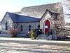 |
(#95000900) |
W. 4th Ave. 45°49′53″N 109°57′12″W / 45.831389°N 109.953333°W |
Big Timber | |
| 8 | Yellowstone Crossing, Bozeman Trail | Upload image | (#78003407) |
Northeast of Springdale on U.S. Route 10 45°45′13″N 110°09′56″W / 45.753611°N 110.165556°W |
Springdale | part of the Bozeman Trail |
Teton County
| [5] | Name on the Register | Image | Date listed[6] | Location | City or town | Description |
|---|---|---|---|---|---|---|
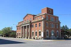
| 1 | Teton County Courthouse | 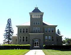 |
(#06001093) |
1 Main Ave., S. 47°48′39″N 112°10′53″W / 47.810833°N 112.181389°W |
Choteau |
Toole County
Treasure County
| [5] | Name on the Register | Image | Date listed[6] | Location | City or town | Description |
|---|---|---|---|---|---|---|
| 1 | Big Horn River Bridge | Upload image | (#09001188) |
Milepost 2 on Montana Highway 104 (Old U.S. Route 10) 46°08′50″N 107°28′03″W / 46.147331°N 107.467608°W |
Custer | |
| 2 | Sanders Gymnasium and Community Hall | Upload image | (#97000976) |
Old Montana Highway 10, 6 miles east of Hysham 46°17′25″N 107°06′06″W / 46.290278°N 107.101667°W |
Sanders | |
| 3 | Yucca Theatre | |
(#93001447) |
520 Division St. 46°17′34″N 107°14′00″W / 46.292778°N 107.233333°W |
Hysham |
Valley County
Wheatland County
| [5] | Name on the Register | Image | Date listed[6] | Location | City or town | Description |
|---|---|---|---|---|---|---|
| 1 | Graves Hotel | 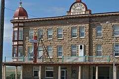 |
(#80002434) |
106 S. Central Ave. 46°26′01″N 109°49′50″W / 46.4336°N 109.83059°W |
Harlowton | |
| 2 | Milwaukee Road Historic District |  |
(#88001024) |
Southern end of Central Ave. 46°25′49″N 109°49′38″W / 46.430278°N 109.827222°W |
Harlowton |
Former listings
| [5] | Name on the Register | Image | Date listed | Date removed | Location | City or town | Summary |
|---|---|---|---|---|---|---|---|
| 1 | McQuitty Building | Upload image | (#80002435) | 121 N. Central Ave. |
Harlowton |
Wibaux County
| [5] | Name on the Register | Image | Date listed[6] | Location | City or town | Description |
|---|---|---|---|---|---|---|
| 1 | St. Peter's Catholic Church | .jpg) |
(#90000356) |
W. Orgain Ave. 46°59′14″N 104°11′28″W / 46.987222°N 104.191111°W |
Wibaux | |
| 2 | Vogt-Nunberg Farm | Upload image | (#08000269) |
7262 Montana Highway 7 46°49′02″N 104°13′27″W / 46.81735°N 104.22417°W |
Wibaux | |
| 3 | Wibaux Commercial Historic District | _-_Wibaux_County%2C_Montana.png) |
(#89002170) |
Roughly bounded by W. Orgain Ave., Wibaux, E. 1st Ave., S., and E 46°59′11″N 104°11′15″W / 46.986389°N 104.1875°W |
Wibaux | |
| 4 | Pierre Wibaux House |  |
(#71000483) |
Orgain Ave. 46°59′12″N 104°11′06″W / 46.986667°N 104.185°W |
Wibaux |
Yellowstone County
See also
References
- ↑ The latitude and longitude information provided in this table was derived originally from the National Register Information System, which has been found to be fairly accurate for about 99% of listings. For about 1% of NRIS original coordinates, experience has shown that one or both coordinates are typos or otherwise extremely far off; some corrections may have been made. A more subtle problem causes many locations to be off by up to 150 yards, depending on location in the country: most NRIS coordinates were derived from tracing out latitude and longitudes off of USGS topographical quadrant maps created under the North American Datum of 1927, which differs from the current, highly accurate WGS84 GPS system used by most on-line maps. Chicago is about right, but NRIS longitudes in Washington are higher by about 4.5 seconds, and are lower by about 2.0 seconds in Maine. Latitudes differ by about 1.0 second in Florida. Some locations in this table may have been corrected to current GPS standards.
- ↑ "National Register of Historic Places: Weekly List Actions". National Park Service, United States Department of the Interior. Retrieved on December 2, 2016.
- ↑ These counts are based on entries in the National Register Information Database as of March 13, 2009 and new weekly listings posted since then on the National Register of Historic Places web site. There are frequent additions to the listings and occasional delistings and the counts here are approximate and not official. New entries are added to the official Register on a weekly basis. Also, the counts in this table exclude boundary increase and decrease listings which only modify the area covered by an existing property or district, although carrying a separate National Register reference number.
- ↑ Going-to-the-Sun Road and Great Northern Railway Buildings are listed in both Flathead and Glacier counties, the Lewis and Clark Bridge spans the Missouri River between McCone and Roosevelt counties, the Butte, Anaconda and Pacific Railway Historic District and the Butte-Anaconda Historic District are split between Deer Lodge and Silver Bow counties, Fort Union Trading Post National Historic Site is listed in both Richland and Roosevelt counties (as well as McKenzie and Williams counties, North Dakota), Froggie's Stopping Place on the Whoop-Up Trail is listed in both Chouteau and Pondera counties, the Fred Robinson Bridge spans the Missouri River between Fergus and Phillips counties, the Judith Landing Historic District is listed in both Chouteau and Fergus counties, and the Red Lodge-Cooke City Approach Road Historic District is listed in both Carbon and Park counties.
- 1 2 3 4 5 6 7 8 9 10 11 12 13 14 15 16 17 18 19 20 21 22 23 24 25 26 27 28 29 30 31 32 Numbers represent an ordering by significant words. Various colorings, defined here, differentiate National Historic Landmarks and historic districts from other NRHP buildings, structures, sites or objects.
- 1 2 3 4 5 6 7 8 9 10 11 12 13 14 15 16 17 18 19 20 21 22 23 24 25 26 27 28 29 30 31 The eight-digit number below each date is the number assigned to each location in the National Register Information System database, which can be viewed by clicking the number.
- ↑ Bradshaw, Glenda Clay. Montana's Historical Highway Markers. 4th ed. Helena: Montana Historical Society Press, 2008, 83.
External links
| Wikimedia Commons has media related to National Register of Historic Places in Montana. |
- Montana History Wiki section on National Register of Historic Places sign texts.
| Topics | |
|---|---|
| Lists by states |
|
| Lists by insular areas | |
| Lists by associated states | |
| Other areas | |
| |
This article is issued from Wikipedia - version of the 11/30/2016. The text is available under the Creative Commons Attribution/Share Alike but additional terms may apply for the media files.