| [3] |
Name on the Register[4] |
Image |
Date listed[5] |
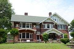
Location |
City or town |
Description |
|---|
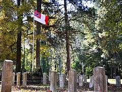
| 1 |
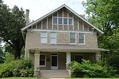
Antioch Missionary Baptist Church Cemetery |
|
000000002010-07-08-0000July 8, 2010
(#10000437) |
500 N. McKinney Rd.
34°23′37″N 91°59′01″W / 34.393666°N 91.983486°W / 34.393666; -91.983486 (Antioch Missionary Baptist Church Cemetery) |
Sherrill |
|
| 2 |
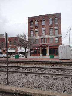
Arkansas Louisiana Gas Company Building |
|
000000002001-05-10-0000May 10, 2001
(#01000480) |
116 W. 6th
34°13′25″N 92°00′14″W / 34.223611°N 92.003889°W / 34.223611; -92.003889 (Arkansas Louisiana Gas Company Building) |
Pine Bluff |
|
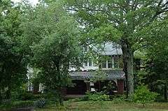
| 3 |
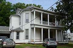
Jewel Bain House Number 2 |
|
000000002013-01-29-0000January 29, 2013
(#12001228) |
3601 S. Cherry St.
34°11′34″N 92°00′47″W / 34.192692°N 92.013054°W / 34.192692; -92.013054 (Jewel Bain House Number 2) |
Pine Bluff |
|
| 4 |
Bellingrath House |
|
000000001994-12-01-0000December 1, 1994
(#94001410) |
7520 Dollarway Rd.
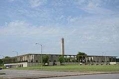
34°24′09″N 92°10′28″W / 34.402563°N 92.174576°W / 34.402563; -92.174576 (Bellingrath House) |
White Hall |
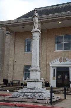
|
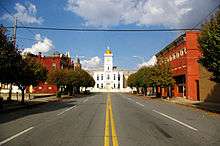
| 5 |
Boone-Murphy House |
|
000000001979-02-18-0000February 18, 1979
(#79000442) |
714 W. 4th Ave.
34°13′32″N 92°00′39″W / 34.225556°N 92.010833°W / 34.225556; -92.010833 (Boone-Murphy House) |
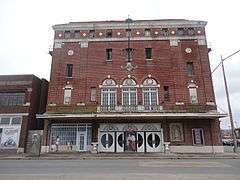
Pine Bluff |
|
| 6 |
Floyd B. Brown House |
Upload image |
000000002006-01-19-0000January 19, 2006
(#04001493) |
1401 S. Georgia St.
34°13′02″N 92°00′00″W / 34.217222°N 92.0°W / 34.217222; -92.0 (Floyd B. Brown House) |
Pine Bluff |
|
| 7 |
Caldwell Hall |
|
000000001982-12-22-0000December 22, 1982
(#82000843) |
University Drive
34°14′32″N 92°01′10″W / 34.242222°N 92.019444°W / 34.242222; -92.019444 (Caldwell Hall) |
Pine Bluff |
part of the Charles L. Thompson Design Collection Thematic Resource (TR)
|
| 8 |
Camp White Sulphur Springs Confederate Cemetery |
|
000000002005-01-19-0000January 19, 2005
(#04001512) |
Luckwood Rd. one half block north of Highway 54
34°10′52″N 92°07′11″W / 34.181125°N 92.119816°W / 34.181125; -92.119816 (Camp White Sulphur Springs Confederate Cemetery) |
Sulphur Springs |
part of the Civil War Commemorative Sculpture Multiple Property Submission (MPS)
|
| 9 |
Carnahan House |
|
000000002014-09-30-0000September 30, 2014
(#14000790) |
1200 S. Laurel St.
34°13′03″N 92°00′30″W / 34.2175°N 92.0082°W / 34.2175; -92.0082 (Carnahan House) |
Pine Bluff |
|
| 10 |
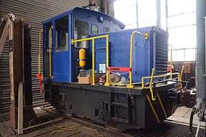
Central Texas Gravel Locomotive #210 |
|
000000002007-05-24-0000May 24, 2007
(#07000442) |
Arkansas Railroad Museum
34°13′46″N 91°59′06″W / 34.229444°N 91.985°W / 34.229444; -91.985 (Central Texas Gravel Locomotive #210) |
Pine Bluff |
|
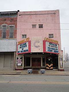
| 11 |
Community Theatre |
|
000000002004-05-26-0000May 26, 2004
(#04000507) |
207 W. 2nd Ave.
34°13′49″N 92°00′17″W / 34.230278°N 92.004722°W / 34.230278; -92.004722 (Community Theatre) |
Pine Bluff |
|
| 12 |
Dilley House |
Upload image |
000000001977-08-03-0000August 3, 1977
(#77000258) |
656 Laurel St.
34°13′24″N 92°00′30″W / 34.223333°N 92.008333°W / 34.223333; -92.008333 (Dilley House) |
Pine Bluff |
|
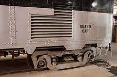
| 13 |
DODX Guard Car #G-56 |
|
000000002007-06-28-0000June 28, 2007
(#07000441) |
Arkansas Railroad Museum
34°13′47″N 91°59′06″W / 34.229722°N 91.985°W / 34.229722; -91.985 (DODX Guard Car #G-56) |
Pine Bluff |
|
| 14 |
Dollarway Road |
|
000000001974-05-17-0000May 17, 1974
(#74000480) |
South of Redfield off U.S. Highway 65
• Boundary increase (listed 000000001999-07-15-0000July 15, 1999, refnum 99000822): Highway 365
34°26′17″N 92°10′49″W / 34.438056°N 92.180278°W / 34.438056; -92.180278 (Dollarway Road) |
Redfield |
|
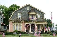
| 15 |
Du Bocage |
|
000000001974-06-24-0000June 24, 1974
(#74000478) |
1115 W. 4th St.
34°13′34″N 92°00′42″W / 34.226111°N 92.011667°W / 34.226111; -92.011667 (Du Bocage) |
Pine Bluff |
|
| 16 |
The Elms |
Upload image |
000000001978-07-07-0000July 7, 1978
(#78000596) |
South of Altheimer
34°18′15″N 91°50′33″W / 34.304167°N 91.8425°W / 34.304167; -91.8425 (The Elms) |
Altheimer |
|
| 17 |
Ferguson House |
|
000000001978-01-18-0000January 18, 1978
(#78000598) |
902 E. 4th Ave.
34°13′33″N 92°00′42″W / 34.225833°N 92.011667°W / 34.225833; -92.011667 (Ferguson House) |
Pine Bluff |
|
| 18 |
Fox House |
|
000000001982-12-22-0000December 22, 1982
(#82000845) |
1303 S. Olive St.
34°12′58″N 92°00′25″W / 34.216111°N 92.006944°W / 34.216111; -92.006944 (Fox House) |
Pine Bluff |
part of the Charles L. Thompson Design Collection TR
|
| 19 |
Gibson-Burnham House |
|
000000001991-06-05-0000June 5, 1991
(#91000694) |
1326 Cherry St.
34°12′56″N 92°00′49″W / 34.215556°N 92.013611°W / 34.215556; -92.013611 (Gibson-Burnham House) |
Pine Bluff |
|
| 20 |
Gracie House |
Upload image |
000000001982-12-22-0000December 22, 1982
(#82000846) |
Off Highway 88
34°13′36″N 91°46′33″W / 34.226667°N 91.775833°W / 34.226667; -91.775833 (Gracie House) |
New Gascony |
part of the Charles L. Thompson Design Collection TR
|
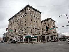
| 21 |
Hotel Pines |
|
000000001979-08-10-0000August 10, 1979
(#79000443) |
Main St. and W. 5th Ave.
34°13′30″N 92°00′13″W / 34.225°N 92.003611°W / 34.225; -92.003611 (Hotel Pines) |
Pine Bluff |
|
| 22 |
Howson House |
|
000000001982-12-22-0000December 22, 1982
(#82000847) |
1700 S. Olive St.
34°12′41″N 92°00′25″W / 34.211389°N 92.006944°W / 34.211389; -92.006944 (Howson House) |
Pine Bluff |
part of the Charles L. Thompson Design Collection TR
|
| 23 |
Hudson House |
|
000000001982-12-22-0000December 22, 1982
(#82000848) |
304 W. 5th St.
34°12′51″N 92°00′20″W / 34.214167°N 92.005556°W / 34.214167; -92.005556 (Hudson House) |
Pine Bluff |
part of the Charles L. Thompson Design Collection TR
|
| 24 |
Hudson-Grace-Borreson House |
|
000000001971-06-24-0000June 24, 1971
(#71000126) |
716 W. Barraque
34°13′44″N 92°00′30″W / 34.228889°N 92.008333°W / 34.228889; -92.008333 (Hudson-Grace-Borreson House) |
Pine Bluff |
|
| 25 |
Johnson House |
|
000000001982-12-22-0000December 22, 1982
(#82000849) |
315 Martin St.
34°13′06″N 92°00′21″W / 34.218333°N 92.005833°W / 34.218333; -92.005833 (Johnson House) |
Pine Bluff |
part of the Charles L. Thompson Design Collection TR
|
| 26 |
Katzenstein House |
|
000000001982-12-22-0000December 22, 1982
(#82000850) |
902 W. 5th St.
34°13′30″N 92°00′46″W / 34.225°N 92.012778°W / 34.225; -92.012778 (Katzenstein House) |
Pine Bluff |
part of the Charles L. Thompson Design Collection TR
|
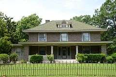
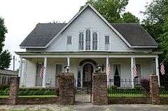
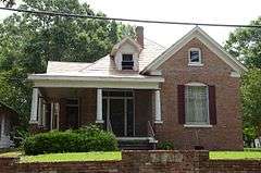
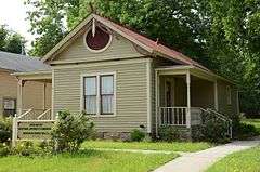
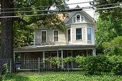
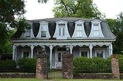
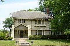
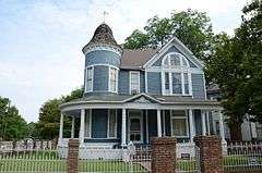
| 27 |
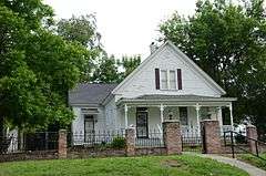
R.M. Knox House |
|
000000001975-06-05-0000June 5, 1975
(#75000395) |
1504 W. 6th St.
34°13′24″N 92°01′04″W / 34.223333°N 92.017778°W / 34.223333; -92.017778 (R.M. Knox House) |
Pine Bluff |
A two-story frame house exemplifying Eastlake Victorian architecture. Features include a three-story tower, a gabled bay, and a two-story porch along the east end. It was built in 1885 by R. M. Knox, a wealthy Pine Bluff businessman.[6]
|
| 28 |
Lake Dick |
|
000000001975-07-03-0000July 3, 1975
(#75000394) |
4 miles (6.4 km) south of Altheimer off Highway 88
34°15′13″N 91°50′30″W / 34.253611°N 91.841667°W / 34.253611; -91.841667 (Lake Dick) |
Altheimer |
|
| 29 |
R.E. Lee House |
|
000000001982-06-08-0000June 8, 1982
(#82002118) |
1302 W. 2nd Ave.
34°13′41″N 92°00′59″W / 34.228056°N 92.016389°W / 34.228056; -92.016389 (R.E. Lee House) |
Pine Bluff |
|
| 30 |
Lone Star Baptist Church |
|
000000002005-09-28-0000September 28, 2005
(#05001076) |
620 Sheridan Rd.
34°26′32″N 92°11′17″W / 34.442269°N 92.188181°W / 34.442269; -92.188181 (Lone Star Baptist Church) |
Redfield |
|
| 31 |
MacMillan-Dilley House |
|
000000001976-12-12-0000December 12, 1976
(#76000422) |
407 Martin Ave.
34°13′05″N 92°00′22″W / 34.218056°N 92.006111°W / 34.218056; -92.006111 (MacMillan-Dilley House) |
Pine Bluff |
|
| 32 |
Masonic Temple |
|
000000001978-11-30-0000November 30, 1978
(#78000599) |
4th and State St.
34°13′35″N 92°00′09″W / 34.226389°N 92.0025°W / 34.226389; -92.0025 (Masonic Temple) |
Pine Bluff |
|
| 33 |
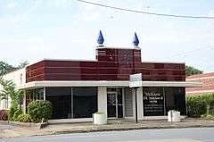
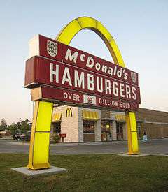
McDonald's Store #433 Sign |
|
000000002006-08-21-0000August 21, 2006
(#06000411) |
2801 S. Olive St.
34°12′00″N 92°00′24″W / 34.200035°N 92.006770°W / 34.200035; -92.006770 (McDonald's Store #433 Sign) |
Pine Bluff |
|
| 34 |
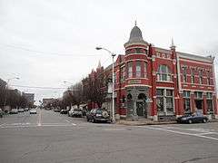
Merchants and Planters Bank Building |
|
000000001978-08-01-0000August 1, 1978
(#78000600) |
100 Main St.
34°13′45″N 92°00′13″W / 34.229167°N 92.003611°W / 34.229167; -92.003611 (Merchants and Planters Bank Building) |
Pine Bluff |
|
| 35 |
Mills House |
|
000000001998-05-29-0000May 29, 1998
(#98000584) |
715 W. Barraque
34°13′15″N 92°00′36″W / 34.220833°N 92.01°W / 34.220833; -92.01 (Mills House) |
Pine Bluff |
|
| 36 |
National Guard Armory-Pine Bluff |
|
000000002001-02-16-0000February 16, 2001
(#01000112) |
623 W. 2nd Ave.
34°13′44″N 92°00′32″W / 34.228889°N 92.008889°W / 34.228889; -92.008889 (National Guard Armory-Pine Bluff) |
Pine Bluff |
|
| 37 |
Nichol House |
|
000000001993-11-12-0000November 12, 1993
(#93001201) |
205 Park Pl.
34°12′39″N 92°00′02″W / 34.210833°N 92.000556°W / 34.210833; -92.000556 (Nichol House) |
Pine Bluff |
part of the Charles L. Thompson Design Collection TR
|
| 38 |
W.E. O'Bryant Bell Tower |
|
000000001998-06-03-0000June 3, 1998
(#98000622) |
1200 N. University Dr. on the campus of the University of Pine Bluff
34°14′35″N 92°01′08″W / 34.243056°N 92.018889°W / 34.243056; -92.018889 (W.E. O'Bryant Bell Tower) |
Pine Bluff |
|
| 39 |
Dr. John Walter Parker Sr. House |
Upload image |
000000002003-09-25-0000September 25, 2003
(#03000947) |
1405 S. Alabama St.
34°12′54″N 92°00′03″W / 34.215°N 92.000833°W / 34.215; -92.000833 (Dr. John Walter Parker Sr. House) |
Pine Bluff |
|
| 40 |
Parkview Apartments |
|
000000001989-05-01-0000May 1, 1989
(#89000335) |
300 W. 13th Ave.
34°12′58″N 92°00′20″W / 34.216111°N 92.005556°W / 34.216111; -92.005556 (Parkview Apartments) |
Pine Bluff |
|
| 41 |
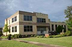
Pine Bluff Civic Center |
|
000000002005-06-01-0000June 1, 2005
(#05000496) |
200 E. 8th Ave.
34°13′19″N 92°00′04″W / 34.221944°N 92.001111°W / 34.221944; -92.001111 (Pine Bluff Civic Center) |
Pine Bluff |
|
| 42 |
Pine Bluff Commercial Historic District |
|
000000002008-05-20-0000May 20, 2008
(#08000438) |
Roughly bounded by U.S. Highway 65B, Walnut St., 10th Ave., and S. Alabama St.
34°13′18″N 92°00′11″W / 34.221714°N 92.003103°W / 34.221714; -92.003103 (Pine Bluff Commercial Historic District) |
Pine Bluff |
|
| 43 |
Pine Bluff Confederate Monument |
|
000000001996-04-26-0000April 26, 1996
(#96000464) |
Northern side of the Jefferson County Courthouse at the junction of Barraque and Main Sts.
34°13′49″N 92°00′11″W / 34.230278°N 92.003056°W / 34.230278; -92.003056 (Pine Bluff Confederate Monument) |
Pine Bluff |
part of the Civil War Commemorative Sculpture MPS
|
| 44 |
Pine Bluff Fifth Avenue Historic District |
|
000000001980-10-29-0000October 29, 1980
(#80000777) |
5th Ave.
34°13′30″N 92°00′27″W / 34.225°N 92.0075°W / 34.225; -92.0075 (Pine Bluff Fifth Avenue Historic District) |
Pine Bluff |
|
| 45 |
Plum Bayou Homesteads |
|
000000001975-06-05-0000June 5, 1975
(#75000396) |
North of Pine Bluff, east of the Arkansas River, includes the community of Wright and its environs
34°25′52″N 92°03′21″W / 34.431111°N 92.055833°W / 34.431111; -92.055833 (Plum Bayou Homesteads) |
Pine Bluff |
|
| 46 |
Prigmore House |
|
000000001986-04-10-0000April 10, 1986
(#86000720) |
1104 W. 5th Ave.
34°13′29″N 92°00′38″W / 34.224722°N 92.010556°W / 34.224722; -92.010556 (Prigmore House) |
Pine Bluff |
|
| 47 |
Puddephatt House |
|
000000001982-12-22-0000December 22, 1982
(#82000851) |
1820 S. Olive St.
34°12′37″N 92°00′26″W / 34.210278°N 92.007222°W / 34.210278; -92.007222 (Puddephatt House) |
Pine Bluff |
part of the Charles L. Thompson Design Collection TR
|
| 48 |
Redfield School Historic District |
|
000000002014-10-01-0000October 1, 2014
(#14000791) |
101 School St.
34°26′54″N 92°11′06″W / 34.4482°N 92.185°W / 34.4482; -92.185 (Redfield School Historic District) |
Redfield |
|
| 49 |
Roselawn |
|
000000001978-05-23-0000May 23, 1978
(#78000597) |
Southwest of Altheimer off Highway 88
34°18′26″N 91°51′34″W / 34.307222°N 91.859444°W / 34.307222; -91.859444 (Roselawn) |
Altheimer |
|
| 50 |
Roth-Rosenzweig House |
|
000000001976-12-12-0000December 12, 1976
(#76000423) |
717 W. 2nd Ave.
34°13′43″N 92°00′34″W / 34.228611°N 92.009444°W / 34.228611; -92.009444 (Roth-Rosenzweig House) |
Pine Bluff |
|
| 51 |
Saenger Theater |
|
000000001995-03-23-0000March 23, 1995
(#95000348) |
Southeastern corner of the junction of W. 2nd Ave. and Pine St.
34°13′41″N 92°00′14″W / 34.228056°N 92.003889°W / 34.228056; -92.003889 (Saenger Theater) |
Pine Bluff |
|
| 52 |
St. Louis San Francisco (Frisco) Railway Coach #661 |
Upload image |
000000002006-05-19-0000May 19, 2006
(#06000413) |
2815 Dixie Woods Dr.
34°16′04″N 92°03′35″W / 34.267778°N 92.059722°W / 34.267778; -92.059722 (St. Louis San Francisco (Frisco) Railway Coach #661) |
Pine Bluff |
|
| 53 |
St. Louis Southwestern Railway (Cotton Belt Route) Caboose #2325 |
Upload image |
000000002006-03-02-0000March 2, 2006
(#06000074) |
2815 Dixie Woods Dr.
34°16′04″N 92°03′34″W / 34.267778°N 92.059444°W / 34.267778; -92.059444 (St. Louis Southwestern Railway (Cotton Belt Route) Caboose #2325) |
Pine Bluff |
|
| 54 |
St. Louis Southwestern Railway (Cotton Belt Route) Relief Train |
|
000000002007-05-25-0000May 25, 2007
(#07000471) |
Arkansas Railroad Museum
34°13′45″N 91°59′09″W / 34.229167°N 91.985833°W / 34.229167; -91.985833 (St. Louis Southwestern Railway (Cotton Belt Route) Relief Train) |
Pine Bluff |
|
| 55 |
St. Louis Southwestern Railway (Cotton Belt Route) Steam Locomotive #336 |
|
000000002007-01-24-0000January 24, 2007
(#06001276) |
Arkansas Railroad Museum
34°13′37″N 91°59′04″W / 34.226944°N 91.984444°W / 34.226944; -91.984444 (St. Louis Southwestern Railway (Cotton Belt Route) Steam Locomotive #336) |
Pine Bluff |
|
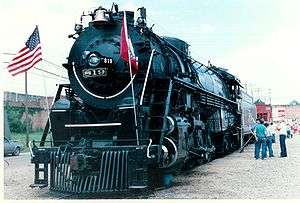
| 56 |
St. Louis Southwestern Railway Steam Locomotive #819 |
|
000000002003-05-18-0000May 18, 2003
(#03000401) |
Arkansas Railroad Museum
34°13′37″N 91°59′05″W / 34.226944°N 91.984722°W / 34.226944; -91.984722 (St. Louis Southwestern Railway Steam Locomotive #819) |
Pine Bluff |
|
| 57 |
St. Peter's Cemetery |
|
000000001998-06-04-0000June 4, 1998
(#98000617) |
Morgan Rd., south of New Gascony
34°13′17″N 91°46′42″W / 34.221384°N 91.778305°W / 34.221384; -91.778305 (St. Peter's Cemetery) |
Pine Bluff |
|
| 58 |
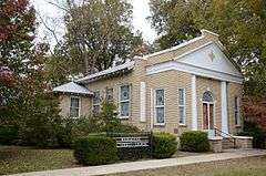
Sherrill Methodist Episcopal Church, South |
|
000000002002-05-16-0000May 16, 2002
(#02000487) |
301 Main St.
34°23′15″N 91°57′08″W / 34.3875°N 91.952222°W / 34.3875; -91.952222 (Sherrill Methodist Episcopal Church, South) |
Sherrill |
|
| 59 |
Walter B. Sorrells Cottage |
|
000000001986-08-04-0000August 4, 1986
(#86002276) |
Off Highway 104
34°13′03″N 92°05′16″W / 34.2175°N 92.087778°W / 34.2175; -92.087778 (Walter B. Sorrells Cottage) |
Pine Bluff |
|
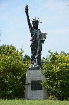
| 60 |
Strengthen the Arm of Liberty Monument-Pine Bluff |
|
000000002000-11-01-0000November 1, 2000
(#00001265) |
10th Ave. between Georgia and State Sts.
34°13′11″N 92°00′03″W / 34.219722°N 92.000833°W / 34.219722; -92.000833 (Strengthen the Arm of Liberty Monument-Pine Bluff) |
Pine Bluff |
|
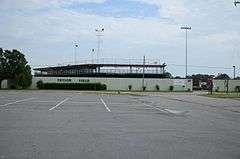
| 61 |
Taylor Field |
|
000000002010-01-21-0000January 21, 2010
(#09001250) |
1201 E. 16th St.
34°12′50″N 91°59′29″W / 34.213906°N 91.991519°W / 34.213906; -91.991519 (Taylor Field) |
Pine Bluff |
part of the New Deal Recovery Efforts in Arkansas MPS
|
| 62 |
Temple House |
|
000000001982-12-22-0000December 22, 1982
(#82000840) |
1702 S. Oak St.
34°12′41″N 92°00′38″W / 34.211389°N 92.010556°W / 34.211389; -92.010556 (Temple House) |
Pine Bluff |
part of the Charles L. Thompson Design Collection TR
|
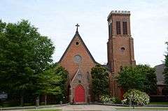
| 63 |
Trinity Episcopal Church |
|
000000001974-07-30-0000July 30, 1974
(#74000479) |
3rd and Oak Sts.
34°13′40″N 92°00′36″W / 34.227778°N 92.01°W / 34.227778; -92.01 (Trinity Episcopal Church) |
Pine Bluff |
|
| 64 |
Trulock-Cook House |
|
000000001979-02-21-0000February 21, 1979
(#79000444) |
703 W. 2nd Ave.
34°13′43″N 92°00′38″W / 34.228611°N 92.010556°W / 34.228611; -92.010556 (Trulock-Cook House) |
Pine Bluff |
|
| 65 |
Trulock-Gould-Mullis House |
|
000000001978-01-03-0000January 3, 1978
(#78003199) |
704 W. Barraque St.
34°13′46″N 92°00′35″W / 34.229444°N 92.009722°W / 34.229444; -92.009722 (Trulock-Gould-Mullis House) |
Pine Bluff |
|
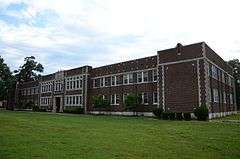
| 66 |
Tucker School |
|
000000002005-06-10-0000June 10, 2005
(#05000538) |
Vandalsen Dr.
34°26′08″N 91°57′21″W / 34.435556°N 91.955833°W / 34.435556; -91.955833 (Tucker School) |
Tucker |
|
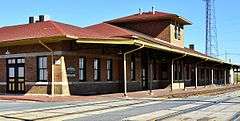
| 67 |
Union Station |
|
000000001978-12-14-0000December 14, 1978
(#78000601) |
E. 4th Ave. and State St.
34°13′34″N 92°00′06″W / 34.226111°N 92.001667°W / 34.226111; -92.001667 (Union Station) |
Pine Bluff |
|
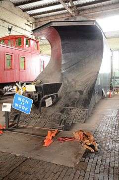
| 68 |
United States Army Snow Plow #SN-87 |
|
000000002007-01-24-0000January 24, 2007
(#06001273) |
Arkansas Railroad Museum
34°13′47″N 91°59′07″W / 34.229722°N 91.985278°W / 34.229722; -91.985278 (United States Army Snow Plow #SN-87) |
Pine Bluff |
|
| 69 |
Wabash Alloys Locomotive |
|
000000002007-05-22-0000May 22, 2007
(#07000444) |
Arkansas Railroad Museum
34°13′45″N 91°59′06″W / 34.229167°N 91.985°W / 34.229167; -91.985 (Wabash Alloys Locomotive) |
Pine Bluff |
|
| 70 |
Wabbaseka Methodist Episcopal Church, South |
|
000000002002-10-04-0000October 4, 2002
(#02001073) |
U.S. Highway 79
34°21′36″N 91°47′52″W / 34.36°N 91.797778°W / 34.36; -91.797778 (Wabbaseka Methodist Episcopal Church, South) |
Wabbaseka |
|
| 71 |
John Brown Watson Memorial Library Building |
|
000000002006-01-13-0000January 13, 2006
(#05001073) |
1200 N. University Dr.
34°14′42″N 92°01′13″W / 34.245°N 92.020278°W / 34.245; -92.020278 (John Brown Watson Memorial Library Building) |
Pine Bluff |
|
| 72 |
West James Street Overpass |
|
000000001995-05-18-0000May 18, 1995
(#95000609) |
W. James St. over Union Pacific railroad tracks
34°26′44″N 92°11′06″W / 34.445556°N 92.185°W / 34.445556; -92.185 (West James Street Overpass) |
Redfield |
part of the Historic Bridges of Arkansas MPS
|
| 73 |
Yauch-Ragar House |
|
000000001978-01-20-0000January 20, 1978
(#78000602) |
625 State St.
34°13′28″N 92°00′07″W / 34.224444°N 92.001944°W / 34.224444; -92.001944 (Yauch-Ragar House) |
Pine Bluff |
|


_before_1905_via_HS_Goodman's_Knox_Family.jpg)


_Relief_Train.jpg)
_Steam_Locomotive_336.jpg)