| [3] |
Name on the Register[4] |
Image |
Date listed[5] |
Location |
City or town |
Description |
|---|
| 1 |
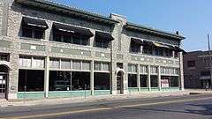
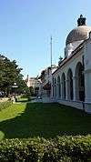
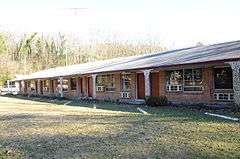
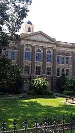
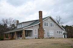
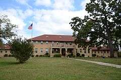
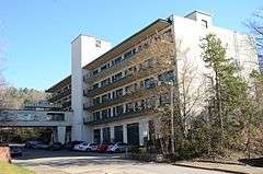
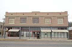
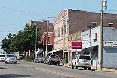
Army and Navy General Hospital Historic District |
|
000000002007-02-09-0000February 9, 2007
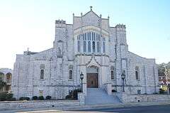
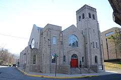
(#05001590) |
105, 200, 417, 421 and 425 Reserve St.
34°30′43″N 93°03′01″W / 34.512022°N 93.050383°W / 34.512022; -93.050383 (Army and Navy General Hospital Historic District) |
Hot Springs |
|
| 2 |
Bathhouse Row |
|
000000001974-11-13-0000November 13, 1974
(#74000275) |
Central Ave. between Reserve and Fountain Sts. in Hot Springs National Park
34°30′50″N 93°03′13″W / 34.513889°N 93.053611°W / 34.513889; -93.053611 (Bathhouse Row) |
Hot Springs |
|
| 3 |
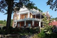
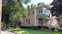
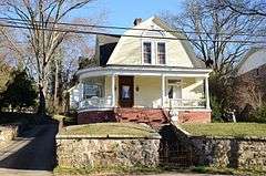
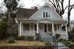
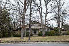
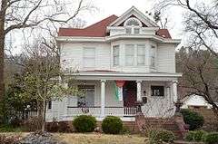
Walter Beauchamp House |
|
000000001994-05-19-0000May 19, 1994
(#94000470) |
492 Prospect Ave.
34°30′27″N 93°03′37″W / 34.5075°N 93.060278°W / 34.5075; -93.060278 (Walter Beauchamp House) |
Hot Springs |
|
| 4 |
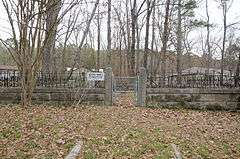
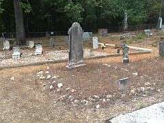
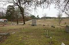
Belding-Gaines Cemetery |
|
000000001993-02-25-0000February 25, 1993
(#93000089) |
U.S. Route 270
34°28′06″N 92°58′45″W / 34.468333°N 92.979167°W / 34.468333; -92.979167 (Belding-Gaines Cemetery) |
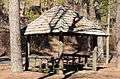
Hot Springs |
|
| 5 |
Bellaire Court Historic District |
|
000000002004-02-11-0000February 11, 2004
(#04000007) |
637 Park Ave.
34°31′28″N 93°03′11″W / 34.524444°N 93.053056°W / 34.524444; -93.053056 (Bellaire Court Historic District) |
Hot Springs |
|
| 6 |
W. C. Brown House |
|
000000001986-10-16-0000October 16, 1986
(#86002862) |
2330 Central Ave.
34°29′21″N 93°03′33″W / 34.489167°N 93.059167°W / 34.489167; -93.059167 (W. C. Brown House) |
Hot Springs |
|
| 7 |
Buckville Cemetery |
|
000000002007-09-27-0000September 27, 2007
(#07000994) |
Buckville Rd.
34°36′51″N 93°20′32″W / 34.614167°N 93.342222°W / 34.614167; -93.342222 (Buckville Cemetery) |
Avant |
|
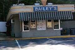
| 8 |
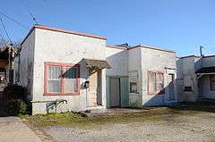
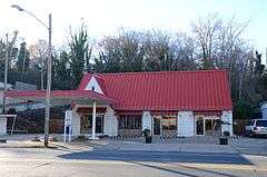
Butchie's Drive-In |
|
000000002004-02-11-0000February 11, 2004
(#04000004) |
534 Park Ave.
34°31′23″N 93°03′13″W / 34.523056°N 93.053611°W / 34.523056; -93.053611 (Butchie's Drive-In) |
Hot Springs |
|
| 9 |
Camp Clearfork Historic District |
|
000000001993-10-21-0000October 21, 1993
(#93001079) |
South of U.S. Route 270 and west of Crystal Springs in the Ouachita National Forest
34°30′28″N 93°23′36″W / 34.507778°N 93.393333°W / 34.507778; -93.393333 (Camp Clearfork Historic District) |
Crystal Springs |
|
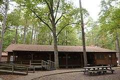
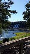
| 10 |
Carpenter Dam |
|
000000001992-09-04-0000September 4, 1992
(#92001083) |
1398 Carpenter Dam Rd.
34°26′32″N 93°01′33″W / 34.442222°N 93.025833°W / 34.442222; -93.025833 (Carpenter Dam) |
Hot Springs |
|
| 11 |
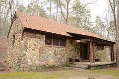
CCC Company 3767 Powder Magazine Historic District |
Upload image |
000000002007-03-30-0000March 30, 2007
(#07000200) |
K59P Rd., north of Forest Service Rd. 11 (Gladstone Rd.)
34°45′54″N 93°11′48″W / 34.7651°N 93.1968°W / 34.7651; -93.1968 (CCC Company 3767 Powder Magazine Historic District) |
Jessieville |
|
| 12 |
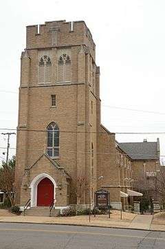
Central Methodist Episcopal Church South |
|
000000002011-09-23-0000September 23, 2011
(#11000689) |
1100 Central Ave.
34°30′17″N 93°03′20″W / 34.504722°N 93.055556°W / 34.504722; -93.055556 (Central Methodist Episcopal Church South) |
Hot Springs |
|
| 13 |
Charlton Bathhouse |
|
000000001993-10-20-0000October 20, 1993
(#93001080) |
North of U.S. Route 270 and west of Crystal Springs in the Ouachita National Forest
34°29′23″N 93°22′16″W / 34.489722°N 93.371111°W / 34.489722; -93.371111 (Charlton Bathhouse) |
Crystal Springs |
|
| 14 |
Charlton Spillway-Dam |
|
000000001993-10-21-0000October 21, 1993
(#93001081) |
North of U.S. Route 270 and west of Crystal Springs in the Ouachita National Forest
34°31′03″N 93°22′53″W / 34.5175°N 93.381389°W / 34.5175; -93.381389 (Charlton Spillway-Dam) |
Crystal Springs |
|
| 15 |
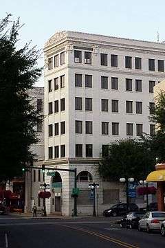
Citizens Building |
|
000000001979-08-09-0000August 9, 1979
(#79000440) |
723 Central Ave.
34°30′43″N 93°03′51″W / 34.511944°N 93.064167°W / 34.511944; -93.064167 (Citizens Building) |
Hot Springs |
|
| 16 |
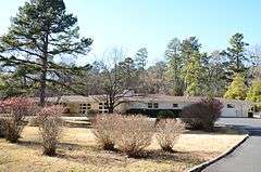
Bill Clinton Boyhood Home |
|
000000001995-05-18-0000May 18, 1995
(#95000655) |
1011 Park Ave.
34°31′53″N 93°02′45″W / 34.531389°N 93.045833°W / 34.531389; -93.045833 (Bill Clinton Boyhood Home) |
Hot Springs |
|
| 17 |
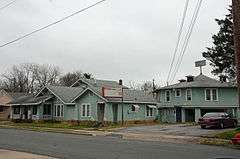
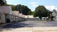
Cottage Courts Historic District |
|
000000002004-02-11-0000February 11, 2004
(#04000005) |
609 Park Ave.
34°31′26″N 93°03′12″W / 34.523889°N 93.053333°W / 34.523889; -93.053333 (Cottage Courts Historic District) |
Hot Springs |
|
| 18 |
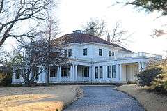
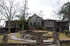
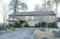
Couchwood |
|
000000001986-12-04-0000December 4, 1986
(#86003582) |
On the grounds of the Couchwood estate, 601 Couchwood Rd.[6]
34°26′58″N 92°54′53″W / 34.449306°N 92.914833°W / 34.449306; -92.914833 (Couchwood) |
Shorewood Hills |
Extends into Hot Spring County; listing encompasses artwork of Dionicio Rodriguez on the private estate of Harvey C. Couch.
|
| 19 |
Couchwood Historic District |
|
000000002001-05-17-0000May 17, 2001
(#01000487) |
601 Couchwood Rd.
34°26′50″N 92°54′50″W / 34.447222°N 92.913889°W / 34.447222; -92.913889 (Couchwood Historic District) |
Hot Springs |
Extends into Hot Spring County; listing encompasses buildings and structures of the private estate of Harvey C. Couch.
|
| 20 |
Cove Tourist Court |
|
000000002004-02-11-0000February 11, 2004
(#04000008) |
771 Park Ave.
34°31′38″N 93°03′05″W / 34.527222°N 93.051389°W / 34.527222; -93.051389 (Cove Tourist Court) |
Hot Springs |
|
| 21 |
Doherty House |
|
000000001978-11-14-0000November 14, 1978
(#78000587) |
705 Malvern Ave.
34°30′16″N 93°02′53″W / 34.504444°N 93.048056°W / 34.504444; -93.048056 (Doherty House) |
Hot Springs |
|
| 22 |
Federal Building-U.S. Post Office and Court House |
|
000000002015-05-05-0000May 5, 2015
(#15000205) |
100 Reserve St.
34°30′42″N 93°03′14″W / 34.5116°N 93.0538°W / 34.5116; -93.0538 (Federal Building-U.S. Post Office and Court House) |
Hot Springs |
|
| 23 |
First Lutheran Church |
|
000000002015-05-27-0000May 27, 2015
(#15000282) |
1700 Central Ave.
34°29′46″N 93°03′28″W / 34.4960°N 93.0577°W / 34.4960; -93.0577 (First Lutheran Church) |
Hot Springs |
|
| 24 |
First Methodist Church Christian Education Building |
|
000000002016-06-07-0000June 7, 2016
(#16000317) |
1100 Central Ave.
34°30′18″N 93°03′19″W / 34.504868°N 93.055365°W / 34.504868; -93.055365 (First Methodist Church Christian Education Building) |
Hot Springs |
|
| 25 |
First Presbyterian Church |
|
000000001982-12-22-0000December 22, 1982
(#82000817) |
213 Whittington
34°30′58″N 93°03′33″W / 34.516111°N 93.059167°W / 34.516111; -93.059167 (First Presbyterian Church) |
Hot Springs |
|
| 26 |
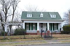
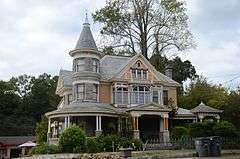
Fordyce House |
|
000000001982-12-22-0000December 22, 1982
(#82000818) |
746 Park Ave.
34°31′45″N 93°02′58″W / 34.529167°N 93.049444°W / 34.529167; -93.049444 (Fordyce House) |
Hot Springs |
|
| 27 |
Fordyce-Ricks House Historic District |
|
000000002003-10-31-0000October 31, 2003
(#03001098) |
1501 Park Ave.
34°32′11″N 93°02′01″W / 34.536389°N 93.033611°W / 34.536389; -93.033611 (Fordyce-Ricks House Historic District) |
Hot Springs |
|
| 28 |
Forest Service Headquarters Historic District |
|
000000001993-10-20-0000October 20, 1993
(#93001089) |
South of the junction of Winona and Indiana Sts.
34°29′32″N 93°03′16″W / 34.492222°N 93.054444°W / 34.492222; -93.054444 (Forest Service Headquarters Historic District) |
Hot Springs |
|
| 29 |
Garland County Courthouse |
|
000000001979-12-06-0000December 6, 1979
(#79000441) |
Ouachita and Hawthorne Aves
34°30′17″N 93°03′32″W / 34.504722°N 93.058889°W / 34.504722; -93.058889 (Garland County Courthouse) |
Hot Springs |
|
| 30 |
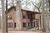
Gillham House |
|
000000001994-03-17-0000March 17, 1994
(#94000188) |
County Road 584 north of its junction with U.S. Route 270
34°31′02″N 93°14′28″W / 34.517222°N 93.241111°W / 34.517222; -93.241111 (Gillham House) |
Royal |
|
| 31 |
Harley E. Green House |
|
000000001979-07-19-0000July 19, 1979
(#79000439) |
North of Bear
34°32′17″N 93°16′29″W / 34.538056°N 93.274722°W / 34.538056; -93.274722 (Harley E. Green House) |
Bear |
|
| 32 |
Hill Wheatley Downtowner Motor Inn |
|
000000002016-09-27-0000September 27, 2016
(#16000650) |
135 Central Ave.
34°31′04″N 93°03′18″W / 34.517916°N 93.054905°W / 34.517916; -93.054905 (Hill Wheatley Downtowner Motor Inn) |
Hot Springs |
|
| 33 |
Hollywood Cemetery, Confederate Section |
|
000000001996-12-06-0000December 6, 1996
(#96001409) |
Near the junction of Hollywood Ave. and Mote Rd.
34°29′11″N 93°02′33″W / 34.486389°N 93.0425°W / 34.486389; -93.0425 (Hollywood Cemetery, Confederate Section) |
Hot Springs |
|
| 34 |
Hot Springs Central Avenue Historic District |
|
000000001985-06-25-0000June 25, 1985
(#85001370) |
Central Ave. from Prospect to Park Sts.; also 101 Park Ave.
34°30′53″N 93°03′16″W / 34.514722°N 93.054444°W / 34.514722; -93.054444 (Hot Springs Central Avenue Historic District) |
Hot Springs |
101 Park represents a boundary increase of 000000002007-09-19-0000September 19, 2007
|
| 35 |
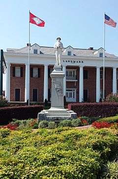
Hot Springs Confederate Monument |
|
000000001996-04-26-0000April 26, 1996
(#96000457) |
Landmark Plaza, bounded by Market St. and Ouachita and Central Aves.
34°30′28″N 93°03′18″W / 34.507778°N 93.055°W / 34.507778; -93.055 (Hot Springs Confederate Monument) |
Hot Springs |
|
| 36 |
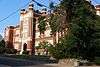
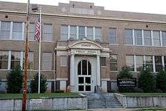
Hot Springs High School |
|
000000001988-01-28-0000January 28, 1988
(#87002495) |
Oak St. between Orange and Olive Sts.
34°30′19″N 93°03′12″W / 34.505278°N 93.053333°W / 34.505278; -93.053333 (Hot Springs High School) |
Hot Springs |
|
| 37 |
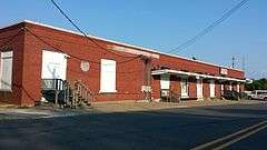
Hot Springs Railroad Warehouse Historic District |
|
000000001996-05-27-0000May 27, 1996
(#96000526) |
401-439 Broadway
34°30′17″N 93°03′05″W / 34.504722°N 93.051389°W / 34.504722; -93.051389 (Hot Springs Railroad Warehouse Historic District) |
Hot Springs |
|
| 38 |
Humphrey's Dairy Farm |
|
000000002012-07-26-0000July 26, 2012
(#12000275) |
1675 Shady Grove Rd.
34°27′08″N 93°00′03″W / 34.452201°N 93.000902°W / 34.452201; -93.000902 (Humphrey's Dairy Farm) |
Hot Springs vicinity |
|
| 39 |
Humphreys-Ryan House |
|
000000002000-06-02-0000June 2, 2000
(#00000606) |
137 Garland Ave.
34°29′58″N 93°03′28″W / 34.499444°N 93.057778°W / 34.499444; -93.057778 (Humphreys-Ryan House) |
Hot Springs |
|
| 40 |
Interstate Orphanage |
|
000000001982-12-22-0000December 22, 1982
(#82000832) |
339 Combs
34°29′50″N 93°03′12″W / 34.497222°N 93.053333°W / 34.497222; -93.053333 (Interstate Orphanage) |
Hot Springs |
|
| 41 |
Iron Springs Dam |
|
000000001993-10-21-0000October 21, 1993
(#93001090) |
Highway 7 north of Jessieville in the Ouachita National Forest
34°45′43″N 93°04′12″W / 34.761944°N 93.07°W / 34.761944; -93.07 (Iron Springs Dam) |
Jessieville |
|
| 42 |
Iron Springs Shelter No. 1 |
|
000000001993-10-20-0000October 20, 1993
(#93001091) |
Highway 7 north of Jessieville in the Ouachita National Forest
34°45′41″N 93°04′09″W / 34.761389°N 93.069167°W / 34.761389; -93.069167 (Iron Springs Shelter No. 1) |
Jessieville |
|
| 43 |
Iron Springs Shelter No. 2 |
|
000000001993-10-20-0000October 20, 1993
(#93001092) |
Highway 7 north of Jessieville in the Ouachita National Forest
34°45′40″N 93°04′09″W / 34.761111°N 93.069167°W / 34.761111; -93.069167 (Iron Springs Shelter No. 2) |
Jessieville |
|
| 44 |
Jack Tar Hotel and Bathhouse |
|
000000002006-02-21-0000February 21, 2006
(#06000079) |
145 Oriole St.
34°31′45″N 93°02′49″W / 34.529139°N 93.047053°W / 34.529139; -93.047053 (Jack Tar Hotel and Bathhouse) |
Hot Springs |
|
| 45 |
Peter Dierks Joers House |
|
000000002009-11-04-0000November 4, 2009
(#09000773) |
2111 Park Ave.
34°32′37″N 93°01′24″W / 34.5437°N 93.023261°W / 34.5437; -93.023261 (Peter Dierks Joers House) |
Hot Springs |
|
| 46 |
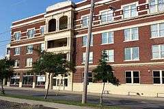
Jones School |
|
000000001988-05-05-0000May 5, 1988
(#88000517) |
Linwood and Hobson Aves.
34°29′51″N 93°03′40″W / 34.4975°N 93.061111°W / 34.4975; -93.061111 (Jones School) |
Hot Springs |
|
| 47 |
Peter Joplin Commercial Block |
|
000000002000-03-31-0000March 31, 2000
(#00000294) |
426-432 Ouachita Ave.
34°30′24″N 93°03′30″W / 34.506667°N 93.058333°W / 34.506667; -93.058333 (Peter Joplin Commercial Block) |
Hot Springs |
|
| 48 |
King-Neimeyer-Mathis House |
|
000000002002-09-14-0000September 14, 2002
(#02000955) |
2145 Malvern Rd.
34°28′42″N 93°01′28″W / 34.478333°N 93.024444°W / 34.478333; -93.024444 (King-Neimeyer-Mathis House) |
Hot Springs |
|
| 49 |
George Klein Tourist Court Historic District |
|
000000001993-06-08-0000June 8, 1993
(#93000480) |
501 Morrison St.
34°29′42″N 93°03′24″W / 34.495°N 93.056667°W / 34.495; -93.056667 (George Klein Tourist Court Historic District) |
Hot Springs |
|
| 50 |
Kraemer-Harman House |
|
000000001999-10-21-0000October 21, 1999
(#99001258) |
513 2nd St.
34°29′50″N 93°03′46″W / 34.497222°N 93.062778°W / 34.497222; -93.062778 (Kraemer-Harman House) |
Hot Springs |
|
| 51 |
Langdon Filling Station |
|
000000002004-02-11-0000February 11, 2004
(#04000003) |
311 Park Ave.
34°31′17″N 93°03′17″W / 34.521389°N 93.054722°W / 34.521389; -93.054722 (Langdon Filling Station) |
Hot Springs |
|
| 52 |
Little Switzerland |
Upload image |
000000001986-12-04-0000December 4, 1986
(#86003584) |
Address Restricted
|
Shorewood Hills |
|
| 53 |
Van Lyell House |
|
000000002004-08-31-0000August 31, 2004
(#04000504) |
130 Van Lyell Terrace
34°26′18″N 93°05′07″W / 34.438422°N 93.085308°W / 34.438422; -93.085308 (Van Lyell House) |
Hot Springs |
|
| 54 |
Lynwood Tourist Court Historic District |
|
000000002004-02-11-0000February 11, 2004
(#04000010) |
857 Park Ave.
34°31′45″N 93°02′58″W / 34.529167°N 93.049444°W / 34.529167; -93.049444 (Lynwood Tourist Court Historic District) |
Hot Springs |
|
| 55 |
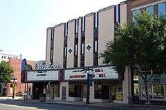
Malco Theatre |
|
000000002010-01-21-0000January 21, 2010
(#09001246) |
817 Central Ave.
34°30′32″N 93°03′15″W / 34.508967°N 93.054236°W / 34.508967; -93.054236 (Malco Theatre) |
Hot Springs |
|
| 56 |
William H. Martin House |
|
000000001986-06-11-0000June 11, 1986
(#86001320) |
815 Quapaw Ave.
34°30′15″N 93°03′47″W / 34.504167°N 93.063056°W / 34.504167; -93.063056 (William H. Martin House) |
Hot Springs |
|
| 57 |
Mayberry Springs |
Upload image |
000000001990-09-05-0000September 5, 1990
(#90001379) |
U.S. Route 270
34°31′01″N 93°18′06″W / 34.516944°N 93.301667°W / 34.516944; -93.301667 (Mayberry Springs) |
Crystal Springs |
(burned down)
|
| 58 |
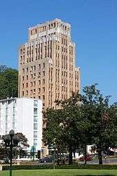
Medical Arts Building |
|
000000001978-11-30-0000November 30, 1978
(#78000588) |
236 Central Ave.
34°30′59″N 93°03′14″W / 34.516389°N 93.053889°W / 34.516389; -93.053889 (Medical Arts Building) |
Hot Springs |
|
| 59 |
Missouri-Pacific Railroad Depot-Hot Springs |
|
000000001992-06-11-0000June 11, 1992
(#92000611) |
Junction of Broadway and Market St.
34°30′27″N 93°03′09″W / 34.5075°N 93.0525°W / 34.5075; -93.0525 (Missouri-Pacific Railroad Depot-Hot Springs) |
Hot Springs |
|
| 60 |
W. H. Moore House |
|
000000001990-03-27-0000March 27, 1990
(#90000429) |
906 Malvern St.
34°30′04″N 93°02′44″W / 34.501111°N 93.045556°W / 34.501111; -93.045556 (W. H. Moore House) |
Hot Springs |
|
| 61 |
Mountainaire Hotel Historic District |
|
000000002004-02-11-0000February 11, 2004
(#04000013) |
1100 Park Ave.
34°31′50″N 93°02′32″W / 34.530556°N 93.042222°W / 34.530556; -93.042222 (Mountainaire Hotel Historic District) |
Hot Springs |
|
| 62 |
Old Post Office |
|
000000001990-04-12-0000April 12, 1990
(#90000547) |
Convention Boulevard
34°30′27″N 93°02′57″W / 34.5075°N 93.049167°W / 34.5075; -93.049167 (Old Post Office) |
Hot Springs |
|
| 63 |
Opal's Steak House |
|
000000002004-02-11-0000February 11, 2004
(#04000011) |
871 Park Ave.
34°31′47″N 93°02′56″W / 34.529722°N 93.048889°W / 34.529722; -93.048889 (Opal's Steak House) |
Hot Springs |
|
| 64 |
Orange Street Presbyterian Church |
|
000000002002-03-28-0000March 28, 2002
(#02000259) |
428 Orange St.
34°30′20″N 93°03′22″W / 34.505556°N 93.056111°W / 34.505556; -93.056111 (Orange Street Presbyterian Church) |
Hot Springs |
|
| 65 |
Ouachita Avenue Historic District |
|
000000002011-09-23-0000September 23, 2011
(#11000690) |
Bounded by Ouachita Ave., Orange St., Central Ave. & Olive St.
34°30′23″N 93°03′21″W / 34.506389°N 93.055833°W / 34.506389; -93.055833 (Ouachita Avenue Historic District) |
Hot Springs |
|
| 66 |
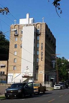
Park Hotel |
|
000000001982-12-22-0000December 22, 1982
(#82000819) |
210 Fountain
34°31′04″N 93°03′05″W / 34.517778°N 93.051389°W / 34.517778; -93.051389 (Park Hotel) |
Hot Springs |
|
| 67 |
Parkway Courts Historic District |
|
000000002004-02-11-0000February 11, 2004
(#04000009) |
815 Park Ave.
34°31′35″N 93°03′07″W / 34.526389°N 93.051944°W / 34.526389; -93.051944 (Parkway Courts Historic District) |
Hot Springs |
|
| 68 |
Passmore House |
|
000000001976-10-08-0000October 8, 1976
(#76000408) |
846 Park Ave.
34°31′46″N 93°02′57″W / 34.529444°N 93.049167°W / 34.529444; -93.049167 (Passmore House) |
Hot Springs |
|
| 69 |
Perry Plaza Court Historic District |
|
000000002004-02-11-0000February 11, 2004
(#04000012) |
1007 Park Ave.
34°31′50″N 93°02′43″W / 34.530556°N 93.045278°W / 34.530556; -93.045278 (Perry Plaza Court Historic District) |
Hot Springs |
|
| 70 |
Plaza Apartments |
|
000000001999-11-05-0000November 5, 1999
(#99001259) |
610 Spring St.
34°30′45″N 93°02′52″W / 34.5125°N 93.047778°W / 34.5125; -93.047778 (Plaza Apartments) |
Hot Springs |
|
| 71 |
Pleasant Street Historic District |
|
000000002003-06-20-0000June 20, 2003
(#03000532) |
Roughly bounded by Malvern Ave. and Pleasant, Church, Gulpha, Garden, Grove, and Kirk Sts.
34°30′26″N 93°02′52″W / 34.507222°N 93.047778°W / 34.507222; -93.047778 (Pleasant Street Historic District) |
Hot Springs |
|
| 72 |
Quapaw-Prospect Historic District |
|
000000002002-03-08-0000March 8, 2002
(#99000821) |
Roughly bounded by Quapaw and Prospect Aves.
34°30′18″N 93°03′47″W / 34.505°N 93.063056°W / 34.505; -93.063056 (Quapaw-Prospect Historic District) |
Hot Springs |
|
| 73 |
Riviera Hotel |
|
000000001982-12-22-0000December 22, 1982
(#82000820) |
719 Central
34°30′32″N 93°03′15″W / 34.508889°N 93.054167°W / 34.508889; -93.054167 (Riviera Hotel) |
Hot Springs |
|
| 74 |
Charles N. Rix House |
|
000000001992-10-15-0000October 15, 1992
(#92001393) |
628 Quapaw Ave.
34°30′22″N 93°03′37″W / 34.506111°N 93.060278°W / 34.506111; -93.060278 (Charles N. Rix House) |
Hot Springs |
|
| 75 |
St. Luke's Episcopal Church |
|
000000001982-12-22-0000December 22, 1982
(#82000821) |
Spring and Cottage Sts.
34°30′38″N 93°03′07″W / 34.510556°N 93.051944°W / 34.510556; -93.051944 (St. Luke's Episcopal Church) |
Hot Springs |
|
| 76 |
Short-Dodson House |
|
000000001976-05-03-0000May 3, 1976
(#76000409) |
755 Park Ave.
34°31′39″N 93°03′07″W / 34.5275°N 93.051944°W / 34.5275; -93.051944 (Short-Dodson House) |
Hot Springs |
|
| 77 |
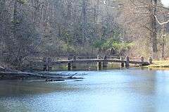
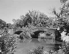
South Fork Bridge |
|
000000001990-04-09-0000April 9, 1990
(#90000521) |
Off Highway 128 over South Fork
34°36′11″N 92°55′20″W / 34.603056°N 92.922222°W / 34.603056; -92.922222 (South Fork Bridge) |
Fountain Lake |
|
| 78 |
Stitt House |
|
000000001976-05-03-0000May 3, 1976
(#76000410) |
824 Park Ave.
34°31′44″N 93°02′59″W / 34.528889°N 93.049722°W / 34.528889; -93.049722 (Stitt House) |
Hot Springs |
|
| 79 |
Taylor Rosamond Motel Historic District |
|
000000002004-05-26-0000May 26, 2004
(#04000497) |
316 Park Ave.
34°31′17″N 93°03′17″W / 34.521389°N 93.054722°W / 34.521389; -93.054722 (Taylor Rosamond Motel Historic District) |
Hot Springs |
|
| 80 |
Visitors Chapel AME |
|
000000001995-06-02-0000June 2, 1995
(#95000682) |
319 Church St.
34°30′31″N 93°03′01″W / 34.508611°N 93.050278°W / 34.508611; -93.050278 (Visitors Chapel AME) |
Hot Springs |
|
| 81 |
Wade Building |
|
000000001982-12-22-0000December 22, 1982
(#82000822) |
231 Central
34°31′01″N 93°03′13″W / 34.516944°N 93.053611°W / 34.516944; -93.053611 (Wade Building) |
Hot Springs |
|
| 82 |
Whittington Park Historic District |
|
000000002012-12-19-0000December 19, 2012
(#12001055) |
Whittington Ave. & Sabie St. between Water & Woodfin Sts.
34°31′00″N 93°03′57″W / 34.51662°N 93.06577°W / 34.51662; -93.06577 (Whittington Park Historic District) |
Hot Springs |
|
| 83 |
Wildwood |
|
000000001976-10-08-0000October 8, 1976
(#76000411) |
808 Park Ave.
34°31′42″N 93°03′00″W / 34.528333°N 93.05°W / 34.528333; -93.05 (Wildwood) |
Hot Springs |
|
| 84 |
Hamp Williams Building |
|
000000002007-09-20-0000September 20, 2007
(#07000972) |
500-504 Ouachita Ave.
34°30′26″N 93°03′32″W / 34.507222°N 93.058889°W / 34.507222; -93.058889 (Hamp Williams Building) |
Hot Springs |
|
| 85 |
Williams-Wootton House |
|
000000001978-11-30-0000November 30, 1978
(#78000589) |
420 Quapaw Ave.
34°30′23″N 93°03′35″W / 34.506389°N 93.059722°W / 34.506389; -93.059722 (Williams-Wootton House) |
Hot Springs |
|
| 86 |
Woodmen of Union Building |
|
000000001997-06-27-0000June 27, 1997
(#97000616) |
501 Malvern Ave.
34°30′25″N 93°02′58″W / 34.506944°N 93.049444°W / 34.506944; -93.049444 (Woodmen of Union Building) |
Hot Springs |
|


_002.jpg)


%2C_1_of_4.JPG)