Montgomery Square, Pennsylvania
| Montgomery Square, Pennsylvania | |
|---|---|
| Unincorporated community | |
 Montgomery Square | |
| Coordinates: 40°14′06″N 75°14′25″W / 40.23500°N 75.24028°WCoordinates: 40°14′06″N 75°14′25″W / 40.23500°N 75.24028°W | |
| Country | United States |
| State | Pennsylvania |
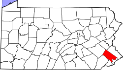
| County | Montgomery |
| Township | Montgomery |
| Elevation | 440 ft (130 m) |
| Time zone | Eastern (EST) (UTC-5) |
| • Summer (DST) | EDT (UTC-4) |
| ZIP code | 19454 |
| Area code(s) | 215 and 267 |
| GNIS feature ID | 1181465[1] |
Montgomery Square is an unincorporated community in Montgomery Township in Montgomery County, Pennsylvania, United States. Montgomery Square is located at the intersection of Pennsylvania Route 309 (Bethlehem Pike) and U.S. Route 202 Business (Dekalb Pike)/Upper State Road. It is the de facto downtown of Montgomery Township, PA.[2]
References
- ↑ "Montgomery Square". Geographic Names Information System. United States Geological Survey.
- ↑ Montgomery County, Pennsylvania Highway Map (PDF) (Map). PennDOT. 2015. Retrieved January 12, 2016.
This article is issued from Wikipedia - version of the 3/13/2016. The text is available under the Creative Commons Attribution/Share Alike but additional terms may apply for the media files.