Souderton, Pennsylvania
| Borough of Souderton | ||
| Borough | ||
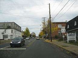 Pennsylvania State Route 113 in Souderton | ||
|
||
| Country | United States | |
|---|---|---|
| State | Pennsylvania | |
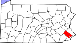
| County | Montgomery | |
| Elevation | 400 ft (121.9 m) | |
| Coordinates | 40°18′37″N 75°19′18″W / 40.31028°N 75.32167°WCoordinates: 40°18′37″N 75°19′18″W / 40.31028°N 75.32167°W | |
| Area | 1.1 sq mi (2.8 km2) | |
| - land | 1.1 sq mi (3 km2) | |
| - water | 0.0 sq mi (0 km2), 0% | |
| Population | 6,618 (2010) | |
| Density | 6,015.7/sq mi (2,322.7/km2) | |
| Incorporated | 1887 | |
| Government | Council-manager | |
| Mayor | John Reynolds | |
| Timezone | EST (UTC-5) | |
| - summer (DST) | EDT (UTC-4) | |
| ZIP Code | 18964 | |
| Area code | 215 Exchange: 723 | |
 Location of Souderton in Montgomery County | ||
 Location of Souderton in Pennsylvania | ||
 Location of Pennsylvania in the United States | ||
| Website: www.soudertonborough.org | ||

Souderton is a borough in Montgomery County, Pennsylvania. The population was 6,618 at the 2010 census.
Souderton hosts the end of the annual Bucks County Classic, a professional bicycle race.
History
The town was originally named Welshtown, because it was settled by the Welsh. Souderton is prefigured in a map of 1847 as Souder's Lumberyard, and the new name was certainly in place by the railroad era in the second half of the 19th century.
The Souderton Historic District was listed on the National Register of Historic Places in 2011.
Geography
Souderton is located at 40°18′37″N 75°19′18″W / 40.31028°N 75.32167°W (40.310215, -75.321682).[1]
According to the United States Census Bureau, the borough has a total area of 1.1 square miles (2.9 km²), of which, 1.1 square miles (2.9 km²) of it is land and none of the area is covered with water. The terrain is mildly rolling hills, with some steeper hills in the downtown area, and flat terrain throughout.
Politics and government
Souderton has a city manager form of government with a mayor and a nine-member borough council. Souderton's current borough councilors are: Richard Godshall, Andrew Schlosser (Vice President), Ned Leight, Preston Miller, Kevin Souder, Richard Halbom, Steven Toy, Brian Goshow (President), and D. Jeffery Gross. The Mayor is John Reynolds. Souderton also has an appointed Junior Councilor who is appointed when under 18 of age and serves a 1-year term, without voting privileges. The current Junior Councilor is E. Shane Myers.[2] The Borough Manager is P. Michael Coll.[3]
The borough is represented by the following officials:
- Mike Fitzpatrick (R), Pennsylvania's 8th congressional district
- Robert Godshall (R), Pennsylvania's 53rd Representative District
- Chuck McIlhinney (R), Pennsylvania's 10th Senatorial District
- Pat Toomey (R), United States Senator from Pennsylvania
| Year | Republican | Democratic |
|---|---|---|
| 2012 | 52.4% 1,508 | 45.1% 1,297 |
| 2008 | 48.2% 1,446 | 50.6% 1,520 |
| 2004 | 56.5% 1,259 | 42.8% 1,663 |
| 2000 | 61.6% 1,451 | 35.2% 830 |
Arts
Souderton is home to Montgomery Theater, one of only three professional theaters in Montgomery County. Sitting in the historic firehouse on Main Street (Rte 113), the Theater produces five subscription-series shows each year, and offers education programs for students ages 8–18. Montgomery Theater draws people to Souderton from around the five-county area. Souderton also hosts an annual Art Jam every September, bringing artists and artisans to the borough park, and offering craft beer and wine tastings. This event is hosted by Souderton-Telford Main Streets, the non-profit organization that supports revitalization in Souderton.
Sports

Souderton was host to the Univest Grand Prix, a one-day road bicycle racing event that is part of the USA Cycling Professional Tour. It took place in early September and publicized its association with Floyd Landis. This event was part of a weekend of longer bike races in surrounding towns. Participants were from varying areas in the United States, and foreign countries, mainly European. Italian, French and Flemish teams often returned to the race annually. Although the race went professional, there were amateur races earlier in the morning for kids and adults. In 2012 the race was officially discontinued in the Souderton Borough.
Demographics
| Historical population | |||
|---|---|---|---|
| Census | Pop. | %± | |
| 1890 | 679 | — | |
| 1900 | 1,077 | 58.6% | |
| 1910 | 1,875 | 74.1% | |
| 1920 | 3,125 | 66.7% | |
| 1930 | 3,857 | 23.4% | |
| 1940 | 4,036 | 4.6% | |
| 1950 | 4,521 | 12.0% | |
| 1960 | 5,381 | 19.0% | |
| 1970 | 6,366 | 18.3% | |
| 1980 | 6,657 | 4.6% | |
| 1990 | 5,957 | −10.5% | |
| 2000 | 6,730 | 13.0% | |
| 2010 | 6,618 | −1.7% | |
| Est. 2015 | 6,747 | [4] | 1.9% |
| Sources:[5][6][7] | |||
As of the 2010 census, the borough was 85.6% White, 2.5% Black or African American, 0.3% Native American, 4.7% Asian, and 2.6% were two or more races. 11.5% of the population were of Hispanic or Latino ancestry [8]
As of the census[6] of 2000, 6,730 people, 2,635 households, and 1,765 families resided in the borough. The population density was 6,015.7 people per square mile (2,320.1/km²). The 2,720 housing units averaged 2,431.3 per square mile (937.7/km²). The racial makeup of the borough was 91.69% White, 1.00% African American, 0.19% Native American, 3.98% Asian, 0.03% Pacific Islander, 1.86% from other races, and 1.25% from two or more races. Hispanics or Latinos of any race were 4.29% of the population.
Of the 2,635 households, 32.5% had children under the age of 18 living with them, 55.1% were married couples living together, 8.3% had a female householder with no husband present, and 33.0% were not families. About 26.4% of all households were made up of individuals, and 10.0% had someone living alone who was 65 years of age or older. The average household size was 2.54 and the average family size was 3.12.
In the borough, the population was distributed as 25.1% under the age of 18, 9.0% from 18 to 24, 34.0% from 25 to 44, 19.3% from 45 to 64, and 12.7% who were 65 years of age or older. The median age was 35 years. For every 100 females, there were 97.5 males. For every 100 females age 18 and over, there were 94.9 males.
The median income for a household in the borough was $47,437, and for a family was $57,200. Males had a median income of $36,280 versus $28,580 for females. The per capita income for the borough was $21,758. About 3.2% of families and 4.4% of the population were below the poverty line, including 3.2% of those under age 18 and 7.1% of those age 65 or over.
Notable people
- Henry Gerhard Appenzeller, a Methodist missionary who brought Protestant Christianity to Korea in 1884, was born in Souderton.
- Donald Haldeman, the 1976 Olympic Gold Medalist in trap shooting, is from Souderton.
- Donald Hunsberger, former conductor of the Eastman Wind Ensemble and recorder for Wynton Marsalis, is from Souderton.
- Jamie Moyer, Philadelphia Phillies pitcher, was born in Sellersville, Pennsylvania, and grew up in Souderton.
- God Lives Underwater guitar player Jeff Turzo graduated from Souderton Area Senior High School in 1989.
- Bloodhound Gang bass player Jared Hasselhoff graduated from Souderton Area Senior High School in 1989.
Transportation
Historically, a rail line which was formally Reading Company's Bethlehem Branch runs north-south through Souderton connecting to Telford, Perkasie, Quakertown, and Bethlehem to the north and Hatfield and Lansdale to the south. The line was used by the SEPTA Bethlehem Line until 1981.
References
- ↑ "US Gazetteer files: 2010, 2000, and 1990". United States Census Bureau. 2011-02-12. Retrieved 2011-04-23.
- ↑ "Administration". Borough of Souderton. Retrieved 2011-03-21.
- ↑ "Contact us". Borough of Souderton. Retrieved 2011-03-21.
- ↑ "Annual Estimates of the Resident Population for Incorporated Places: April 1, 2010 to July 1, 2015". Retrieved July 2, 2016.
- ↑ "Census of Population and Housing". U.S. Census Bureau. Retrieved 11 December 2013.
- 1 2 "American FactFinder". United States Census Bureau. Retrieved 2008-01-31.
- ↑ "Incorporated Places and Minor Civil Divisions Datasets: Subcounty Resident Population Estimates: April 1, 2010 to July 1, 2012". Population Estimates. U.S. Census Bureau. Retrieved 11 December 2013.
- ↑
External links
![]() Media related to Souderton, Pennsylvania at Wikimedia Commons
Media related to Souderton, Pennsylvania at Wikimedia Commons
- Borough of Souderton
- Souderton-Telford Main Streets
- Souderton Independent newspaper
- Souderton Outdoor Grass Leagues (Indian Valley Volleyball Club)