Hatfield Township, Montgomery County, Pennsylvania
| Hatfield Township | |
| Township | |
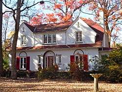 Scene in Oak Park | |
| Country | United States |
|---|---|
| State | Pennsylvania |
| County | Montgomery |
| Elevation | 305 ft (93.0 m) |
| Coordinates | 40°16′38″N 75°15′37″W / 40.27722°N 75.26028°WCoordinates: 40°16′38″N 75°15′37″W / 40.27722°N 75.26028°W |
| Area | 10.0 sq mi (25.9 km2) |
| - land | 10.0 sq mi (26 km2) |
| - water | 0.0 sq mi (0 km2), 0% |
| Population | 17,249 (2010) |
| Density | 1,677.6/sq mi (647.7/km2) |
| Timezone | EST (UTC-5) |
| - summer (DST) | EDT (UTC-4) |
| Area code | 215 |
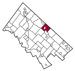 Location of Hatfield Township in Montgomery County | |
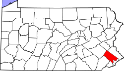
 Location of Hatfield Township in Pennsylvania | |
 Location of Pennsylvania in the United States | |
| Website: http://www.hatfieldtownship.org | |
Hatfield Township is a township in Montgomery County, Pennsylvania, United States. The population was 17,249 at the 2010 census. It is part of the North Penn Valley region that is centered around the borough of Lansdale.
History
The Bridge in Hatfield Township and Oak Park Historic District are listed on the National Register of Historic Places.[1]
Geography
According to the United States Census Bureau, the township has a total area of 10.0 square miles (26 km2), all of it land. It is in the Delaware watershed and is drained mainly by the West Branch Neshaminy Creek. Its villages include Colmar (also in Montgomery Townswhip,) Fortuna (also in Montgomery Townswhip,) Line Lexington (also in Bucks County,) Oak Park (also in Towamencin Township,) Orvilla, Trewigtown, and Unionville (also in Bucks County.)
Neighboring municipalities
- Montgomery Township (southeast)
- Lansdale (south)
- Towamencin Township (southwest)
- Franconia Township (northwest)
- Hilltown Township, Bucks County (north)
- New Britain Township, Bucks County (northeast)
Hatfield Township surrounds the borough of Hatfield.
Government and politics
| Year | Republican | Democratic |
|---|---|---|
| 2012 | 46.8% 3,723 | 51.8% 4,121 |
| 2008 | 43.7% 3,588 | 55.1% 4,252 |
| 2004 | 51.3% 3,949 | 48.3% 3,720 |
| 2000 | 52.4% 3,226 | 44.5% 2,740 |
| 1996 | 46.4% 2,517 | 41.2% 2,235 |
| 1992 | 42.7% 2,470 | 34.9% 2,023 |
Supervisors
Hatfield Township elects five supervisors by ward.
- Ward I: Laura Thomas
- Ward II: Bob Rodgers
- Ward III: Larry Hughes, Vice President
- Ward IV: Tom Zipfel, President
- Ward V: Gerald Andris
Demographics
| Historical population | |||
|---|---|---|---|
| Census | Pop. | %± | |
| 1930 | 1,828 | — | |
| 1940 | 2,264 | 23.9% | |
| 1950 | 3,101 | 37.0% | |
| 1960 | 5,759 | 85.7% | |
| 1970 | 8,613 | 49.6% | |
| 1980 | 13,411 | 55.7% | |
| 1990 | 15,357 | 14.5% | |
| 2000 | 16,712 | 8.8% | |
| 2010 | 17,249 | 3.2% | |
| http://www.dvrpc.org/data/databull/rdb/db82/appedixa.xls. | |||
As of the 2010 census, the township was 75.6% White, 4.5% Black or African American, 0.2% Native American, 16.3% Asian, 0.1% Native Hawaiian, and 2.1% were two or more races. 3.8% of the population were of Hispanic or Latino ancestry.[2]
As of the census[3] of 2000, there were 16,712 people, 6,302 households, and 4,449 families residing in the township. The population density was 1,677.6 people per square mile (647.8/km2). There were 6,592 housing units at an average density of 661.7/sq mi (255.5/km2). The racial makeup of the township was 82.93% White, 3.65% African American, 0.14% Native American, 10.38% Asian, 0.04% Pacific Islander, 0.99% from other races, and 1.87% from two or more races. Hispanic or Latino of any race were 2.39% of the population.
There were 6,302 households, out of which 33.8% had children under the age of 18 living with them, 59.9% were married couples living together, 7.2% had a female householder with no husband present, and 29.4% were non-families. 24.2% of all households were made up of individuals, and 7.6% had someone living alone who was 65 years of age or older. The average household size was 2.63 and the average family size was 3.17.
In the township the population was spread out, with 25.1% under the age of 18, 7.9% from 18 to 24, 32.2% from 25 to 44, 23.6% from 45 to 64, and 11.1% who were 65 years of age or older. The median age was 37 years. For every 100 females there were 100.8 males. For every 100 females age 18 and over, there were 97.5 males.
The median income for a household in the township was $57,247, and the median income for a family was $68,409. Males had a median income of $45,596 versus $30,439 for females. The per capita income for the township was $25,051. About 2.5% of families and 3.9% of the population were below the poverty line, including 4.5% of those under age 18 and 1.8% of those age 65 or over.
Education
North Penn School District operates public schools.
St. Maria Goretti School, a Catholic school of the Roman Catholic Archdiocese of Philadelphia, is located in the township. In 2012 the archdiocese announced that Goretti is merging with Corpus Christi School in Upper Gwynedd Township, with the new school in Upper Gwynedd Township.[4]
References
- ↑ National Park Service (2010-07-09). "National Register Information System". National Register of Historic Places. National Park Service.
- ↑ http://www.usatoday.com/news/nation/census/profile/PA
- ↑ "American FactFinder". United States Census Bureau. Retrieved 2008-01-31.
- ↑ Di Domizio, Tony. "St. Rose Goes and Goretti, Gone." Montgomeryville-Lansdale Patch. January 6, 2012. Retrieved on January 7, 2012.