Sanatoga, Pennsylvania
| Sanatoga | |
| Census-designated place | |
| Country | United States |
|---|---|
| State | Pennsylvania |
| County | Montgomery |
| Township | Lower Pottsgrove |
| Elevation | 236 ft (71.9 m) |
| Coordinates | 40°15′01″N 75°35′20″W / 40.25028°N 75.58889°WCoordinates: 40°15′01″N 75°35′20″W / 40.25028°N 75.58889°W |
| Area | 3.4 sq mi (8.8 km2) |
| - land | 3.4 sq mi (9 km2) |
| - water | 0.0 sq mi (0 km2), 0% |
| Population | 8,378 (2010) |
| Density | 2,464.1/sq mi (951.4/km2) |
| Timezone | EST (UTC-5) |
| - summer (DST) | EDT (UTC-4) |
| Area code | 610 |
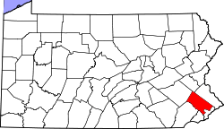
 Location of Sanatoga in Pennsylvania | |
 Location of Pennsylvania in the United States | |
Sanatoga is a community and census-designated place (CDP) in Montgomery County, Pennsylvania, United States. It is immediately east of the borough of Pottstown, Pennsylvania on route US 422. The population was 8,378 at the 2010 census.
Geography
Sanatoga is located at 40°15′1″N 75°35′20″W / 40.25028°N 75.58889°W (40.250252, -75.588933).[1]
According to the United States Census Bureau, the CDP has a total area of 3.4 square miles (8.8 km2), of which 0.29% is water.
Sanatoga is adjacent to U.S. Route 422.
Demographics
| Historical population | |||
|---|---|---|---|
| Census | Pop. | %± | |
| 1990 | 5,534 | — | |
| 2000 | 7,734 | 39.8% | |
| 2010 | 8,378 | 8.3% | |
As of the 2010 census, the CDP was 79.3% Non-Hispanic White, 13.3% Black or African American, 0.1% Native American and Alaskan Native, 1.9% Asian, 0.1% Native Hawaiian and Other Pacific Islander, 0.6% were Some Other Race, and 2.8% were two or more races. 3.1% of the population were of Hispanic or Latino ancestry.[2]
As of the census[3] of 2000, there were 7,734 people, 2,734 households, and 2,058 families residing in the CDP. The population density was 2,265.7 people per square mile (875.7/km2). There were 2,811 housing units at an average density of 823.5/sq mi (318.3/km2). The racial makeup of the CDP was 85.60% White, 11.46% African American, 0.14% Native American, 0.92% Asian, 0.04% Pacific Islander, 0.32% from other races, and 1.53% from two or more races. Hispanic or Latino of any race were 1.51% of the population.
There were 2,734 households, out of which 42.8% had children under the age of 18 living with them, 57.9% were married couples living together, 13.8% had a female householder with no husband present, and 24.7% were non-families. 20.2% of all households were made up of individuals, and 8.2% had someone living alone who was 65 years of age or older. The average household size was 2.76 and the average family size was 3.20.
In the CDP the population was spread out, with 30.8% under the age of 18, 6.4% from 18 to 24, 32.9% from 25 to 44, 18.9% from 45 to 64, and 11.0% who were 65 years of age or older. The median age was 34 years. For every 100 females there were 90.9 males. For every 100 females age 18 and over, there were 84.3 males.
The median income for a household in the CDP was $48,765, and the median income for a family was $55,559. Males had a median income of $44,605 versus $31,727 for females. The per capita income for the CDP was $20,816. About 9.8% of families and 10.4% of the population were below the poverty line, including 16.5% of those under age 18 and 8.9% of those age 65 or over.
References
- ↑ "US Gazetteer files: 2010, 2000, and 1990". United States Census Bureau. 2011-02-12. Retrieved 2011-04-23.
- ↑ Census 2010: Pennsylvania. Usatoday.Com. Retrieved on 2013-07-21.
- ↑ "American FactFinder". United States Census Bureau. Retrieved 2008-01-31.