Erdenheim, Pennsylvania
| Erdenheim, Pennsylvania | |
|---|---|
| Unincorporated community | |
 Erdenheim, Pennsylvania | |
| Coordinates: 40°05′31″N 75°12′50″W / 40.09194°N 75.21389°WCoordinates: 40°05′31″N 75°12′50″W / 40.09194°N 75.21389°W | |
| Country | United States |
| State | Pennsylvania |
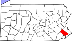
| County | Montgomery |
| Elevation | 164 ft (50 m) |
| Time zone | Eastern (EST) (UTC-5) |
| • Summer (DST) | EDT (UTC-4) |
| ZIP code | 19038 |
| Area code(s) | 215 |
| GNIS feature ID | 1174301[1] |
Erdenheim is a community in Springfield Township, Montgomery County, Pennsylvania. It is served by the 19038 zip code. The primary commercial areas are located along Bethlehem Pike.
The name is German for "Earthly Home," and comes from nearby Erdenheim Farm, which was established in 1765 by Johannes Georg Hocker. The area was known as "Heydricksdale" or simply "Wheelpump" after a local inn, but was changed to "Erdenheim" when the community was laid out in 1892.
Students in Erdenheim attend schools in the Springfield Township School District. Specifically, the Springfield Township High School is located in Erdenheim. Phil-Mont Christian Academy is a private school located adjacent to Cisco Park in the building originally housing Hillcrest Junior High. Students grades K-12 attend from both Erdenheim and nearby townships. Antonelli Art Institute is also located in the community, occupying the former site of Penn Manor Elementary on Montgomery Avenue.
Both Hillcrest and Penn Manor were closed and sold off from the township during declining school enrollment in the post baby boom era.
The local fire company Flourtown Fire Company in neighboring Flourtown protect the citizens of the small community.
Erdenheim Terrace (near Auchy Lane and Erdenheim Road) contains some of the oldest (still standing) homes in the township.
Erdenheim was subject to some of the first Post-War suburban development in the Philadelphia Area, with the Chesney Downs development, located between Glendalough Road, Avondale Road, and Longfield Road being constructed in the late 1940s, while the Holiday at Paper Mill Glen development, located between Harston Road, Fraser Road, and Atwood Road was constructed in 1955.
The Springfield Mill and Yeakle and Miller Houses are listed on the National Register of Historic Places.[2]
References
- ↑ "Erdenheim". Geographic Names Information System. United States Geological Survey.
- ↑ National Park Service (2010-07-09). "National Register Information System". National Register of Historic Places. National Park Service.