Hatboro, Pennsylvania
| Borough of Hatboro | ||
| Borough | ||
 | ||
|
||
| Country | United States | |
|---|---|---|
| State | Pennsylvania | |
| County | Montgomery | |
| Elevation | 253 ft (77.1 m) | |
| Coordinates | 40°10′39″N 75°06′16″W / 40.17750°N 75.10444°WCoordinates: 40°10′39″N 75°06′16″W / 40.17750°N 75.10444°W | |
| Area | 1.4 sq mi (3.6 km2) | |
| - land | 1.4 sq mi (4 km2) | |
| - water | 0.0 sq mi (0 km2), 0% | |
| Population | 7,360 (2010) | |
| Density | 5,217.5/sq mi (2,014.5/km2) | |
| Founded | 1715 | |
| Government | Council-manager | |
| Mayor | F. Norman Hawkes | |
| Timezone | EST (UTC-5) | |
| - summer (DST) | EDT (UTC-4) | |
| ZIP Code | 19040 | |
| Area code | 215 and 267 | |
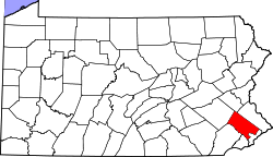
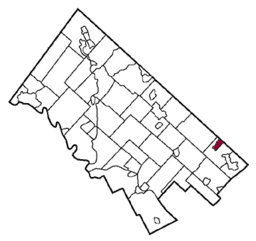 Location of Hatboro in Montgomery County | ||
 Location of Hatboro in Pennsylvania | ||
 Location of Pennsylvania in the United States | ||
| Website: http://www.hatborogov.com | ||

Hatboro is a borough in Montgomery County, Pennsylvania, United States. The population was 7,360 at the 2010 census.
Geography
Hatboro is located at 40°10′39″N 75°6′16″W / 40.17750°N 75.10444°W (40.177635, -75.104424).[1]
According to the United States Census Bureau, the borough has a total area of 1.4 square miles (3.6 km2), all land.
The Borough of Hatboro is a small municipality that is surrounded by Upper Moreland Township in Montgomery County and Warminster Township in Bucks County. The Pennypack Creek runs through the center of town under Pennsylvania Route 263 (York Road) and through the municipality.
History
The town of Hatboro is located on land purchased from William Penn by the family of Nicholas More around 1705. The first land titles in town were issued in 1711. Original construction by early residents of the town occurred between 1715 and 1719. Early settlement pre-dating the Hatboro name occurred in the Crooked Billet area east of York Road, between Moreland Avenue and Byberry Road.
Early resident John Dawson entertained guests at the Crooked Billet Inn as well as manufacturing a line of hats. When the post office opened in 1809 the town was officially called Hatborough. U.S. Postmaster General John Wanamaker officially changed the name of the town in the 1880s to Hatboro.
The Union Library Company of Hatboro, the third library company to be founded in Pennsylvania, was formed in 1755. This building still stands on its original site today and still serves as a library. George Washington and his troops passed through the town numerous times during 1777 in pursuit of British Troops. The Battle of Crooked Billet was fought in 1778.
The year 1811 saw the construction of the Loller Academy, the first bank was built in 1873, and railroad service connected to Hatboro in 1874.[2]
The Loller Academy, Roberts and Mander Stove Company Buildings, and Union Library Company are listed on the National Register of Historic Places.[3]
Demographics
| Historical population | |||
|---|---|---|---|
| Census | Pop. | %± | |
| 1880 | 586 | — | |
| 1890 | 781 | 33.3% | |
| 1900 | 823 | 5.4% | |
| 1910 | 963 | 17.0% | |
| 1920 | 1,102 | 14.4% | |
| 1930 | 2,651 | 140.6% | |
| 1940 | 2,605 | −1.7% | |
| 1950 | 4,788 | 83.8% | |
| 1960 | 7,315 | 52.8% | |
| 1970 | 8,880 | 21.4% | |
| 1980 | 7,579 | −14.7% | |
| 1990 | 7,382 | −2.6% | |
| 2000 | 7,393 | 0.1% | |
| 2010 | 7,360 | −0.4% | |
| Est. 2015 | 7,411 | [4] | 0.7% |
| Sources:[5][6][7] | |||
| Year | Republican | Democratic |
|---|---|---|
| 2012 | 42.1% 1,551 | 56.1% 2,065 |
| 2008 | 39.8% 1,452 | 58.7% 2,142 |
| 2004 | 45.8% 1,632 | 53.5% 1,906 |
| 2000 | 46.6% 1,383 | 49.2% 1,461 |
As of the 2010 census, the borough was 92.4% White, 2.7% Black or African American, 0.3% Native American, 1.6% Asian, and 1.6% were two or more races. 4.3% of the population were of Hispanic or Latino ancestry [8]
As of the census[6] of 2000, there were 7,393 people, 3,041 households, and 1,955 families residing in the borough. The population density was 5,217.5 people per square mile (2,010.2/km2). There were 3,121 housing units at an average density of 2,202.6 per square mile (848.6/km2). The racial makeup of the borough was 95.74% White, 1.95% African American, 0.14% Native American, 1.06% Asian, 0.58% from other races, and 0.54% from two or more races. Hispanic or Latino of any race were 1.45% of the population.
There were 3,041 households, out of which 30.7% had children under the age of 18 living with them, 49.3% were married couples living together, 10.7% had a female householder with no husband present, and 35.7% were non-families. 30.8% of all households were made up of individuals, and 13.9% had someone living alone who was 65 years of age or older. The average household size was 2.43 and the average family size was 3.07.
In the borough the population was spread out, with 24.0% under the age of 18, 6.6% from 18 to 24, 33.0% from 25 to 44, 21.2% from 45 to 64, and 15.1% who were 65 years of age or older. The median age was 38 years. For every 100 females there were 92.3 males. For every 100 females age 18 and over, there were 88.4 males.
The median income for a household in the borough was $44,901, and the median income for a family was $58,063. Males had a median income of $37,291 versus $30,934 for females. The per capita income for the borough was $21,911. About 1.8% of families and 3.3% of the population were below the poverty line, including 3.4% of those under age 18 and 7.5% of those age 65 or over.
Parks
Public parks serving the borough of Hatboro include Hatboro Memorial Park, Eaton Park, Tanner Park, Miller Meadow, and Blair Mill Park (home of the Hatboro Little League field).[9] The Hatboro Memorial Pool is located adjacent to Hatboro Memorial Park and is open during the summer from Memorial Day weekend to Labor Day weekend. The pool offers a water slide, a baby pool, and a dew drop. The Hatboro Memorial Pool offers day passes and season memberships, with lower rates for borough residents, and has a swim team.[10][11]
Politics and government
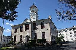
.jpg)
Hatboro has a city manager form of government with a mayor and a seven-member borough council.
- Mayor - Norman Hawkes
- Council President - Bill Tompkins
- Council Vice President - Dave Rich
- Council Pro Tempore - Robert Hegele, Sr
- Councilperson - George Forgeng
- Councilperson - Thomas Harbaugh, Sr.
- Councilperson - Martyn Palmer
- Councilperson - John Zygmont
The borough is part of the:
- Thirteenth Congressional District (represented by Rep. Brendan F. Boyle)
- Pennsylvania's 152nd State House District (represented by Rep. Thomas Murt).
- Pennsylvania's 12th State Senate District (represented by Sen. Stewart Greenleaf).
The borough maintains the Hatboro Police Department.
Education
Hatboro is served by the Hatboro-Horsham School District, along with Horsham Township. Two of the district's elementary schools are located in the borough: Crooked Billet Elementary School and Pennypack Elementary School. The remainder of the schools, including Keith Valley Middle School and Hatboro-Horsham High School, are in Horsham Township.[12][13]
Transportation
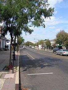
The main north-south road in Hatboro is Pennsylvania Route 263 (York Road), which serves as the town's main street. Pennsylvania Route 332 begins at PA 263 in Hatboro and heads east on Montgomery Avenue and northeast on Jacksonville Road. The main east-west street in Hatboro is Moreland Avenue. Other important roads in Hatboro include County Line Road (which runs along the northern border with Warminster Township in Bucks County), Warminster Road (which runs along the eastern border with Upper Moreland Township), Byberry Road, and Horsham Road. The Willow Grove interchange of the Pennsylvania Turnpike is nearby in Upper Moreland Township.[12]
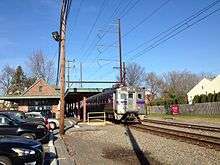
SEPTA provides Regional Rail service to the borough at the Hatboro station along the Warminster Line which runs between Warminster and Center City Philadelphia.[14] SEPTA's Route 22 bus serves Hatboro along York Road, running between Warminster and the Olney Transportation Center in North Philadelphia.[15]
Notable people
- Jack Agnew (1922–2010) — World War II figure, who was an inspiration for the novel and film, The Dirty Dozen, spent his last year at a retirement community in Hatboro.[16]
- Roy Cornell — Representative for Pennsylvania House of Representatives, District 152 from 1979 until his death in 2004.
- Susan Cornell — Daughter of Roy Cornell and Representative for Pennsylvania House of Representatives, District 152 from 2004 to 2006.
- Séamus Egan — Irish musician.
- Greg Erwin — Team manager for Team Penske in the NASCAR Xfinity Series and former crew chief[17][18]
- Isaac Newton Evans — U.S. Representative for Pennsylvania's 7th congressional district from 1883 to 1887.
- Tom Murt — Representative for Pennsylvania House of Representatives, District 152 since 2007.[19]
- Steve Yerkes — Major League Baseball player
References
- ↑ "US Gazetteer files: 2010, 2000, and 1990". United States Census Bureau. 2011-02-12. Retrieved 2011-04-23.
- ↑ Hatboro. Arcadia Publishing. 2000. ISBN 0-7385-0342-8.
- ↑ National Park Service (2010-07-09). "National Register Information System". National Register of Historic Places. National Park Service.
- ↑ "Annual Estimates of the Resident Population for Incorporated Places: April 1, 2010 to July 1, 2015". Retrieved July 2, 2016.
- ↑ "Census of Population and Housing". U.S. Census Bureau. Retrieved 11 December 2013.
- 1 2 "American FactFinder". United States Census Bureau. Retrieved 2008-01-31.
- ↑ "Incorporated Places and Minor Civil Divisions Datasets: Subcounty Resident Population Estimates: April 1, 2010 to July 1, 2012". Population Estimates. U.S. Census Bureau. Retrieved 11 December 2013.
- ↑ http://www.usatoday.com/news/nation/census/profile/PA#locality-tab
- ↑ "Public Parks". Borough of Hatboro. Retrieved May 8, 2016.
- ↑ "Memorial Pool". Borough of Hatboro. Retrieved May 8, 2016.
- ↑ "Hatboro Memorial Pool Summer 2016" (PDF). Hatboro Memorial Pool. Retrieved May 8, 2016.
- 1 2 Montgomery County, Pennsylvania (Map) (18th ed.). 1"=2000'. ADC Map. 2006. ISBN 0-87530-775-2.
- ↑ "Hatboro-Horsham School District". Borough of Hatboro. Retrieved May 9, 2016.
- ↑ "Warminster Line schedule" (PDF). SEPTA. Retrieved August 24, 2014.
- ↑ "Route 22 bus map" (PDF). SEPTA. Retrieved October 13, 2010.
- ↑ "John "Jack" Agnew dies at 88; his World War II unit inspired The Dirty Dozen". The Los Angeles Times, April 13, 2010. April 13, 2010. Retrieved April 18, 2010.
- ↑ "HATBORO-HORSHAM HIGH SCHOOL INDUCTS SEVEN NEW MEMBERS TO HALL OF FAME ON APRIL 29". Hatboro-Horsham School District. Retrieved March 17, 2013.
- ↑ "Brian Wilson promoted to No. 22 crew chief in XFINITY Series". NASCAR.com. January 18, 2016. Retrieved February 22, 2016.
- ↑ "Representative Thomas P. 'Tom' Murt (PA)". Project Vote Smart. Project Vote Smart. 2008. Retrieved 2009-01-09.
External links
| Wikimedia Commons has media related to Hatboro, Pennsylvania. |
- Borough of Hatboro official website
- Hatboro-Horsham School District official website
- Greater Hatboro Chamber of Commerce official website
History:
- The Millbrook Society - " ... a non-profit organization, whose mission is historical preservation, education, presentation, and Archaeology; with an emphasis on local history. We serve as the Historical commission and Historical Society for the Borough of Hatboro, Pennsylvania ..."
- Upper Moreland Historical Association - "The Upper Moreland Historical Association is a non-profit organization founded by a group of citizens concerned that the community's significant and colorful history not be forgotten."
- Old York Road Historical Society - "The Old York Road Historical Society was founded in 1936 to study and preserve the history and folklore of the communities along and adjacent to Old York Road from Philadelphia to New Hope."
- "Historic Hatboro" Pictures by John Pitrone
Entertainment:
- Philadelphia Athletics Historical Society - Hatboro is the home to a museum dedicated to the Philadelphia Athletics. The Athletics played baseball in Philadelphia from 1901-1954 before moving to Kansas City, Missouri, and ultimately to Oakland, California, where they have been since 1968.