Marshall County, Kentucky
| Marshall County, Kentucky | |
|---|---|
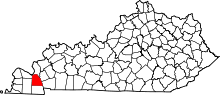 Location in the U.S. state of Kentucky | |
 Kentucky's location in the U.S. | |
| Founded | 1842 |
| Named for | John Marshall |
| Seat | Benton |
| Largest city | Benton |
| Area | |
| • Total | 340 sq mi (881 km2) |
| • Land | 301 sq mi (780 km2) |
| • Water | 39 sq mi (101 km2), 11% |
| Population | |
| • (2010) | 31,448 |
| • Density | 104/sq mi (40/km²) |
| Congressional district | 1st |
| Time zone | Central: UTC-6/-5 |
| Website |
www |
Marshall County is a county located in the U.S. state of Kentucky. As of the 2010 census, the population was 31,448.[1] Its county seat is Benton.[2] It was a dry county until July 28, 2015, when residents voted for the county to go "wet". It is the only Purchase Area county to not border another state.
Marshall County was named Kentucky's "Best County to Live In" ten years in a row, from 1999–2009.[3]
History
Marshall County was formed by the Kentucky legislature in 1842 from part of Calloway County.[4] The first settlers came about 1818, when the area was bought from the Chickasaw Indians as part of the Jackson Purchase. The Native Americans then moved to new lands west of the Mississippi River. Marshall County was named in honor of Chief Justice John Marshall, who had died shortly before the county's creation.[5]
From its settlement until the 1930s, Marshall County was nearly completely agricultural.
In the 1940s, the Tennessee Valley Authority created Kentucky Lake, which brought tourism to the county with lake shore resorts. The Kentucky Dam's cheap and plentiful electricity also attracted chemical and manufacturing plants, mostly in the Calvert City area. However, the creation of the lake destroyed two historic Marshall County towns - Birmingham, located six miles north of the present town of Fairdealing, and Gilbertsville, which was at the dam's site. Gilbertsville was rebuilt to the west of its original location. Birmingham residents had to move elsewhere. Gilbertsville was an incorporated town until the 1970s, when its charter was dissolved by public vote. Kentucky Lake (created on the Tennessee River) and Lake Barkley (created on the Cumberland River) form one of the largest man-made bodies of water in the world.
Historically, Marshall County has been a stronghold of the Democratic Party. Since the founding of the county, Democrats have dominated county politics. At present, all elected county officials are Democrats, with the exception of one. Republican Kevin Neal defeated Melonie Watkins Chambers to finish the unexpired term of the late Mike Miller who died in office on December 17, 2014.
Geography
According to the U.S. Census Bureau, the county has a total area of 340 square miles (880 km2), of which 301 square miles (780 km2) is land and 39 square miles (100 km2) (11%) is water.[6] The county's northeastern border is formed by the Tennessee River and Kentucky Lake.
Adjacent counties
- Livingston County (north)
- Lyon County (northeast)
- Trigg County (east)
- Calloway County (south)
- Graves County (west)
- McCracken County (northwest)
National protected area
Demographics
| Historical population | |||
|---|---|---|---|
| Census | Pop. | %± | |
| 1850 | 5,269 | — | |
| 1860 | 6,982 | 32.5% | |
| 1870 | 9,455 | 35.4% | |
| 1880 | 9,647 | 2.0% | |
| 1890 | 11,287 | 17.0% | |
| 1900 | 13,692 | 21.3% | |
| 1910 | 15,771 | 15.2% | |
| 1920 | 15,215 | −3.5% | |
| 1930 | 12,889 | −15.3% | |
| 1940 | 16,602 | 28.8% | |
| 1950 | 13,387 | −19.4% | |
| 1960 | 16,736 | 25.0% | |
| 1970 | 20,381 | 21.8% | |
| 1980 | 25,637 | 25.8% | |
| 1990 | 27,205 | 6.1% | |
| 2000 | 30,125 | 10.7% | |
| 2010 | 31,448 | 4.4% | |
| Est. 2015 | 31,101 | [7] | −1.1% |
| U.S. Decennial Census[8] 1790-1960[9] 1900-1990[10] 1990-2000[11] 2010-2013[1] | |||
As of the census[12] of 2000, there were 30,125 people, 12,412 households, and 8,998 families residing in the county. The population density was 99 per square mile (38/km2). There were 14,730 housing units at an average density of 48 per square mile (19/km2). The racial makeup of the county was 98.57% White, 0.2% Black or African American, 0.17% Native American, 0.15% Asian, 0.01% Pacific Islander, 0.22% from other races, and 0.76% from two or more races. 0.76% of the population were Hispanics or Latinos of any race.
There were 12,412 households out of which 29.20% had children under the age of 18 living with them, 61.40% were married couples living together, 7.90% had a female householder with no husband present, and 27.50% were non-families. 25.00% of all households were made up of individuals and 11.90% had someone living alone who was 65 years of age or older. The average household size was 2.38 and the average family size was 2.83.
The age distribution was 21.80% under the age of 18, 7.50% from 18 to 24, 27.00% from 25 to 44, 26.20% from 45 to 64, and 17.50% who were 65 years of age or older. The median age was 41 years. For every 100 females there were 96.10 males. For every 100 females age 18 and over, there were 93.50 males.
The median income for a household in the county was $35,573, and the median income for a family was $43,670. Males had a median income of $36,673 versus $21,941 for females. The per capita income for the county was $18,069. About 6.60% of families and 9.50% of the population were below the poverty line, including 11.60% of those under age 18 and 10.90% of those age 65 or over.
Communities
Cities
- Benton (county seat)
- Calvert City
- Hardin
Unincorporated communities
- Aurora
- Big Bear Area
- Brewers
- Briensburg
- Draffenville
- Fairdealing
- Gilbertsville
- Harvey
- Moors Camp Area
- Oak Level
- Olive
- Palma
- Possum Trot
- Sharpe
- Tatumsville
Annual events
On the first Monday of April, Benton holds its Tater Day. Originating in 1842 as a day for farmers to gather at the county seat to trade their agricultural goods, today Tater Day is a celebration that includes a festival and parade. Tater Day derives its name from the main item traded—sweet potatoes for seed, i.e., for bedding in prepared "seedbed" to produce slips for growers to transplant to gardens or fields.
On the fourth Sunday of each May, The Big Singing, an all-day sing-along program of Southern Harmony shape note gospel music is held at the county courthouse. While other major singings still survive, The Big Singing, begun in 1884, is the only singing in the world to use the William Walker Southern Harmony system of shape-note singing. The Big Singing is also distinguished as the oldest continuously operating indigenous music festival in the United States.
Americans celebrate the Fourth of July. Calvert City has AmeriBration and sponsored by the Calvert Area Development Agency(CADA). Ameribration is one of the Lakes Biggest Fourth of July Celebrations. Some of the events include Community Photo Contest,5K race and walk, Car Show, children's Train Ride, Arts and Crafts Vendors, Other community tournaments, Youth and Adult Talent Show, Water wall and slide ride for children, Kids Parade, Live bands, Main Parade, and Fireworks show (45 minutes).
Other annual events include Hardin Day and Aurora Country Festival, celebrated in the small towns of Hardin and Aurora. More recently, the area has become known for the annual Hot August Blues and Barbecue Festival and for the Kentucky Lake Bluegrass Festival, held at Kenlake State Resort Park. Marshall County is also home to Jackson Purchase barbecue, a unique style that is found in the Jackson Purchase region of Kentucky. In Benton, Hutchens Open Pit BBQ has been in continuous operation since the 1940s. While in Aurora there is Belews a drive in dairyette open seasonally since the 1950s.
Other unique factoids
Marshall County is the home of Calvert Drive In Theater, the only one in the Purchase area and one of three within an 85-mile radius in far western Kentucky.[13][14]
Marshall County is also home to the Silver Trail Distillery where a family legend was revitalized to restore the LBL Moonshine. The distillery and museum is in Hardin and Aurora. The original founder of the moonshine Cilous was known to have a sipping ritual when it came time to drink his shine. "Great Grandfather Cilous' Moonshine Sippin Ritual.... Take a small sip, don't shoot it.. and keep your lips closed. With your lips still closed, swish gently then let it ease down. When it is down to the navel level, open your lips slowly while exhaling. There will be a fresh corn taste on both sides of the mouth and no bitter aftertaste."[15]
Before Interstate 24 rerouted much of Hwy 68 traffic Generations spent summer days and nights at The Forgotten Past Amusement Past with its gift shop, go carts, bumper cars, mini golf, museum, and arcade.[16] For many years it hosted an Antique (steel wheeled) Tractor Show.
Marshall County is home to one of the largest and most complete parks in the purchase area. It has Lighted baseball fields, 2 basketball courts, 4 soccer fields, 2 tennis courts, large fishing pond, Large playground, spray park, and multiple picnic pavilions as well as a conference center. It is built upon land donated from a private family in memorial of their son who was killed in action in the Vietnam Conflict. In September 2000 the park was dedicated as the Marshall County Park. Later that year the local judge executive Mike Miller appointed the new park board. Upon the Grand Opening the park board had named it Mike Miller Park. Several people protested and the park board renamed it Mike Miller County Park. The original statute dedication as Marshall County Park remains at the entrance of the park. The original park didn't have any mention of a veterans in its mission, in response the fiscal court commissioned a large veteran park adjacent to the main conference center.[17]
Marshall County is home to the FLW Bass Tournament organization named after legendary founder of Ranger Boats, Forrest L. Wood. FLW is, without question, the purveyor of America's largest and most prestigious fishing tournaments, including the FLW Tour, FLW Series, Bass Fishing League, College Fishing and High School Fishing.[18]
Marshall County was at the precipices of the Wal-Mart growth as it became home to one of the earliest stores east of the Mississippi River with Store Number 143.
See also
- Eggner Ferry Bridge
- Dry counties
- Kaintuck Territory
- National Register of Historic Places listings in Marshall County, Kentucky
- Sacred Harp
Resources
Books
- Big Singing Day in Benton, Kentucky: A Study of the History, Ethnic Identity and Musical Style of Southern Harmony Singers, by Deborah Carlton Loftis, Ph.D. dissertation, University of Kentucky, 1987. Review
References
- 1 2 "State & County QuickFacts". United States Census Bureau. Retrieved March 6, 2014.
- ↑ "Find a County". National Association of Counties. Retrieved 2011-06-07.
- ↑ Jackson Purchase Historical Society. Marshall County August 22, 2010, accessed December 6, 2010.
- ↑ Collins, Lewis (1877). History of Kentucky. p. 542.
- ↑ The Register of the Kentucky State Historical Society, Volume 1. Kentucky State Historical Society. 1903. p. 36.
- ↑ "2010 Census Gazetteer Files". United States Census Bureau. August 22, 2012. Retrieved August 17, 2014.
- ↑ "County Totals Dataset: Population, Population Change and Estimated Components of Population Change: April 1, 2010 to July 1, 2015". Retrieved July 2, 2016.
- ↑ "U.S. Decennial Census". United States Census Bureau. Retrieved August 17, 2014.
- ↑ "Historical Census Browser". University of Virginia Library. Retrieved August 17, 2014.
- ↑ "Population of Counties by Decennial Census: 1900 to 1990". United States Census Bureau. Retrieved August 17, 2014.
- ↑ "Census 2000 PHC-T-4. Ranking Tables for Counties: 1990 and 2000" (PDF). United States Census Bureau. Retrieved August 17, 2014.
- ↑ "American FactFinder". United States Census Bureau. Retrieved 2008-01-31.
- ↑ http://www.driveinmovie.com/KY.htm
- ↑ http://www.calvertdrivein.com/
- ↑ http://lblmoonshine.com/home/
- ↑ http://www.kentuckytourism.com/forgotten-past/2397/
- ↑ interview with former County Commissioner Jerome Hicks
- ↑ http://www.flwfishing.com/about-us
External links
- Marshall County Chamber of Commerce
- Marshall County roadside historical markers
- Marshall County schools
- Marshall County Public Library
- The Southern Harmony Online
Municipalities and communities of Marshall County, Kentucky, United States | ||
|---|---|---|
| Cities | | |
| CDP | ||
| Other unincorporated communities | ||
| Ghost town | ||

Coordinates: 36°53′N 88°20′W / 36.88°N 88.34°W