Laurel Mountain, Pennsylvania
| Laurel Mountain, Pennsylvania | |
|---|---|
| Borough | |
|
Locust Street | |
 Laurel Mountain, Pennsylvania | |
| Coordinates: 40°12′41″N 79°11′04″W / 40.21139°N 79.18444°WCoordinates: 40°12′41″N 79°11′04″W / 40.21139°N 79.18444°W | |
| Country | United States |
| State | Pennsylvania |
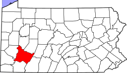
| County | Westmoreland |
| Settled | 1926 |
| Incorporated | 1982 |
| Government | |
| • Type | Borough Council |
| Area | |
| • Total | 0.1 sq mi (0.3 km2) |
| Elevation | 1,421 ft (433 m) |
| Population (2000) | |
| • Total | 185 |
| • Density | 1,347.4/sq mi (520.2/km2) |
| Time zone | Eastern (EST) (UTC-5) |
| • Summer (DST) | EDT (UTC-4) |
| Zip code | 15655 |
| Website | Official borough website |

Laurel Mountain is a borough in Westmoreland County, Pennsylvania, United States. The population was 185 at the 2000 census. Located at the foot of Laurel Mountain (elev. 2,800 ft.), the borough lies near numerous limestone caves and is surrounded by venues for skiing, hiking, and other outdoor activities.
Geography
Laurel Mountain is located at 40°12′41″N 79°11′4″W / 40.21139°N 79.18444°W (40.211418, -79.184568).[1]
According to the United States Census Bureau, the borough has a total area of 0.1 square miles (0.26 km2), all of it land.
Demographics
| Historical population | |||
|---|---|---|---|
| Census | Pop. | %± | |
| 1990 | 195 | — | |
| 2000 | 185 | −5.1% | |
| 2010 | 167 | −9.7% | |
| Est. 2015 | 164 | [2] | −1.8% |
| Sources:[3][4][5] | |||
As of the census[4] of 2000, there were 185 people, 78 households, and 56 families residing in the borough. The population density was 1,347.4 people per square mile (510.2/km²). There were 109 housing units at an average density of 793.9 per square mile (300.6/km²). The racial makeup of the borough was 100.00% White. Hispanic or Latino of any race were 1.62% of the population.
There were 78 households out of which 26.9% had children under the age of 18 living with them, 61.5% were married couples living together, 6.4% had a female householder with no husband present, and 28.2% were non-families. 24.4% of all households were made up of individuals and 11.5% had someone living alone who was 65 years of age or older. The average household size was 2.37 and the average family size was 2.80.
In the borough the population was spread out with 19.5% under the age of 18, 5.9% from 18 to 24, 27.0% from 25 to 44, 25.4% from 45 to 64, and 22.2% who were 65 years of age or older. The median age was 44 years. For every 100 females there were 96.8 males. For every 100 females age 18 and over, there were 96.1 males.
The median income for a household in the borough was $44,750, and the median income for a family was $63,125. Males had a median income of $51,250 versus $30,833 for females. The per capita income for the borough was $21,564. About 13.2% of families and 20.0% of the population were below the poverty line, including 36.4% of those under the age of eighteen and 6.5% of those sixty five or over.
References
- ↑ "US Gazetteer files: 2010, 2000, and 1990". United States Census Bureau. 2011-02-12. Retrieved 2011-04-23.
- ↑ "Annual Estimates of the Resident Population for Incorporated Places: April 1, 2010 to July 1, 2015". Retrieved July 2, 2016.
- ↑ "Census of Population and Housing". U.S. Census Bureau. Retrieved 11 December 2013.
- 1 2 "American FactFinder". United States Census Bureau. Retrieved 2008-01-31.
- ↑ "Incorporated Places and Minor Civil Divisions Datasets: Subcounty Resident Population Estimates: April 1, 2010 to July 1, 2012". Population Estimates. U.S. Census Bureau. Retrieved 11 December 2013.
| Counties |  Map of the Pittsburgh Tri-State with green counties in the metropolitan area and yellow counties in the combined area. | |
|---|---|---|
| Major cities | ||
| Cities and towns 15k-50k (in 2010) | ||
| Airports | ||
| Topics | ||
| ||