Delmont, Pennsylvania
| Delmont, Pennsylvania | |
|---|---|
| Borough | |
|
Historic water trough on East Pittsburgh Street | |
 Delmont, Pennsylvania | |
| Coordinates: 40°24′47″N 79°34′17″W / 40.41306°N 79.57139°WCoordinates: 40°24′47″N 79°34′17″W / 40.41306°N 79.57139°W | |
| Country | United States |
| State | Pennsylvania |
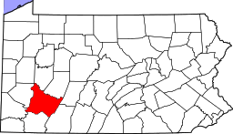
| County | Westmoreland |
| Settled | 1814 |
| Incorporated | 1833 |
| Government | |
| • Type | Borough Council |
| Area | |
| • Total | 1.1 sq mi (3 km2) |
| Elevation | 1,260 ft (380 m) |
| Population (2000) | |
| • Total | 2,497 |
| • Density | 2,333.1/sq mi (900.8/km2) |
| Time zone | Eastern (EST) (UTC-5) |
| • Summer (DST) | EDT (UTC-4) |
| Zip code | 15626 |
| Website | Delmont's website |

Delmont is a borough in Westmoreland County, Pennsylvania, United States. The population was 2,686 at the 2010 census.
History
Delmont was initially known as New Salem. The 300 acres of land was warranted to William Wilson in 1784 and upon his arrival in 1785 he named the area New Salem. In 1812 a post office was established in New Salem and it was named Salem X Roads(Salem Crossroads), Pennsylvania. Hugh Bigham was the first postmaster. Wilson continued to farm on the land until his death in 1796. After Wilson's death in 1796 his estate was divided between his sons, Thomas and George. It was not until 1812 that the patent was validated. Eventually, the family conveyed their deeds over to Thomas and he became the sole owner of the property. Thomas decided to divide the property into 48 lots to form a crossroads village. Thomas Wilson designed the town around a watering trough that was built in 1810 by Hugh Bigham. The watering trough was originally known as the "running pump." The watering trough was connected with wooden pipes to a "Big Spring" that's never known to run dry. In 1814, two days before Christmas, 48 lots were auctioned off to form a "crossroads" town. As the area developed, the town was referred to locally as "Salem Crossroads."
On April 8, 1833, the town was incorporated as "New Salem Borough." The mailing address was Salem Crossroads until 1871, when town postmaster Zachariah Zimmerman changed it to Delmont. The town and the post office carried two different names until May 16, 1967, when residents voted to change the borough's name to Delmont after a promotional campaign by then-Mayor Franklin Mangery. Several areas in and around the borough still carry the Salem reference. Major navigational roads were built through the area in the late 18th century, and what is now local Route 66 was built in 1800. The East-West Northern Turnpike was completed in 1819 linking Philadelphia to Pittsburgh. Delmont was a busy stagecoach stop boasting at one time five stage coach lines through the village. Travelers would stop tired and hungry and patronized the several inns and taverns in town. In 1853, the Pennsylvania Railroad was complete through Westmoreland County to Pittsburgh. This was a faster more economical way to travel. In 1855,the last stagecoach passed through the crossroads village and ended the stagecoach era for the crossroads town.[1]
The now defunct Salem Crossroads Historical Restoration Society worked to maintain the local history and to restore the area. As a result of their efforts, the Salem Crossroads Historic District was listed on the National Register of Historic Places in 1978.[2] In 1980 the society purchased Shields Farm, which hosts the annual Apple 'N Arts festival on Shields farm during the first week of October.
Geography
Delmont is located at 40°24′47″N 79°34′17″W / 40.41306°N 79.57139°W (40.412971, -79.571433).[3]
According to the United States Census Bureau, the borough has a total area of 1.1 square miles (2.8 km2), all of it land.
Delmont has been assigned the ZIP code of 15626.
Demographics
| Historical population | |||
|---|---|---|---|
| Census | Pop. | %± | |
| 1850 | 299 | — | |
| 1860 | 419 | 40.1% | |
| 1870 | 448 | 6.9% | |
| 1880 | 440 | −1.8% | |
| 1890 | 311 | −29.3% | |
| 1900 | 381 | 22.5% | |
| 1910 | 424 | 11.3% | |
| 1920 | 671 | 58.3% | |
| 1930 | 721 | 7.5% | |
| 1940 | 705 | −2.2% | |
| 1950 | 695 | −1.4% | |
| 1960 | 1,313 | 88.9% | |
| 1970 | 1,934 | 47.3% | |
| 1980 | 2,159 | 11.6% | |
| 1990 | 2,041 | −5.5% | |
| 2000 | 2,497 | 22.3% | |
| 2010 | 2,686 | 7.6% | |
| Est. 2015 | 2,640 | [4] | −1.7% |
| Sources:[5][6][7] | |||
As of the census[6] of 2000, there were 2,497 people, 1,070 households, and 714 families residing in the borough. The population density was 2,333.1 people per square mile (901.0/km²). There were 1,139 housing units at an average density of 1,064.2 per square mile (411.0/km²). The racial makeup of the borough was 97.96% White, 0.52% African American, 0.04% Native American, 0.44% Asian, 0.04% from other races, and 1.00% from two or more races. Hispanic or Latino of any race were 0.24% of the population.
There were 1,070 households out of which 31.0% had children under the age of 18 living with them, 55.4% were married couples living together, 9.3% had a female householder with no husband present, and 33.2% were non-families. 29.9% of all households were made up of individuals and 12.1% had someone living alone who was 65 years of age or older. The average household size was 2.33 and the average family size was 2.91.
In the borough the population was spread out with 24.4% under the age of 18, 6.2% from 18 to 24, 31.0% from 25 to 44, 24.7% from 45 to 64, and 13.7% who were 65 years of age or older. The median age was 39 years. For every 100 females there were 92.2 males. For every 100 females age 18 and over, there were 88.2 males.
The median income for a household in the borough was $39,700, and the median income for a family was $52,056. Males had a median income of $39,097 versus $25,804 for females. The per capita income for the borough was $21,090. About 4.6% of families and 6.9% of the population were below the poverty line, including 7.1% of those under age 18 and 14.9% of those age 65 or over.
Most primary and secondary education is provided by two school districts - Greensburg Salem, in Greensburg, and Franklin Regional, in Murrysville. Students to the south and east of the borough are generally assigned to Greensburg Salem, while the bulk of the students in the borough, and those who reside in the north and west portions, attend Franklin Regional.
Roads
Aside from the historical genesis of the town as a toll intersection and stagecoach stop, one of Delmont's notable characteristics is that it is the meeting point of two major highways, U.S. Route 22 and State Route 66.
For many years, these roads did not directly intersect but were linked by a cloverleaf interchange. Delmont became known for this interchange; many local merchants incorporated "Cloverleaf" into their business names as a result. Recently, the "cloverleaf" system was dismantled and a single-point urban interchange was built in its place. This change was made to accommodate a plan to widen Route 22, which is one of the most heavily traveled roads in Pennsylvania. The interchange on Route 22 marks the boundary between suburban Pittsburgh and the more rural foothills of the Appalachian Mountains.
Points of interest
Note some of the places listed below are not located within the defined limits of Delmont, but are commonly considered in the borough.
- The watering trough – provided stagecoach horses with water from the nearby spring in the 19th century. The watering trough although disconnected from the big spring in the 1970s it was refurbished by The Delmont Lion's club and still stands today.
- Salem Evangelical Lutheran Church – constructed in 1868. Today, the church is nationally recognized as a historical place and still holds worship every Sunday morning.
- Jacob Earnest's home. Built in 1825. Earnest was a descendant of Indiana Eve. He owned a gunsmith shop and was a woodcarver and rifle maker in the area. He also served on council.
- Eastview Union Cemetery. Jacob Earnest is interred there as well as Jimmy Ripple, notableAmerican professional baseball player.
- Robert Shield's tannery, located on East Pittsburgh Street. Now a private home, this was once a tannery during the early days of New Salem.
- Shields Farm – location of the Apple ‘N Arts Festival, “Christmas in Salem Crossroads,” and Delmont Area Athletic Association (D.A.A.A.) recreational baseball and softball games.
- The Central Hotel – Historical building; served as lodging for early stagecoach passengers. Serves as offices for several businesses.
- Salem Antiquities at 1 West Pittsburgh Street: One of Delmont's historical buildings-formerly The First National Bank of Delmont and Mook's Hardware.
- Delmont Public Library – formerly the Delmont Public School building, which held classes from 1898 until the early 1980s, when Franklin Regional consolidated its elementary school buildings.
- Apple Hill Playhouse – hosts plays and other theatrical performances. The theater commemorated its 50th season in 2006.
- Center Ice Arena – an ice skating and recreational facility consisting of three NHL-size ice rinks, a skate shop, party room, conference area, video arcade, and fitness center. It hosts local high school and college hockey games in addition to other events during the year.
- Newhouse Park – a recreational park with a walking/running path, two tennis courts, a basketball court, a deck hockey rink, a little league baseball field, and a standard-size baseball field.
- Kovalcik Park - includes a baseball field, tennis courts and small play area, adjacent to the Surrey Farm housing development.
- Cloverleaf Golf Club – a 27-hole public golf course that accommodates outings and weekly leagues.
- Steel City Raceway – a professional motocross racetrack that hosts a variety of races throughout the year, including an AMA Motocross Championship.
- Spagnolo’s Shop ‘N Save – Notable because it was originally Fatur’s Market, which served the Delmont area for 79 years and played an important role in the community. The Spagnolo family bought the grocery store in January 2006.
References
- ↑ "Book's pages flip through rich history of Delmont, Salem Township". Trib Total Media. 22 October 2012. Retrieved 12 January 2014.
- ↑ National Park Service (2010-07-09). "National Register Information System". National Register of Historic Places. National Park Service.
- ↑ "US Gazetteer files: 2010, 2000, and 1990". United States Census Bureau. 2011-02-12. Retrieved 2011-04-23.
- ↑ "Annual Estimates of the Resident Population for Incorporated Places: April 1, 2010 to July 1, 2015". Retrieved July 2, 2016.
- ↑ "Census of Population and Housing". U.S. Census Bureau. Retrieved 11 December 2013.
- 1 2 "American FactFinder". United States Census Bureau. Retrieved 2008-01-31.
- ↑ "Incorporated Places and Minor Civil Divisions Datasets: Subcounty Resident Population Estimates: April 1, 2010 to July 1, 2012". Population Estimates. U.S. Census Bureau. Retrieved 11 December 2013.
Images in America Salem Township, Arcadia publishing, October 2012. Author Tracy Searight
External links
| Counties |  Map of the Pittsburgh Tri-State with green counties in the metropolitan area and yellow counties in the combined area. | |
|---|---|---|
| Major cities | ||
| Cities and towns 15k-50k (in 2010) | ||
| Airports | ||
| Topics | ||
| ||