Huber Heights, Ohio
| Huber Heights, Ohio | |
|---|---|
| City | |
|
Huber Heights welcome sign with the phrase, "Come Grow With Us!" | |
| Nickname(s): Brick City, Huber | |
| Motto: Come Grow With us! | |
 Location in Montgomery County and the state of Ohio. | |
| Coordinates: 39°51′3″N 84°7′39″W / 39.85083°N 84.12750°WCoordinates: 39°51′3″N 84°7′39″W / 39.85083°N 84.12750°W | |
| Country | United States |
| State | Ohio |
| Counties | Montgomery, Miami, Greene |
| Government | |
| • Mayor | Tom McMasters (D) |
| • City manager | Robert Schommer |
| Area[1] | |
| • Total | 22.37 sq mi (57.94 km2) |
| • Land | 22.27 sq mi (57.68 km2) |
| • Water | 0.10 sq mi (0.26 km2) |
| Elevation[2] | 932 ft (284 m) |
| Population (2010)[3] | |
| • Total | 38,101 |
| • Estimate (2012[4]) | 38,129 |
| • Density | 1,710.9/sq mi (660.6/km2) |
| Time zone | Eastern (EST) (UTC-5) |
| • Summer (DST) | EDT (UTC-4) |
| ZIP code | 45424 |
| Area code(s) | 937 |
| FIPS code | 39-36610[5] |
| GNIS feature ID | 1048856[2] |
| Website | http://www.hhoh.org |

Huber Heights is a city in Montgomery, Miami and Greene counties in the U.S. state of Ohio. Huber Heights' motto is "America's largest community of brick homes." The city is named for Charles Huber, the developer who constructed a number of the houses that would later comprise the city. Suburban development began in the area in 1956. The former Wayne Township, now defunct, incorporated as the City of Huber Heights on January 23, 1981.[6] Huber Heights continued to grow by annexing parcels in Miami and Greene Counties. Huber Heights is the third largest suburb in the Dayton Metropolitan Statistical Area by population, behind Kettering with 56,163, and Beavercreek with 45,193. Huber Heights' current mayor is Tom McMasters. The population of Huber Heights was 38,101 at the 2010 census.[7]
Geography
Most of Huber Heights is in Montgomery County while the city has more recently annexed land in Miami County. One small parcel of the city is located in Greene County.[8]
According to the United States Census Bureau, the city has a total area of 22.37 square miles (57.94 km2), of which 22.27 square miles (57.68 km2) is land and 0.10 square miles (0.26 km2) is water.[1]
The city developed northeast of Dayton on land between the Great Miami River and the Mad River. State Routes 202 (Old Troy Pike) and 201 (Brandt Pike) serve as the main north-south arteries, while Shull Rd., Executive Blvd., Interstate 70, Taylorsville, Chambersburg, and Fishburg Roads serve as the main east-west arteries. The bulk of the city lies between Needmore Road to the south and Interstate 70 to the North. Recent development has expanded the boundaries of the city north into Miami County near National Road.
Demographics
| Historical population | |||
|---|---|---|---|
| Census | Pop. | %± | |
| 1970 | 18,943 | — | |
| 1980 | 34,642 | 82.9% | |
| 1990 | 38,696 | 11.7% | |
| 2000 | 38,212 | −1.3% | |
| 2010 | 38,101 | −0.3% | |
| Est. 2015 | 38,176 | [9] | 0.2% |
| Population 1970-2000.[10][11] | |||
2010 census
As of the census[3] of 2010, there were 38,101 people, 14,720 households, and 10,552 families residing in the city. The population density was 1,710.9 inhabitants per square mile (660.6/km2). There were 15,875 housing units at an average density of 712.8 per square mile (275.2/km2). The racial makeup of the city was 79.6% White, 13.0% African American, 0.3% Native American, 2.5% Asian, 0.1% Pacific Islander, 1.0% from other races, and 3.5% from two or more races. Hispanic or Latino of any race were 3.1% of the population.
There were 14,720 households of which 35.8% had children under the age of 18 living with them, 51.5% were married couples living together, 14.9% had a female householder with no husband present, 5.3% had a male householder with no wife present, and 28.3% were non-families. 22.8% of all households were made up of individuals and 8.1% had someone living alone who was 65 years of age or older. The average household size was 2.58 and the average family size was 3.01.
The median age in the city was 37.4 years. 25.4% of residents were under the age of 18; 8.2% were between the ages of 18 and 24; 26.3% were from 25 to 44; 27.2% were from 45 to 64; and 12.9% were 65 years of age or older. The gender makeup of the city was 48.3% male and 51.7% female.
2000 census
As of the census[5] of 2000, there were 38,212 people, 14,392 households, and 10,779 families residing in the city. The population density was 1,817.2 people per square mile (701.6/km²). There were 14,938 housing units at an average density of 710.4 per square mile (274.3/km²). The racial makeup of the city was 84.88% White, 9.78% African American, 0.28% Native American, 2.18% Asian, 0.06% Pacific Islander, 0.58% from other races, and 2.25% from two or more races. Hispanic or Latino of any race were 1.66% of the population.
There were 14,392 households of which 36.9% had children under the age of 18 living with them, 58.7% were married couples living together, 12.0% had a female householder with no husband present, and 25.1% were non-families. 20.5% of all households were made up of individuals and 5.9% had someone living alone who was 65 years of age or older. The average household size was 2.64 and the average family size was 3.05.
In the city the population was spread out with 27.4% under the age of 18, 8.6% from 18 to 24, 31.1% from 25 to 44, 23.7% from 45 to 64, and 9.3% who were 65 years of age or older. The median age was 34 years. For every 100 females there were 95.0 males. For every 100 females age 18 and over, there were 91.8 males.
The median income for a household in the city was $49,073, and the median income for a family was $53,579. Males had a median income of $40,099 versus $28,723 for females. The per capita income for the city was $20,951. About 4.2% of families and 5.9% of the population were below the poverty line, including 6.6% of those under age 18 and 5.6% of those age 65 or over.
Economy
Huber Heights' location near the intersection of I-70 and I-75 has long made it an attractive hub for the trucking industry.
The city chamber of commerce notes the following large businesses as operating within the city: ABF Freight System, Inc. Apache Technologies, Dayton Freight, LaserMike, AIDA/DTC, Bowser Morner, Coca-Cola, Enginetics, Fukuvi USA, Hughes-Peters, Metokote and Trimble Navigation.[12]
In January 2013, Magnetar Capital bought 1,900 properties in Huber Heights from the family of the original developer. It rents these homes as part of its overall investment strategy. About one in every eleven homes in the city is owned by the firm.[13]
Tourist attractions
- Carriage Hill Historical Farm - http://www.metroparks.org/historical-farm/
- Rose Music Center at The Heights
- Ving Tsun Museum - http://home.vtmuseum.org/
Notable people
- Will Allen – safety for the Pittsburgh Steelers
- Tina Bockrath – Playboy centerfold
- George Crook – Civil War general, born on family farm at corner of Chambersburg and Endicott roads
- Kelley Deal – musician
- Kim Deal – musician
- Dallas Egbert – sixteen-year-old child prodigy whose four-week disappearance in 1979 was incorrectly attributed to steam tunnels and Dungeons & Dragons
- Marcus Freeman – former linebacker for the Ohio State Buckeyes and in the National Football League, currently linebackers coach for Purdue University
- Vince Heflin – NFL wide receiver, Miami Dolphins and Tampa Bay Buccaneers
- Braxton Miller – former starting quarterback and wide receiver for the Ohio State Buckeyes, current wide receiver for the NFL's Houston Texans
- Michelle Mouser – 1991 Miss Ohio Teen USA and the 1997 Miss Ohio USA, the first to represent Ohio in both nationally televised Miss USA and Miss Teen USA pageants.
- Kim Mullen – Miss Ohio USA 2002 and Survivor: Palau contestant
- Kofi Sarkodie – Defender for San Jose Earthquakes in Major League Soccer
- Jerel Worthy – defensive end for the Green Bay Packers
Sister cities
Huber Heights has two sister cities, as designated by Sister Cities International:
|
See also
References
- 1 2 "US Gazetteer files 2010". United States Census Bureau. Retrieved 2013-01-06.
- 1 2 "US Board on Geographic Names". United States Geological Survey. 2007-10-25. Retrieved 2008-01-31.
- 1 2 "American FactFinder". United States Census Bureau. Retrieved 2013-01-06.
- ↑ "Population Estimates". United States Census Bureau. Retrieved 2013-06-17.
- 1 2 "American FactFinder". United States Census Bureau. Retrieved 2008-01-31.
- ↑ "City History". City of Huber Heights. Retrieved March 19, 2013.
- ↑ "American FactFinder2". Retrieved 2010-03-20.
- ↑ Greene County, Ohio, Greene County Auditor's Office, 2002. Accessed 2007-11-09.
- ↑ "Annual Estimates of the Resident Population for Incorporated Places: April 1, 2010 to July 1, 2015". Retrieved July 2, 2016.
- ↑ "Census Of Population And Housing". U.S. Census Bureau. Retrieved 2010-03-23.
- ↑ "Incorporated Places and Minor Civil Divisions Datasets: Subcounty Population Estimates: April 1, 2010 to July 1, 2012". U.S. Census Bureau. Retrieved 25 November 2013.
- ↑ http://www.huberheightschamber.com/business.php
- ↑ Perlberg, Heather; Gittelsohn, John (October 21, 2013). "Magnetar Goes Long Ohio Town While Shorting Its Tax Base". Bloomberg News. Retrieved October 22, 2013.
External links
Municipalities and communities of Greene County, Ohio, United States | ||
|---|---|---|
| Cities | 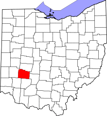 | |
| Villages | ||
| Townships | ||
| CDPs | ||
| Unincorporated communities | ||
| Footnotes | ‡This populated place also has portions in an adjacent county or counties | |
Municipalities and communities of Miami County, Ohio, United States | ||
|---|---|---|
| Cities | 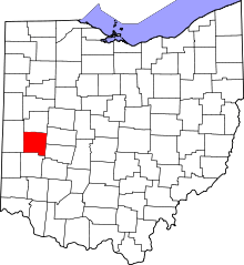 | |
| Villages | ||
| Townships | ||
| Unincorporated communities | ||
| Footnotes | ‡This populated place also has portions in an adjacent county or counties | |
Municipalities and communities of Montgomery County, Ohio, United States | ||
|---|---|---|
| Cities | 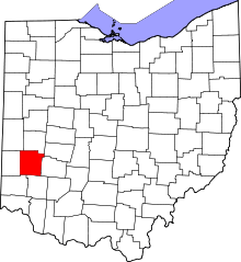 | |
| Villages | ||
| Townships | ||
| CDPs | ||
| Unincorporated communities | ||
| Ghost towns | ||
| Footnotes | ‡This populated place also has portions in an adjacent county or counties | |