Jefferson Township, Montgomery County, Ohio
| Jefferson Township, Montgomery County, Ohio | |
|---|---|
| Township | |
|
Methodist church at Liberty | |
 Location in Montgomery County and the state of Ohio. | |
| Coordinates: 39°43′25″N 84°17′59″W / 39.72361°N 84.29972°WCoordinates: 39°43′25″N 84°17′59″W / 39.72361°N 84.29972°W | |
| Country | United States |
| State | Ohio |
| County | Montgomery |
| Area | |
| • Total | 25.5 sq mi (66.0 km2) |
| • Land | 25.5 sq mi (66.0 km2) |
| • Water | 0.0 sq mi (0.0 km2) |
| Elevation[1] | 922 ft (281 m) |
| Population (2010) | |
| • Total | 6,972 |
| • Density | 270/sq mi (110/km2) |
| Time zone | Eastern (EST) (UTC-5) |
| • Summer (DST) | EDT (UTC-4) |
| FIPS code | 39-38738[2] |
| GNIS feature ID | 1086671[1] |

Jefferson Township is one of the nine townships of Montgomery County, Ohio, United States. As of the 2010 census the population was 6,972.[3]
Geography
Located in the central part of the county, it borders the following townships and cities:
- Trotwood - north
- Dayton - northeast
- Moraine - east
- Miami Township - southeast
- German Township - southwest
- Jackson Township - west
- Perry Township - northwest corner
Parts of several cities are located in Jefferson Township:
- Dayton, the county seat of Montgomery County, in the northeast
- Moraine, in the east
- West Carrollton, in the southeast
The census-designated place of Drexel is located in the township's northeast.
Name and history
It is one of twenty-four Jefferson Townships statewide.[4]
Jefferson Township was created from German Township on 10 June 1805.[5]
In 1833, Jefferson Township contained three gristmills, three saw mills, and eight distilleries.[6]
Government
The township is governed by a three-member board of trustees, who are elected in November of odd-numbered years to a four-year term beginning on the following January 1. Two are elected in the year after the presidential election and one is elected in the year before it. There is also an elected township fiscal officer,[7] who serves a four-year term beginning on April 1 of the year after the election, which is held in November of the year before the presidential election. Vacancies in the fiscal officership or on the board of trustees are filled by the remaining trustees.
References
- 1 2 "US Board on Geographic Names". United States Geological Survey. 2007-10-25. Retrieved 2008-01-31.
- ↑ "American FactFinder". United States Census Bureau. Retrieved 2008-01-31.
- ↑ "Profile of General Population and Housing Characteristics: 2010 Demographic Profile Data (DP-1): Jefferson township, Montgomery County, Ohio". U.S. Census Bureau, American Factfinder. Retrieved November 29, 2011.
- ↑ "Detailed map of Ohio" (PDF). United States Census Bureau. 2000. Retrieved 2007-02-16.
- ↑ History of Montgomery County. N.p.: Beers, 1882, pp. 307-308.
- ↑ Kilbourn, John (1833). "The Ohio Gazetteer, or, a Topographical Dictionary". Scott and Wright. p. 256. Retrieved 12 December 2013.
- ↑ §503.24, §505.01, and §507.01 of the Ohio Revised Code. Accessed 4/30/2009.
External links
Municipalities and communities of Montgomery County, Ohio, United States | ||
|---|---|---|
| Cities | 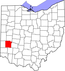 | |
| Villages | ||
| Townships | ||
| CDPs | ||
| Unincorporated communities | ||
| Ghost towns | ||
| Footnotes | ‡This populated place also has portions in an adjacent county or counties | |