Clayton, Ohio
| Clayton, Ohio | |
|---|---|
| City | |
| Motto: "The Learning Community" | |
 Location in Montgomery County and the state of Ohio. | |
| Coordinates: 39°51′38.38″N 84°21′18.29″W / 39.8606611°N 84.3550806°WCoordinates: 39°51′38.38″N 84°21′18.29″W / 39.8606611°N 84.3550806°W | |
| Country | United States |
| State | Ohio |
| Counties | Miami, Montgomery |
| Government | |
| • Mayor | Joyce Deitering |
| • Council Members | Tim Gorman, Greg Merkle, Mike Stevens, Kenneth Henning, Tina Kelly, Dennis Lieberman |
| Area[1] | |
| • Total | 18.60 sq mi (48.17 km2) |
| • Land | 18.51 sq mi (47.94 km2) |
| • Water | 0.09 sq mi (0.23 km2) |
| Elevation[2] | 1,001 ft (305 m) |
| Population (2010)[3] | |
| • Total | 13,209 |
| • Estimate (2012[4]) | 13,216 |
| • Density | 713.6/sq mi (275.5/km2) |
| Time zone | Eastern (EST) (UTC-5) |
| • Summer (DST) | EDT (UTC-4) |
| ZIP code | 45315 |
| Area code(s) | 937 |
| FIPS code | 39-15644[5] |
| GNIS feature ID | 1056811[2] |
| Website | http://www.clayton.oh.us/ |
Clayton is a city in Miami and Montgomery counties in the U.S. state of Ohio. The population was 13,209 at the 2010 census.[6] It is part of the Dayton Metropolitan Statistical Area.
The city has the name of John Clayton, a War of 1812 veteran.[7]
Geography
Clayton is located at 39°51′38.38″N 84°21′18.29″W / 39.8606611°N 84.3550806°W (39.86066, -84.35508).[8]
According to the United States Census Bureau, the city has a total area of 18.60 square miles (48.17 km2), of which 18.51 square miles (47.94 km2) is land and 0.09 square miles (0.23 km2) is water.[1]
In 1998,[9] Clayton annexed the remainder of Montgomery County's Randolph Township.[10]
Demographics
| Historical population | |||
|---|---|---|---|
| Census | Pop. | %± | |
| 1950 | 466 | — | |
| 1960 | 550 | 18.0% | |
| 1970 | 773 | 40.5% | |
| 1980 | 752 | −2.7% | |
| 1990 | 713 | −5.2% | |
| 2000 | 13,347 | 1,771.9% | |
| 2010 | 13,209 | −1.0% | |
| Est. 2015 | 13,146 | [11] | −0.5% |
| Sources:[5][12] | |||
2010 census
As of the census[3] of 2010, there were 13,209 people, 5,118 households, and 3,766 families residing in the city. The population density was 713.6 inhabitants per square mile (275.5/km2). There were 5,423 housing units at an average density of 293.0 per square mile (113.1/km2). The racial makeup of the city was 76.5% White, 18.8% African American, 0.2% Native American, 1.4% Asian, 0.6% from other races, and 2.5% from two or more races. Hispanic or Latino of any race were 1.4% of the population.
There were 5,118 households of which 32.1% had children under the age of 18 living with them, 59.2% were married couples living together, 10.7% had a female householder with no husband present, 3.6% had a male householder with no wife present, and 26.4% were non-families. 22.7% of all households were made up of individuals and 7.8% had someone living alone who was 65 years of age or older. The average household size was 2.56 and the average family size was 3.00.
The median age in the city was 42.6 years. 23.4% of residents were under the age of 18; 7.6% were between the ages of 18 and 24; 22.3% were from 25 to 44; 32.7% were from 45 to 64; and 14% were 65 years of age or older. The gender makeup of the city was 49.0% male and 51.0% female.
2000 census
As of the census[5] of 2000, there were 13,347 people, 4,975 households, and 3,850 families residing in the city. The population density was 723.7 people per square mile (279.5/km²). There were 5,193 housing units at an average density of 281.6 per square mile (108.7/km²). The racial makeup of the city was 87.14% White, 9.87% African American, 0.15% Native American, 1.45% Asian, 0.04% Pacific Islander, 0.30% from other races, and 1.03% from two or more races. Hispanic or Latino of any race were 0.90% of the population.
There were 4,975 households out of which 35.7% had children under the age of 18 living with them, 65.4% were married couples living together, 8.6% had a female householder with no husband present, and 22.6% were non-families. 19.2% of all households were made up of individuals and 6.5% had someone living alone who was 65 years of age or older. The average household size was 2.66 and the average family size was 3.05.
In the city the population was spread out with 26.9% under the age of 18, 6.7% from 18 to 24, 27.2% from 25 to 44, 28.0% from 45 to 64, and 11.2% who were 65 years of age or older. The median age was 39 years. For every 100 females there were 97.9 males. For every 100 females age 18 and over, there were 94.7 males.
The median income for a household in the city was $60,625, and the median income for a family was $67,250. Males had a median income of $45,569 versus $29,261 for females. The per capita income for the city was $26,569. About 3.3% of families and 4.4% of the population were below the poverty line, including 5.9% of those under age 18 and 2.8% of those age 65 or over.
Education
Clayton is served by Montgomery County's Northmont City School District, which operates the following schools:
- Northmont High School
- Northmont Middle School
- Englewood Elementary
- Englewood Hills Elementary
- Northmoor Elementary
- Northwood Elementary
- Union Elementary
- Kleptz Early Learning Center
Notable people
- Jesse "Pop" Haines - member of the Baseball Hall of Fame
- Johnnie Wilder, Jr. - former lead singer of the funk group Heatwave.
- Chris Hero - professional wrestler, ROH tag team champion Ring of Honor
In fiction
Part of Ayn Rand's novel The Fountainhead[13] is set at Clayton. In the early 1930s the novel's male protagonist, the controversial architect Howard Roark, gets a contract to build in Clayton the fictional Janer's Department Store, a five-story building. Later on Roark's beloved, Dominique Francon, comes seeking him there, and feels that in a sense Clayton "belongs to her more than to any of its inhabitants" because her beloved is there.
The book presents Clayton as the archetype of "Middle America", the polar opposite of the cosmopolitan New York City where most of the plot takes place.
References
- 1 2 "US Gazetteer files 2010". United States Census Bureau. Archived from the original on 2012-06-26. Retrieved 2013-01-06.
- 1 2 "US Board on Geographic Names". United States Geological Survey. 2007-10-25. Retrieved 2008-01-31.
- 1 2 "American FactFinder". United States Census Bureau. Retrieved 2013-01-06.
- ↑ "Population Estimates". United States Census Bureau. Archived from the original on 2013-06-17. Retrieved 2013-06-17.
- 1 2 3 "American FactFinder". United States Census Bureau. Archived from the original on 2013-09-11. Retrieved 2008-01-31.
- ↑ "American FactFinder2". Retrieved 2010-03-20.
- ↑ Overman, William Daniel (1958). Ohio Town Names. Akron, OH: Atlantic Press. p. 30.
- ↑ "US Gazetteer files: 2010, 2000, and 1990". United States Census Bureau. 2011-02-12. Retrieved 2011-04-23.
- ↑ http://www.rths.org/
- ↑ http://www.mergerstudy.com/Clayton-RandolphMergerReport.pdf
- ↑ "Annual Estimates of the Resident Population for Incorporated Places: April 1, 2010 to July 1, 2015". Retrieved July 2, 2016.
- ↑ "Incorporated Places and Minor Civil Divisions Datasets: Subcounty Population Estimates: April 1, 2010 to July 1, 2012". U.S. Census Bureau. Archived from the original on 17 June 2013. Retrieved 25 November 2013.
- ↑ The Fountainhead, Part III, Ch. 4.
Municipalities and communities of Miami County, Ohio, United States | ||
|---|---|---|
| Cities | 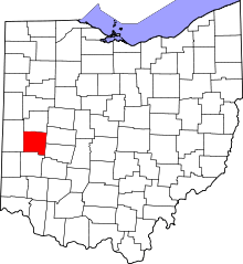 | |
| Villages | ||
| Townships | ||
| Unincorporated communities | ||
| Footnotes | ‡This populated place also has portions in an adjacent county or counties | |
Municipalities and communities of Montgomery County, Ohio, United States | ||
|---|---|---|
| Cities | 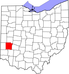 | |
| Villages | ||
| Townships | ||
| CDPs | ||
| Unincorporated communities | ||
| Ghost towns | ||
| Footnotes | ‡This populated place also has portions in an adjacent county or counties | |