Phillipsburg, Ohio
| Phillipsburg, Ohio | |
|---|---|
| Village | |
|
West Main Street | |
 Location in Montgomery County and the state of Ohio. | |
| Coordinates: 39°54′17″N 84°24′6″W / 39.90472°N 84.40167°WCoordinates: 39°54′17″N 84°24′6″W / 39.90472°N 84.40167°W | |
| Country | United States |
| State | Ohio |
| County | Montgomery |
| Township | Clay |
| Area[1] | |
| • Total | 0.27 sq mi (0.70 km2) |
| • Land | 0.27 sq mi (0.70 km2) |
| • Water | 0 sq mi (0 km2) |
| Elevation[2] | 1,037 ft (316 m) |
| Population (2010)[3] | |
| • Total | 557 |
| • Estimate (2012[4]) | 557 |
| • Density | 2,063.0/sq mi (796.5/km2) |
| Time zone | Eastern (EST) (UTC-5) |
| • Summer (DST) | EDT (UTC-4) |
| ZIP code | 45354 |
| Area code(s) | 937 |
| FIPS code | 39-62414[5] |
| GNIS feature ID | 1056916[2] |

Phillipsburg is a village in Montgomery County, Ohio, United States. The population was 557 at the 2010 census.[6] It is part of the Dayton Metropolitan Statistical Area.
History
Phillipsburg was platted in 1836, and named for Philip Studybaker, a member of the town company.[7] A post office was established as Centre in 1848, the name was changed to Center in 1893, and changed again to Phillipsburg in 1903.[8] Phillipsburg was incorporated as a village in 1899.[7]
Geography
Phillipsburg is located at 39°54′17″N 84°24′6″W / 39.90472°N 84.40167°W (39.904603, -84.401630).[9]
According to the United States Census Bureau, the village has a total area of 0.27 square miles (0.70 km2), all land.[1]
Demographics
| Historical population | |||
|---|---|---|---|
| Census | Pop. | %± | |
| 1870 | 187 | — | |
| 1880 | 215 | 15.0% | |
| 1890 | 270 | 25.6% | |
| 1910 | 343 | — | |
| 1920 | 348 | 1.5% | |
| 1930 | 436 | 25.3% | |
| 1940 | 504 | 15.6% | |
| 1950 | 609 | 20.8% | |
| 1960 | 715 | 17.4% | |
| 1970 | 831 | 16.2% | |
| 1980 | 705 | −15.2% | |
| 1990 | 644 | −8.7% | |
| 2000 | 628 | −2.5% | |
| 2010 | 557 | −11.3% | |
| Est. 2015 | 554 | [10] | −0.5% |
2010 census
As of the census[3] of 2010, there were 557 people, 235 households, and 163 families residing in the village. The population density was 2,063.0 inhabitants per square mile (796.5/km2). There were 255 housing units at an average density of 944.4 per square mile (364.6/km2). The racial makeup of the village was 97.7% White, 1.4% African American, 0.4% Asian, 0.4% from other races, and 0.2% from two or more races. Hispanic or Latino of any race were 3.2% of the population.
There were 235 households of which 30.2% had children under the age of 18 living with them, 47.2% were married couples living together, 14.0% had a female householder with no husband present, 8.1% had a male householder with no wife present, and 30.6% were non-families. 26.4% of all households were made up of individuals and 8.1% had someone living alone who was 65 years of age or older. The average household size was 2.37 and the average family size was 2.81.
The median age in the village was 40.4 years. 21.5% of residents were under the age of 18; 7.8% were between the ages of 18 and 24; 28% were from 25 to 44; 24.1% were from 45 to 64; and 18.5% were 65 years of age or older. The gender makeup of the village was 51.3% male and 48.7% female.
2000 census
As of the census[5] of 2000, there were 628 people, 250 households, and 188 families residing in the village. The population density was 2,365.2 people per square mile (898.0/km²). There were 257 housing units at an average density of 967.9 per square mile (367.5/km²). The racial makeup of the village was 98.57% White, 0.80% African American, 0.32% Native American, 0.16% from other races, and 0.16% from two or more races. Hispanic or Latino of any race were 0.80% of the population.
There were 250 households out of which 30.4% had children under the age of 18 living with them, 60.8% were married couples living together, 10.0% had a female householder with no husband present, and 24.4% were non-families. 20.4% of all households were made up of individuals and 10.0% had someone living alone who was 65 years of age or older. The average household size was 2.51 and the average family size was 2.89.
In the village the population was spread out with 24.5% under the age of 18, 7.8% from 18 to 24, 27.9% from 25 to 44, 25.0% from 45 to 64, and 14.8% who were 65 years of age or older. The median age was 37 years. For every 100 females there were 93.8 males. For every 100 females age 18 and over, there were 95.1 males.
The median income for a household in the village was $41,458, and the median income for a family was $47,969. Males had a median income of $37,625 versus $25,917 for females. The per capita income for the village was $17,687. About 5.1% of families and 6.1% of the population were below the poverty line, including 9.3% of those under age 18 and 12.2% of those age 65 or over.
Education
Phillipsburg is served by the Northmont City School District of Montgomery County, Ohio. The schools include:
- Northmont High School
- Northmont Middle School
- Englewood Elementary
- Englewood Hills Elementary
- Northmoor Elementary
- Northwood Elementary
- O. R. Edgington Elementary
- Union Elementary
Phillipsburg Elementary School was closed in 2009, with its students being sent to Union Elementary School,[12] and the property was sold to a private owner in the following November.[13]
Transportation
Major highways
Ohio State Route 49 bisects Phillipsburg 4 miles north of I-70 in Montgomery County, Ohio
Airports
Phillipsburg Airport is located on the Northeast edge of the village of Phillipsburg. The airport was opened in 1949 and remains active to this day.[14] The airport is home to 35 aircraft and averages 186 aircraft operations per day.[15] Phillipsburg Airport was originally named Myer's Airport after it original owner John L. Myers. The airport was run by Gene and Jayne Miller for many years. As of 2013, the airport is now owned and operated by Danny and Jaime Steel-Potter.[14]
Notable people
- Jesse Haines, pitcher in Baseball Hall of Fame, raised in Phillipsburg
References
- 1 2 "US Gazetteer files 2010". United States Census Bureau. Retrieved 2013-01-06.
- 1 2 "US Board on Geographic Names". United States Geological Survey. 2007-10-25. Retrieved 2008-01-31.
- 1 2 "American FactFinder". United States Census Bureau. Retrieved 2013-01-06.
- ↑ "Population Estimates". United States Census Bureau. Retrieved 2013-06-17.
- 1 2 "American FactFinder". United States Census Bureau. Retrieved 2008-01-31.
- ↑ "Profile of General Population and Housing Characteristics: 2010 Demographic Profile Data (DP-1): Phillipsburg village, Ohio". U.S. Census Bureau, American Factfinder. Retrieved November 28, 2011.
- 1 2 Drury, Augustus Waldo (1909). History of the City of Dayton and Montgomery County, Ohio, Volume 1. S. J. Clarke Publishing Company. p. 929.
- ↑ U.S. Geological Survey Geographic Names Information System: Phillipsburg Post Office
- ↑ "US Gazetteer files: 2010, 2000, and 1990". United States Census Bureau. 2011-02-12. Retrieved 2011-04-23.
- ↑ "Annual Estimates of the Resident Population for Incorporated Places: April 1, 2010 to July 1, 2015". Retrieved July 2, 2016.
- ↑ "Census of Population and Housing". Census.gov. Retrieved June 4, 2015.
- ↑ http://www.daytondailynews.com/localnews/content/oh/story/news/local/2009/01/26/ddn012609northmontwebfolo.html?cxtype=rss&cxsvc=7&cxcat=16
- ↑ http://public.mcrecorder.org/External/LandRecords/protected/SrchQuickParcel.aspx?bAutoSearch=True&gp=2010002619
- 1 2 "Phillipsburg Airport website".
- ↑ "AirNav".
Municipalities and communities of Montgomery County, Ohio, United States | ||
|---|---|---|
| Cities | 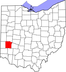 | |
| Villages | ||
| Townships | ||
| CDPs | ||
| Unincorporated communities | ||
| Ghost towns | ||
| Footnotes | ‡This populated place also has portions in an adjacent county or counties | |