Pleasant Hill, Ohio
| Pleasant Hill, Ohio | |
|---|---|
| Village | |
|
Pleasant Hill's Civil War monument | |
 Location of Pleasant Hill, Ohio | |
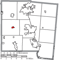 Location of Pleasant Hill in Miami County | |
| Coordinates: 40°3′9″N 84°20′42″W / 40.05250°N 84.34500°WCoordinates: 40°3′9″N 84°20′42″W / 40.05250°N 84.34500°W | |
| Country | United States |
| State | Ohio |
| County | Miami |
| Township | Newton |
| Government | |
| • Mayor | Gary L. Johnston |
| Area[1] | |
| • Total | 0.61 sq mi (1.58 km2) |
| • Land | 0.61 sq mi (1.58 km2) |
| • Water | 0 sq mi (0 km2) |
| Elevation[2] | 932 ft (284 m) |
| Population (2010)[3] | |
| • Total | 1,200 |
| • Estimate (2012[4]) | 1,205 |
| • Density | 1,967.2/sq mi (759.5/km2) |
| Time zone | Eastern (EST) (UTC-5) |
| • Summer (DST) | EDT (UTC-4) |
| ZIP code | 45359 |
| Area code(s) | 937 |
| FIPS code | 39-63534[5] |
| GNIS feature ID | 1061552[2] |
| Website | http://www.pleasanthillohio.com |

Pleasant Hill is a village in Miami County, Ohio, United States. The population was 1,200 at the 2010 census. It is part of the Dayton Metropolitan Statistical Area.
History
Pleasant Hill was originally called Newton, and under the latter name was platted in 1843.[6] A post office called Pleasant Hill has been in operation since 1839,[7] although the post office was originally located about one mile away from its present location.[8] The village was incorporated in 1866.[9]
Geography
Pleasant Hill is located at 40°3′9″N 84°20′42″W / 40.05250°N 84.34500°W (40.052427, -84.344878).[10]
According to the United States Census Bureau, the village has a total area of 0.61 square miles (1.58 km2), all land.[1]
Demographics
| Historical population | |||
|---|---|---|---|
| Census | Pop. | %± | |
| 1870 | 324 | — | |
| 1880 | 461 | 42.3% | |
| 1890 | 521 | 13.0% | |
| 1900 | 557 | 6.9% | |
| 1910 | 571 | 2.5% | |
| 1920 | 682 | 19.4% | |
| 1930 | 746 | 9.4% | |
| 1940 | 738 | −1.1% | |
| 1950 | 940 | 27.4% | |
| 1960 | 1,060 | 12.8% | |
| 1970 | 1,025 | −3.3% | |
| 1980 | 1,051 | 2.5% | |
| 1990 | 1,066 | 1.4% | |
| 2000 | 1,134 | 6.4% | |
| 2010 | 1,200 | 5.8% | |
| Est. 2015 | 1,219 | [11] | 1.6% |
2010 census
As of the census[3] of 2010, there were 1,200 people, 458 households, and 327 families residing in the village. The population density was 1,967.2 inhabitants per square mile (759.5/km2). There were 498 housing units at an average density of 816.4 per square mile (315.2/km2). The racial makeup of the village was 98.7% White, 0.3% African American, 0.1% Native American, 0.3% Asian, 0.2% from other races, and 0.6% from two or more races. Hispanic or Latino of any race were 1.9% of the population.
There were 458 households of which 39.1% had children under the age of 18 living with them, 59.8% were married couples living together, 7.9% had a female householder with no husband present, 3.7% had a male householder with no wife present, and 28.6% were non-families. 24.0% of all households were made up of individuals and 11.8% had someone living alone who was 65 years of age or older. The average household size was 2.62 and the average family size was 3.15.
The median age in the village was 35.7 years. 27.7% of residents were under the age of 18; 8.9% were between the ages of 18 and 24; 26% were from 25 to 44; 23.4% were from 45 to 64; and 14.1% were 65 years of age or older. The gender makeup of the village was 48.4% male and 51.6% female.
2000 census
As of the census[5] of 2000, there were 1,134 people, 423 households, and 326 families residing in the village. The population density was 2,393.0 people per square mile (931.6/km²). There were 437 housing units at an average density of 922.2 per square mile (359.0/km²). The racial makeup of the village was 99.38% White, 0.09% Native American, 0.18% Asian, and 0.35% from two or more races. Hispanic or Latino of any race were 0.26% of the population.
There were 423 households, 39.2% had children under the age of 18 living with them, 68.3% were married couples living together, 7.6% had a female householder with no husband present, and 22.7% were non-families. 19.6% of all households were made up of individuals and 10.2% had someone living alone who was 65 years of age or older. The average household size was 2.68 and the average family size was 3.10.
In the village the population was spread out with 29.9% under the age of 18, 5.6% from 18 to 24, 29.9% from 25 to 44, 21.6% from 45 to 64, and 13.1% who were 65 years of age or older. The median age was 35 years. For every 100 females there were 91.9 males. For every 100 females age 18 and over, there were 87.5 males.
The median income for a household in the village was $45,703, and the median income for a family was $50,260. Males had a median income of $38,036 versus $23,750 for females. The per capita income for the village was $18,477. About 2.1% of families and 2.6% of the population were below the poverty line, including 3.6% of those under age 18 and 1.6% of those age 65 or over.
References
- 1 2 "US Gazetteer files 2010". United States Census Bureau. Retrieved 2013-01-06.
- 1 2 "US Board on Geographic Names". United States Geological Survey. 2007-10-25. Retrieved 2008-01-31.
- 1 2 "American FactFinder". United States Census Bureau. Retrieved 2013-01-06.
- ↑ "Population Estimates". United States Census Bureau. Retrieved 2013-06-17.
- 1 2 "American FactFinder". United States Census Bureau. Retrieved 2008-01-31.
- ↑ The History of Miami County, Ohio: Containing a History of the County; Its Cities, Towns, Etc. Windmill Publications. 1880. p. 366.
- ↑ "Miami County". Jim Forte Postal History. Retrieved 9 January 2016.
- ↑ Overman, William Daniel (1958). Ohio Town Names. Akron, OH: Atlantic Press. p. 112.
- ↑ Harbaugh, T. C. (1909). Centennial history. Troy, Piqua and Miami county, Ohio. Chicago: Richmond-Arnold Publishing Co. p. 95.
- ↑ "US Gazetteer files: 2010, 2000, and 1990". United States Census Bureau. 2011-02-12. Retrieved 2011-04-23.
- ↑ "Annual Estimates of the Resident Population for Incorporated Places: April 1, 2010 to July 1, 2015". Retrieved July 2, 2016.
- ↑ "Census of Population and Housing". Census.gov. Retrieved June 4, 2015.
External links
Municipalities and communities of Miami County, Ohio, United States | ||
|---|---|---|
| Cities | 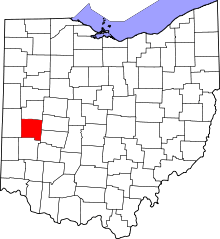 | |
| Villages | ||
| Townships | ||
| Unincorporated communities | ||
| Footnotes | ‡This populated place also has portions in an adjacent county or counties | |