Casstown, Ohio
| Casstown, Ohio | |
|---|---|
| Village | |
|
| |
 Location of Casstown, Ohio | |
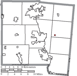 Location of Casstown in Miami County | |
| Coordinates: 40°3′9″N 84°7′39″W / 40.05250°N 84.12750°WCoordinates: 40°3′9″N 84°7′39″W / 40.05250°N 84.12750°W | |
| Country | United States |
| State | Ohio |
| County | Miami |
| Township | Lostcreek |
| Area[1] | |
| • Total | 0.10 sq mi (0.26 km2) |
| • Land | 0.10 sq mi (0.26 km2) |
| • Water | 0 sq mi (0 km2) |
| Elevation[2] | 935 ft (285 m) |
| Population (2010)[3] | |
| • Total | 267 |
| • Estimate (2012[4]) | 269 |
| • Density | 2,670.0/sq mi (1,030.9/km2) |
| Time zone | Eastern (EST) (UTC-5) |
| • Summer (DST) | EDT (UTC-4) |
| ZIP code | 45312 |
| Area code(s) | 937 |
| FIPS code | 39-12462[5] |
| GNIS feature ID | 1064495[2] |

Casstown is a village in Miami County, Ohio, United States. The population was 267 at the 2010 census. It is part of the Dayton Metropolitan Statistical Area.
History
Casstown was originally called Trimmensburgh, and under the latter name was laid out in 1832 by one Mr. Trimmens, and named for him.[6] The present name honors Lewis Cass, an American military officer, politician, and statesman.[6] A post office called Casstown has been in operation since 1846.[7]
Geography
Casstown is located at 40°3′9″N 84°7′39″W / 40.05250°N 84.12750°W (40.052583, -84.127577).[8]
According to the United States Census Bureau, the village has a total area of 0.10 square miles (0.26 km2), all land.[1]
Demographics
| Historical population | |||
|---|---|---|---|
| Census | Pop. | %± | |
| 1850 | 394 | — | |
| 1860 | 232 | −41.1% | |
| 1870 | 241 | 3.9% | |
| 1880 | 331 | 37.3% | |
| 1890 | 292 | −11.8% | |
| 1900 | 262 | −10.3% | |
| 1910 | 265 | 1.1% | |
| 1920 | 291 | 9.8% | |
| 1930 | 298 | 2.4% | |
| 1940 | 306 | 2.7% | |
| 1950 | 368 | 20.3% | |
| 1960 | 366 | −0.5% | |
| 1970 | 380 | 3.8% | |
| 1980 | 331 | −12.9% | |
| 1990 | 246 | −25.7% | |
| 2000 | 322 | 30.9% | |
| 2010 | 267 | −17.1% | |
| Est. 2015 | 271 | [9] | 1.5% |
2010 census
As of the census[3] of 2010, there were 267 people, 113 households, and 71 families residing in the village. The population density was 2,670.0 inhabitants per square mile (1,030.9/km2). There were 122 housing units at an average density of 1,220.0 per square mile (471.0/km2). The racial makeup of the village was 100.0% White.
There were 113 households of which 30.1% had children under the age of 18 living with them, 46.9% were married couples living together, 10.6% had a female householder with no husband present, 5.3% had a male householder with no wife present, and 37.2% were non-families. 34.5% of all households were made up of individuals and 14.2% had someone living alone who was 65 years of age or older. The average household size was 2.36 and the average family size was 3.07.
The median age in the village was 36.8 years. 24% of residents were under the age of 18; 11.2% were between the ages of 18 and 24; 27.7% were from 25 to 44; 23.6% were from 45 to 64; and 13.5% were 65 years of age or older. The gender makeup of the village was 46.8% male and 53.2% female.
2000 census
As of the census[5] of 2000, there were 322 people, 127 households, and 83 families residing in the village. The population density was 3,017.0 people per square mile (1,130.2/km²). There were 132 housing units at an average density of 1,236.8 per square mile (463.3/km²). The racial makeup of the village was 100.00% White.
There were 127 households out of which 28.3% had children under the age of 18 living with them, 56.7% were married couples living together, 6.3% had a female householder with no husband present, and 34.6% were non-families. 31.5% of all households were made up of individuals and 15.7% had someone living alone who was 65 years of age or older. The average household size was 2.54 and the average family size was 3.17.
In the village the population was spread out with 25.5% under the age of 18, 9.3% from 18 to 24, 26.7% from 25 to 44, 23.6% from 45 to 64, and 14.9% who were 65 years of age or older. The median age was 40 years. For every 100 females there were 92.8 males. For every 100 females age 18 and over, there were 83.2 males.
The median income for a household in the village was $41,250, and the median income for a family was $48,333. Males had a median income of $31,250 versus $23,000 for females. The per capita income for the village was $16,296. About 2.6% of families and 4.3% of the population were below the poverty line, including 7.9% of those under age 18 and 5.6% of those age 65 or over.
School
The Miami East High School district's middle school was formerly located in Casstown. The district recently built a new K-8 building and sold all other school buildings except the high school. The building is now privately owned.
References
- 1 2 "US Gazetteer files 2010". United States Census Bureau. Archived from the original on 2012-07-14. Retrieved 2013-01-06.
- 1 2 "US Board on Geographic Names". United States Geological Survey. 2007-10-25. Retrieved 2008-01-31.
- 1 2 "American FactFinder". United States Census Bureau. Retrieved 2013-01-06.
- ↑ "Population Estimates". United States Census Bureau. Archived from the original on 2013-06-17. Retrieved 2013-06-17.
- 1 2 "American FactFinder". United States Census Bureau. Archived from the original on 2013-09-11. Retrieved 2008-01-31.
- 1 2 The History of Miami County, Ohio: Containing a History of the County; Its Cities, Towns, Etc. Windmill Publications. 1880. pp. 395–396.
- ↑ "Miami County". Jim Forte Postal History. Retrieved 9 January 2016.
- ↑ "US Gazetteer files: 2010, 2000, and 1990". United States Census Bureau. 2011-02-12. Retrieved 2011-04-23.
- ↑ "Annual Estimates of the Resident Population for Incorporated Places: April 1, 2010 to July 1, 2015". Retrieved July 2, 2016.
- ↑ "Census of Population and Housing". Census.gov. Archived from the original on April 22, 2013. Retrieved June 4, 2015.
External links
Municipalities and communities of Miami County, Ohio, United States | ||
|---|---|---|
| Cities | 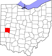 | |
| Villages | ||
| Townships | ||
| Unincorporated communities | ||
| Footnotes | ‡This populated place also has portions in an adjacent county or counties | |