Cedarville, Ohio
| Cedarville, Ohio | |
|---|---|
| Village | |
|
Cedarville's historic opera house | |
 Location of Cedarville, Ohio | |
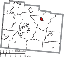 Location of Cedarville in Greene County | |
| Coordinates: 39°44′34″N 83°48′26″W / 39.74278°N 83.80722°WCoordinates: 39°44′34″N 83°48′26″W / 39.74278°N 83.80722°W | |
| Country | United States |
| State | Ohio |
| County | Greene |
| Government | |
| • Mayor | Robert Fudge |
| Area[1] | |
| • Total | 1.32 sq mi (3.42 km2) |
| • Land | 1.28 sq mi (3.32 km2) |
| • Water | 0.04 sq mi (0.10 km2) |
| Elevation[2] | 1,050 ft (320 m) |
| Population (2010)[3] | |
| • Total | 4,019 |
| • Estimate (2012[4]) | 4,032 |
| • Density | 3,000/sq mi (1,200/km2) |
| Time zone | Eastern (EST) (UTC-5) |
| • Summer (DST) | EDT (UTC-4) |
| ZIP code | 45314 |
| Area code(s) | 937 |
| FIPS code | 39-12784 [5] |
| GNIS feature ID | 1056780 [2] |
| Website | cedarvilleohio.net |

Cedarville is a village in Greene County, Ohio, United States. The population was 4,019 at the 2010 census. It is the home of Cedarville University and Cedarville High School.
Cedarville is part of the Dayton Metropolitan Statistical Area. It is served by a branch of the Greene County Public Library.
History
Cedarville was originally known as Milford, and under the latter name was platted in 1816.[6] A post office called Massies Creek was established in 1837, and the name was changed to Cedarville in 1843.[7] The present name is for cedar trees near the original town site.[8]
For many years beginning in the 1880s, public life in Cedarville centered around the downtown Cedarville Opera House; it survives to the present day,[9] and is listed on the National Register of Historic Places.[10]
Geography
Cedarville is located at 39°44′34″N 83°48′26″W / 39.74278°N 83.80722°W (39.742796, -83.807084).[11] According to the United States Census Bureau, the village has a total area of 1.32 square miles (3.42 km2), of which 1.28 square miles (3.32 km2) is land and 0.04 square miles (0.10 km2) is water.[1]
Demographics
| Historical population | |||
|---|---|---|---|
| Census | Pop. | %± | |
| 1860 | 688 | — | |
| 1870 | 753 | 9.4% | |
| 1880 | 1,181 | 56.8% | |
| 1890 | 1,355 | 14.7% | |
| 1900 | 1,189 | −12.3% | |
| 1910 | 1,059 | −10.9% | |
| 1920 | 1,028 | −2.9% | |
| 1930 | 940 | −8.6% | |
| 1940 | 1,034 | 10.0% | |
| 1950 | 1,292 | 25.0% | |
| 1960 | 1,702 | 31.7% | |
| 1970 | 2,342 | 37.6% | |
| 1980 | 2,799 | 19.5% | |
| 1990 | 3,210 | 14.7% | |
| 2000 | 3,828 | 19.3% | |
| 2010 | 4,019 | 5.0% | |
| Est. 2015 | 4,177 | [12] | 3.9% |
2010 census
As of the census[3] of 2010, there were 4,019 people, 686 households, and 411 families residing in the village. The population density was 3,139.8 inhabitants per square mile (1,212.3/km2). There were 759 housing units at an average density of 593.0 per square mile (229.0/km2). The racial makeup of the village was 94.4% White, 2.3% African American, 0.1% Native American, 1.1% Asian, 0.3% from other races, and 1.7% from two or more races. Hispanic or Latino of any race were 2.2% of the population.
There were 686 households of which 26.5% had children under the age of 18 living with them, 47.7% were married couples living together, 9.3% had a female householder with no husband present, 2.9% had a male householder with no wife present, and 40.1% were non-families. 28.4% of all households were made up of individuals and 12.3% had someone living alone who was 65 years of age or older. The average household size was 2.45 and the average family size was 2.96.
The median age in the village was 21 years. 9.2% of residents were under the age of 18; 66.4% were between the ages of 18 and 24; 8.4% were from 25 to 44; 9.8% were from 45 to 64; and 6% were 65 years of age or older. The gender makeup of the village was 46.5% male and 53.5% female.
2000 census
As of the census[5] of 2000, there were 3,828 people, 681 households, and 420 families residing in the village. The population density was 3,594.6 people per square mile (1,394.3/km²). There were 722 housing units at an average density of 678.0 per square mile (263.0/km²). The racial makeup of the village was 95.06% White, 1.99% African American, 0.39% Native American, 0.81% Asian, 0.03% Pacific Islander, 0.31% from other races, and 1.41% from two or more races. Hispanic or Latino of any race were 0.94% of the population.
There were 681 households out of which 28.8% had children under the age of 18 living with them, 51.2% were married couples living together, 7.6% had a female householder with no husband present, and 38.2% were non-families. 26.1% of all households were made up of individuals and 9.1% had someone living alone who was 65 years of age or older. The average household size was 2.55 and the average family size was 3.08.
In the village the population was spread out with 10.4% under the age of 18, 65.0% from 18 to 24, 10.7% from 25 to 44, 8.4% from 45 to 64, and 5.5% who were 65 years of age or older. The median age was 21 years. For every 100 females there were 85.9 males. For every 100 females age 18 and over, there were 83.8 males.
The median income for a household in the village was $37,200, and the median income for a family was $44,234. Males had a median income of $32,500 versus $22,813 for females. The per capita income for the village was $9,499. About 5.4% of families and 13.8% of the population were below the poverty line, including 5.6% of those under age 18 and 4.3% of those age 65 or over.
Religion
There were and are numerous churches of different denominations in the village of Cedarville, including Presbyterian, Baptist, Nazarene, Methodist, and others.
The Presbyterian church in Cedarville has moved locations at least 3 times; from the building currently owned by Cedarville University (and currently known as Alford Auditorium), to the church that is now Grace Baptist, to its current location beside Grace Baptist.
Grace Baptist Church is the largest church in Cedarville and offers ministry opportunities and services to all ages. They have an active AWANA program, Parish Nursing Ministry, DivorceCare program, MOPS program, and many other opportunities.
Festivals
CedarFest
To celebrate its distinction as the birthplace of James H. Kyle, Cedarville commemorates Labor Day with CedarFest, an annual festival including a parade, a performance by the Cedarville High School Marching Band, pancake breakfast at the fire station, carnival games and rides,a community church service, and exhibitions of local cuisine. The weekend is capped by a fireworks display on the Sunday before Labor Day in Cedar Park.
Little Town of Lights
The Little Town of Lights is held annually on the first weekend of December. Residents coordinate their outdoor lighted decorations (traditionally empty gallon milk jugs with a candle placed inside) and also compete for the best display. There are also hay rides, photo opportunities with Santa Claus, outdoor caroling and samples of local cuisine. There is a live Nativity scene complete with live animals located outside of Grace Baptist Church, where they also offer homemade cookies.
Notable people
- Mike DeWine, former US Senator, current Ohio Attorney General
- David Jeremiah, American evangelist
- Bumpus Jones, Major League Baseball player
- Mike Kellogg, American radio evangelist
- James H. Kyle, politician, "Father" of Labor Day
- Eleanor Parker, actress
- Whitelaw Reid, newspaper publisher and statesman
- Wolves at the Gate, Christian post hardcore band
References
- 1 2 "US Gazetteer files 2010". United States Census Bureau. Archived from the original on 2012-01-24. Retrieved 2013-01-06.
- 1 2 "US Board on Geographic Names". United States Geological Survey. 2007-10-25. Retrieved 2008-01-31.
- 1 2 "American FactFinder". United States Census Bureau. Retrieved 2013-01-06.
- ↑ "Population Estimates". United States Census Bureau. Archived from the original on 2013-06-17. Retrieved 2013-06-17.
- 1 2 "American FactFinder". United States Census Bureau. Archived from the original on 2013-09-11. Retrieved 2008-01-31.
- ↑ Dills, R. S. (1881). History of Greene County: Together with Historic Notes on the Northwest, and the State of Ohio. Odell & Mayer. p. 548.
- ↑ U.S. Geological Survey Geographic Names Information System: Cedarville Post Office
- ↑ Broadstone, Michael A. (1918). History of Greene County, Ohio: Its People, Industries and Institutions, Volume 1. B.F. Bowen. p. 363.
- ↑ Owen, Lorrie K., ed. Dictionary of Ohio Historic Places. Vol. 1. St. Clair Shores: Somerset, 1999, 537.
- ↑ National Park Service (2010-07-09). "National Register Information System". National Register of Historic Places. National Park Service.
- ↑ "US Gazetteer files: 2010, 2000, and 1990". United States Census Bureau. 2011-02-12. Retrieved 2011-04-23.
- ↑ "Annual Estimates of the Resident Population for Incorporated Places: April 1, 2010 to July 1, 2015". Retrieved July 2, 2016.
- ↑ "Census of Population and Housing". Census.gov. Archived from the original on May 11, 2015. Retrieved June 4, 2015.
External links
- Village of Cedarville
- Cedarville Chamber of Commerce
- Cedarville branch of the Greene Country Public Library
- Cedarville University
Municipalities and communities of Greene County, Ohio, United States | ||
|---|---|---|
| Cities | 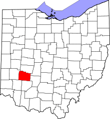 | |
| Villages | ||
| Townships | ||
| CDPs | ||
| Unincorporated communities | ||
| Footnotes | ‡This populated place also has portions in an adjacent county or counties | |