Clay Township, Montgomery County, Ohio
| Clay Township, Montgomery County, Ohio | |
|---|---|
| Township | |
|
Although located near Dayton, Clay Township is rural enough that it has many farms. | |
 Location in Montgomery County and the state of Ohio. | |
| Coordinates: 39°51′51″N 84°24′59″W / 39.86417°N 84.41639°WCoordinates: 39°51′51″N 84°24′59″W / 39.86417°N 84.41639°W | |
| Country | United States |
| State | Ohio |
| County | Montgomery |
| Area | |
| • Total | 37.8 sq mi (98.0 km2) |
| • Land | 37.8 sq mi (98.0 km2) |
| • Water | 0.0 sq mi (0.0 km2) |
| Elevation[1] | 1,050 ft (320 m) |
| Population (2010) | |
| • Total | 8,847 |
| • Density | 230/sq mi (90/km2) |
| Time zone | Eastern (EST) (UTC-5) |
| • Summer (DST) | EDT (UTC-4) |
| FIPS code | 39-15518[2] |
| GNIS feature ID | 1086665[1] |

Clay Township is one of the nine townships of Montgomery County, Ohio, United States. As of the 2010 census the population was 8,847.[3]
Geography
Located in the northwestern corner of the county, it borders the following townships and cities:
- Union Township, Miami County - northeast
- Clayton - east
- Trotwood - southeast corner
- Perry Township - south
- Twin Township, Preble County - southwest corner
- Harrison Township, Preble County - west
- Monroe Township, Darke County - northwest
It is the only township in the county with a border on Darke County.
Three municipalities are located in Clay Township:
- Part of the city of Brookville, in the south
- The village of Phillipsburg, in the northeast
- Part of the village of Verona, in the northwest
The following unincorporated communities are located in Clay Township:
Fire & Public Safety
Fire & Emergency Medical Service throughout Clay Township is available under contract with the following full service departments (arranged by order of size of catchment area):
- Brookville, in the south,
- Phillipsburg, in the northeast,
- Verona, in the northwest
Clay Township maintains a full-service police force with an enforcement area throughout unincorporated areas of the township. Brookville, Phillipsburg, and Verona also have a dedicated police force for their respective communities.
Education
The township is served by the following public school districts:
- Northmont City School District
- Tri-County North Local School District
- Brookville Local School District
Economy
Interstate 70 crosses Clay Township east-west in the south and the National Road (US-40) crosses east-west just north of I-70. OH-49, also known as Dayton-Greenville Pike is a main north-south connector from Greenville to the north in Darke County to I-70.
Clay Township has established a Joint Economic Development District (a "JEDD") with the neighboring city of Clayton at the intersection of Interstate 70 and OH-49.
Name and history
Established on June 8, 1825. It is one of nine Clay Townships statewide.[4] It is named after the statesman Henry Clay.
Government
The township is governed by a three-member board of trustees, who are elected in November of odd-numbered years to a four-year term beginning on the following January 1. Two are elected in the year after the presidential election and one is elected in the year before it. There is also an elected township fiscal officer,[5] who serves a four-year term beginning on April 1 of the year after the election, which is held in November of the year before the presidential election. Vacancies in the fiscal officership or on the board of trustees are filled by the remaining trustees.
References
- 1 2 "US Board on Geographic Names". United States Geological Survey. 2007-10-25. Retrieved 2008-01-31.
- ↑ "American FactFinder". United States Census Bureau. Archived from the original on 2013-09-11. Retrieved 2008-01-31.
- ↑ "Profile of General Population and Housing Characteristics: 2010 Demographic Profile Data (DP-1): Clay township, Montgomery County, Ohio". U.S. Census Bureau, American Factfinder. Archived from the original on September 11, 2013. Retrieved November 28, 2011.
- ↑ "Detailed map of Ohio" (PDF). United States Census Bureau. 2000. Retrieved 2007-02-16.
- ↑ §503.24, §505.01, and §507.01 of the Ohio Revised Code. Accessed 4/30/2009.
External links
Municipalities and communities of Montgomery County, Ohio, United States | ||
|---|---|---|
| Cities | 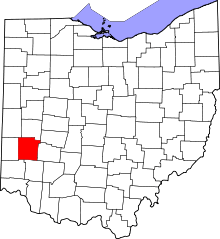 | |
| Villages | ||
| Townships | ||
| CDPs | ||
| Unincorporated communities | ||
| Ghost towns | ||
| Footnotes | ‡This populated place also has portions in an adjacent county or counties | |