Tipp City, Ohio
| Tipp City, Ohio | |
|---|---|
| City | |
|
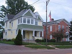
Houses on Main Street | |
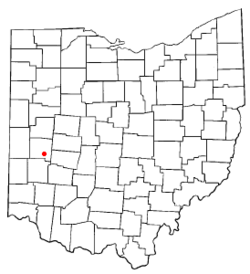 Location of Tipp City, Ohio | |
 Location of Tipp City in Miami County | |
| Coordinates: 39°57′50″N 84°11′1″W / 39.96389°N 84.18361°WCoordinates: 39°57′50″N 84°11′1″W / 39.96389°N 84.18361°W | |
| Country | United States |
| State | Ohio |
| County | Miami |
| Government | |
| • Mayor | Pat Hale |
| Elevation[1] | 827 ft (252 m) |
| Population (2010)[2] | |
| • Total | 9,689 |
| • Estimate (2012[3]) | 9,775 |
| • Density | 1,286.7/sq mi (496.8/km2) |
| Time zone | Eastern (EST) (UTC-5) |
| • Summer (DST) | EDT (UTC-4) |
| ZIP code | 45371 |
| Area code(s) | 937 Exchanges: 667, 669 |
| FIPS code | 39-76876[4] |
| GNIS feature ID | 1061692[1] |
| Website | http://www.tippcityohio.gov/ |
Tipp City is a city in Miami County, Ohio, United States just outside Dayton. The population was 9,689 at the 2010 census. Formerly known as Tippecanoe, and then Tippecanoe City, this town was renamed to Tipp City in 1938 because another town in Ohio was likewise named Tippecanoe. The city lies in the Miami Valley and sits along Interstate 75 near the Interstate 70 interchange.
Tipp City is part of the Dayton Metropolitan Statistical Area.
Geography
Tipp City is located on the Miami River, approximately 10 miles north of Dayton and has direct highway access to Interstate 75. 39°57′50″N 84°11′1″W / 39.96389°N 84.18361°W (39.963876, -84.183704).[5]
According to the United States Census Bureau, the city has a total area of 7.64 square miles (19.79 km2), of which 7.53 square miles (19.50 km2) is land and 0.11 square miles (0.28 km2) is water.[6]
Demographics
| Historical population | |||
|---|---|---|---|
| Census | Pop. | %± | |
| 1860 | 949 | — | |
| 1870 | 1,204 | 26.9% | |
| 1880 | 1,401 | 16.4% | |
| 1890 | 1,465 | 4.6% | |
| 1900 | 1,703 | 16.2% | |
| 1910 | 2,038 | 19.7% | |
| 1920 | 2,426 | 19.0% | |
| 1930 | 2,559 | 5.5% | |
| 1940 | 2,879 | 12.5% | |
| 1950 | 3,304 | 14.8% | |
| 1960 | 4,267 | 29.1% | |
| 1970 | 5,090 | 19.3% | |
| 1980 | 5,595 | 9.9% | |
| 1990 | 6,027 | 7.7% | |
| 2000 | 9,221 | 53.0% | |
| 2010 | 9,689 | 5.1% | |
| Est. 2015 | 9,899 | [7] | 2.2% |
| Sources:[4][8][9][10][11][12][13][14] | |||
2010 census
As of the census[2] of 2010, there were 9,689 people, 3,861 households, and 2,685 families residing in the city. The population density was 1,286.7 inhabitants per square mile (496.8/km2). There were 4,194 housing units at an average density of 557.0 per square mile (215.1/km2). The racial makeup of the city was 95.9% White, 0.6% African American, 0.2% Native American, 1.5% Asian, 0.7% from other races, and 1.2% from two or more races. Hispanic or Latino of any race were 1.6% of the population.
There were 3,861 households of which 35.5% had children under the age of 18 living with them, 54.3% were married couples living together, 11.0% had a female householder with no husband present, 4.2% had a male householder with no wife present, and 30.5% were non-families. 27.0% of all households were made up of individuals and 11.7% had someone living alone who was 65 years of age or older. The average household size was 2.48 and the average family size was 3.01.
The median age in the city was 40.3 years. 25.9% of residents were under the age of 18; 7% were between the ages of 18 and 24; 24.2% were from 25 to 44; 27.9% were from 45 to 64; and 15% were 65 years of age or older. The gender makeup of the city was 48.2% male and 51.8% female.
2000 census
As of the census[4] of 2000, there were 9,221 people, 3,632 households, and 2,542 families residing in the city. The population density was 1,492.6 people per square mile (576.1/km²). There were 3,799 housing units at an average density of 615.0 per square mile (237.3/km²). The racial makeup of the city was 97.54% White, 0.25% African American, 0.23% Native American, 0.90% Asian, 0.39% from other races, and 0.69% from two or more races. Hispanic or Latino of any race were 1.20% of the population.
There were 3,632 households out of which 36.9% had children under the age of 18 living with them, 56.6% were married couples living together, 9.6% had a female householder with no husband present, and 30.0% were non-families. 25.1% of all households were made up of individuals and 10.7% had someone living alone who was 65 years of age or older. The average household size was 2.51 and the average family size was 3.02.
In the city the population was spread out with 28.2% under the age of 18, 7.7% from 18 to 24, 30.1% from 25 to 44, 21.1% from 45 to 64, and 13.0% who were 65 years of age or older. The median age was 36 years. For every 100 females there were 93.9 males. For every 100 females age 18 and over, there were 89.9 males.
The median income for a household in the city was $48,675, and the median income for a family was $62,991. Males had a median income of $44,917 versus $27,973 for females. The per capita income for the city was $24,118. About 3.8% of families and 5.2% of the population were below the poverty line, including 6.5% of those under age 18 and 2.4% of those age 65 or over.
History
Tippecanoe City was founded in 1840 along the developing Miami and Erie Canal. Its name derives from Presidential candidate William Henry Harrison's nickname, Tippecanoe, which, in turn, was derived from his heroism at the Battle of Tippecanoe, November 7, 1811.
The early city was a popular stopping-off point for boatmen traveling along the Miami and Erie Canal. The original downtown purportedly included a large number of bars and a red light district. The now dry canal locks can be seen just east of downtown. As Tippecanoe City grew, it merged with Hyattsville, a contiguous village, located on present-day Hyatt Street.
Development of the railroads in the 1850s and 1860s put the canals out of business and slowed the city's initially rapid growth. Ruins of a repair shop (yard barn) for the old Inter-Urban rail system can still be seen on the outskirts of town.
The development of U.S. Route 25 (County Road 25-A) and subsequently Interstate 75 brought construction and vibrance back to the town throughout the 20th century.
History of city name
The dramatic modern growth of the town has occurred under a new name: Tipp City. The US Postal Service abbreviated the town's name in the 1930s to resolve a conflict with Tippecanoe, Ohio. Some local controversy exists as to whether the name can or should revert to the former Tippecanoe City.
Proponents of the change argue that ZIP codes obviate the conflict. Tipp City and Tippecanoe are 200 miles apart. Tippecanoe is too small for many Ohio maps and is not even one of the 10 incorporated municipalities of Harrison County. The sparsely populated Harrison County is the 5th smallest of Ohio's 88 counties. Downtown Tipp City businesses that wish to play up the Tippecanoe City 19th century heritage have argued that modern geography and postal methods would alleviate any confusion in reverting to the old name.
On the other hand, residents are used to the name Tipp City. Addresses and signage would have to be changed if renaming were sought. While the city's name was changed long ago, the high school never changed its name; Tippecanoe High School, is a constant reminder to people in the area of what "Tipp" refers to. Currently, the issue does not seem to matter enough to most residents to prompt political action.
Economics
Tipp City functions as a bedroom community north of Dayton, and includes light manufacturing, small business and family-owned restaurants, serving the local community and travelers along I-75.
Government
Tipp City uses the council-manager government system. In this system, the mayor is the ceremonial head, selected by the council from among its members. The Council President is likewise selected and presides over each council meeting. The council chooses a City Manager, who holds administrative authority over the city government. Council members are selected on a nonpartisan, at-large ballot.
Education
Tipp City Exempted Village Schools serve the city proper and surrounding Monroe Township. The buildings are located on three campuses and serve Kindergarten through 12th grade. The MVCTC provides vocational training to secondary students.
- Broadway Elementary School, Grades K–3 (South)
- Nevin Coppock Elementary School, Grades K–3 (North)
- L.T. Ball Intermediate School, Grades 4–5
- Tippecanoe Middle School, Grades 6–8
- Tippecanoe High School, Grades 9–12
- Bethel Local School, Grades K–12
Parks and recreation
Staffed by four full-time employees, the Parks Division is responsible for the maintenance of City Park and Kyle Park as well as eight neighborhood parks and the Nature Center. Park facilities include tennis courts, basketball courts, swimming pool, athletic fields, picnic shelters, playground equipment, nature trails, driving range, batting cages, community canoe livery and boat ramp on the Great Miami River. City Park also is home to a historic structure called the "Roundhouse," a favorite spot for family picnics and reunions. Tipp-Monroe Community Services hosts a summer playground at the Roundhouse for eight weeks, while organizations such as the Mum Festival Committee utilize the facility for their annual events.
Tipp City Bike Trail
Currently under construction, the Miami County Bike Trail will be Tipp City's addition to the Buckeye Trail. The Miami County Bike Trail will be a north-south paved trail that will stretch the length of Miami County, allowing bikers, hikers and hitchhikers to follow the path of the Great Miami River and Miami and Erie Canal. Starting at the Shelby county line, it will run through the south end of Piqua, Troy and Tipp City before meeting up with the Miami ? County Municipal Jail just south of Tipp City. The Tipp City portion of the trail will consist of three sections:
- The first stage, which was completed in July 2005, runs from Main Street at the Canal Lock Park, north past the new Aquatic Center, west of the baseball fields, then meanders along the river before ending at the Nature Center on North Third Street.
- A second segment will run north from the Nature Center to the southern end of the Troy Trail, which currently ends about 1/2 mile north of Tipp-Cowlesville Road. This portion of the trail is funded and construction is set to begin in 2007. Monroe Township is the sponsor for this trail section, and the lead agency is Five Rivers Metroparks. The part of uncompleted trail wrapped up construction in the Autumn of 2008 with the Trail partnership with Miami County Park District. The 1/2 mile connector to the Troy Trail was dedicated on October 30, 2008 by local subpolitical jurisdictions attending the ceremonial ribbon-cutting. Media: KIT-channel 5, Tipp City Independent Voice
- A third segment, due to begin construction in 2007-2008, will run south from Main Street, connect with the existing bike trail in Kyle Park, and run south along the eastern side of Canal Road before connecting with the Montgomery County trail at Ross Road. There is currently a parking lot here that allows access and convenient parking to the Montgomery Trail, which runs through Huber Heights, under I-70, and south to Needmore Road. Eventually, the Montgomery Trail will lead to the Triangle Park area in northern Dayton. When these sections are completed, bikers will be able to travel all the way from Tipp City to downtown Dayton via bike path.
For more information on the trail construction, visit Miami Valley Trails. For general information, visit the Miami Conservancy District. In addition, there was an article published by the Dayton Daily News on July 6, 2006 about the trails.
Culture
The cultural focus of Tipp City is largely based on high school and community-gathering events. In the fourth week of September each year, the city, in partnership with local garden center Spring Hill Nurseries, puts on the Mum Festival, the largest community event of the year, attracting visitors from neighboring towns and cities to the parade and festival grounds. Other community events include Canal Days (the third weekend in May), Independence Day fireworks, Tippecanoe High School "Red Devil" football games. The Miami County Visitors Bureau as well as the Tipp City Visitor's Bureau maintains a list of upcoming special events.[15][16]
In popular culture
"Tipp City" is the name of a song by The Amps, a band fronted by Kim Deal, who hails from nearby Huber Heights municipality.
Media
Newspapers
- Weekly Record Herald (2010) – Available through subscription as well as an insert in the Sunday edition of the Troy Daily News.
- {http://www.tippgazette.com/ Tippecanoe Gazette (2010) – Available through subscription as well as several retail outlets in Tipp City such as Foodtown, Speedway, CVS Pharmacy and Sam & Ethel's Restaurant in Tipp City's historic downtown district.
Online news resource
- TippNews DAILY is a daily, free online news resource for residents of Tipp City. It is an internet-only publication that features citizen journalism.[17]
Internet radio
- Get Social Radio broadcasts over the Public Internet 24/7 carrying local weather, news, sports, syndicated talk shows and music.[18]
Public-access television
- KIT-TV Cable Channel 5 on Time Warner Cable
Media no longer in publication
- The Tipp City Independent Voice ceased publication with the final issue on July 22, 2009.
- The Tipp City Herald ceased publication in late 2008.
Presidential visit
In response to a letter by local businessman Steve Bruns, United States President George W. Bush visited Tipp City for a speech on the Global War on Terrorism at Tippecanoe High School on April 19, 2007. The visit was the first to Tipp City by a sitting president, and in honor of this visit, a local street was renamed George W. Bush Parkway.
References
- 1 2 "US Board on Geographic Names". United States Geological Survey. 2007-10-25. Retrieved 2008-01-31.
- 1 2 "American FactFinder". United States Census Bureau. Retrieved 2013-01-06.
- ↑ "Population Estimates". United States Census Bureau. Retrieved 2013-06-17.
- 1 2 3 "American FactFinder". United States Census Bureau. Retrieved 2008-01-31.
- ↑ "US Gazetteer files: 2010, 2000, and 1990". United States Census Bureau. 2011-02-12. Retrieved 2011-04-23.
- ↑ "US Gazetteer files 2010". United States Census Bureau. Retrieved 2013-01-06.
- ↑ "Annual Estimates of the Resident Population for Incorporated Places: April 1, 2010 to July 1, 2015". Retrieved July 2, 2016.
- ↑ "Population of Civil Divisions Less than Counties" (PDF). Statistics of the Population of the United States at the Tenth Census. U.S. Census Bureau. Retrieved 28 November 2013.
- ↑ "Population of Civil Divisions Less than Counties" (PDF). Statistics of the Population of the United States at the Tenth Census. U.S. Census Bureau. Retrieved 28 November 2013.
- ↑ "Population: Ohio" (PDF). 1910 U.S. Census. U.S. Census Bureau. Retrieved 28 November 2013.
- ↑ "Population: Ohio" (PDF). 1930 US Census. U.S. Census Bureau. Retrieved 28 November 2013.
- ↑ "Number of Inhabitants: Ohio" (PDF). 18th Census of the United States. U.S. Census Bureau. Retrieved 22 November 2013.
- ↑ "Ohio: Population and Housing Unit Counts" (PDF). U.S. Census Bureau. Retrieved 22 November 2013.
- ↑ "Incorporated Places and Minor Civil Divisions Datasets: Subcounty Population Estimates: April 1, 2010 to July 1, 2012". U.S. Census Bureau. Retrieved 25 November 2013.
- ↑ Miami County Visitors Bureau
- ↑ Tipp City Visitor's Bureau
- ↑ TippNews DAILY
- ↑ Get Social Radio online
External links
- City website
- Tipp City Chamber of Commerce
- Tipp City Public Library
- Tipp City Schools
- Tipp City Visitor's Bureau
- Tipp Small Business Directory
Municipalities and communities of Miami County, Ohio, United States | ||
|---|---|---|
| Cities | 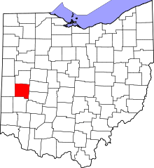 | |
| Villages | ||
| Townships | ||
| Unincorporated communities | ||
| Footnotes | ‡This populated place also has portions in an adjacent county or counties | |