Xenia, Ohio
| Xenia, Ohio | |
|---|---|
| City | |
|
L TO R: Greene County Courthouse, Collier Chapel, Shawnee Park, Xenia City Hall, B&O Railroad Caboose | |
| Nickname(s): "City of Hospitality", "Bicycle Capital of the Midwest", "X-Town" | |
| Motto: "Vivid History, Vibrant Future" | |
 Location of Xenia, Ohio | |
 Location of Xenia in Greene County | |
| Coordinates: 39°41′1″N 83°56′17″W / 39.68361°N 83.93806°WCoordinates: 39°41′1″N 83°56′17″W / 39.68361°N 83.93806°W | |
| Country | United States |
| State | Ohio |
| County | Greene |
| Founded | 1803 |
| Government | |
| • Mayor | Marsha J. Bayless |
| • City Manager | Brent Merriman |
| Area[1] | |
| • Total | 13.29 sq mi (34.42 km2) |
| • Land | 13.28 sq mi (34.40 km2) |
| • Water | 0.01 sq mi (0.03 km2) |
| Elevation[2] | 932 ft (284 m) |
| Population (2010)[3] | |
| • Total | 25,719 |
| • Estimate (2012[4]) | 25,944 |
| • Density | 1,936.7/sq mi (747.8/km2) |
| • Demonym | Xenian |
| Time zone | Eastern (EST) (UTC-5) |
| • Summer (DST) | EDT (UTC-4) |
| ZIP code | 45385 |
| Area code(s) | 937 |
| FIPS code | 39-86772[5] |
| GNIS feature ID | 1061805[2] |
| Website | http://www.ci.xenia.oh.us/ |

| Wikimedia Commons has media related to Xenia, Ohio. |
.jpg)
Xenia /ˈziːnjə/ ZEEN-yə is a city in and the county seat of Greene County, Ohio, United States.[6] The municipality is located in southwestern Ohio 21 miles (34 km) from Dayton and is part of the Dayton Metropolitan Statistical Area, as well as the Miami Valley region. The name comes from the Greek word Xenia (ξενία), which means "hospitality".
As of the 2010 census, the city had a population of 25,719.[7] Xenia is the third largest city by population in Greene County, behind Fairborn and Beavercreek. It serves as the county seat of Greene County, being at the geographical center, and housing the County Courthouse, the County Sheriff's Department, Jail, and other Government departments. By population, it is the largest place in the United States whose name begins with the letter X.
History
Xenia was founded in 1803, the year Ohio was admitted into the Union. In that year, pioneer John Paul bought 2,000 acres (8.1 km2) of land from Thomas and Elizabeth Richardson of Hanover County, Virginia, for "1050 pounds current moneys of Virginia." Paul influenced county commissioners to locate the county seat on this land at the forks of the Shawnee Creeks.
Joseph C. Vance was named to survey the site and lay out the town. The following year, he bought the town site of 257 acres (1.04 km2) from John Paul for $250. The name of the new village was chosen in typically democratic fashion. Vance called a town meeting to discuss possible names. The committee had considered several suggestions without reaching any decision. Then the Rev. Robert Armstrong proposed the name "Xenia," meaning "hospitality" in Greek, because of the fine hospitality extended to him in this friendly community. When a tie vote occurred, Laticia Davis, wife of Owen Davis, was invited to cast the deciding ballot. She voted for "Xenia."
The first session of the Ohio General Assembly created Greene County from the Northwest Territory, embracing the homeland of the Shawnee Indians. Their chief tribal village was north of Xenia at Old Chillicothe, now called Old Town. The Shawnee war chief Tecumseh was born there in 1768.
William Beattie was Xenia's first businessman. In 1804, he opened a tavern which became a center of community affairs. In 1804, John Marshall built Xenia's first home. The first log school house was constructed in 1805, and, that same year, the Rev. James Towler became the town's first postmaster. The growing community soon attracted many pioneer industries - flour mills, sawmills, woolen mills, pork packing plants, oil mills, and tow mills.
Xenia was incorporated by an act of the legislature in 1817 and became a city in 1834. However, it was the arrival of the Little Miami Railroad (now the site of the Little Miami Scenic Trail, which passes through Xenia Station) in 1843 which gave the city its first industrial impetus. On March 2, 1850 the Ohio General Assembly rode from Columbus, Ohio to Xenia and back on the newly completed Columbus and Xenia Railroad.
President-Elect Abraham Lincoln made a brief appearance in the city as his inaugural train traveled from Cincinnati to Columbus on Wednesday morning, February 13, 1861. He gave a short speech which was not recorded by a traveling writer from the New York Times as it echoed the same sentiments that he had expressed before in his previous stops. According to the Times writer, "a very large crowd assembled, and amid the firing of a cannon and enthusiasm, Mr. Lincoln addressed them from the rear car, reiterating what he had said before.".[8]
The town progressed rapidly during the mid-19th century. Artificial gas was provided in the 1840s and continued in use until natural gas was made available in 1905. The first fire engine house was built in 1831; the telephone came to Xenia in 1879; electricity in 1881 and a water works system in 1886. Xenia opened its first free public library in 1899. By 1900 the city was operating its own sewage system.
Xenia elected Cornelius Clark as its first mayor in 1834. On January 1, 1918, the current commission-manager plan succeeded the old form of municipal government.
Tornadoes
Xenia has a history of severe storm activity. According to local legend, the Shawnee Indians referred to the area as "the place of the devil wind" or "the land of the crazy winds" (depending upon the translation).[9] Records of storms go back to the early 19th century. Local records show 20 tornadoes in Greene County since 1884.

On April 3, 1974 a tornado[10] rated F5 on the Fujita scale cut a path directly through the middle of Xenia during the 1974 Super Outbreak, the second largest series of tornadoes in recorded history. The disaster killed 34 people (including two Ohio National Guardsmen who died days later in a related fire), injured an additional 1,150, destroyed almost half of the city's buildings, and left 10,000 people homeless. Five schools, including Xenia High School, Central Junior High School, McKinley Elementary, Simon Kenton Elementary, and Saint Brigid Catholic School were destroyed, as were nine churches and 180 businesses.
The city's plight was featured in the national news, including a 1974 NBC television documentary, Tornado!, hosted by Floyd Kalber. President Richard Nixon visited stricken areas of Xenia following the devastation. Comedian Bob Hope organized a benefit for Xenia and, in appreciation, the new Xenia High School Auditorium was named the "Bob Hope Auditorium." In recognition of their coverage of this tornado, the staff of the Xenia Daily Gazette won the Pulitzer Prize for Spot News Reporting in 1975.[11]
Xenia was struck by an F2 tornado on April 25, 1989 and again by an F4 tornado on September 20, 2000. The 1989 tornado caused over $2 million in damage, but no one was killed. The twister of 2000 killed one person, and injured 100 people. This tornado followed a path roughly parallel to the 1974 tornado.[12][13]
Xenia currently has a system of tornado sirens. After the 1974 tornado outbreak, the city purchased a system of Federal Signal Thunderbolt Sirens for warning. During the 2000 tornado strike, the lack of backup power silenced the sirens, so the city purchased Federal Signal 2001-SRN series sirens with battery backup. Most of Xenia's old sirens are still standing, but not operational.

Railroads
Xenia originally hosted several lines owned by the Baltimore & Ohio (B&O) and Pennsylvania (PRR) railroads. All lines have since been abandoned, the last being dismantled by 1989.
The lines that previously served Xenia were:
- B&O Wellston subdivision, between Washington Court House and Dayton.
- PRR Little Miami branch, between Cincinnati and Springfield; portion of the line ran down Detroit Street and was the first section to be dismantled.
- PRR Pittsburgh-St. Louis mainline; Amtrak operated the National Limited over this line until 1979.
The roadbeds of five of Xenia's six rail lines were converted for rail trail use. The one exception — the B&O line west of town — was not converted because it closely paralleled the PRR mainline for most if its length. The large number of rail trails resulted in Xenia being referred to as the Bicycle Capital of the Midwest.[14]
Xenia was also served by two interurban railways until the 1940s:
- Dayton & Xenia Transit Company
- Springfield & Xenia Railway
Geography
Xenia is centrally located in the "transportation triangle" formed by three major interstate highways: I-70, I-71, and I-75. These north-south, east-west arteries are within minutes of Xenia via U.S. Routes 35, 42, and 68, tying the community to one of the nation's largest 90-minute highway markets. Before the creation of the U.S. Interstate Highway system, U.S. 68 was one of the main southward routes from Detroit, Michigan. Within Xenia, U.S. 68 is named "Detroit Street".
Xenia is at 39°41′1″N 83°56′17″W / 39.68361°N 83.93806°W (39.68, -83.94).[15]
According to the United States Census Bureau, the city has a total area of 13.29 square miles (34.42 km2), of which, 13.28 square miles (34.40 km2) is land and 0.01 square miles (0.03 km2) is water.[1]
Climate
| Climate data for Xenia, Ohio | |||||||||||||
|---|---|---|---|---|---|---|---|---|---|---|---|---|---|
| Month | Jan | Feb | Mar | Apr | May | Jun | Jul | Aug | Sep | Oct | Nov | Dec | Year |
| Record high °F (°C) | 73 (23) |
74 (23) |
83 (28) |
89 (32) |
95 (35) |
102 (39) |
108 (42) |
107 (42) |
103 (39) |
92 (33) |
80 (27) |
74 (23) |
108 (42) |
| Average high °F (°C) | 36 (2) |
41 (5) |
51 (11) |
63 (17) |
72 (22) |
80 (27) |
84 (29) |
82 (28) |
76 (24) |
65 (18) |
52 (11) |
41 (5) |
61.9 (16.6) |
| Average low °F (°C) | 19 (−7) |
23 (−5) |
32 (0) |
41 (5) |
51 (11) |
59 (15) |
63 (17) |
60 (16) |
53 (12) |
42 (6) |
34 (1) |
25 (−4) |
41.8 (5.6) |
| Record low °F (°C) | −28 (−33) |
−20 (−29) |
−5 (−21) |
14 (−10) |
25 (−4) |
37 (3) |
42 (6) |
38 (3) |
25 (−4) |
16 (−9) |
−8 (−22) |
−24 (−31) |
−28 (−33) |
| Average precipitation inches (mm) | 2.64 (67.1) |
2.28 (57.9) |
3.15 (80) |
3.90 (99.1) |
4.57 (116.1) |
4.02 (102.1) |
4.13 (104.9) |
3.62 (91.9) |
2.72 (69.1) |
2.83 (71.9) |
3.27 (83.1) |
2.99 (75.9) |
39.58 (1,005.3) |
| Source: NOAA,[16] The Weather Channel (extremes),[17] HKO (sun only)[18] | |||||||||||||
Local government
The Xenia City Council exercises the powers and authority of a municipal corporation as determined by the constitution of the State of Ohio and the Charter and ordinances of the City of Xenia. The City Council of Xenia, Ohio, is composed of seven elected council members, including one mayor. Council members are each elected for one four-year term of office.

City Council Members and term start years:
- Mayor Marsha J. Bayless (2014) – Mayor of Xenia – 2nd term
- Councilman Michael D. Engle (2016) – City Council President – 5th term
- Councilman Joshua Long (2016) – City Council Vice President – 2nd term
- Councilman Dale Louderback (2016) – 3rd term
- Councilman Wesley Smith (2014) – 1st term
- Councilwoman Sarah Mays (2016) – 1st term
- Councilman Edgar Wallace (2016) – 1st term
Others:
- Brent Merriman — City Manager
- Ryan Duke — Assistant City Manager
- Mark Bazelak — Finance Director
- Jason Lake — Assistant Finance Director
- Ronald Lewis — Law Director
Demographics
| Historical population | |||
|---|---|---|---|
| Census | Pop. | %± | |
| 1810 | 429 | — | |
| 1820 | 799 | 86.2% | |
| 1830 | 917 | 14.8% | |
| 1840 | 1,913 | 108.6% | |
| 1850 | 3,024 | 58.1% | |
| 1860 | 4,658 | 54.0% | |
| 1870 | 6,377 | 36.9% | |
| 1880 | 7,026 | 10.2% | |
| 1890 | 7,301 | 3.9% | |
| 1900 | 8,696 | 19.1% | |
| 1910 | 8,706 | 0.1% | |
| 1920 | 9,110 | 4.6% | |
| 1930 | 10,507 | 15.3% | |
| 1940 | 10,633 | 1.2% | |
| 1950 | 12,877 | 21.1% | |
| 1960 | 20,445 | 58.8% | |
| 1970 | 25,373 | 24.1% | |
| 1980 | 24,712 | −2.6% | |
| 1990 | 24,664 | −0.2% | |
| 2000 | 24,164 | −2.0% | |
| 2010 | 25,719 | 6.4% | |
| Est. 2015 | 25,976 | [19] | 1.0% |
| Sources:[5][20][21][22] | |||
2010 census
As of the census[3] of 2010, there were 25,719 people, 10,390 households, and 6,631 families residing in the city. The population density was 1,936.7 inhabitants per square mile (747.8/km2). There were 11,424 housing units at an average density of 860.2 per square mile (332.1/km2). The racial makeup of the city was 82.0% White, 13.4% African American, 0.4% Native American, 0.5% Asian, 0.5% from other races, and 3.2% from two or more races. Hispanic or Latino of any race were 1.7% of the population.
There were 10,390 households of which 32.3% had children under the age of 18 living with them, 42.6% were married couples living together, 16.3% had a female householder with no husband present, 4.9% had a male householder with no wife present, and 36.2% were non-families. 31.0% of all households were made up of individuals and 12.9% had someone living alone who was 65 years of age or older. The average household size was 2.39 and the average family size was 2.98.
The median age in the city was 37.1 years. 24.8% of residents were under the age of 18; 9.1% were between the ages of 18 and 24; 25.6% were from 25 to 44; 24.9% were from 45 to 64; and 15.7% were 65 years of age or older. The gender makeup of the city was 47.2% male and 52.8% female.
2000 census
As of the census[5] of 2000, there were 24,164 people, 9,378 households, and 6,527 families residing in the city. The population density was 1,989.3 people per square mile (767.9/km²). There were 9,924 housing units at an average density of 817.0 per square mile (315.4/km²). The racial makeup of the city was 83.30% White, 13.51% African American, 0.34% Native American, 0.29% Asian, 0.05% Pacific Islander, 0.53% from other races, and 1.98% from two or more races. Hispanic or Latino of any race were 1.09% of the population.
There were 9,378 households out of which 34.2% had children under the age of 18 living with them, 50.2% were married couples living together, 15.5% had a female householder with no husband present, and 30.4% were non-families. 26.2% of all households were made up of individuals and 11.1% had someone living alone who was 65 years of age or older. The average household size was 2.51 and the average family size was 3.02.
In the city the population was spread out with 27.1% under the age of 18, 9.6% from 18 to 24, 28.5% from 25 to 44, 21.3% from 45 to 64, and 13.5% who were 65 years of age or older. The median age was 34 years. For every 100 females there were 90.5 males. For every 100 females age 18 and over, there were 84.4 males.
The median income for a household in the city was $36,457, and the median income for a family was $43,046. Males had a median income of $34,497 versus $24,094 for females. The per capita income for the city was $16,481. About 8.9% of families and 11.6% of the population were below the poverty line, including 14.8% of those under age 18 and 9.4% of those age 65 or over.
Education
The Xenia Community School District has 5 elementary, 2 middle, and 1 high school:
- Cox Elementary School (Grade K-5)
- McKinley Elementary School (Grade K-5)
- Arrowood Elementary (Grade K-5)
- Shawnee Elementary (Grade K-5)
- Tecumseh Elementary (Grade K-5)
- Central Middle School (Grade 6)
- Warner Middle School (Grade 7-8)
- Xenia High School (Grade 9-12)
Private schools in Xenia:
- Legacy Christian Academy (Grade Pre-K-12)
- St. Brigid School (Grade Pre-K-8)
Media
Newspapers
Newspapers covering the City of Xenia include:
- Dayton Daily News
- Fairborn Daily Herald
- Springfield News-Sun
- Xenia Daily Gazette
Online news and information
Online News & Information Sites Covering Xenia include:
Radio
Popular radio stations that can be heard in and around Xenia include:
- AM
- 610 AM (WTVN) Columbus ("NewsRadio 610 WTVN")
- 700 AM (WLW) Cincinnati ("NewsRadio 700 WLW"—News/Talk)
- 980 AM (WONE) Dayton (Fox Sports Radio)
- 1290 AM (WHIO) Pleasant Hill ("NewsTalk 1290 WHIO")
- 1410 AM (WING) Dayton (ESPN Radio)
- 1500 AM (WBZI) Xenia (Classic Country)
- FM
- 90.3 FM WKCD Cedarville ("K-LOVE") -- Contemporary Christian
- 91.3 FM WYSO Yellow Springs (NPR)
- 92.9 FM WGTZ Eaton ("Fly 92.9") -- Adult Hits
- 93.7 FM WFCJ Miamisburg ("Inspiration 93.7") -- Christian
- 94.5 FM WYDB Dayton ("Lite 94.5") -- Lite Rock
- 94.9 FM WREW Fairfield ("Rewind 94.9") -- Adult Hits
- 95.3 FM WZLR Xenia ("The Eagle") -- Classic Hits
- 95.7 FM WHIO-FM Pleasant Hill ("WHIO News Talk Radio")
- 99.1 FM WHKO Dayton ("K99.1 FM") -- Country
- 99.9 FM WCHD Kettering ("Channel 9-9-9") -- Top 40
- 100.3 FM WBZI Xenia ("Classic Country Radio") -- Classic ;Contemporary
- 101.5 FM WCLI Enon (101.5 FM "Click 101.5") -- Modern Adult
- 102.9 FM WDHT Urbana ("Hot 102.9") -- Hip Hop/R&B
- 103.5 FM WGRR Hamilton ("WGRR") -- Greatest Hits
- 104.7 FM WTUE Dayton ("WTUE") -- Classic Rock
- 106.5 FM WOLT Greenville ("Big 106.5") -- ;Country
- 107.7 FM WMMX Dayton ("Mix 107.7") -- Hot Adult Contemporary
Television
Television news stations covering the City of Xenia in news and weather broadcasts include:
- WDTN, Channel 2 (NBC Affiliate)
- WHIO-TV, Channel 7 (CBS Affiliate)
- WKEF, Channel 22 (ABC Affiliate)
- WBDT, Channel 26 (CW Affiliate)
- WRGT-TV, Channel 45 (Fox Affiliate)
Popular culture
Film
- The town is featured in the nonprofit historical documentary film Ropewalk: A Cordage Engineer's Journey Through History
- The town was the setting of the independent film Who's Your Daddy?, directed by Andy Fickman
- Xenia is the setting for Harmony Korine's film Gummo (1997); the movie was not filmed in Xenia, however, but in Korine's hometown of Nashville, Tennessee.
Literature
- Tom Clancy mentions the town in his Jack Ryan novel The Bear And The Dragon (2000)
- Stephen King mentions the town in his novel The Stand (1978, rereleased in 1990), in which it is the hometown of character Dayna Jurgens, and another novel, The Talisman (1984).
- Novelist Helen Hooven Santmyer lived here; her best-known work, "...And Ladies of the Club", is set in a fictional version of Xenia
Music
- Maynard James Keenan mentions Xenia at least twice with his band Puscifer, first in "Sour Grapes (Where is the Line Mix)", and again in a fictional documentary played before shows on their 2011 tour. The Puscifer Characters Billy Dee Burger and Hildy Burger are credited as being from Xenia.
- They Might Be Giants mention Xenia in the song "Out of Jail" on their album John Henry (1994).
Trivia
- Xenia is the only city in the United States starting with the letter "X", with a population over 5,000.
- Xenia calls itself the "Bicycle Capital of the Midwest".
Television
- Brooke Soso, a character on Orange Is the New Black, mentions WWOOFing in the town during the second-season episode, "Hugs Can Be Deceiving"
Notable people
- Doug Adair — television news anchor and journalist
- Doug Adams — NFL player
- Steve Austria — U.S. Congressman
- Elizabeth Gowdy Baker — painter
- Matt Brown — mixed martial artist
- Dave Chappelle — comedian, owns several houses in Xenia
- John Barry Clemens — NBA player for 11 seasons
- Trent Cole — NFL defensive end for the Indianapolis Colts
- Lloyd Gearhart — MLB player and scout
- Charley Grapewin — actor
- Caitlin Halligan — lawyer and nominee for federal judge
- Roger Huston — harness race caller
- Coates Kinney — lawyer, journalist, and poet
- John Little — U.S. Congressman
- Roger McMurrin — conductor
- Rose Murphy — jazz singer
- Helen Hooven Santmyer — novelist lived here
- Obiwu — poet and author
- Arthur M. Schlesinger, Sr. — historian
- Thomas Taggart — Mayor of Indianapolis and U.S. Senator from Indiana
- Ridgely Torrence — poet
See also
References
- 1 2 "US Gazetteer files 2010". United States Census Bureau. Archived from the original on January 24, 2012. Retrieved 2013-01-06.
- 1 2 "US Board on Geographic Names". United States Geological Survey. 2007-10-25. Retrieved 2008-01-31.
- 1 2 "American FactFinder". United States Census Bureau. Retrieved 2013-01-06.
- ↑ "Population Estimates". United States Census Bureau. Archived from the original on June 17, 2013. Retrieved 2013-06-17.
- 1 2 3 "American FactFinder". United States Census Bureau. Archived from the original on September 11, 2013. Retrieved 2008-01-31.
- ↑ "Find a County". National Association of Counties. Archived from the original on May 31, 2011. Retrieved 2011-06-07.
- ↑ "Archived copy" (PDF). Archived from the original (PDF) on April 1, 2012. Retrieved September 13, 2011.
- ↑ "The Incoming Administration; Progress Of President-Elect Towards Washington". New York Times. February 14, 1861. p. 1.
- ↑ Smith, Joanne Huist; "Devil Winds: City's Curse or Tall Tale?" Dayton Daily News, Sept. 16, 2001, page 1B.
- ↑ Ramby, Homer G. "Xenia, Ohio- Tornado- April 3, 1974".
- ↑ "1975 Winners". Pulitzer.org. Retrieved June 12, 2012.
- ↑ "Tornadoes in Greene County, Ohio". Tornado History Project. Retrieved 7 February 2014.
- ↑ "Tornadoes in Greene County, Ohio in April 1989". Tornado History Project. Retrieved 7 February 2014.
- ↑ citytowninfo.com/Xenia
- ↑ "US Gazetteer files: 2010, 2000, and 1990". United States Census Bureau. 2011-02-12. Retrieved 2011-04-23.
- ↑ "NCDC: U.S. Climate Normals" (PDF). National Oceanic and Atmospheric Administration. Retrieved 2010-03-29.
- ↑ "Monthly Averages for Dayton, OH – Temperature and Precipitation". The Weather Channel. Retrieved 2010-07-04.
- ↑ "Climatological Normals of Dayton". Hong Kong Observatory. Retrieved 2010-07-04.
- ↑ "Annual Estimates of the Resident Population for Incorporated Places: April 1, 2010 to July 1, 2015". Retrieved July 2, 2016.
- ↑ "Number of Inhabitants: Ohio" (PDF). 18th Census of the United States. U.S. Census Bureau. Retrieved 22 November 2013.
- ↑ "Ohio: Population and Housing Unit Counts" (PDF). U.S. Census Bureau. Retrieved 22 November 2013.
- ↑ "Incorporated Places and Minor Civil Divisions Datasets: Subcounty Population Estimates: April 1, 2010 to July 1, 2012". U.S. Census Bureau. Archived from the original on June 17, 2013. Retrieved 25 November 2013.
External links
| Wikivoyage has a travel guide for Xenia. |
 |
Fairborn | Yellow Springs | Cedarville | |
| Beavercreek Township | |
Jamestown | ||
| ||||
| | ||||
| Bellbrook | Spring Valley | Bowersville |
Municipalities and communities of Greene County, Ohio, United States | ||
|---|---|---|
| Cities | 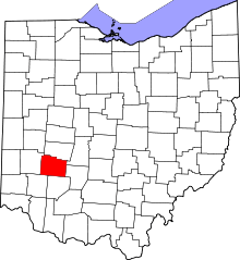 | |
| Villages | ||
| Townships | ||
| CDPs | ||
| Unincorporated communities | ||
| Footnotes | ‡This populated place also has portions in an adjacent county or counties | |