Holland Township, New Jersey
- For the unincorporated community in Monmouth County, see Holland, Monmouth County, New Jersey.
| Holland Township, New Jersey | |
|---|---|
| Township | |
| Township of Holland | |
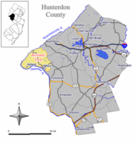 Map of Holland Township in Hunterdon County. Inset: Location of Hunterdon County highlighted in the State of New Jersey. | |
 Census Bureau map of Holland Township, New Jersey | |
| Coordinates: 40°35′53″N 75°07′27″W / 40.598039°N 75.124165°WCoordinates: 40°35′53″N 75°07′27″W / 40.598039°N 75.124165°W[1][2] | |
| Country |
|
| State |
|
| County | Hunterdon |
| Incorporated | April 13, 1874 |
| Government[3] | |
| • Type | Township |
| • Body | Township Committee |
| • Mayor | Ray Krov (R, term ends December 31, 2016)[4][5] |
| • Clerk | Catherine M. Miller[6] |
| Area[1] | |
| • Total | 24.024 sq mi (62.221 km2) |
| • Land | 23.515 sq mi (60.903 km2) |
| • Water | 0.509 sq mi (1.318 km2) 2.12% |
| Area rank |
117th of 566 in state 10th of 26 in county[1] |
| Elevation[7] | 381 ft (116 m) |
| Population (2010 census)[8][9][10] | |
| • Total | 5,291 |
| • Estimate (2015)[11] | 5,162 |
| • Rank |
368th of 566 in state 7th of 26 in county[12] |
| • Density | 225.0/sq mi (86.9/km2) |
| • Density rank |
497th of 566 in state 17th of 26 in county[12] |
| Time zone | Eastern (EST) (UTC-5) |
| • Summer (DST) | Eastern (EDT) (UTC-4) |
| ZIP codes |
08804 - Bloomsbury[13] 08848 - Milford[14] |
| Area code(s) | 908[15] |
| FIPS code | 3401932460[1][16][17] |
| GNIS feature ID | 0882185[1][18] |
| Website |
www |
Holland Township is a township in Hunterdon County, New Jersey, United States. As of the 2010 United States Census, the township's population was 5,291,[8][9][10] reflecting an increase of 167 (+3.3%) from the 5,124 counted in the 2000 Census, which had in turn increased by 232 (+4.7%) from the 4,892 counted in the 1990 Census.[19]
Holland Township is located in the northwestern part of Hunterdon County. The Delaware River forms its boundary with Pennsylvania and the Musconetcong River its boundary with Warren County. It was created from Alexandria Township on April 13, 1874, returning and remerged with Alexandria Township on March 4, 1878. The township was reformed and separated as a municipality of its own again on March 11, 1879. Milford was created on April 15, 1911 from portions of Holland Township, based on the results of a referendum held on May 8, 1911.[20] The township was named by Dutch settlers for Holland.[21]
The Volendam Windmill Museum is a working mill driven by wind, used for grinding raw grain into flour. The 60-foot (18 m) structure is seven stories high with sail arms 68 feet (21 m) from tip to tip.[22]
Geography
According to the United States Census Bureau, the township had a total area of 24.024 square miles (62.221 km2), including 23.515 square miles (60.903 km2) of land and 0.509 square miles (1.318 km2) of water (2.12%).[1][2]
The 379-acre (1.53 km2) Musconetcong Gorge Nature Preserve is an undeveloped park managed by the Hunterdon County Parks and Recreational System, with steeply wooded terrain overlooking the Musconetcong River. The gorge includes many spring-fed streams, a variety of plant species and wildlife. While much of the area offers challenging hikes, a variety of trails are being developed to offer access to less-seasoned hikers.[23]
The township borders Alexandria Township, Bethlehem Township, and Milford Borough. Holland Township also borders Warren County and the Commonwealth of Pennsylvania.[24]
Unincorporated communities, localities and place names located partially or completely within the township include Amsterdam, Finesville, Hughesville, Little York, Mount Joy, Riegel Ridge, Spring Mills and Warren Paper Mills.[25]
Demographics
| Historical population | |||
|---|---|---|---|
| Census | Pop. | %± | |
| 1880 | 1,886 | — | |
| 1890 | 1,704 | −9.7% | |
| 1900 | 1,652 | −3.1% | |
| 1910 | 1,699 | 2.8% | |
| 1920 | 911 | * | −46.4% |
| 1930 | 994 | 9.1% | |
| 1940 | 1,150 | 15.7% | |
| 1950 | 1,341 | 16.6% | |
| 1960 | 2,495 | 86.1% | |
| 1970 | 3,587 | 43.8% | |
| 1980 | 4,593 | 28.0% | |
| 1990 | 4,892 | 6.5% | |
| 2000 | 5,124 | 4.7% | |
| 2010 | 5,291 | 3.3% | |
| Est. 2015 | 5,162 | [11][26] | −2.4% |
| Population sources: 1880-1920[27] 1880-1890[28] 1890-1910[29] 1910-1930[30] 1930-1990[31] 2000[32][33] 2010[8][9][10] * = Lost territory in previous decade.[20] | |||
Census 2010
At the 2010 United States Census, there were 5,291 people, 1,972 households, and 1,544 families residing in the township. The population density was 225.0 per square mile (86.9/km2). There were 2,066 housing units at an average density of 87.9 per square mile (33.9/km2). The racial makeup of the township was 97.62% (5,165) White, 0.72% (38) Black or African American, 0.06% (3) Native American, 0.77% (41) Asian, 0.04% (2) Pacific Islander, 0.28% (15) from other races, and 0.51% (27) from two or more races. Hispanics or Latinos of any race were 2.68% (142) of the population.[8]
There were 1,972 households, of which 34.0% had children under the age of 18 living with them, 68.8% were married couples living together, 6.9% had a female householder with no husband present, and 21.7% were non-families. 18.1% of all households were made up of individuals, and 9.0% had someone living alone who was 65 years of age or older. The average household size was 2.68 and the average family size was 3.06.[8]
In the township, 24.1% of the population were under the age of 18, 6.1% from 18 to 24, 20.5% from 25 to 44, 33.3% from 45 to 64, and 16.0% who were 65 years of age or older. The median age was 44.5 years. For every 100 females there were 96.7 males. For every 100 females age 18 and over, there were 92.8 males.[8]
The Census Bureau's 2006-2010 American Community Survey showed that (in 2010 inflation-adjusted dollars) median household income was $85,190 (with a margin of error of +/- $11,358) and the median family income was $99,535 (+/- $16,553). Males had a median income of $77,951 (+/- $14,766) versus $56,719 (+/- $14,287) for females. The per capita income for the borough was $43,162 (+/- $5,210). About 1.9% of families and 3.2% of the population were below the poverty line, including 3.6% of those under age 18 and 0.0% of those age 65 or over.[34]
Census 2000
As of the 2000 United States Census[16] there were 5,124 people, 1,881 households, and 1,523 families residing in the township. The population density was 216.2 people per square mile (83.5/km²). There were 1,942 housing units at an average density of 81.9 per square mile (31.6/km²). The racial makeup of the township was 98.09% White, 0.43% African American, 0.04% Native American, 0.43% Asian, 0.39% from other races, and 0.62% from two or more races. Hispanic or Latino of any race were 1.70% of the population.[32][33]
There were 1,881 households out of which 33.3% had children under the age of 18 living with them, 73.2% were married couples living together, 5.2% had a female householder with no husband present, and 19.0% were non-families. 15.5% of all households were made up of individuals and 7.7% had someone living alone who was 65 years of age or older. The average household size was 2.72 and the average family size was 3.06.[32][33]
In the township the population was spread out with 24.7% under the age of 18, 5.6% from 18 to 24, 26.8% from 25 to 44, 28.4% from 45 to 64, and 14.5% who were 65 years of age or older. The median age was 41 years. For every 100 females there were 97.7 males. For every 100 females age 18 and over, there were 95.1 males.[32][33]
The median income for a household in the township was $68,083, and the median income for a family was $71,925. Males had a median income of $50,737 versus $35,615 for females. The per capita income for the township was $28,581. About 1.6% of families and 2.2% of the population were below the poverty line, including 2.9% of those under age 18 and 3.3% of those age 65 or over.[32][33]
Government
Local government
Holland Township is governed under the Township form of government. The five-member Township Committee is elected directly by the voters at-large in partisan elections to serve three-year terms of office on a staggered basis, with either one or two seats coming up for election each year as part of the November general election in a three-year cycle.[3][35] At an annual reorganization meeting, the Township Committee selects one of its members to serve as Mayor.[36]
As of 2016, members of the Holland Township Committee are Mayor Ray Krov (R, term on committee ends December 31, 2017; term as mayor ends 2016), Deputy Mayor Dan Bush (R, term on committee ends 2018; term as deputy mayor ends 2016), Thomas Scheibener (R, 2017), Robert Thurgarland (R, 2016; appointed to serve an unexpired term) and Ken Vogel (R, 2016).[4][23][37][38][39][40][41]
In March 2016, the Township Committee selected Robert Thurgarland from three candidates nominated by the Republican municipal committee to fill the term expiring December 2016 of Tony Roselle, who had resigned from office the previous month.[42]
Federal, state and county representation
Holland Township is located in the 7th Congressional District[43] and is part of New Jersey's 23rd state legislative district.[9][44][45]
New Jersey's Seventh Congressional District is represented by Leonard Lance (R, Clinton Township).[46] New Jersey is represented in the United States Senate by Cory Booker (D, Newark, term ends 2021)[47] and Bob Menendez (D, Paramus, 2019).[48][49]
For the 2016–2017 session (Senate, General Assembly), the 23rd Legislative District of the New Jersey Legislature is represented in the State Senate by Michael J. Doherty (R, Washington Township, Warren County) and in the General Assembly by John DiMaio (R, Hackettstown) and Erik Peterson (R, Franklin Township, Hunterdon County).[50] The Governor of New Jersey is Chris Christie (R, Mendham Township).[51] The Lieutenant Governor of New Jersey is Kim Guadagno (R, Monmouth Beach).[52]
Hunterdon County is governed by a five-member Board of Chosen Freeholders, who serve three-year terms of office at-large on a staggered basis, with either one or two seats up for election each year on a partisan basis as part of the November general election. At an annual reorganization meeting held each January, the freeholders select one member to serve as the board's Director and another to serve as Deputy Director.[53] As of 2015, Hunterdon County's Freeholders are Freeholder Director John King (R; Raritan Township, 2015),[54] Freeholder Deputy Director Suzanne Lagay (R; Holland Township, 2016),[55] J. Matthew Holt (R; Clinton Town, 2015),[56] John E. Lanza (R; Flemington, 2016)[57] and Robert G. Walton (R; Hampton, 2017).[58][59] Constitutional officers elected on a countywide basis are County Clerk Mary H. Melfi (R; Flemington, 2017),[60] Sheriff Fredrick W. Brown (R; Alexandria Township, 2016)[61] and Surrogate Susan J. Hoffman (R; Kingwood Township, 2018).[62][63][64]
Politics
As of March 23, 2011, there were a total of 3,699 registered voters in Holland Township, of which 669 (18.1%) were registered as Democrats, 1,537 (41.6%) were registered as Republicans and 1,490 (40.3%) were registered as Unaffiliated. There were 3 voters registered to other parties.[65]
In the 2012 presidential election, Republican Mitt Romney received 60.8% of the vote (1,680 cast), ahead of Democrat Barack Obama with 37.7% (1,041 votes), and other candidates with 1.6% (43 votes), among the 2,785 ballots cast by the township's 3,867 registered voters (21 ballots were spoiled), for a turnout of 72.0%.[66][67] In the 2008 presidential election, Republican John McCain received 57.5% of the vote (1,698 cast), ahead of Democrat Barack Obama with 39.9% (1,180 votes) and other candidates with 1.6% (48 votes), among the 2,955 ballots cast by the township's 3,723 registered voters, for a turnout of 79.4%.[68] In the 2004 presidential election, Republican George W. Bush received 62.9% of the vote (1,805 ballots cast), outpolling Democrat John Kerry with 36.1% (1,036 votes) and other candidates with 1.1% (38 votes), among the 2,871 ballots cast by the township's 3,612 registered voters, for a turnout percentage of 79.5.[69]
In the 2013 gubernatorial election, Republican Chris Christie received 74.4% of the vote (1,353 cast), ahead of Democrat Barbara Buono with 23.9% (435 votes), and other candidates with 1.7% (30 votes), among the 1,849 ballots cast by the township's 3,836 registered voters (31 ballots were spoiled), for a turnout of 48.2%.[70][71] In the 2009 gubernatorial election, Republican Chris Christie received 65.0% of the vote (1,478 ballots cast), ahead of Democrat Jon Corzine with 24.2% (551 votes), Independent Chris Daggett with 8.4% (192 votes) and other candidates with 1.0% (22 votes), among the 2,274 ballots cast by the township's 3,693 registered voters, yielding a 61.6% turnout.[72]
Education
The Holland Township School District serves public school students in Pre-Kindergarten through eighth grade at Holland Township Elementary School. As of the 2012-13 school year, the district's one school had an enrollment of 617 students and 61.8 classroom teachers (on an FTE basis), for a student–teacher ratio of 9.99:1.[73]
Students in public school for ninth through twelfth grades attend Delaware Valley Regional High School, together with students from Alexandria Township, Frenchtown, Kingwood Township and Milford. The school is part of the Delaware Valley Regional High School District.[74][75][76] As of the 2013-14 school year, the school had an enrollment of 952 students and 70.4 classroom teachers (on an FTE basis), for a student–teacher ratio of 13.5:1.[77]
Transportation
As of May 2010, the township had a total of 62.58 miles (100.71 km) of roadways, of which 45.73 miles (73.60 km) were maintained by the municipality and 16.85 miles (27.12 km) by Hunterdon County.[78]
The only major road that passes through is County Route 519.
The closest limited access road is Interstate 78/U.S. Route 22 ("Phillipsburg-Newark Expressway") in neighboring Pohatcong Township in Warren County.
References in fiction
In the 1984 film The Adventures of Buckaroo Banzai Across the 8th Dimension, Holland Township is the location of the Banzai Institute for Biomedical Research and Strategic Information.[79]
References
- 1 2 3 4 5 6 2010 Census Gazetteer Files: New Jersey County Subdivisions, United States Census Bureau. Accessed May 21, 2015.
- 1 2 US Gazetteer files: 2010, 2000, and 1990, United States Census Bureau. Accessed September 4, 2014.
- 1 2 2012 New Jersey Legislative District Data Book, Rutgers University Edward J. Bloustein School of Planning and Public Policy, March 2013, p. 103.
- 1 2 Township Committee, Holland Township. Accessed July 10, 2016.
- ↑ 2016 New Jersey Mayors Directory, New Jersey Department of Community Affairs. Accessed June 14, 2016.
- ↑ Clerk & Registrar Office, Holland Township. Accessed July 10, 2016.
- ↑ U.S. Geological Survey Geographic Names Information System: Township of Holland, Geographic Names Information System. Accessed March 5, 2013.
- 1 2 3 4 5 6 DP-1 - Profile of General Population and Housing Characteristics: 2010 for Holland township, Hunterdon County, New Jersey, United States Census Bureau. Accessed November 14, 2012.
- 1 2 3 4 Municipalities Grouped by 2011-2020 Legislative Districts, New Jersey Department of State, p. 10. Accessed January 6, 2013.
- 1 2 3 Profile of General Demographic Characteristics: 2010 for Holland township, New Jersey Department of Labor and Workforce Development. Accessed November 14, 2012.
- 1 2 PEPANNRES - Annual Estimates of the Resident Population: April 1, 2010 to July 1, 2015 - 2015 Population Estimates for New Jersey municipalities, United States Census Bureau. Accessed May 22, 2016.
- 1 2 GCT-PH1 Population, Housing Units, Area, and Density: 2010 - State -- County Subdivision from the 2010 Census Summary File 1 for New Jersey, United States Census Bureau. Accessed November 14, 2012.
- ↑ Look Up a ZIP Code for Bloomsbury, NJ, United States Postal Service. Accessed November 14, 2012.
- ↑ Look Up a ZIP Code for Milford, NJ, United States Postal Service. Accessed November 14, 2012.
- ↑ Area Code Lookup - NPA NXX for Bloomsbury, NJ, Area-Codes.com. Accessed February 4, 2015.
- 1 2 American FactFinder, United States Census Bureau. Accessed September 4, 2014.
- ↑ A Cure for the Common Codes: New Jersey, Missouri Census Data Center. Accessed October 28, 2012.
- ↑ US Board on Geographic Names, United States Geological Survey. Accessed September 4, 2014.
- ↑ Table 7. Population for the Counties and Municipalities in New Jersey: 1990, 2000 and 2010, New Jersey Department of Labor and Workforce Development, February 2011. Accessed November 14, 2012.
- 1 2 Snyder, John P. The Story of New Jersey's Civil Boundaries: 1606-1968, Bureau of Geology and Topography; Trenton, New Jersey; 1969. pp. 155-156. Accessed October 26, 2012.
- ↑ Hutchinson, Viola L. The Origin of New Jersey Place Names, New Jersey Public Library Commission, May 1945. Accessed September 2, 2015.
- ↑ Hunterdon County web page for Holland Township, accessed March 20, 2007
- 1 2 Township of Holland, Hunterdon County, New Jersey. Accessed July 7, 2016.
- ↑ Areas touching Holland Township, MapIt. Accessed July 10, 2016.
- ↑ Locality Search, State of New Jersey. Accessed April 20, 2015.
- ↑ Census Estimates for New Jersey April 1, 2010 to July 1, 2015, United States Census Bureau. Accessed May 22, 2016.
- ↑ Compendium of censuses 1726-1905: together with the tabulated returns of 1905, New Jersey Department of State, 1906. Accessed July 26, 2013.
- ↑ Porter, Robert Percival. Preliminary Results as Contained in the Eleventh Census Bulletins: Volume III - 51 to 75, p. 98. United States Census Bureau, 1890. Accessed November 14, 2012.
- ↑ Thirteenth Census of the United States, 1910: Population by Counties and Minor Civil Divisions, 1910, 1900, 1890, United States Census Bureau, p. 337. Accessed November 14, 2012.
- ↑ Fifteenth Census of the United States : 1930 - Population Volume I, United States Census Bureau, p. 716. Accessed November 14, 2012.
- ↑ Table 6. New Jersey Resident Population by Municipality: 1930 - 1990, New Jersey Department of Labor and Workforce Development. Accessed June 28, 2015.
- 1 2 3 4 5 Census 2000 Profiles of Demographic / Social / Economic / Housing Characteristics for Holland township, Hunterdon County, New Jersey, United States Census Bureau. Accessed November 14, 2012.
- 1 2 3 4 5 DP-1: Profile of General Demographic Characteristics: 2000 - Census 2000 Summary File 1 (SF 1) 100-Percent Data for Holland township, Hunterdon County, New Jersey, United States Census Bureau. Accessed November 14, 2012.
- ↑ DP03: Selected Economic Characteristics from the 2006-2010 American Community Survey 5-Year Estimates for Holland township, Hunterdon County, New Jersey, United States Census Bureau. Accessed November 14, 2012.
- ↑ "Forms of Municipal Government in New Jersey", p. 7. Rutgers University Center for Government Studies. Accessed June 3, 2015.
- ↑ Form of Government, Holland Township. Accessed July 10, 2016.
- ↑ 2016 Municipal User Freindly Budget, Holland Township. Accessed July 10, 2016.
- ↑ 2016 County and Municipal Directory, Hunterdon County, New Jersey. Accessed July 7, 2016.
- ↑ Hunterdon County District Canvass November 3, 2015, Hunterdon County, New Jersey, updated November 5, 2015. Accessed July 7, 2016.
- ↑ Hunterdon County Statement of Vote November 4, 2014, Hunterdon County, New Jersey, updated November 6, 2014. Accessed July 7, 2016.
- ↑ Hunterdon County Statement of Vote November 5, 2013, Hunterdon County, New Jersey, updated November 12, 2013. Accessed July 7, 2016.
- ↑ Township Council Minutes March 1, 2016, Holland Township. Accessed July 10, 2016. "WHEREAS, on January 21, 2016, the written resignation, stating the effective date to be February 4, 2016, of Anthony Roselle as member of the Township Committee of this Township was filed with the Municipal Clerk of this Township, and by operation of N.J.S.A. 40A:16-3 a vacancy in the office of Township Committee member thereupon occurred... NOW, THEREFORE, BE IT RESOLVED, by the Township Committee of the Township of Holland, in the County of Hunterdon and State of New Jersey, [by the majority vote of its remaining members] that Robert Thurgarland be, and hereby is, appointed to fill the vacancy in the office of member of this Township Committee created by the resignation of Anthony Roselle, to take office and to serve as specified in N.J.S.A. 40A:16-21."
- ↑ Plan Components Report, New Jersey Redistricting Commission, December 23, 2011. Accessed January 6, 2013.
- ↑ 2016 New Jersey Citizen's Guide to Government, p. 58, New Jersey League of Women Voters. Accessed July 20, 2016.
- ↑ Districts by Number for 2011-2020, New Jersey Legislature. Accessed January 6, 2013.
- ↑ Directory of Representatives: New Jersey, United States House of Representatives. Accessed January 5, 2012.
- ↑ About Cory Booker, United States Senate. Accessed January 26, 2015. "He now owns a home and lives in Newark's Central Ward community."
- ↑ Biography of Bob Menendez, United States Senate, January 26, 2015. "He currently lives in Paramus and has two children, Alicia and Robert."
- ↑ Senators of the 114th Congress from New Jersey. United States Senate. Accessed January 26, 2015. "Booker, Cory A. - (D - NJ) Class II; Menendez, Robert - (D - NJ) Class I"
- ↑ Legislative Roster 2016-2017 Session, New Jersey Legislature. Accessed January 17, 2016.
- ↑ "About the Governor". State of New Jersey. Retrieved 2010-01-21.
- ↑ "About the Lieutenant Governor". State of New Jersey. Retrieved 2010-01-21.
- ↑ About the Board, Hunterdon County, New Jersey. Accessed January 8, 2015.
- ↑ John King, Hunterdon County, New Jersey. Accessed January 8, 2015.
- ↑ Suzanne Lagay, Hunterdon County, New Jersey. Accessed January 8, 2015.
- ↑ J. Matthew Holt, Hunterdon County, New Jersey. Accessed January 8, 2015.
- ↑ John E. Lanza, Hunterdon County, New Jersey. Accessed January 8, 2015.
- ↑ Robert G. Walton, Hunterdon County, New Jersey. Accessed January 8, 2015.
- ↑ Hunterdon County Board of Chosen Freeholders, Hunterdon County, New Jersey. Accessed January 8, 2015.
- ↑ Hunterdon County Clerk Mary H. Melfi, Hunterdon County, New Jersey. Accessed January 8, 2015.
- ↑ Frederick W. Brown; Hunterdon County Sheriff, Hunterdon County, New Jersey. Accessed January 8, 2015.
- ↑ Surrogate Susan J. Hoffman, Hunterdon County, New Jersey. Accessed January 8, 2015.
- ↑ 2014 Elected Officials, Hunterdon County, New Jersey. Accessed January 8, 2015.
- ↑ 2014 County and Municipal Guide ... Hunterdon County Now, Hunterdon County, New Jersey. Accessed January 8, 2015.
- ↑ Voter Registration Summary - Hunterdon, New Jersey Department of State Division of Elections, March 23, 2011. Accessed November 14, 2012.
- ↑ "Presidential General Election Results - November 6, 2012 - Hunterdon County" (PDF). New Jersey Department of Elections. March 15, 2013. Retrieved December 24, 2014.
- ↑ "Number of Registered Voters and Ballots Cast - November 6, 2012 - General Election Results - Hunterdon County" (PDF). New Jersey Department of Elections. March 15, 2013. Retrieved December 24, 2014.
- ↑ 2008 Presidential General Election Results: Hunterdon County, New Jersey Department of State Division of Elections, December 23, 2008. Accessed November 14, 2012.
- ↑ 2004 Presidential Election: Hunterdon County, New Jersey Department of State Division of Elections, December 13, 2004. Accessed November 14, 2012.
- ↑ "Governor - Hunterdon County" (PDF). New Jersey Department of Elections. January 29, 2014. Retrieved December 24, 2014.
- ↑ "Number of Registered Voters and Ballots Cast - November 5, 2013 - General Election Results - Hunterdon County" (PDF). New Jersey Department of Elections. January 29, 2014. Retrieved December 24, 2014.
- ↑ 2009 Governor: Hunterdon County, New Jersey Department of State Division of Elections, December 31, 2009. Accessed November 14, 2012.
- ↑ District information for Holland Township School District, National Center for Education Statistics. Accessed April 21, 2015.
- ↑ Delaware Valley Regional School District 2015 Report Card Narrative, New Jersey Department of Education. Accessed June 6, 2016. "The Delaware Valley Regional High School District can be found in the heart of pastoral and beautiful Hunterdon County, New Jersey. The District serves students in grades nine through twelve who reside in the five municipalities that comprise our region: Alexandria Township, Frenchtown Borough, Holland Township, Kingwood Township, and Milford Borough."
- ↑ About Us, Delaware Valley Regional High School District. Accessed June 6, 2016. "The Delaware Valley Regional High School District can be found in the heart of pastoral and beautiful Hunterdon County, New Jersey. The District serves students in grades nine through twelve who reside in the five municipalities that comprise our region: Alexandria Township, Frenchtown Borough, Holland Township, Kingwood Township, and Milford Borough."
- ↑ Chief School Administrators/Sending Districts, Hunterdon County, New Jersey Superintendent of Schools. Accessed June 6, 2016.
- ↑ School Data for Delaware Valley Regional High School District, National Center for Education Statistics. Accessed June 6, 2016.
- ↑ Hunterdon County Mileage by Municipality and Jurisdiction, New Jersey Department of Transportation, May 2010. Accessed July 18, 2014.
- ↑ About the Institute, Banzai Institute for Biomedical Engineering and Strategic Information. Accessed November 14, 2012. "The Banzai Institute for Biomedical Engineering and Strategic Information is an independent, non-profit research organization of ranking scientists. Its East Coast campus is located an hour from New York City in Holland township, New Jersey."
External links
- Holland Township website
- Hunterdon County web page for Holland Township
- Holland Township School District
- Holland Township School District's 2014–15 School Report Card from the New Jersey Department of Education
- School Data for the Holland Township School District, National Center for Education Statistics
- Delaware Valley Regional High School District
- Hunterdon Land Trust Alliance
