Rosemont, Hunterdon County, New Jersey
Not to be confused with Rosemont, Mercer County, New Jersey.
| Rosemont, New Jersey | |
|---|---|
| Unincorporated community | |
|
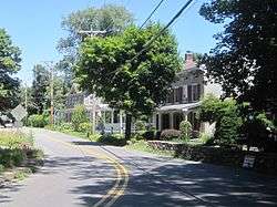
Center of Rosemont | |
 Rosemont, New Jersey  Rosemont, New Jersey  Rosemont, New Jersey Location of Rosemont in Hunterdon County Inset: Location of county within the state of New Jersey | |
| Coordinates: 40°25′38″N 74°59′24″W / 40.42722°N 74.99000°WCoordinates: 40°25′38″N 74°59′24″W / 40.42722°N 74.99000°W | |
| Country |
|
| State |
|
| County | Hunterdon |
| Township | Delaware |
| Elevation[1] | 315 ft (96 m) |
| ZIP code | 08556 |
| Area code(s) | 908 |
| GNIS feature ID | 879825[1] |
|
Rosemont Rural Agricultural District | |
| NRHP Reference # | 10000354[2] |
|---|---|
| Added to NRHP | June 18, 2010 |
Rosemont is an unincorporated community located within Delaware Township in Hunterdon County, New Jersey, United States.[3] Its ZIP code is 08556.[4] Located at the top of a small hill, the center of the community is located along Kingwood Stockton Road (County Route 519) near its intersections with Raven Rock Rosemont Road and Rosemont Ringoes Road (CR 604). Farmland (for which it is listed on the National Register of Historic Places[2]) and residences make up the surrounding area while the center of the settlement includes residences, a post office, and an antique shop.[5]
References
- 1 2 "Rosemont". Geographic Names Information System. United States Geological Survey.
- 1 2 National Park Service (2010-07-09). "National Register Information System". National Register of Historic Places. National Park Service.
- ↑ Locality Search, State of New Jersey. Accessed December 14, 2014.
- ↑ United States Postal Service (2012). "USPS - Look Up a ZIP Code". Retrieved 2012-02-15.
- ↑ Google (July 25, 2015). "Aerial view of Rosemont" (Map). Google Maps. Google. Retrieved July 25, 2015.

| Topics | 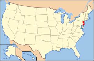 | ||
|---|---|---|---|
| Lists by county | |||
| Lists by city |
| ||
| Other lists | |||
| |||
This article is issued from Wikipedia - version of the 6/9/2016. The text is available under the Creative Commons Attribution/Share Alike but additional terms may apply for the media files.