Franklin Township, Hunterdon County, New Jersey
| Franklin Township, New Jersey | |
|---|---|
| Township | |
| Township of Franklin | |
 Map of Franklin Township in Hunterdon County. Inset; Location of Hunterdon County highlighted in the State of New Jersey. | |
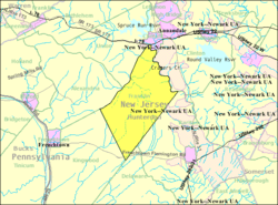 Census Bureau map of Franklin Township, Hunterdon County, New Jersey | |
| Coordinates: 40°34′09″N 74°55′52″W / 40.569033°N 74.931227°WCoordinates: 40°34′09″N 74°55′52″W / 40.569033°N 74.931227°W[1][2] | |
| Country |
|
| State |
|
| County | Hunterdon |
| Incorporated | April 7, 1845 |
| Named for | Benjamin Franklin |
| Government[3] | |
| • Type | Township |
| • Body | Township Committee |
| • Mayor | Susan Soloway (R, term ends December 31, 2016)[4][5] |
| • Clerk | Ursula Stryker[6] |
| Area[1] | |
| • Total | 22.998 sq mi (59.563 km2) |
| • Land | 22.803 sq mi (59.058 km2) |
| • Water | 0.195 sq mi (0.505 km2) 0.85% |
| Area rank |
120th of 566 in state 11th of 26 in county[1] |
| Elevation[7] | 600 ft (200 m) |
| Population (2010 Census)[8][9][10] | |
| • Total | 3,195 |
| • Estimate (2015)[11] | 3,229 |
| • Rank |
444th of 566 in state 17th of 26 in county[12] |
| • Density | 140.1/sq mi (54.1/km2) |
| • Density rank |
530th of 566 in state 24th of 26 in county[12] |
| Time zone | Eastern (EST) (UTC-5) |
| • Summer (DST) | Eastern (EDT) (UTC-4) |
| ZIP code | 08867 - Pittstown, New Jersey[13][14] |
| Area code(s) | 908[15] |
| FIPS code | 3401924870[1][16][17] |
| GNIS feature ID | 0882184[1][18] |
| Website |
www |
Franklin Township is a township in central Hunterdon County, New Jersey, United States. As of the 2010 United States Census, the township's population was 3,195,[8][9][10] reflecting an increase of 205 (+6.9%) from the 2,990 counted in the 2000 Census, which had in turn increased by 139 (+4.9%) from the 2,851 counted in the 1990 Census.[19] Most of the township lies on the Hunterdon Plateau with only the eastern section along the South Branch Raritan River being on the lower part of the Newark Basin.
Franklin Township was established by an act of the New Jersey Legislature on April 7, 1845, when it was created from portions of Kingwood Township, based on the results of a referendum held that day. Portions of the township were taken to form Clinton town on April 5, 1865.[20] The township was named for Benjamin Franklin.[21]
In its early days, Franklin was a Quaker settlement. The most reliable records that are available about the early days of the Township are found in the minutes of the Friends' Meeting in Quakertown.
Geography
According to the United States Census Bureau, the township had a total area of 22.998 square miles (59.563 km2), including 22.803 square miles (59.058 km2) of land and 0.195 square miles (0.505 km2) of water (0.85%).[1][2]
Unincorporated communities, localities and place names located partially or completely within the township include Allens Corner, Alvater Corner, Cherryville (previously known as Dogtown), Grandin, Kingtown, Lansdowne, Littletown, Oak Grove, Pittstown, Quakertown (previously known as Fairview), Sidney and Sunnyside.[22] Pittstown, previously known as Hoffs, is also spread across Alexandria Township and Union Township.[23]
The Capoolong Creek, which runs through Pittstown, was an attraction to early settlers and they soon established three of the oldest churches in present-day Hunterdon: Thomas Episcopal, established in 1723, Bethlehem Presbyterian, organized in 1730 and the Quaker Church in 1733.
Demographics
| Historical population | |||
|---|---|---|---|
| Census | Pop. | %± | |
| 1850 | 1,454 | — | |
| 1860 | 1,552 | 6.7% | |
| 1870 | 1,342 | * | −13.5% |
| 1880 | 1,338 | −0.3% | |
| 1890 | 1,287 | −3.8% | |
| 1900 | 1,258 | −2.3% | |
| 1910 | 1,099 | −12.6% | |
| 1920 | 980 | −10.8% | |
| 1930 | 1,100 | 12.2% | |
| 1940 | 1,211 | 10.1% | |
| 1950 | 1,255 | 3.6% | |
| 1960 | 1,777 | 41.6% | |
| 1970 | 2,154 | 21.2% | |
| 1980 | 2,294 | 6.5% | |
| 1990 | 2,851 | 24.3% | |
| 2000 | 2,990 | 4.9% | |
| 2010 | 3,195 | 6.9% | |
| Est. 2015 | 3,229 | [11][24] | 1.1% |
| Population sources: 1850-1920[25] 1850-1870[26] 1850[27] 1870[28] 1880-1890[29] 1890-1910[30] 1910-1930[31] 1930-1990[32] 2000[33][34] 2010[8][9][10] * = Lost territory in previous decade.[20] | |||
Census 2010
At the 2010 United States Census, there were 3,195 people, 1,137 households, and 908.5 families residing in the township. The population density was 140.1 per square mile (54.1/km2). There were 1,204 housing units at an average density of 52.8 per square mile (20.4/km2). The racial makeup of the township was 96.84% (3,094) White, 0.69% (22) Black or African American, 0.16% (5) Native American, 1.25% (40) Asian, 0.09% (3) Pacific Islander, 0.44% (14) from other races, and 0.53% (17) from two or more races. Hispanics or Latinos of any race were 3.44% (110) of the population.[8]
There were 1,137 households, of which 34.6% had children under the age of 18 living with them, 71.0% were married couples living together, 5.3% had a female householder with no husband present, and 20.1% were non-families. 15.1% of all households were made up of individuals, and 6.9% had someone living alone who was 65 years of age or older. The average household size was 2.80 and the average family size was 3.13.[8]
In the township, 24.7% of the population were under the age of 18, 5.9% from 18 to 24, 19.4% from 25 to 44, 34.6% from 45 to 64, and 15.3% who were 65 years of age or older. The median age was 45.0 years. For every 100 females there were 98.1 males. For every 100 females age 18 and over, there were 98.9 males.[8]
The Census Bureau's 2006-2010 American Community Survey showed that (in 2010 inflation-adjusted dollars) median household income was $104,500 (with a margin of error of +/- $19,534) and the median family income was $118,182 (+/- $16,643). Males had a median income of $72,303 (+/- $13,313) versus $52,202 (+/- $5,525) for females. The per capita income for the borough was $46,892 (+/- $5,196). About 1.7% of families and 1.1% of the population were below the poverty line, including 1.0% of those under age 18 and 0.0% of those age 65 or over.[35]
Census 2000
As of the 2000 United States Census[16] there were 2,990 people, 1,091 households, and 890 families residing in the township. The population density was 130.7 people per square mile (50.5/km²). There were 1,125 housing units at an average density of 49.2 per square mile (19.0/km²). The racial makeup of the township was 97.53% White, 0.40% African American, 0.23% Native American, 0.77% Asian, 0.33% from other races, and 0.74% from two or more races. Hispanic or Latino of any race were 2.24% of the population.[33][34]
There were 1,091 households out of which 34.6% had children under the age of 18 living with them, 73.8% were married couples living together, 5.7% had a female householder with no husband present, and 18.4% were non-families. 14.2% of all households were made up of individuals and 6.0% had someone living alone who was 65 years of age or older. The average household size was 2.74 and the average family size was 3.04.[33][34]
In the township the population was spread out with 24.9% under the age of 18, 4.4% from 18 to 24, 28.0% from 25 to 44, 30.6% from 45 to 64, and 12.1% who were 65 years of age or older. The median age was 42 years. For every 100 females there were 98.3 males. For every 100 females age 18 and over, there were 99.1 males.[33][34]
The median income for a household in the township was $91,364, and the median income for a family was $96,320. Males had a median income of $66,667 versus $44,779 for females. The per capita income for the township was $39,668. About 1.5% of families and 1.6% of the population were below the poverty line, including 1.5% of those under age 18 and 4.9% of those age 65 or over.[33][34]
Government
Local government
Franklin Township is governed under the Township form of government. The five-member Township Committee is elected directly by the voters at-large in partisan elections to serve three-year terms of office on a staggered basis, with either one or two seats coming up for election each year as part of the November general election in a three-year cycle.[3][36] At an annual reorganization meeting, the Township Committee selects one of its members to serve as Mayor and another as Deputy Mayor.
As of 2016, members of the Franklin Township Committee are Mayor Susan Soloway (R, term on committee and as mayor ends December 31, 2016), Deputy Mayor Kathryn Blew (R, term on committee ends 2017; term as deputy mayor ends 2016), Joseph Darocha (R, 2018), James Fania (R, 2016; appointed to serve an unexpired term) and Craig Repmann (R, 2018).[4][37][38][39][40][41][42]
In April 2016, the Township Committee selected Jim Fania from three candidates nominated by the Republican municipal committee to fill the seat expiring on December 2016 that was vacated by Tim Wintermute who left office after moving out of the township.[43]
Federal, state and county representation
Franklin Township is located in the 7th Congressional District[44] and is part of New Jersey's 23rd state legislative district.[9][45][46] Prior to the 2010 Census, Franklin Township had been part of the 12th Congressional District, a change made by the New Jersey Redistricting Commission that took effect in January 2013, based on the results of the November 2012 general elections.[47]
New Jersey's Seventh Congressional District is represented by Leonard Lance (R, Clinton Township).[48] New Jersey is represented in the United States Senate by Cory Booker (D, Newark, term ends 2021)[49] and Bob Menendez (D, Paramus, 2019).[50][51]
For the 2016–2017 session (Senate, General Assembly), the 23rd Legislative District of the New Jersey Legislature is represented in the State Senate by Michael J. Doherty (R, Washington Township, Warren County) and in the General Assembly by John DiMaio (R, Hackettstown) and Erik Peterson (R, Franklin Township, Hunterdon County).[52] The Governor of New Jersey is Chris Christie (R, Mendham Township).[53] The Lieutenant Governor of New Jersey is Kim Guadagno (R, Monmouth Beach).[54]
Hunterdon County is governed by a five-member Board of Chosen Freeholders, who serve three-year terms of office at-large on a staggered basis, with either one or two seats up for election each year on a partisan basis as part of the November general election. At an annual reorganization meeting held each January, the freeholders select one member to serve as the board's Director and another to serve as Deputy Director.[55] As of 2015, Hunterdon County's Freeholders are Freeholder Director John King (R; Raritan Township, 2015),[56] Freeholder Deputy Director Suzanne Lagay (R; Holland Township, 2016),[57] J. Matthew Holt (R; Clinton Town, 2015),[58] John E. Lanza (R; Flemington, 2016)[59] and Robert G. Walton (R; Hampton, 2017).[60][61] Constitutional officers elected on a countywide basis are County Clerk Mary H. Melfi (R; Flemington, 2017),[62] Sheriff Fredrick W. Brown (R; Alexandria Township, 2016)[63] and Surrogate Susan J. Hoffman (R; Kingwood Township, 2018).[64][65][66]
Politics
As of March 23, 2011, there were a total of 2,253 registered voters in Franklin Township, of which 382 (17.0%) were registered as Democrats, 1,021 (45.3%) were registered as Republicans and 850 (37.7%) were registered as Unaffiliated. There were no voters registered to other parties.[67]
In the 2012 presidential election, Republican Mitt Romney received 65.8% of the vote (1,166 cast), ahead of Democrat Barack Obama with 33.2% (588 votes), and other candidates with 1.0% (18 votes), among the 1,781 ballots cast by the township's 2,362 registered voters (9 ballots were spoiled), for a turnout of 75.4%.[68][69] In the 2008 presidential election, Republican John McCain received 61.0% of the vote (1,118 cast), ahead of Democrat Barack Obama with 36.6% (670 votes) and other candidates with 1.7% (31 votes), among the 1,833 ballots cast by the township's 2,228 registered voters, for a turnout of 82.3%.[70] In the 2004 presidential election, Republican George W. Bush received 63.3% of the vote (1,130 ballots cast), outpolling Democrat John Kerry with 35.3% (630 votes) and other candidates with 1.1% (24 votes), among the 1,784 ballots cast by the township's 2,133 registered voters, for a turnout percentage of 83.6.[71]
In the 2013 gubernatorial election, Republican Chris Christie received 77.8% of the vote (861 cast), ahead of Democrat Barbara Buono with 20.3% (225 votes), and other candidates with 1.9% (21 votes), among the 1,132 ballots cast by the township's 2,279 registered voters (25 ballots were spoiled), for a turnout of 49.7%.[72][73] In the 2009 gubernatorial election, Republican Chris Christie received 69.5% of the vote (977 ballots cast), ahead of Democrat Jon Corzine with 21.6% (303 votes), Independent Chris Daggett with 8.0% (112 votes) and other candidates with 0.3% (4 votes), among the 1,406 ballots cast by the township's 2,215 registered voters, yielding a 63.5% turnout.[74]
Education
The Franklin Township School District serves public school students in pre-Kindergarten through eighth grade at Franklin Township School. As of the 2012-13 school year, the district's one school had an enrollment of 285 students and 25.8 classroom teachers (on an FTE basis), for a student–teacher ratio of 11.05:1.[75]
Public school students in ninth through twelfth grades attend North Hunterdon High School in Annandale together with students from Bethlehem Township, Clinton Town, Clinton Township, Lebanon Borough and Union Township.[76][77][78] The school is part of the North Hunterdon-Voorhees Regional High School District, which also includes students from Califon, Glen Gardner, Hampton, High Bridge, Lebanon Township and Tewksbury Township, who attend Voorhees High School in Lebanon Township.[79][80][81]
Transportation
As of May 2010, the township had a total of 53.09 miles (85.44 km) of roadways, of which 32.91 miles (52.96 km) were maintained by the municipality, 19.55 miles (31.46 km) by Hunterdon County and 0.63 miles (1.01 km) by the New Jersey Department of Transportation.[82]
County roads that pass through include CR 513 and CR 579.
Route 12 passes through for just less than ½ mile. Interstate 78/U.S. Route 22 traverse through for a fifth of a mile with an interchange (Exit 15) at the northern tip of the township (which is the eastern overlapping end of Route 173).
The Norfolk Southern Railway's Lehigh Line (formerly the mainline of the Lehigh Valley Railroad), runs through the northern part of Franklin Township.
Notable people
People who were born in, residents of, or otherwise closely associated with Franklin Township include:
- Chris Kappler (born 1967), Olympic gold and silver medalist in equestrian events.[83]
Surrounding communities
 |
Union Township | Town of Clinton | Clinton Township | |
| Alexandria Township | |
|||
| ||||
| | ||||
| Kingwood Township | Delaware Township | Raritan Township |
References
- 1 2 3 4 5 6 2010 Census Gazetteer Files: New Jersey County Subdivisions, United States Census Bureau. Accessed May 21, 2015.
- 1 2 US Gazetteer files: 2010, 2000, and 1990, United States Census Bureau. Accessed September 4, 2014.
- 1 2 2012 New Jersey Legislative District Data Book, Rutgers University Edward J. Bloustein School of Planning and Public Policy, March 2013, p. 103.
- 1 2 Franklin Township Committee, Franklin Township. Accessed July 9, 2016.
- ↑ 2016 New Jersey Mayors Directory, New Jersey Department of Community Affairs. Accessed June 14, 2016.
- ↑ Township Clerk, Franklin Township. Accessed July 7, 2014.
- ↑ U.S. Geological Survey Geographic Names Information System: Township of Franklin, Geographic Names Information System. Accessed March 5, 2013.
- 1 2 3 4 5 6 DP-1 - Profile of General Population and Housing Characteristics: 2010 for Franklin township, Hunterdon County, New Jersey, United States Census Bureau. Accessed November 14, 2012.
- 1 2 3 4 Municipalities Grouped by 2011-2020 Legislative Districts, New Jersey Department of State, p. 10. Accessed January 6, 2013.
- 1 2 3 Profile of General Demographic Characteristics: 2010 for Franklin township, New Jersey Department of Labor and Workforce Development. Accessed November 14, 2012.
- 1 2 PEPANNRES - Annual Estimates of the Resident Population: April 1, 2010 to July 1, 2015 - 2015 Population Estimates for New Jersey municipalities, United States Census Bureau. Accessed May 22, 2016.
- 1 2 GCT-PH1 Population, Housing Units, Area, and Density: 2010 - State -- County Subdivision from the 2010 Census Summary File 1 for New Jersey, United States Census Bureau. Accessed November 14, 2012.
- ↑ Look Up a ZIP Code for Pittstown, NJ, United States Postal Service. Accessed November 14, 2012.
- ↑ Zip Codes, State of New Jersey. Accessed September 8, 2013.
- ↑ Area Code Lookup - NPA NXX for Pittstown, NJ, Area-Codes.com. Accessed September 8, 2013.
- 1 2 American FactFinder, United States Census Bureau. Accessed September 4, 2014.
- ↑ A Cure for the Common Codes: New Jersey, Missouri Census Data Center. Accessed October 28, 2012.
- ↑ US Board on Geographic Names, United States Geological Survey. Accessed September 4, 2014.
- ↑ Table 7. Population for the Counties and Municipalities in New Jersey: 1990, 2000 and 2010, New Jersey Department of Labor and Workforce Development, February 2011. Accessed November 14, 2012.
- 1 2 Snyder, John P. The Story of New Jersey's Civil Boundaries: 1606-1968, Bureau of Geology and Topography; Trenton, New Jersey; 1969. p. 155. Accessed October 25, 2012.
- ↑ Hutchinson, Viola L. The Origin of New Jersey Place Names, New Jersey Public Library Commission, May 1945. Accessed August 31, 2015.
- ↑ Locality Search, State of New Jersey. Accessed May 21, 2015.
- ↑ The Township of Franklin, Hunterdon County, New Jersey. Accessed January 1, 2015. "Villages and hamlets in Franklin are Cherryville (Dogtown until 1856), Quakertown (sometimes called Fairview between 1834 and 1856) and Pittstown (Hoffs until the late 1700s), which also is partly in Alexandria and Union Townships."
- ↑ Census Estimates for New Jersey April 1, 2010 to July 1, 2015, United States Census Bureau. Accessed May 22, 2016.
- ↑ Compendium of censuses 1726-1905: together with the tabulated returns of 1905, New Jersey Department of State, 1906. Accessed July 10, 2013.
- ↑ Raum, John O. The History of New Jersey: From Its Earliest Settlement to the Present Time, Volume 1, p. 267, J. E. Potter and company, 1877. Accessed July 10, 2013. "Franklin township contained in 1850 a population of 1,452; in 1860, 1,552; and in 1870 1,342. Sidney, Pittstown, Quakertown, Oak Grove and Cherryville are post towns "
- ↑ Debow, James Dunwoody Brownson. The Seventh Census of the United States: 1850, p. 139. R. Armstrong, 1853. Accessed July 10, 2013.
- ↑ Staff. A compendium of the ninth census, 1870, p. 260. United States Census Bureau, 1872. Accessed July 10, 2013.
- ↑ Porter, Robert Percival. Preliminary Results as Contained in the Eleventh Census Bulletins: Volume III - 51 to 75, p. 98. United States Census Bureau, 1890. Accessed November 14, 2012.
- ↑ Thirteenth Census of the United States, 1910: Population by Counties and Minor Civil Divisions, 1910, 1900, 1890, United States Census Bureau, p. 337. Accessed November 14, 2012.
- ↑ Fifteenth Census of the United States : 1930 - Population Volume I, United States Census Bureau, p. 716. Accessed November 14, 2012.
- ↑ New Jersey Resident Population by Municipality: 1930 - 1990, Workforce New Jersey Public Information Network. Accessed June 28, 2015.
- 1 2 3 4 5 Census 2000 Profiles of Demographic / Social / Economic / Housing Characteristics for Franklin township, Hunterdon County, New Jersey, United States Census Bureau. Accessed November 14, 2012.
- 1 2 3 4 5 DP-1: Profile of General Demographic Characteristics: 2000 - Census 2000 Summary File 1 (SF 1) 100-Percent Data for Franklin township, Hunterdon County, New Jersey, United States Census Bureau. Accessed November 14, 2012.
- ↑ DP03: Selected Economic Characteristics from the 2006-2010 American Community Survey 5-Year Estimates for Franklin township, Hunterdon County, New Jersey, United States Census Bureau. Accessed November 14, 2012.
- ↑ "Forms of Municipal Government in New Jersey", p. 7. Rutgers University Center for Government Studies. Accessed June 3, 2015.
- ↑ 2016 Municipal User Friendly Budget, Franklin Township. Accessed July 9, 2016.
- ↑ 2016 County and Municipal Directory, Hunterdon County, New Jersey. Accessed July 7, 2016.
- ↑ Township of Franklin, Hunterdon County, New Jersey. Accessed July 7, 2016.
- ↑ Hunterdon County District Canvass November 3, 2015, Hunterdon County, New Jersey, updated November 5, 2015. Accessed July 7, 2016.
- ↑ Hunterdon County Statement of Vote November 4, 2014, Hunterdon County, New Jersey, updated November 6, 2014. Accessed July 7, 2016.
- ↑ Hunterdon County Statement of Vote November 5, 2013, Hunterdon County, New Jersey, updated November 12, 2013. Accessed July 7, 2016.
- ↑ Minutes Franklin Township Committee Regular Meeting Thursday, April 28, 2016, Franklin Township. Accessed July 9, 2016. "Discussion: Vacancy on Township Committee: Committee Member Tim Wintermute sold his home in and has moved out of the township; therefore, there is a vacancy on the Township Committee since Mr. Wintermute has submitted his formal letter of resignation. The Township Committee considered the three (3) candidates to be considered from the County Republican Committee and is prepared to appoint. Motion to Adopt Resolution 2016 – 32 to appoint Jim Fania to fill the vacancy for a term of office on the Township Committee to expire on December 31, 2016.... Motion carried."
- ↑ Plan Components Report, New Jersey Redistricting Commission, December 23, 2011. Accessed January 6, 2013.
- ↑ 2016 New Jersey Citizen's Guide to Government, p. 57, New Jersey League of Women Voters. Accessed July 20, 2016.
- ↑ Districts by Number for 2011-2020, New Jersey Legislature. Accessed January 6, 2013.
- ↑ 2011 New Jersey Citizen's Guide to Government, p. 57, New Jersey League of Women Voters. Accessed May 22, 2015.
- ↑ Directory of Representatives: New Jersey, United States House of Representatives. Accessed January 5, 2012.
- ↑ About Cory Booker, United States Senate. Accessed January 26, 2015. "He now owns a home and lives in Newark's Central Ward community."
- ↑ Biography of Bob Menendez, United States Senate, January 26, 2015. "He currently lives in Paramus and has two children, Alicia and Robert."
- ↑ Senators of the 114th Congress from New Jersey. United States Senate. Accessed January 26, 2015. "Booker, Cory A. - (D - NJ) Class II; Menendez, Robert - (D - NJ) Class I"
- ↑ Legislative Roster 2016-2017 Session, New Jersey Legislature. Accessed January 17, 2016.
- ↑ "About the Governor". State of New Jersey. Retrieved 2010-01-21.
- ↑ "About the Lieutenant Governor". State of New Jersey. Retrieved 2010-01-21.
- ↑ About the Board, Hunterdon County, New Jersey. Accessed January 8, 2015.
- ↑ John King, Hunterdon County, New Jersey. Accessed January 8, 2015.
- ↑ Suzanne Lagay, Hunterdon County, New Jersey. Accessed January 8, 2015.
- ↑ J. Matthew Holt, Hunterdon County, New Jersey. Accessed January 8, 2015.
- ↑ John E. Lanza, Hunterdon County, New Jersey. Accessed January 8, 2015.
- ↑ Robert G. Walton, Hunterdon County, New Jersey. Accessed January 8, 2015.
- ↑ Hunterdon County Board of Chosen Freeholders, Hunterdon County, New Jersey. Accessed January 8, 2015.
- ↑ Hunterdon County Clerk Mary H. Melfi, Hunterdon County, New Jersey. Accessed January 8, 2015.
- ↑ Frederick W. Brown; Hunterdon County Sheriff, Hunterdon County, New Jersey. Accessed January 8, 2015.
- ↑ Surrogate Susan J. Hoffman, Hunterdon County, New Jersey. Accessed January 8, 2015.
- ↑ 2014 Elected Officials, Hunterdon County, New Jersey. Accessed January 8, 2015.
- ↑ 2014 County and Municipal Guide ... Hunterdon County Now, Hunterdon County, New Jersey. Accessed January 8, 2015.
- ↑ Voter Registration Summary - Hunterdon, New Jersey Department of State Division of Elections, March 23, 2011. Accessed November 14, 2012.
- ↑ "Presidential General Election Results - November 6, 2012 - Hunterdon County" (PDF). New Jersey Department of Elections. March 15, 2013. Retrieved December 24, 2014.
- ↑ "Number of Registered Voters and Ballots Cast - November 6, 2012 - General Election Results - Hunterdon County" (PDF). New Jersey Department of Elections. March 15, 2013. Retrieved December 24, 2014.
- ↑ 2008 Presidential General Election Results: Hunterdon County, New Jersey Department of State Division of Elections, December 23, 2008. Accessed November 14, 2012.
- ↑ 2004 Presidential Election: Hunterdon County, New Jersey Department of State Division of Elections, December 13, 2004. Accessed November 14, 2012.
- ↑ "Governor - Hunterdon County" (PDF). New Jersey Department of Elections. January 29, 2014. Retrieved December 24, 2014.
- ↑ "Number of Registered Voters and Ballots Cast - November 5, 2013 - General Election Results - Hunterdon County" (PDF). New Jersey Department of Elections. January 29, 2014. Retrieved December 24, 2014.
- ↑ 2009 Governor: Hunterdon County, New Jersey Department of State Division of Elections, December 31, 2009. Accessed November 14, 2012.
- ↑ District information for Franklin Township School District, National Center for Education Statistics. Accessed February 17, 2015.
- ↑ About the North Hunterdon-Voorhees Regional High School District, North Hunterdon-Voorhees Regional High School District. Accessed February 17, 2015. "North Hunterdon High School educates students from: Bethlehem Township, Clinton Town, Clinton Township, Franklin Township, Lebanon Borough, Union Township; Voorhees High School educates students from: Califon, Glen Gardner, Hampton, High Bridge, Lebanon Township, Tewksbury Township"
- ↑ Information Regarding Choice of District School, North Hunterdon-Voorhees Regional High School District. Accessed February 17, 2015. "In the past, parents and students of the North Hunterdon High School sending districts were able to select either North Hunterdon High School or Voorhees High School as their school of choice.... As our student population continued to grow and our two high schools reached, and exceeded, 90% capacity, the option of choosing Voorhees was eliminated in the 2005-2006 school year for the North Hunterdon sending districts (Bethlehem Township, Clinton Township, Franklin Township, Lebanon Borough and Union Township – Clinton Town students still have choice as they are classmates at Clinton Public School with Glen Gardner students, who attend Voorhees)."
- ↑ About the District North Hunterdoon-Voorhees Regional High School District. Accessed February 17, 2015. "North Hunterdon High School educates students from: Bethlehem Township, Clinton Town, Clinton Township, Franklin Township, Lebanon Borough, Union Township; Voorhees High School educates students from: Califon, Glen Gardner, Hampton, High Bridge, Lebanon Township, Tewksbury Township"
- ↑ Voorhees High School 2015 Report Card Narrative, New Jersey Department of Education. Accessed June 3, 2016. "Voorhees High School has consistently ranked among the top high schools in New Jersey and was named a National Blue Ribbon School in 2015. With an enrollment of 1,095 students in grades 9-12, the school serves the communities of Califon, Glen Gardner, Hampton, High Bridge, Lebanon Township, and Tewksbury Township."
- ↑ Public School Directory 2015-2016, p. 55. Hunterdon County Department of Education. Accessed June 3, 2016.
- ↑ About the North Hunterdon-Voorhees Regional High School District, North Hunterdon-Voorhees Regional High School District, updated November 16, 2015. Accessed June 3, 2016. "North Hunterdon High School educates students from: Bethlehem Township, Clinton Town, Clinton Township, Franklin Township, Lebanon Borough, Union Township; Voorhees High School educates students from: Califon, Glen Gardner, Hampton, High Bridge, Lebanon Township, Tewksbury Township"
- ↑ Hunterdon County Mileage by Municipality and Jurisdiction, New Jersey Department of Transportation, May 2010. Accessed July 18, 2014.
- ↑ Editorial. "Editorial: Hunterdon can be proud of residents who have competed in the Olympics, Culley is next", Hunterdon County Democrat, July 26, 2012. Accessed May 29, 2013. "Two equestrians have ridden for the U.S. show jumping team. In 2000, Nona Garson, then of Tewksbury Township, went to Australia and in 2004, Chris Kappler of Franklin Township won the team gold and individual silver in Athens."
External links
- Official Franklin Township, Hunterdon County Site
- Hunterdon County webpage for Franklin Township
- Franklin Township School
- Franklin Township School's 2014–15 School Report Card from the New Jersey Department of Education
- School Data for the Franklin Township School, National Center for Education Statistics
- North Hunterdon-Voorhees Regional High School District
- Hunterdon Land Trust Alliance
- Rural Awareness, Inc. -- Preserving Franklin Township's Rich History and Rural Character
