Ontario Highway 118
| |||||||||||||
|---|---|---|---|---|---|---|---|---|---|---|---|---|---|
| Route information | |||||||||||||
| Maintained by the Ministry of Transportation | |||||||||||||
| Length: | 127.8 km[1] (79.4 mi) | ||||||||||||
| Major junctions | |||||||||||||
| West end: |
| ||||||||||||
| East end: |
| ||||||||||||
| Highway system | |||||||||||||
| |||||||||||||
King's Highway 118, commonly referred to as Highway 118, is a provincially maintained highway in the Canadian province of Ontario. The route travels across South-Central Ontario between Highway 11 near Bracebridge and Highway 28 near Bancroft
Route description
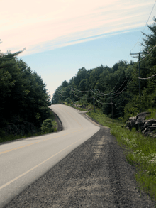
Highway 118 travels from Highway 11 near Muskoka Falls, southeast of Bracebridge, to Highway 28 in Paudash. The highway generally follows near the 45th parallel north. East of Tory Hill, the highway follows the historic Monck Road colonization road.[2]
The total length of Highway 118 is 127.8 kilometres (79.4 mi).[1] It is situated in Muskoka District and Haliburton County with a small section in Hastings County at its eastern terminus.[2]
Communities between the western and eastern ends are Uffington (a short distance off Highway 118), Vankoughnet (also nearby, off-route), Carnarvon, West Guilford, Haliburton, Tory Hill, Cardiff.[2]
History

Prior to 1998, Highway 118's western terminus was Highway 169 in Glen Orchard, making the total road length 116.1 kilometres (72.1 mi) from that point to Haliburton. On January 1, 1998, 26.6 kilometres (16.5 mi) of Highway 118, between Highway 169 and Highway 11 was redesignated as Muskoka Regional Road 118 West. A majority of that route is also cosigned as the Frank Miller Memorial Route.
Before 2003, Highway 118's eastern terminus was in Haliburton, at a junction with Highway 121. During the spring of 2003, Highway 121 was renumbered east of Haliburton as Highway 118.[3]
Major intersections
The following table lists the major junctions along Highway 118, as noted by the Ministry of Transportation of Ontario.[1]
| Division | Location | km[1] | mi | Destinations | Notes |
|---|---|---|---|---|---|
| Muskoka|District Municipality of Muskoka|Muskoka | Glen Orchard | Highway 169 | |||
| Bracebridge | |||||
| Haliburton | Carnarvon | ||||
| County Road 7 | |||||
| County Road 14 | |||||
| Haliburton Village | Sunnyside Street | ||||
| Concession 7–8 | |||||
| Tory Hill | |||||
| Highway 648 (Wilberforce Road) | |||||
| Highway 648 (Dyno Mines Road) | |||||
| Highway 648 (Highland Grove Road) | |||||
| Hastings | Paudash | ||||
1.000 mi = 1.609 km; 1.000 km = 0.621 mi
| |||||
References
- 1 2 3 4 Ministry of Transportation of Ontario (2008). "Annual Average Daily Traffic (AADT) counts". Retrieved February 9, 2012.
- 1 2 3 Ontario Back Road Atlas (Map). Cartography by MapArt. Peter Heiler. 2010. pp. 59–61. § T33–V44. ISBN 978-1-55198-226-7.
- ↑ Ministry of Transportation (February 11, 2002). "Ontario government improves provincial highway numbering". Newswire. Archived from the original on August 4, 2002. Retrieved February 29, 2012.