Glasgow, Pennsylvania
| Glasgow, Pennsylvania | |
|---|---|
| Borough | |
|
Smiths Ferry United Methodist Church on Liberty Avenue | |
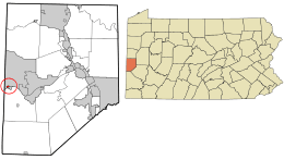 Location in Beaver County and state of Pennsylvania | |
| Coordinates: 40°38′42″N 80°30′31″W / 40.64500°N 80.50861°WCoordinates: 40°38′42″N 80°30′31″W / 40.64500°N 80.50861°W | |
| Country | United States |
| State | Pennsylvania |
| County | Beaver |
| Settled | 1836 |
| Incorporated | 1854 |
| Government | |
| • Type | Borough Council |
| Area | |
| • Total | 0.1 sq mi (0.3 km2) |
| Elevation | 732 ft (223 m) |
| Population (2010) | |
| • Total | 60 |
| • Density | 778.4/sq mi (300.5/km2) |
| Time zone | Eastern (EST) (UTC-5) |
| • Summer (DST) | EDT (UTC-4) |
| Area code(s) | 724 |

Glasgow is a borough in Beaver County, Pennsylvania, United States, along the Ohio River. The population was 60 at the 2010 census.
The borough was named after Glasgow, in Scotland.[1]
Geography
Glasgow is located at 40°38′42″N 80°30′31″W / 40.64500°N 80.50861°W (40.645093, -80.508614).[2]
According to the United States Census Bureau, the borough has a total area of 0.1 square miles (0.26 km2), of which, 0.1 square miles (0.26 km2) of it is land and 0.1 square miles (0.26 km2) of it (38.46%) is water. The town is referred to as Smith's Ferry by locals because a ferry used to connect the town with Georgetown on the other side of the Ohio River.
Demographics
| Historical population | |||
|---|---|---|---|
| Census | Pop. | %± | |
| 1880 | 573 | — | |
| 1890 | 218 | −62.0% | |
| 1900 | 172 | −21.1% | |
| 1910 | 203 | 18.0% | |
| 1920 | 239 | 17.7% | |
| 1930 | 271 | 13.4% | |
| 1940 | 204 | −24.7% | |
| 1950 | 214 | 4.9% | |
| 1960 | 142 | −33.6% | |
| 1970 | 112 | −21.1% | |
| 1980 | 106 | −5.4% | |
| 1990 | 74 | −30.2% | |
| 2000 | 63 | −14.9% | |
| 2010 | 60 | −4.8% | |
| Est. 2015 | 59 | [3] | −1.7% |
| Sources:[4][5][6] | |||
As of the census[5] of 2000, there were 63 people, 27 households, and 17 families residing in the borough. The population density was 778.4 people per square mile (304.1/km²). There were 28 housing units at an average density of 345.9 per square mile (135.1/km²). The racial makeup of the borough was 98.41% White, and 1.59% from two or more races.
There were 27 households, out of which 18.5% had children under the age of 18 living with them, 44.4% were married couples living together, 7.4% had a female householder with no husband present, and 37.0% were non-families. 25.9% of all households were made up of individuals, and 18.5% had someone living alone who was 65 years of age or older. The average household size was 2.33 and the average family size was 2.88.
In the borough the population was spread out, with 14.3% under the age of 18, 7.9% from 18 to 24, 33.3% from 25 to 44, 14.3% from 45 to 64, and 30.2% who were 65 years of age or older. The median age was 42 years. For every 100 females there were 117.2 males. For every 100 females age 18 and over, there were 107.7 males.
The median income for a household in the borough was $33,500, and the median income for a family was $36,250. Males had a median income of $26,563 versus $15,625 for females. The per capita income for the borough was $17,989. There were 12.5% of families and 12.7% of the population living below the poverty line, including no under eighteens and 7.7% of those over 64.
See also
References
- ↑ Espenshade, A. Howry (1925). Pennsylvania place names. State College, PA: The Pennsylvania State College. p. 245.
- ↑ "US Gazetteer files: 2010, 2000, and 1990". United States Census Bureau. 2011-02-12. Retrieved 2011-04-23.
- ↑ "Annual Estimates of the Resident Population for Incorporated Places: April 1, 2010 to July 1, 2015". Retrieved July 2, 2016.
- ↑ "Census of Population and Housing". U.S. Census Bureau. Retrieved 11 December 2013.
- 1 2 "American FactFinder". United States Census Bureau. Retrieved 2008-01-31.
- ↑ "Incorporated Places and Minor Civil Divisions Datasets: Subcounty Resident Population Estimates: April 1, 2010 to July 1, 2012". Population Estimates. U.S. Census Bureau. Retrieved 11 December 2013.
| Counties |  Map of the Pittsburgh Tri-State with green counties in the metropolitan area and yellow counties in the combined area. | |
|---|---|---|
| Major cities | ||
| Cities and towns 15k-50k (in 2010) | ||
| Airports | ||
| Topics | ||
| ||
Municipalities and communities of Beaver County, Pennsylvania, United States | ||
|---|---|---|
| Cities | 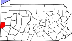 | |
| Boroughs |
| |
| Townships | ||
| Unincorporated communities | ||
| Footnotes | ‡This populated place also has portions in an adjacent county or counties | |