Cooke City-Silver Gate, Montana
| Cooke City-Silver Gate, Montana | |
|---|---|
| CDP | |
|
Entering Cooke City from the East | |
 Location of Cooke City-Silver Gate, Montana | |
| Coordinates: 45°1′3″N 109°56′19″W / 45.01750°N 109.93861°WCoordinates: 45°1′3″N 109°56′19″W / 45.01750°N 109.93861°W | |
| Country | United States |
| State | Montana |
| County | Park |
| Area | |
| • Total | 10.0 sq mi (25.9 km2) |
| • Land | 10.0 sq mi (25.9 km2) |
| • Water | 0.0 sq mi (0.0 km2) |
| Elevation | 7,608 ft (2,318.9 m) |
| Population (2000) | |
| • Total | 140 |
| • Density | 14.0/sq mi (5.4/km2) |
| Time zone | Mountain (MST) (UTC-7) |
| • Summer (DST) | MDT (UTC-6) |
| Area code(s) | 406 |
| FIPS code | 30-17359 |

Cooke City-Silver Gate is a census-designated place (CDP) in Park County, Montana, United States. The population was 140 at the 2000 census. It sits toward the northeast of Yellowstone National Park on a road remaining open during the winter connecting through Tower Junction to Mammoth and north to Livingston, Montana. During the summer the road opens eastward to connect to Red Lodge, Montana via the Beartooth Highway on a scenic route rising about 10,000 feet elevation through the Absaroka Mountains. Its chief industry is tourism, which during the winter includes snowmobiling.
Geography
Cooke City-Silver Gate is located at 45°1′3″N 109°56′19″W / 45.01750°N 109.93861°W (45.017378, −109.938599),[1] at an elevation of 7,608 feet (2,318 m).[2]
According to the United States Census Bureau, the CDP has a total area of 10.0 square miles (26 km2), all of it land.
Climate
| Climate data for 2 Miles West of Cooke City, Montana | |||||||||||||
|---|---|---|---|---|---|---|---|---|---|---|---|---|---|
| Month | Jan | Feb | Mar | Apr | May | Jun | Jul | Aug | Sep | Oct | Nov | Dec | Year |
| Record high °F (°C) | 48 (9) |
54 (12) |
58 (14) |
72 (22) |
80 (27) |
88 (31) |
90 (32) |
88 (31) |
85 (29) |
76 (24) |
58 (14) |
47 (8) |
90 (32) |
| Average high °F (°C) | 24.3 (−4.3) |
30.1 (−1.1) |
37.1 (2.8) |
44.4 (6.9) |
54.2 (12.3) |
64.5 (18.1) |
74.0 (23.3) |
72.2 (22.3) |
62.4 (16.9) |
48.6 (9.2) |
32.1 (0.1) |
23.6 (−4.7) |
47.29 (8.48) |
| Daily mean °F (°C) | 14.3 (−9.8) |
17.9 (−7.8) |
24.4 (−4.2) |
31.6 (−0.2) |
40.8 (4.9) |
49.1 (9.5) |
56.2 (13.4) |
54.6 (12.6) |
46.1 (7.8) |
35.6 (2) |
22.3 (−5.4) |
14.1 (−9.9) |
33.92 (1.07) |
| Average low °F (°C) | 4.3 (−15.4) |
5.7 (−14.6) |
11.8 (−11.2) |
18.8 (−7.3) |
27.5 (−2.5) |
33.7 (0.9) |
38.5 (3.6) |
37.0 (2.8) |
29.9 (−1.2) |
22.6 (−5.2) |
12.4 (−10.9) |
4.6 (−15.2) |
20.57 (−6.35) |
| Record low °F (°C) | −41 (−41) |
−43 (−42) |
−27 (−33) |
−18 (−28) |
1 (−17) |
20 (−7) |
22 (−6) |
20 (−7) |
3 (−16) |
−13 (−25) |
−23 (−31) |
−42 (−41) |
−43 (−42) |
| Average precipitation inches (mm) | 2.30 (58.4) |
1.76 (44.7) |
1.93 (49) |
1.96 (49.8) |
2.75 (69.9) |
3.14 (79.8) |
2.05 (52.1) |
2.03 (51.6) |
1.87 (47.5) |
1.70 (43.2) |
2.08 (52.8) |
2.27 (57.7) |
25.84 (656.5) |
| Average snowfall inches (cm) | 40.7 (103.4) |
29.4 (74.7) |
26.5 (67.3) |
18.6 (47.2) |
9.3 (23.6) |
2.2 (5.6) |
0.0 (0) |
0.0 (0) |
2.2 (5.6) |
11.1 (28.2) |
29.5 (74.9) |
39.4 (100.1) |
208.9 (530.6) |
| Average precipitation days (≥ 0.01 in) | 17 | 13 | 13 | 11 | 14 | 13 | 11 | 11 | 10 | 10 | 14 | 16 | 153 |
| Source: [3][4] | |||||||||||||
Demographics
As of the census[5] of 2000, there were 140 people, 79 households, and 27 families residing in the CDP. The population density was 14.0 people per square mile (5.4/km²). There were 247 housing units at an average density of 24.7 per square mile (9.5/km²). The racial makeup of the CDP was 97.86% White, 0.71% African American, 0.71% Native American, and 0.71% from two or more races.
There were 79 households out of which 11.4% had children under the age of 18 living with them, 29.1% were married couples living together, 5.1% had a female householder with no husband present, and 65.8% were non-families. 40.5% of all households were made up of individuals and 11.4% had someone living alone who was 65 years of age or older. The average household size was 1.77 and the average family size was 2.44.
In the CDP the population was spread out with 8.6% under the age of 18, 4.3% from 18 to 24, 42.1% from 25 to 44, 35.0% from 45 to 64, and 10.0% who were 65 years of age or older. The median age was 43 years. For every 100 females there were 122.2 males. For every 100 females age 18 and over, there were 113.3 males.
The median income for a household in the CDP was $25,000, and the median income for a family was $50,625. Males had a median income of $38,125 versus $17,813 for females. The per capita income for the CDP was $31,618. There were 7.4% of families and 15.8% of the population living below the poverty line, including 18.2% of under eighteens and 10.5% of those over 64.
| Images of Cooke City-Silver Gate, Montana | ||||
|---|---|---|---|---|
|


References
- ↑ "US Gazetteer files: 2010, 2000, and 1990". United States Census Bureau. 2011-02-12. Retrieved 2011-04-23.
- ↑ "Elevation of Montana Cities and Towns". geoinfo.msl.mt.gov. Retrieved 2016-11-27.
- ↑ "Cooke City 2 W Climate Summary - Temperature". Western Regional Climate Center. Retrieved July 1, 2012.
- ↑ "Cooke City 2 W Climate Summary - Precipitation". Western Regional Climate Center. Retrieved July 1, 2012.
- ↑ "American FactFinder". United States Census Bureau. Archived from the original on 2013-09-11. Retrieved 2008-01-31.
| Wikivoyage has a travel guide for Cooke City. |
| Wikimedia Commons has media related to Cooke City, Montana. |
Municipalities and communities of Park County, Montana, United States | ||
|---|---|---|
| City | 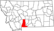 | |
| Town | ||
| CDPs | ||
| Unincorporated communities | ||
| Ghost towns | ||
Yellowstone National Park - Tower-Roosevelt and Lamar Valley | ||
|---|---|---|
Geography, historic structures and other attractions in the Tower Roosevelt and Lamar Valley areas | ||
| Structures and History |  | |
| Geography and Geology |
| |
| ||