Clymer, Pennsylvania
| Clymer, Pennsylvania | |
|---|---|
| Borough | |
|
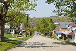
Sixth Street, looking northwest from Wolcott Street | |
 Clymer, Pennsylvania | |
| Coordinates: 40°40′08″N 79°00′43″W / 40.66889°N 79.01194°WCoordinates: 40°40′08″N 79°00′43″W / 40.66889°N 79.01194°W | |
| Country | United States |
| State | Pennsylvania |
| County | Indiana |
| Settled | 1905 |
| Incorporated | 1908 |
| Government | |
| • Type | Borough Council |
| • Mayor | Dennis Clawson |
| Area | |
| • Total | 0.6 sq mi (2 km2) |
| Population (2010) | |
| • Total | 1,357 |
| • Density | 2,606.6/sq mi (1,006.4/km2) |
| Time zone | Eastern (EST) (UTC-5) |
| • Summer (DST) | EDT (UTC-4) |
| Zip code | 15728 |
| Area code(s) | 724 |
| Website | Clymer Borough |
Clymer is a borough in Cherry Hill (sometimes written as "Cherryhill") Township,[1] Indiana County, Pennsylvania, United States. The population was 1,357 at the 2010 census. The community was named after George Clymer, one of the signers of the United States Declaration of Independence.
Geography
Clymer is located at 40°40′8″N 79°0′43″W / 40.66889°N 79.01194°W (40.668977, -79.011925).[2]
According to the United States Census Bureau, the borough has a total area of 0.6 square miles (1.6 km2), all of it land.
Demographics
| Historical population | |||
|---|---|---|---|
| Census | Pop. | %± | |
| 1910 | 1,753 | — | |
| 1920 | 2,867 | 63.5% | |
| 1930 | 2,672 | −6.8% | |
| 1940 | 3,062 | 14.6% | |
| 1950 | 2,500 | −18.4% | |
| 1960 | 2,251 | −10.0% | |
| 1970 | 2,054 | −8.8% | |
| 1980 | 1,761 | −14.3% | |
| 1990 | 1,499 | −14.9% | |
| 2000 | 1,547 | 3.2% | |
| 2010 | 1,357 | −12.3% | |
| Est. 2015 | 1,315 | [3] | −3.1% |
| Sources:[4][5][6] | |||
As of the census[5] of 2000, there were 1,547 people, 679 households, and 418 families residing in the borough. The population density was 2,606.6 people per square mile (1,012.4/km²). There were 734 housing units at an average density of 1,236.8 per square mile (480.3/km²). The racial makeup of the borough was 99.55% White, 0.19% Native American, 0.06% Asian, 0.06% from other races, and 0.13% from two or more races. Hispanic or Latino of any race were 0.19% of the population.
There were 679 households, out of which 27.0% had children under the age of 18 living with them, 44.9% were married couples living together, 12.5% had a female householder with no husband present, and 38.3% were non-families. 35.1% of all households were made up of individuals, and 21.6% had someone living alone who was 65 years of age or older. The average household size was 2.28 and the average family size was 2.97.
In the borough the population was spread out, with 22.9% under the age of 18, 7.4% from 18 to 24, 27.1% from 25 to 44, 21.6% from 45 to 64, and 20.9% who were 65 years of age or older. The median age was 39 years. For every 100 females there were 81.6 males. For every 100 females age 18 and over, there were 76.3 males.
The median income for a household in the borough was $24,688, and the median income for a family was $36,688. Males had a median income of $29,375 versus $25,000 for females. The per capita income for the borough was $14,250. About 14.5% of families and 16.5% of the population were below the poverty line, including 21.6% of those under age 18 and 15.9% of those age 65 or over.
References
- ↑ DeLorme's Pennsylvania Atlas & Gazetteer, p. 59, map grid C6
- ↑ "US Gazetteer files: 2010, 2000, and 1990". United States Census Bureau. 2011-02-12. Retrieved 2011-04-23.
- ↑ "Annual Estimates of the Resident Population for Incorporated Places: April 1, 2010 to July 1, 2015". Retrieved July 2, 2016.
- ↑ "Census of Population and Housing". U.S. Census Bureau. Archived from the original on 11 May 2015. Retrieved 11 December 2013.
- 1 2 "American FactFinder". United States Census Bureau. Archived from the original on 2013-09-11. Retrieved 2008-01-31.
- ↑ "Incorporated Places and Minor Civil Divisions Datasets: Subcounty Resident Population Estimates: April 1, 2010 to July 1, 2012". Population Estimates. U.S. Census Bureau. Archived from the original on 17 June 2013. Retrieved 11 December 2013.
External links
Municipalities and communities of Indiana County, Pennsylvania, United States | ||
|---|---|---|
| Boroughs | 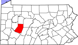 | |
| Townships | ||
| CDPs | ||
| Unincorporated communities | ||
| Counties |  Map of the Pittsburgh Tri-State with green counties in the metropolitan area and yellow counties in the combined area. | |
|---|---|---|
| Major cities | ||
| Cities and towns 15k-50k (in 2010) | ||
| Airports | ||
| Topics | ||
| ||