Centreville, Illinois
| Centreville | |
| City | |
| Country | United States |
|---|---|
| State | Illinois |
| County | St. Clair |
| Coordinates | 41°35′4″N 90°6′14″W / 41.58444°N 90.10389°WCoordinates: 41°35′4″N 90°6′14″W / 41.58444°N 90.10389°W |
| Area | 4.29 sq mi (11 km2) |
| - land | 4.24 sq mi (11 km2) |
| - water | 0.06 sq mi (0 km2) |
| Population | 5,951 (2000) |
| Density | 1,373.3/sq mi (530/km2) |
| Timezone | CST (UTC-6) |
| - summer (DST) | CDT (UTC-5) |
| Postal code | 62207 |
| Area code | 618 |
 Location in St. Clair County and the state of Illinois.
| |
.svg.png) Location of Illinois in the United States
| |
| Wikimedia Commons: Centreville, Illinois | |
Centreville is a city in St. Clair County, Illinois, United States. The population was 5,309 in 2010, down from 5,951 at the 2000 census.
Geography
Centreville is located at 38°35′4″N 90°6′14″W / 38.58444°N 90.10389°W (38.584583, -90.103768).[1]
According to the 2010 census, Centreville has a total area of 4.287 square miles (11.10 km2), of which 4.23 square miles (10.96 km2) (or 98.67%) is land and 0.057 square miles (0.15 km2) (or 1.33%) is water.[2]
Demographics
| Historical population | |||
|---|---|---|---|
| Census | Pop. | %± | |
| 1870 | 1,116 | — | |
| 1960 | 12,769 | — | |
| 1970 | 11,378 | −10.9% | |
| 1980 | 9,747 | −14.3% | |
| 1990 | 7,489 | −23.2% | |
| 2000 | 5,951 | −20.5% | |
| 2010 | 5,309 | −10.8% | |
| Est. 2015 | 5,027 | [3] | −5.3% |
As of the census[5] of 2000, there were 5,951 people, 2,125 households, and 1,476 families residing in the city. The population density was 1,373.3 people per square mile (530.6/km²). There were 2,363 housing units at an average density of 545.3 per square mile (210.7/km²). The racial makeup of the city was 95.46% African American, 3.38% White, 0.13% Native American, 0.02% Pacific Islander, 0.13% from other races, and 0.87% from two or more races. Hispanic or Latino of any race were 0.57% of the population.
There were 2,125 households out of which 34.8% had children under the age of 18 living with them, 27.5% were married couples living together, 35.2% had a female householder with no husband present, and 30.5% were non-families. 26.8% of all households were made up of individuals and 11.8% had someone living alone who was 65 years of age or older. The average household size was 2.80 and the average family size was 3.38.
In the city the population was spread out with 33.5% under the age of 18, 9.2% from 18 to 24, 23.9% from 25 to 44, 20.1% from 45 to 64, and 13.2% who were 65 years of age or older. The median age was 31 years. For every 100 females there were 85.3 males. For every 100 females age 18 and over, there were 77.2 males.
The median income for a household in the city was $23,500, and the median income for a family was $27,310. Males had a median income of $32,024 versus $23,528 for females. The per capita income for the city was $11,150. About 28.7% of families and 34.4% of the population were below the poverty line, including 48.4% of those under age 18 and 14.6% of those age 65 or over.
Notable people
- Edward Burch, alternative country musician
- John Dettmer, pitcher for the Texas Rangers
- Byron Gettis, outfielder for the Kansas City Royals
- Reginald Hudlin, film director
Education
Some of the city is served by Cahokia Unit School District 187. Lalumier K-8 School is located in Centreville.[6] Centerville K-8 is located in an unincorporated area near Centreville.[7]
Some of the city is served by East St. Louis School District 189. Brown Elementary School is located in Centreville.[8][9]
Culture
The Centreville Cultural Union is an association aimed at preserving the rich heritage and history of Centreville, such as the Centreville skirmish which took place during the American Civil War, a little known battle between local militia against splinters from the Confederate army after the Battle of Barbourville.[10] It is located on 1518 N 56th St, East St Louis, 62204.
References
- ↑ "US Gazetteer files: 2010, 2000, and 1990". United States Census Bureau. 2011-02-12. Retrieved 2011-04-23.
- ↑ "G001 - Geographic Identifiers - 2010 Census Summary File 1". United States Census Bureau. Retrieved 2015-12-25.
- ↑ "Annual Estimates of the Resident Population for Incorporated Places: April 1, 2010 to July 1, 2015". Retrieved July 2, 2016.
- ↑ "Census of Population and Housing". Census.gov. Archived from the original on May 11, 2015. Retrieved June 4, 2015.
- ↑ "American FactFinder". United States Census Bureau. Archived from the original on 2013-09-11. Retrieved 2008-01-31.
- ↑ "Lalumier Elementary School." Cahokia Unit School District 187. Retrieved on January 24, 2011. "6702 Bond Ave."
- ↑ "Centerville Elementary School." Cahokia Unit School District 187. Retrieved on January 24, 2011. "3429 Camp Jackson."
- ↑ "Brown Elementary School." East St. Louis School District 189. Retrieved on January 24, 2011. "4901 Market St. East St. Louis , IL 62207."
- ↑ "Centreville city, Illinois." U.S. Census Bureau. Retrieved on January 24, 2011.
- ↑ http://www.cityofcentreville-il.com/virtual-tour/
Municipalities and communities of St. Clair County, Illinois, United States | ||
|---|---|---|
| Cities | ||
| Villages | ||
| Townships | ||
| CDPs | ||
| Other unincorporated communities | ||
| Footnotes | ‡This populated place also has portions in an adjacent county or counties | |
| Counties | 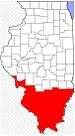 | |
|---|---|---|
| Mid-sized cities (25,000+) | ||
| Small Cities (10,000-25,000) | ||
| Small Cities (5,000-10,000) | ||
| Interstates | ||
| Airports/Military bases |
| |
| Universities | ||
| Colleges | ||
| Sports teams based in the Southern Illinois | ||