Dupo, Illinois
| Dupo | |
| Village | |
| Country | United States |
|---|---|
| State | Illinois |
| County | St. Clair |
| Elevation | 410 ft (125 m) |
| Coordinates | 38°30′57″N 90°12′29″W / 38.51583°N 90.20806°WCoordinates: 38°30′57″N 90°12′29″W / 38.51583°N 90.20806°W |
| Area | 4.42 sq mi (11 km2) |
| - land | 4.42 sq mi (11 km2) |
| - water | 0.00 sq mi (0 km2) |
| Population | 3,933 (2000) |
| Density | 888.6/sq mi (343/km2) |
| Timezone | CST (UTC-6) |
| - summer (DST) | CDT (UTC-5) |
| Postal code | 62239 |
| Area code | 618 |
| FIPS code | 17-21254 |
| GNIS ID | 2398759 |
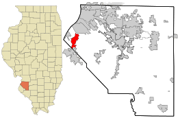 Location in St. Clair County and the state of Illinois. | |
.svg.png) Location of Illinois in the United States | |
| Wikimedia Commons: Dupo, Illinois | |
Dupo is a village in St. Clair County, Illinois, United States. The population was 4,138 at the 2010 census, an increase from 3,933 in 2000. The village was settled in about 1750 and was incorporated in 1876. Its name is derived from Common Fields of Prairie du Pont (French: Bridge Prairie).
Geography
Dupo is located at 38°30′57″N 90°12′29″W / 38.51583°N 90.20806°W (38.515702, -90.207992).[1] It is located in the American Bottom floodplain of the Mississippi River.
According to the 2010 census, Dupo has a total area of 4.42 square miles (11.45 km2), all land.[2]
History
Dupo had its start ca. 1905 when the railroad was extended to that point.[3] The name is an abbreviation of DuPont.[4]
Demographics
| Historical population | |||
|---|---|---|---|
| Census | Pop. | %± | |
| 1910 | 433 | — | |
| 1920 | 1,393 | 221.7% | |
| 1930 | 2,082 | 49.5% | |
| 1940 | 2,073 | −0.4% | |
| 1950 | 2,239 | 8.0% | |
| 1960 | 2,937 | 31.2% | |
| 1970 | 2,842 | −3.2% | |
| 1980 | 3,039 | 6.9% | |
| 1990 | 3,164 | 4.1% | |
| 2000 | 3,933 | 24.3% | |
| 2010 | 4,138 | 5.2% | |
| Est. 2015 | 3,921 | [5] | −5.2% |
As of the census[7] of 2000, there were 3,933 people, 1,557 households, and 1,063 families residing in the village. The population density was 888.6 people per square mile (342.8/km²). There were 1,668 housing units at an average density of 376.9 per square mile (145.4/km²). The racial makeup of the village was 97.20% White, 1.17% African American, 0.31% Native American, 0.25% Asian, 0.36% from other races, and 0.71% from two or more races. Hispanic or Latino of any race were 0.69% of the population.
There were 1,557 households out of which 32.6% had children under the age of 18 living with them, 52.9% were married couples living together, 11.0% had a female householder with no husband present, and 31.7% were non-families. 26.1% of all households were made up of individuals and 10.9% had someone living alone who was 65 years of age or older. The average household size was 2.53 and the average family size was 3.04.
In the village the population was spread out with 25.2% under the age of 18, 10.7% from 18 to 24, 30.5% from 25 to 44, 21.4% from 45 to 64, and 12.1% who were 65 years of age or older. The median age was 35 years. For every 100 females there were 96.0 males. For every 100 females age 18 and over, there were 92.9 males.
The median income for a household in the village was $43,036, and the median income for a family was $47,000. Males had a median income of $35,529 versus $24,135 for females. The per capita income for the village was $18,505. About 2.9% of families and 4.3% of the population were below the poverty line, including 5.2% of those under age 18 and 3.8% of those age 65 or over.
Notable person
- Candace Jordan, television personality, Playboy Playmate December 1979
See also
References
- ↑ "US Gazetteer files: 2010, 2000, and 1990". United States Census Bureau. 2011-02-12. Retrieved 2011-04-23.
- ↑ "G001 - Geographic Identifiers - 2010 Census Summary File 1". United States Census Bureau. Retrieved 2015-08-02.
- ↑ Callary, Edward (29 September 2008). Place Names of Illinois. University of Illinois Press. p. 101. ISBN 978-0-252-09070-7.
- ↑ Society, Illinois State Historical (1915). Papers in Illinois History and Transactions. Society. p. 97.
- ↑ "Annual Estimates of the Resident Population for Incorporated Places: April 1, 2010 to July 1, 2015". Retrieved July 2, 2016.
- ↑ "Census of Population and Housing". Census.gov. Retrieved June 4, 2015.
- ↑ "American FactFinder". United States Census Bureau. Retrieved 2008-01-31.
Municipalities and communities of St. Clair County, Illinois, United States | ||
|---|---|---|
| Cities | ||
| Villages | ||
| Townships | ||
| CDPs | ||
| Other unincorporated communities | ||
| Footnotes | ‡This populated place also has portions in an adjacent county or counties | |