Franklin County, Illinois
| Franklin County, Illinois | |
|---|---|
 Franklin County Courthouse in Benton | |
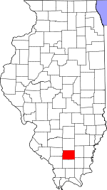 Location in the U.S. state of Illinois | |
 Illinois's location in the U.S. | |
| Founded | January 2, 1818 |
| Named for | Benjamin Franklin |
| Seat | Benton |
| Largest city | West Frankfort |
| Area | |
| • Total | 431 sq mi (1,116 km2) |
| • Land | 409 sq mi (1,059 km2) |
| • Water | 23 sq mi (60 km2), 5.2% |
| Population | |
| • (2010) | 39,561 |
| • Density | 97/sq mi (37/km²) |
| Congressional district | 12th |
| Time zone | Central: UTC-6/-5 |
| Website |
www |
Franklin County is a county located in the U.S. state of Illinois. According to the 2010 census, it has a population of 39,561.[1] Its county seat is Benton.[2] It is located in the southern portion of Illinois known locally as "Little Egypt".
History
Franklin County was established on January 2, 1818 and formed from parts of Gallatin and White counties. It was named for Benjamin Franklin.[3]
 Franklin County at the time of its formation in 1818
 The creation of Williamson County in 1839 reduced Franklin to its current borders.
Geography
According to the U.S. Census Bureau, the county has a total area of 431 square miles (1,120 km2), of which 409 square miles (1,060 km2) is land and 23 square miles (60 km2) (5.2%) is water.[4] Justin Kay State Recreation Area is located in this county.
Climate and weather
| Benton, Illinois | ||||||||||||||||||||||||||||||||||||||||||||||||||||||||||||
|---|---|---|---|---|---|---|---|---|---|---|---|---|---|---|---|---|---|---|---|---|---|---|---|---|---|---|---|---|---|---|---|---|---|---|---|---|---|---|---|---|---|---|---|---|---|---|---|---|---|---|---|---|---|---|---|---|---|---|---|---|
| Climate chart (explanation) | ||||||||||||||||||||||||||||||||||||||||||||||||||||||||||||
| ||||||||||||||||||||||||||||||||||||||||||||||||||||||||||||
| ||||||||||||||||||||||||||||||||||||||||||||||||||||||||||||
In recent years, average temperatures in the county seat of Benton have ranged from a low of 21 °F (−6 °C) in January to a high of 90 °F (32 °C) in July, although a record low of −22 °F (−30 °C) was recorded in January 1977 and a record high of 104 °F (40 °C) was recorded in August 2007. Average monthly precipitation ranged from 2.87 inches (73 mm) in February to 4.59 inches (117 mm) in May.[5]
Adjacent counties
- Jefferson County (north)
- Hamilton County (east)
- Saline County (southeast)
- Williamson County (south)
- Jackson County (southwest)
- Perry County (west)
Major highways
Demographics
| Historical population | |||
|---|---|---|---|
| Census | Pop. | %± | |
| 1820 | 1,763 | — | |
| 1830 | 4,083 | 131.6% | |
| 1840 | 3,682 | −9.8% | |
| 1850 | 5,681 | 54.3% | |
| 1860 | 9,393 | 65.3% | |
| 1870 | 12,652 | 34.7% | |
| 1880 | 16,129 | 27.5% | |
| 1890 | 17,138 | 6.3% | |
| 1900 | 19,675 | 14.8% | |
| 1910 | 25,943 | 31.9% | |
| 1920 | 57,293 | 120.8% | |
| 1930 | 59,442 | 3.8% | |
| 1940 | 53,137 | −10.6% | |
| 1950 | 48,685 | −8.4% | |
| 1960 | 39,281 | −19.3% | |
| 1970 | 38,329 | −2.4% | |
| 1980 | 43,201 | 12.7% | |
| 1990 | 40,319 | −6.7% | |
| 2000 | 39,018 | −3.2% | |
| 2010 | 39,561 | 1.4% | |
| Est. 2015 | 39,485 | [6] | −0.2% |
| U.S. Decennial Census[7] 1790-1960[8] 1900-1990[9] 1990-2000[10] 2010-2013[1] | |||
As of the 2010 United States Census, there were 39,561 people, 16,617 households, and 10,912 families residing in the county.[11] The population density was 96.8 inhabitants per square mile (37.4/km2). There were 18,525 housing units at an average density of 45.3 per square mile (17.5/km2).[4] The racial makeup of the county was 97.7% white, 0.3% Asian, 0.3% American Indian, 0.3% black or African American, 0.3% from other races, and 1.1% from two or more races. Those of Hispanic or Latino origin made up 1.2% of the population.[11] In terms of ancestry, 21.8% were German, 18.7% were Irish, 15.9% were English, 9.4% were American, and 5.7% were Italian.[12]
Of the 16,617 households, 30.0% had children under the age of 18 living with them, 48.8% were married couples living together, 11.6% had a female householder with no husband present, 34.3% were non-families, and 30.0% of all households were made up of individuals. The average household size was 2.35 and the average family size was 2.88. The median age was 41.8 years.[11]
The median income for a household in the county was $34,381 and the median income for a family was $43,170. Males had a median income of $39,122 versus $28,950 for females. The per capita income for the county was $18,504. About 14.5% of families and 19.8% of the population were below the poverty line, including 30.5% of those under age 18 and 9.9% of those age 65 or over.[13]
Communities

Cities
Villages
Townships
Franklin County is divided into twelve townships:
Education Services
Regional
Primary & Secondary
- Christopher Unit School District #99
- Sesser Unit School District #196
- Benton School District #47
- Frankfort Community Unit School District #168
- Zeigler-Royalton Community Unit School District #188
- Thompsonville Community Unit School District #174
- Ewing-Northern Community Unit School District #115
Higher Education
- Morthland College - West Frankfort
- John A. Logan College Extension Center - West Frankfort
Specialized
See also
References
- United States Census Bureau 2007 TIGER/Line Shapefiles
- United States Board on Geographic Names (GNIS)
- United States National Atlas
- 1 2 "State & County QuickFacts". United States Census Bureau. Retrieved July 5, 2014.
- ↑ "Find a County". National Association of Counties. Retrieved 2011-06-07.
- ↑ Gannett, Henry (1905). The Origin of Certain Place Names in the United States. Govt. Print. Off. p. 131.
- 1 2 "Population, Housing Units, Area, and Density: 2010 - County". United States Census Bureau. Retrieved 2015-07-11.
- 1 2 "Monthly Averages for Benton, Illinois". The Weather Channel. Retrieved 2011-01-27.
- ↑ "County Totals Dataset: Population, Population Change and Estimated Components of Population Change: April 1, 2010 to July 1, 2015". Retrieved July 2, 2016.
- ↑ "U.S. Decennial Census". United States Census Bureau. Retrieved July 5, 2014.
- ↑ "Historical Census Browser". University of Virginia Library. Retrieved July 5, 2014.
- ↑ "Population of Counties by Decennial Census: 1900 to 1990". United States Census Bureau. Retrieved July 5, 2014.
- ↑ "Census 2000 PHC-T-4. Ranking Tables for Counties: 1990 and 2000" (PDF). United States Census Bureau. Retrieved July 5, 2014.
- 1 2 3 "DP-1 Profile of General Population and Housing Characteristics: 2010 Demographic Profile Data". United States Census Bureau. Retrieved 2015-07-11.
- ↑ "DP02 SELECTED SOCIAL CHARACTERISTICS IN THE UNITED STATES – 2006-2010 American Community Survey 5-Year Estimates". United States Census Bureau. Retrieved 2015-07-11.
- ↑ "DP03 SELECTED ECONOMIC CHARACTERISTICS – 2006-2010 American Community Survey 5-Year Estimates". United States Census Bureau. Retrieved 2015-07-11.
 |
Jefferson County | | ||
| Perry County | |
Hamilton County | ||
| ||||
| | ||||
| Jackson County | Williamson County | Saline County |
Municipalities and communities of Franklin County, Illinois, United States | ||
|---|---|---|
| Cities | ||
| Villages | ||
| Townships | ||
| CDP | ||
| Other unincorporated communities | ||

| Counties |  | |
|---|---|---|
| Mid-sized cities (25,000+) | ||
| Small Cities (10,000-25,000) | ||
| Small Cities (5,000-10,000) | ||
| Interstates | ||
| Airports/Military bases |
| |
| Universities | ||
| Colleges | ||
| Sports teams based in the Southern Illinois | ||
Coordinates: 37°59′N 88°55′W / 37.99°N 88.92°W