Central Coast Council, New South Wales
| Central Coast Council New South Wales | |||||||||||||
|---|---|---|---|---|---|---|---|---|---|---|---|---|---|
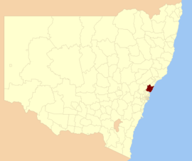 Location of Central Coast LGA in NSW | |||||||||||||
| Population | 331,007 (2015)[1] (6th) | ||||||||||||
| • Density | 176.68/km2 (457.6/sq mi) | ||||||||||||
| Established | 12 May 2016 | ||||||||||||
| Area | 1,681 km2 (649.0 sq mi)[2] | ||||||||||||
| Time zone | AEST (UTC+10) | ||||||||||||
| • Summer (DST) | AEDT (UTC+11) | ||||||||||||
| Administrator | Ian Reynolds | ||||||||||||
| Region | Central Coast | ||||||||||||
| State electorate(s) | |||||||||||||
| Federal Division(s) | |||||||||||||
|
| |||||||||||||
| Website | Central Coast Council | ||||||||||||
| |||||||||||||
The Central Coast Council is a local government area serving the Central Coast region of New South Wales, Australia, established on 12 May 2016 following the amalgamation of Gosford City and Wyong Shire councils.[2]
The council comprises an area of 1,681 square kilometres (649 sq mi) and is bounded to the east by the Tasman Sea, to the south by Broken Bay and the Hawkesbury River, and to the west by the Yengo National Park northwards to Bucketty before heading eastward along George Downes Drive, encompassing the Olney State Forest and crossing the Pacific Motorway, meeting the southern edge of Lake Macquarie at Mannering Park and eventually reaching the coast north of Moonee. At the time of the council's establishment it had an estimated population of 331,007.[2]
The Administrator of the Central Coast Council is Ian Reynolds, pending elections to be held on 9 September 2017.[2]
Demographics
At the 2011 Census the former Gosford local government area had a population of 162,440;[3] while the former Wyong local government area had a population of 149,746.[4] This gave a nominal 2011 population of 312,186 for the Central Coast local government area; estimated as 331,007 in 2016 at the time of the council's establishment.[2]
Council
Administration
Pending the election to be held in September 2017, the local government area is administered by Ian Reynolds, with former Wyong Shire Acting General Manager Rob Noble appointed as Interim General Manager and Gosford City General Manager Paul Anderson appointed Deputy General Manager.[5]
Wards
Will comprise fifteen Councillors elected proportionally in five wards with three Councillors elected in each ward. All Councillors are expected to be elected for a fixed four-year term of office with effect from 9 September 2017. The councillors will be elected to serve each of the following wards:
- Gosford West – encompassing the former City of Gosford west of the Pacific Motorway, this ward also includes Kariong, East Gosford, Gosford, West Gosford and all other residents between the western edges of Brisbane Water and Broken Bay and the motorway;
- Gosford East – generally encompassing the remainder of the former City of Gosford, with the exception of Forresters Beach, Lisarow, Mount Elliot, Narara, Niagara Park, North Gosford, Wamberal and Wyoming;
- The Entrance – encompasses the portion of Wyong Shire along the eastern side of Tuggerah Lake to Magenta, the southern edge to Tuggerah and following the Main North railway line southward to Fountaindale, this ward also includes Forresters Beach, and Wamberal;
- Wyong – encompassing the former Wyong Shire west of the Pacific Motorway, this ward includes the portion of the shire east of the motorway to the western edge of Tuggerah Lake and south of Sparks Road not in The Entrance ward (with the exception of Hamlyn Terrace), as well as Bushells Ridge, Lisarow, Mount Elliot, Narara, Niagara Park, and Wallarah;
- Budgewoi – encompassing the remainder of the former Wyong Shire, including Hamlyn Terrace, Noraville, Norah Head, and Toukley.
Suburbs and localities
The local government area includes a moderately densely populated coastal strip that extends northward from the Hawkesbury River and is bounded by the Pacific Motorway to the west, and an extensive sparsely-populated region to the west of the motorway that is largely native bush. The towns and villages located within Central Coast Council are:
- Alison
- Avoca Beach
- Bar Point
- Bateau Bay
- Bensville
- Berkeley Vale
- Blackwall
- Blue Bay
- Blue Haven
- Booker Bay
- Bouddi
- Box Head
- Budgewoi
- Budgewoi Peninsula
- Buff Point
- Calga
- Canton Beach
- Cedar Brush
- Central Mangrove
- Chain Valley Bay
- Charmhaven
- Cheero Point
- Chittaway Bay
- Chittaway Point
- Cogra Bay
- Colongra
- Copacabana
- Daleys Point
- Davistown
- Dooralong
- Doyalson
- East Gosford
- Empire Bay
- Erina
- Erina Heights
- Ettalong Beach
- Forresters Beach
- Fountaindale
- Glenning Valley
- Glenworth Valley
- Gorokan
- Gosford
- Green Point
- Greengrove
- Gunderman
- Gwandalan
- Halekulani
- Hamlyn Terrace
- Hardys Bay
- Holgate
- Horsfield Bay
- Jilliby
- Kangy Angy
- Kanwal
- Kariong
- Killarney Vale
- Killcare
- Killcare Heights
- Kincumber
- Kincumber South
- Koolewong
- Kulnura
- Lake Haven
- Lake Munmorah
- Lemon Tree
- Little Jilliby
- Lisarow
- Little Wobby
- Long Jetty
- Lower Mangrove
- MacMasters Beach
- Magenta
- Mangrove Creek
- Mangrove Mountain
- Mannering Park
- Mardi
- Marlow
- Matcham
- Mooney Mooney
- Mooney Mooney Creek
- Mount Elliot
- Mount White
- Narara
- Niagara Park
- Norah Head
- Noraville
- North Avoca
- North Gosford
- Ourimbah
- Palm Grove
- Palmdale
- Patonga
- Pearl Beach
- Peats Ridge
- Phegans Bay
- Picketts Valley
- Point Clare
- Point Frederick
- Pretty Beach
- Ravensdale
- Rocky Point
- St Huberts Island
- San Remo
- Saratoga
- Shelly Beach
- Somersby
- Spencer
- Springfield
- Summerland Point
- Tacoma
- Tacoma South
- Tascott
- Terrigal
- The Entrance
- The Entrance North
- Toowoon Bay
- Toukley
- Tuggerah
- Tuggerawong
- Tumbi Umbi
- Umina
- Upper Mangrove
- Wadalba
- Wagstaffe
- Wallarah
- Wamberal
- Warnervale
- Watanobbi
- Wendoree Park
- West Gosford
- Wisemans Ferry
- Wondabyne
- Woongarrah
- Woy Woy
- Woy Woy Bay
- Wyoming
- Wyong
- Wyong Creek
- Wyongah
- Yarramalong
- Yattalunga
See also
References
- ↑ "3218.0 – Regional Population Growth, Australia, 2014–15". Australian Bureau of Statistics. Retrieved 29 September 2016.
- 1 2 3 4 5 "Central Coast Council". Stronger Councils. Government of New South Wales. 12 May 2016. Retrieved 14 May 2016.
- ↑ Australian Bureau of Statistics (31 October 2012). "Gosford (C)". 2011 Census QuickStats. Retrieved 27 December 2012.
- ↑ Australian Bureau of Statistics (31 October 2012). "Wyong (A)". 2011 Census QuickStats. Retrieved 28 November 2012.
- ↑ "Central Coast Council Officially Underway". City of Gosford. 12 May 2016. Retrieved 14 May 2016.
Hawkesbury River region, New South Wales, Australia | |
|---|---|
| Islands | |
| National parks and nature reserves | |
| European explorers of the region | |
| Bridges and ferries | |
| Adjoining rivers, bays, reservoirs, and creeks | |
| Local government areas | |
| Events | |
| |
| Capital | |
|---|---|
| Cities | |