Dharug National Park
| Dharug National Park New South Wales | |
|---|---|
|
IUCN category II (national park) | |
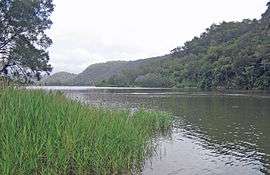 A view from Settlers Road, located adjacent to the national park, looking across the Hawkesbury River. | |
 Dharug National Park | |
| Nearest town or city | Gosford |
| Coordinates | 33°22′08″S 151°03′06″E / 33.36889°S 151.05167°ECoordinates: 33°22′08″S 151°03′06″E / 33.36889°S 151.05167°E |
| Established | 1 October 1967[1] |
| Area | 148.50 km2 (57.3 sq mi)[1] |
| Managing authorities | NSW National Parks & Wildlife Service |
| Website | Dharug National Park |
| See also |
Protected areas of New South Wales |
The Dharug National Park is a protected national park that is located in the Central Coast region of New South Wales, in eastern Australia. The 14,850-hectare (36,700-acre) national park is situated approximately 58 kilometres (36 mi) north of the Sydney central business district and 25 kilometres (16 mi) west of Gosford.
The park contains the Great North Road, one of the eleven UNESCO World Heritage–listed Australian Convict Sites. These eleven sites present the story of the forced migration of convicts and the ideas and practices of punishment and reform of criminals during this time.[2] The relatively intact Devine's Hill and Finch's Line sections of the Old Great North Road, approximately 16 kilometres (9.9 mi) long and contained within the national park,[3] were inscribed on the World Heritage register in July 2010.
Location and features
The park is bounded by the Yengo National Park, the Wisemans Ferry and Old Great North Roads, McPherson State Forest, private land along Mangrove Creek and the townships of Gunderman and Spencer.[3] The Popran National Park is located on the eastern bank of Mangrove Creek and the Marramarra National Park is located on the southern shore of the Hawkesbury River; making the Dharug National Park, when combined with adjoining parks, a virtually contiguous area of protected national park stretching from Jerrys Plains in the Hunter Region in the north to Pennant Hills in the Hills District in the south.[4]
The Dharug National Park lies within the Sydney Basin, a major structural unit of Permian and Triassic age (270-180 million years ago) consisting almost entirely of horizontally bedded sedimentary rocks. The park lies on the northern margin of the Hornsby Plateau; a subdivision of the Sydney Basin.[3]
Etymology
The park derives its name from the indigenous Darug people, who are the traditional custodians of the area.[3]
See also
References
- 1 2 "Dharug National Park: Park management". Office of Environment & Heritage. Government of New South Wales. Retrieved 11 October 2014.
- ↑ "World Heritage Listing - Australian convict sites including the Old Great North Road". Office of Environment & Heritage. Government of New South Wales. 9 June 2011. Retrieved 11 October 2014.
- 1 2 3 4 "Dharug National Park: Plan of management" (PDF). NSW National Parks & Wildlife Service (PDF). Government of New South Wales. July 1997. ISBN 0-7310-7685-0. Retrieved 11 October 2014.
- ↑ Dharug National Park (Map). NSW National Parks & Wildlife Service, Government of New South Wales. Retrieved 11 October 2014.
External links
- "Dharug National Park". NSW National Parks & Wildlife Service. Government of New South Wales.
- Dharug National Park: Mountain Bike Routes (PDF) (Map). NSW National Parks & Wildlife Service, Government of New South Wales. 2010.
- "Dharug National Park: Plan of management" (PDF). NSW National Parks & Wildlife Service (PDF). Government of New South Wales. July 1997. ISBN 0-7310-7685-0.
- "Dharug National Park". Office of Environment & Heritage. Government of New South Wales.
Hawkesbury River region, New South Wales, Australia | |
|---|---|
| Islands | |
| National parks and nature reserves | |
| European explorers of the region | |
| Bridges and ferries | |
| Adjoining rivers, bays, reservoirs, and creeks | |
| Local government areas | |
| Events | |
| |