Murrumbidgee Council
| Murrumbidgee Council New South Wales | |||||||||||||
|---|---|---|---|---|---|---|---|---|---|---|---|---|---|
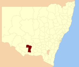 Location in New South Wales | |||||||||||||
| Coordinates | 35°9′S 145°46′E / 35.150°S 145.767°ECoordinates: 35°9′S 145°46′E / 35.150°S 145.767°E | ||||||||||||
| Population | 4,047[1] | ||||||||||||
| • Density | 0.5882/km2 (1.5235/sq mi) | ||||||||||||
| Established | 12 May 2016 | ||||||||||||
| Area | 6,880 km2 (2,656.4 sq mi)[1] | ||||||||||||
| Administrator | Austin Evans | ||||||||||||
| Region | Riverina | ||||||||||||
| State electorate(s) | Albury, Murray | ||||||||||||
| Federal Division(s) | Farrer | ||||||||||||
| |||||||||||||
Murrumbidgee Council is a local government area in the Riverina region of New South Wales, Australia. This area was formed in 2016 from the merger of the Murrumbidgee Shire with the neighbouring Jerilderie Shire.[1]
The combined area comprises 6,880 square kilometres (2,660 sq mi) and covers the urban areas of Coleambally, Darlington Point and Jerilderie and the surrounding cropping and pastoral areas. At the time of its establishmeent, the estimated population of the area was 4,047.[1]
The Administrator of Murrumbidgee Council is former Murrumbidgee Shire councillor Austin Evans, until the elections for councillors to take place on 9 September 2017.
Council
Once elected, Murrumbidgee Council will comprise nine Councillors, with three councillors elected proportionally from three wards - Jerilderie, Murrumbidgee and Murrumbidgee East. All Councillors are expected to be elected for a fixed four-year term of office with effect from 9 September 2017.[1]
See also
References
- 1 2 3 4 5 "Murrumbidgee Council". Stronger Councils. Government of New South Wales. 12 May 2016. Retrieved 13 May 2016.