California Junction, Iowa
| California Junction, Iowa | |
|---|---|
| Unincorporated community | |
 Location of Iowa in the United States | |
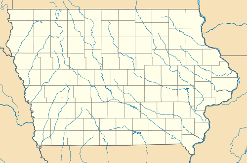 California Junction, Iowa Location in Harrison County in Iowa | |
| Coordinates: 41°33′31″N 95°59′41″W / 41.55861°N 95.99472°WCoordinates: 41°33′31″N 95°59′41″W / 41.55861°N 95.99472°W | |
| Country |
|
| State |
|
| County | Harrison |
| Township | Cincinnati |
| Founded | September 9, 1880 |
| Founded by | Missouri Valley Land Company |
| Area[1] | |
| • Total | 0.461 sq mi (1.19 km2) |
| • Land | 0.461 sq mi (1.19 km2) |
| • Water | 0 sq mi (0 km2) |
| Elevation | 1,007 ft (307 m) |
| Population (2010)[2] | |
| • Total | 85 |
| • Density | 184.38/sq mi (71.19/km2) |
| Time zone | Central (CST) (UTC-6) |
| • Summer (DST) | CDT (UTC-5) |
| ZIP code | 51555 |
| Area code(s) | 712 |
| FIPS code | 19-09910 |
| GNIS feature ID | 455054 |
California Junction is an unincorporated community in Harrison County, Iowa, United States. It lies just east of the junction between the east-west and north-south lines of the former Sioux City and Pacific Railroad. In the 2010 census[2] it had a population of 85 inhabitants and a population density of 184.38 people per square mile (71.19/km²).
Geography
California Junction is located at coordinates 41°33′31″N 95°59′41″W / 41.55861°N 95.99472°W. According to the United States Census Bureau, California Junction has a total area of 0.461 square miles (1.19 km²), all of it land.[1]
Demographics
As of the 2010 census,[2] there were 85 people, 32 households, and 26 families residing in the town. The population density was 184.38 people per square mile (71.19/km²). There were 34 housing units at an average density of 73.75 per square mile (28.57/km²). The racial makeup of the town was 98.82% White and 1.18% from two or more races. Of the total population, 4.7% were Hispanic or Latino of any race.
History
The town of California Junction traces its origins to the Yazoo post office and the ill-fated towns of Cincinnati and Parrish City, which were founded in Cincinnati township during the later half of the 1850s.[3] Yazoo Landing was a ferry crossing on the Missouri River where the Blair Bridge now stands.[4] The present settlement was established in 1880, after the Sioux City and Pacific Railroad was built. John I. Blair, the railroad tycoon, believed that this would be an important hub for passengers heading west, and gave the town its current name.[5][6] In 1883, the name of the town was changed to "California" to avoid confusion with Columbia Junction; it retained this name as of 1915.[3]
In 1879, California Junction had a population of 200 people.[7] In 1903, the California Grain and Lumber Company was organized in California Junction.[8] By 1915, there was also a town hall, high school, general store, blacksmith shop, post office, two churches, and a train station.[3][8] A grain elevator is still operated at California Junction by the United Western Coop.[9]
On January 1, 1922, a 1460-foot deep well was drilled at the nearby oil prospect of Hugh R. Coulthard,[10][11] a prominent landowner, businessman, and farmer from California Junction.[8] No oil was obtained from the site, but the capped well leaks water to this day. A marshy area surrounding the well remains as a local landmark, which is visible about 160 yards north of town on Fremont Ave., about 30 yards west of the roadway.[12]
Education
The community of California Junction and the surrounding rural area educational needs are met by the Missouri Valley Community School District.
Notable people
- James F. O'Connor (1878–1945) U.S. Representative of Montana[13]
References
- 1 2 "US Gazetteer files: 2010, 2000, and 1990". United States Census Bureau. 2011-02-12. Retrieved 2011-04-23.
- 1 2 3 "Find a County". National Association of Counties. Archived from the original on 2011-05-31. Retrieved 2011-06-07.
- 1 2 3 Charles Walter Hunt (1915), History of Harrison County, Iowa, Indianapolis: B. F. Bowen, pp. 394–399
- ↑ Morton, J.S.; Watkins, A.; Miller, G. L. (1913). Illustrated History of Nebraska: A History of Nebraska from the Earliest Explorations of the Trans-Mississippi Region, with Steel Engravings, Photogravures, Copper Plates, Maps, and Tables. J. North. p. 446.
- ↑ Chicago and North Western Railway Company (1908). A History of the Origin of the Place Names Connected with the Chicago & North Western and Chicago, St. Paul, Minneapolis & Omaha Railways. p. 50.
- ↑ Savage, Tom (2007). A dictionary of Iowa place-names. A Bur Oak guide. University of Iowa Press. p. 46. ISBN 978-1-58729-531-7.
- ↑ The North and West illustrated for Tourist, Business, and Pleasure Travel, Chicago, Ill: Chicago & North-Western Railway Co., 1879, p. 24, OCLC 23054179
- 1 2 3 "1915 Harrison County Iowa Biographies". 2010.
- ↑ United Western Co-op, California Junction
- ↑ Norton, WH (1928). "Deep Wells of Iowa": 130.
- ↑ Iowa Geological Survey, Site Record Wnumber 40
- ↑ Location of H. R. Coulthard Oil Prospect
- ↑ "O'CONNOR, James Francis". Biographical Directory of the United States Congress. Retrieved 2011-01-16.
External links
Metropolitan area of Omaha–Council Bluffs | ||||||||
|---|---|---|---|---|---|---|---|---|
| Primary Cities |
|  | ||||||
| Cities over 10,000 (per 2010 Census) |
| |||||||
| Cities of 5,000 to 10,000 (per 2010 Census) |
| |||||||
| Cities of 1,000 to 5,000 (per 2010 Census) |
| |||||||
| Census-designated places |
| |||||||
| Cities and villages of fewer than 1,000 (per 2010 Census) |
| |||||||
| Counties |
| |||||||
Municipalities and communities of Harrison County, Iowa, United States | ||
|---|---|---|
| Cities | ||
| Townships |
| |
| CDPs | ||
| Other unincorporated communities | ||
| Footnotes | ‡This populated place also has portions in an adjacent county or counties | |