Prague, Nebraska
| Prague, Nebraska | |
|---|---|
| Village | |
|
Downtown Prague | |
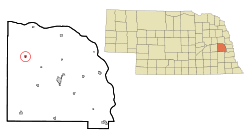 Location of Prague, Nebraska | |
| Coordinates: 41°18′34″N 96°48′27″W / 41.30944°N 96.80750°WCoordinates: 41°18′34″N 96°48′27″W / 41.30944°N 96.80750°W | |
| Country | United States |
| State | Nebraska |
| County | Saunders |
| Area[1] | |
| • Total | 0.31 sq mi (0.80 km2) |
| • Land | 0.31 sq mi (0.80 km2) |
| • Water | 0 sq mi (0 km2) |
| Elevation | 1,342 ft (409 m) |
| Population (2010)[2] | |
| • Total | 303 |
| • Estimate (2012[3]) | 301 |
| • Density | 977.4/sq mi (377.4/km2) |
| Time zone | Central (CST) (UTC-6) |
| • Summer (DST) | CDT (UTC-5) |
| ZIP code | 68050 |
| Area code(s) | 402 |
| FIPS code | 31-39975[4] |
| GNIS feature ID | 0832340[5] |
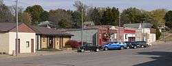
Prague is a village in Saunders County, Nebraska, United States. The population was 303 at the 2010 census. It was named after Prague, capital of Bohemia (now in the Czech Republic).[6]
History
Prague was platted in 1887 when the railroad was extended to that point.[7] A majority of the early settlers being natives of Bohemia caused the name to be selected.[6]
Geography
Prague is located at 41°18′34″N 96°48′27″W / 41.30944°N 96.80750°W (41.309572, -96.807636).[8]
According to the United States Census Bureau, the village has a total area of 0.31 square miles (0.80 km2), all land.[1]
Demographics
| Historical population | |||
|---|---|---|---|
| Census | Pop. | %± | |
| 1890 | 185 | — | |
| 1900 | 324 | 75.1% | |
| 1910 | 394 | 21.6% | |
| 1920 | 353 | −10.4% | |
| 1930 | 421 | 19.3% | |
| 1940 | 385 | −8.6% | |
| 1950 | 396 | 2.9% | |
| 1960 | 372 | −6.1% | |
| 1970 | 291 | −21.8% | |
| 1980 | 285 | −2.1% | |
| 1990 | 282 | −1.1% | |
| 2000 | 346 | 22.7% | |
| 2010 | 303 | −12.4% | |
| Est. 2015 | 299 | [9] | −1.3% |
Prague is commonly referred to as the home of the world's largest kolache, as says the sign along Nebraska Highway 79 when entering the town from the south.
2010 census
As of the census[2] of 2010, there were 303 people, 125 households, and 81 families residing in the village. The population density was 977.4 inhabitants per square mile (377.4/km2). There were 154 housing units at an average density of 496.8 per square mile (191.8/km2). The racial makeup of the village was 97.7% White, 1.7% Native American, and 0.7% from two or more races. Hispanic or Latino of any race were 0.7% of the population.
There were 125 households of which 29.6% had children under the age of 18 living with them, 48.8% were married couples living together, 9.6% had a female householder with no husband present, 6.4% had a male householder with no wife present, and 35.2% were non-families. 33.6% of all households were made up of individuals and 16.8% had someone living alone who was 65 years of age or older. The average household size was 2.42 and the average family size was 3.01.
The median age in the village was 42.3 years. 22.8% of residents were under the age of 18; 8.3% were between the ages of 18 and 24; 22.8% were from 25 to 44; 26.1% were from 45 to 64; and 20.1% were 65 years of age or older. The gender makeup of the village was 50.5% male and 49.5% female.
2000 census
As of the census[4] of 2000, there were 346 people, 136 households, and 91 families residing in the village. The population density was 1,261.4 people per square mile (494.8/km²). There were 149 housing units at an average density of 543.2 per square mile (213.1/km²). The racial makeup of the village was 97.98% White, 0.29% Asian, 0.29% from other races, and 1.45% from two or more races. Hispanic or Latino of any race were 1.16% of the population.
There were 136 households out of which 33.8% had children under the age of 18 living with them, 58.8% were married couples living together, 5.9% had a female householder with no husband present, and 32.4% were non-families. 30.9% of all households were made up of individuals and 17.6% had someone living alone who was 65 years of age or older. The average household size was 2.54 and the average family size was 3.24.
In the village the population was spread out with 31.2% under the age of 18, 3.5% from 18 to 24, 26.3% from 25 to 44, 17.1% from 45 to 64, and 22.0% who were 65 years of age or older. The median age was 37 years. For every 100 females there were 98.9 males. For every 100 females age 18 and over, there were 98.3 males.
As of 2000 the median income for a household in the village was $33,393, and the median income for a family was $41,458. Males had a median income of $32,083 versus $19,688 for females. The per capita income for the village was $13,395. About 7.2% of families and 6.9% of the population were below the poverty line, including 10.7% of those under age 18 and none of those age 65 or over.
Recreation
Northwest of Prague is located the Czechland Lake Recreation Area.[11]
References
- 1 2 "US Gazetteer files 2010". United States Census Bureau. Retrieved 2012-06-24.
- 1 2 "American FactFinder". United States Census Bureau. Retrieved 2012-06-24.
- ↑ "Population Estimates". United States Census Bureau. Retrieved 2013-05-29.
- 1 2 "American FactFinder". United States Census Bureau. Retrieved 2008-01-31.
- ↑ "US Board on Geographic Names". United States Geological Survey. 2007-10-25. Retrieved 2008-01-31.
- 1 2 Fitzpatrick, Lillian L. (1960). Nebraska Place-Names. University of Nebraska Press. ISBN 0-8032-5060-6.
- ↑ "Prague, Saunders County". Center for Advanced Land Management Information Technologies. University of Nebraska. Retrieved 23 August 2014.
- ↑ "US Gazetteer files: 2010, 2000, and 1990". United States Census Bureau. 2011-02-12. Retrieved 2011-04-23.
- ↑ "Annual Estimates of the Resident Population for Incorporated Places: April 1, 2010 to July 1, 2015". Retrieved July 2, 2016.
- ↑ "Census of Population and Housing". Census.gov. Retrieved June 4, 2015.
- ↑ Czechland Lake Recreation Area
Municipalities and communities of Saunders County, Nebraska, United States | ||
|---|---|---|
| Cities | ||
| Villages | ||
| Townships | ||
| CDP | ||
| Unincorporated communities | ||
Metropolitan area of Omaha–Council Bluffs | ||||||||
|---|---|---|---|---|---|---|---|---|
| Primary Cities |
|  | ||||||
| Cities over 10,000 (per 2010 Census) |
| |||||||
| Cities of 5,000 to 10,000 (per 2010 Census) |
| |||||||
| Cities of 1,000 to 5,000 (per 2010 Census) |
| |||||||
| Census-designated places |
| |||||||
| Cities and villages of fewer than 1,000 (per 2010 Census) |
| |||||||
| Counties |
| |||||||