Herman, Nebraska
| Herman, Nebraska | |
|---|---|
| Village | |
|
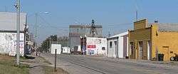
Main Street (U.S. Highway 75) | |
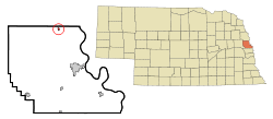 Location of Herman, Nebraska | |
| Coordinates: 41°40′25″N 96°12′57″W / 41.67361°N 96.21583°WCoordinates: 41°40′25″N 96°12′57″W / 41.67361°N 96.21583°W | |
| Country | United States |
| State | Nebraska |
| County | Washington |
| Area[1] | |
| • Total | 0.14 sq mi (0.36 km2) |
| • Land | 0.14 sq mi (0.36 km2) |
| • Water | 0 sq mi (0 km2) |
| Elevation | 1,040 ft (317 m) |
| Population (2010)[2] | |
| • Total | 268 |
| • Estimate (2012[3]) | 265 |
| • Density | 1,914.3/sq mi (739.1/km2) |
| Time zone | Central (CST) (UTC-6) |
| • Summer (DST) | CDT (UTC-5) |
| ZIP code | 68029 |
| Area code(s) | 402 |
| FIPS code | 31-22185[4] |
| GNIS feature ID | 0829934[5] |
Herman is a village in Washington County, Nebraska, United States. The population was 268 at the 2010 census.
History
Herman was platted in 1871 when the railroad was extended to that point.[6] It was named for Samuel Herman, a railroad employee.[7]
On July 13, 1899, Herman was struck by a tornado that killed 13 people.[8]
Geography
Herman is located at 41°40′25″N 96°12′57″W / 41.67361°N 96.21583°W (41.673500, -96.215935).[9]
According to the United States Census Bureau, the village has a total area of 0.14 square miles (0.36 km2), all of it land.[1]
Demographics
| Historical population | |||
|---|---|---|---|
| Census | Pop. | %± | |
| 1880 | 95 | — | |
| 1890 | 319 | 235.8% | |
| 1900 | 321 | 0.6% | |
| 1910 | 345 | 7.5% | |
| 1920 | 385 | 11.6% | |
| 1930 | 421 | 9.4% | |
| 1940 | 427 | 1.4% | |
| 1950 | 380 | −11.0% | |
| 1960 | 335 | −11.8% | |
| 1970 | 323 | −3.6% | |
| 1980 | 340 | 5.3% | |
| 1990 | 186 | −45.3% | |
| 2000 | 310 | 66.7% | |
| 2010 | 268 | −13.5% | |
| Est. 2015 | 265 | [10] | −1.1% |
2010 census
As of the census[2] of 2010, there were 268 people, 116 households, and 74 families residing in the village. The population density was 1,914.3 inhabitants per square mile (739.1/km2). There were 134 housing units at an average density of 957.1 per square mile (369.5/km2). The racial makeup of the village was 99.6% White and 0.4% Asian. Hispanic or Latino of any race were 1.1% of the population.
There were 116 households of which 28.4% had children under the age of 18 living with them, 49.1% were married couples living together, 8.6% had a female householder with no husband present, 6.0% had a male householder with no wife present, and 36.2% were non-families. 31.9% of all households were made up of individuals and 14.6% had someone living alone who was 65 years of age or older. The average household size was 2.31 and the average family size was 2.91.
The median age in the village was 41.3 years. 22.4% of residents were under the age of 18; 5.9% were between the ages of 18 and 24; 27.2% were from 25 to 44; 25.8% were from 45 to 64; and 18.7% were 65 years of age or older. The gender makeup of the village was 50.4% male and 49.6% female.
2000 census
As of the census[4] of 2000, there were 310 people, 134 households, and 86 families residing in the village. The population density was 2,107.7 people per square mile (797.9/km²). There were 151 housing units at an average density of 1,026.6 per square mile (388.7/km²). The racial makeup of the village was 98.71% White, 0.65% Native American, and 0.65% from two or more races. Hispanic or Latino of any race were 1.29% of the population.
There were 134 households out of which 26.9% had children under the age of 18 living with them, 55.2% were married couples living together, 5.2% had a female householder with no husband present, and 35.8% were non-families. 32.1% of all households were made up of individuals and 16.4% had someone living alone who was 65 years of age or older. The average household size was 2.31 and the average family size was 2.93.
In the village the population was spread out with 23.5% under the age of 18, 8.7% from 18 to 24, 27.1% from 25 to 44, 23.2% from 45 to 64, and 17.4% who were 65 years of age or older. The median age was 38 years. For every 100 females there were 110.9 males. For every 100 females age 18 and over, there were 107.9 males.
As of 2000 the median income for a household in the village was $38,750, and the median income for a family was $47,750. Males had a median income of $31,750 versus $20,795 for females. The per capita income for the village was $16,492. About 11.8% of families and 11.1% of the population were below the poverty line, including 21.4% of those under age 18 and 4.8% of those age 65 or over.
Notable residents
- Stanley M. Truhlsen grew up in Herman.
See also
References
- 1 2 "US Gazetteer files 2010". United States Census Bureau. Retrieved 2012-06-24.
- 1 2 "American FactFinder". United States Census Bureau. Retrieved 2012-06-24.
- ↑ "Population Estimates". United States Census Bureau. Retrieved 2013-05-29.
- 1 2 "American FactFinder". United States Census Bureau. Retrieved 2008-01-31.
- ↑ "US Board on Geographic Names". United States Geological Survey. 2007-10-25. Retrieved 2008-01-31.
- ↑ Buss, William Henry; Osterman, Thomas T. (1921). History of Dodge and Washington Counties, Nebraska, and Their People. American Historical Society. p. 423.
- ↑ "Profile for Herman, NE". ePodunk. Retrieved 24 August 2014.
- ↑ "Herman, Washington County". Center for Advanced Land Management Information Technologies. University of Nebraska. Retrieved 24 August 2014.
- ↑ "US Gazetteer files: 2010, 2000, and 1990". United States Census Bureau. 2011-02-12. Retrieved 2011-04-23.
- ↑ "Annual Estimates of the Resident Population for Incorporated Places: April 1, 2010 to July 1, 2015". Retrieved July 2, 2016.
- ↑ "Census of Population and Housing". Census.gov. Retrieved June 4, 2015.
Municipalities and communities of Washington County, Nebraska, United States | ||
|---|---|---|
| Cities | ||
| Villages | ||
| Townships | ||
| CDP | ||
| Unincorporated communities | ||
| Former community | ||
| Footnotes | ‡This populated place also has portions in an adjacent county or counties | |
Metropolitan area of Omaha–Council Bluffs | ||||||||
|---|---|---|---|---|---|---|---|---|
| Primary Cities |
|  | ||||||
| Cities over 10,000 (per 2010 Census) |
| |||||||
| Cities of 5,000 to 10,000 (per 2010 Census) |
| |||||||
| Cities of 1,000 to 5,000 (per 2010 Census) |
| |||||||
| Census-designated places |
| |||||||
| Cities and villages of fewer than 1,000 (per 2010 Census) |
| |||||||
| Counties |
| |||||||