Chalco, Nebraska
| Chalco, Nebraska | |
|---|---|
| CDP | |
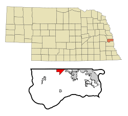 Location of Chalco, Nebraska | |
| Coordinates: 41°11′1″N 96°8′2″W / 41.18361°N 96.13389°WCoordinates: 41°11′1″N 96°8′2″W / 41.18361°N 96.13389°W | |
| Country | United States |
| State | Nebraska |
| County | Sarpy |
| Area | |
| • Total | 2.9 sq mi (7.5 km2) |
| • Land | 2.9 sq mi (7.5 km2) |
| • Water | 0.0 sq mi (0.0 km2) |
| Elevation | 1,073 ft (327 m) |
| Population (2010) | |
| • Total | 10,994 |
| • Density | 3,703.3/sq mi (1,429.9/km2) |
| Time zone | Central (CST) (UTC-6) |
| • Summer (DST) | CDT (UTC-5) |
| Area code(s) | 402,531 |
| FIPS code | 31-08640[1] |
| GNIS feature ID | 0828081[2] |
Chalco is a census-designated place (CDP) in northern Sarpy County, Nebraska, United States, directly south of and adjacent to Omaha. The population was 10,994 at the 2010 census.
History
A post office was established at Chalco in 1888, and remained in operation until it was discontinued in 1950.[3] The community was likely named after Chalco, in Mexico.[4]
Geography
Chalco is located at 41°11′1″N 96°8′2″W / 41.18361°N 96.13389°W (41.183539, -96.133791).[5]
According to the United States Census Bureau, the CDP has a total area of 2.9 square miles (7.5 km2), all of it land.
Demographics
As of the census[1] of 2000, there were 10,736 people, 3,719 households, and 2,915 families residing in the CDP. The population density was 3,703.3 people per square mile (1,429.4/km²). There were 3,758 housing units at an average density of 1,296.3/sq mi (500.3/km²). The racial makeup of the CDP was 95.24% White, 0.82% Black or African American, 0.30% Native American, 1.08% Asian, 0.02% Pacific Islander, 0.90% from other races, and 1.64% from two or more races. Hispanic or Latino of any race were 2.81% of the population.
There were 3,719 households out of which 51.1% had children under the age of 18 living with them, 67.0% were married couples living together, 8.6% had a female householder with no husband present, and 21.6% were non-families. 16.0% of all households were made up of individuals and 0.8% had someone living alone who was 65 years of age or older. The average household size was 2.89 and the average family size was 3.28.
In the CDP the population was spread out with 33.2% under the age of 18, 7.6% from 18 to 24, 43.6% from 25 to 44, 13.9% from 45 to 64, and 1.6% who were 65 years of age or older. The median age was 29 years. For every 100 females there were 100.7 males. For every 100 females age 18 and over, there were 98.1 males.
The median income for a household in the CDP was $60,357, and the median income for a family was $62,217. Males had a median income of $40,403 versus $28,066 for females. The per capita income for the CDP was $21,370. About 2.0% of families and 2.9% of the population were below the poverty line, including 4.1% of those under age 18 and none of those age 65 or over.
References
- 1 2 "American FactFinder". United States Census Bureau. Archived from the original on 2013-09-11. Retrieved 2008-01-31.
- ↑ "US Board on Geographic Names". United States Geological Survey. 2007-10-25. Retrieved 2008-01-31.
- ↑ "Sarpy County". Jim Forte Postal History. Retrieved 23 August 2014.
- ↑ Fitzpatrick, Lillian L. (1960). Nebraska Place-Names. University of Nebraska Press. p. 124. ISBN 0-8032-5060-6. A 1925 edition is available for download at University of Nebraska—Lincoln Digital Commons.
- ↑ "US Gazetteer files: 2010, 2000, and 1990". United States Census Bureau. 2011-02-12. Retrieved 2011-04-23.
Municipalities and communities of Sarpy County, Nebraska, United States | ||
|---|---|---|
| Cities | ||
| CDPs | ||
| Other unincorporated communities | ||
Metropolitan area of Omaha–Council Bluffs | ||||||||
|---|---|---|---|---|---|---|---|---|
| Primary Cities |
|  | ||||||
| Cities over 10,000 (per 2010 Census) |
| |||||||
| Cities of 5,000 to 10,000 (per 2010 Census) |
| |||||||
| Cities of 1,000 to 5,000 (per 2010 Census) |
| |||||||
| Census-designated places |
| |||||||
| Cities and villages of fewer than 1,000 (per 2010 Census) |
| |||||||
| Counties |
| |||||||