Saunders County, Nebraska
| Saunders County, Nebraska | |
|---|---|
 Saunders County Courthouse in Wahoo | |
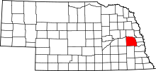 Location in the U.S. state of Nebraska | |
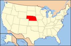 Nebraska's location in the U.S. | |
| Founded | 1866 |
| Named for | Alvin Saunders |
| Seat | Wahoo |
| Largest city | Wahoo |
| Area | |
| • Total | 760 sq mi (1,968 km2) |
| • Land | 750 sq mi (1,942 km2) |
| • Water | 9.6 sq mi (25 km2), 1.3% |
| Population | |
| • (2010) | 20,780 |
| • Density | 28/sq mi (11/km²) |
| Congressional district | 1st |
| Time zone | Central: UTC-6/-5 |
| Website |
www |
Saunders County is a county in the U.S. state of Nebraska. As of the 2010 census, the population was 20,780.[1] Its county seat is Wahoo.[2]
Saunders County is included in the Omaha-Council Bluffs, NE-IA Metropolitan Statistical Area.[3]
In the Nebraska license plate system, Saunders County is represented by the prefix 6 (the county had the sixth-largest number of vehicles registered in the state when the license plate system was established in 1922).
History
Saunders County was established by an 1856 act of the Nebraska Territorial Legislature and later organized in 1866;[4][5] its boundaries were redefined in 1858.[6] The county was originally named after John C. Calhoun; in 1862, during the American Civil War, it was renamed after Nebraska territorial governor Alvin Saunders.[7][8]
Geography
According to the U.S. Census Bureau, the county has an area of 760 square miles (2,000 km2), of which 750 square miles (1,900 km2) is land and 9.6 square miles (25 km2) (1.3%) is water.[9]
Major highways
-
 U.S. Highway 6
 -
 U.S. Highway 77
 -
 Nebraska Highway 64
 -
 Nebraska Highway 66
 -
 Nebraska Highway 79
 -
 Nebraska Highway 92
 -
 Nebraska Highway 109
Adjacent counties
- Douglas County (east)
- Sarpy County (east)
- Cass County (southeast)
- Lancaster County (south)
- Butler County (west)
- Dodge County (north)
Demographics
| Historical population | |||
|---|---|---|---|
| Census | Pop. | %± | |
| 1870 | 4,547 | — | |
| 1880 | 15,810 | 247.7% | |
| 1890 | 21,577 | 36.5% | |
| 1900 | 22,085 | 2.4% | |
| 1910 | 21,179 | −4.1% | |
| 1920 | 20,589 | −2.8% | |
| 1930 | 20,167 | −2.0% | |
| 1940 | 17,892 | −11.3% | |
| 1950 | 16,923 | −5.4% | |
| 1960 | 17,270 | 2.1% | |
| 1970 | 17,018 | −1.5% | |
| 1980 | 18,716 | 10.0% | |
| 1990 | 18,285 | −2.3% | |
| 2000 | 19,830 | 8.4% | |
| 2010 | 20,780 | 4.8% | |
| Est. 2015 | 21,016 | [10] | 1.1% |
| U.S. Decennial Census[11] 1790-1960[12] 1900-1990[13] 1990-2000[14] 2010-2013[1] | |||
As of the census[15] of 2000, there were 19,830 people, 7,498 households, and 5,443 families residing in the county. The population density was 26 people per square mile (10/km²). There were 8,266 housing units at an average density of 11 per square mile (4/km²). The racial makeup of the county was 98.49% White, 0.11% Black or African American, 0.29% Native American, 0.22% Asian, 0.01% Pacific Islander, 0.35% from other races, and 0.55% from two or more races. 1.03% of the population were Hispanic or Latino of any race.
There were 7,498 households out of which 34.20% had children under the age of 18 living with them, 62.60% were married couples living together, 6.70% had a female householder with no husband present, and 27.40% were non-families. 23.60% of all households were made up of individuals and 11.90% had someone living alone who was 65 years of age or older. The average household size was 2.61 and the average family size was 3.11.
In the county the population was spread out with 27.90% under the age of 18, 6.30% from 18 to 24, 27.60% from 25 to 44, 22.90% from 45 to 64, and 15.30% who were 65 years of age or older. The median age was 38 years. For every 100 females there were 99.10 males. For every 100 females age 18 and over, there were 98.10 males.
The median income for a household in the county was $42,173, and the median income for a family was $49,443. Males had a median income of $33,309 versus $22,922 for females. The per capita income for the county was $18,392. About 5.30% of families and 6.60% of the population were below the poverty line, including 7.30% of those under age 18 and 7.00% of those age 65 or over.
Communities

Cities
Villages
Townships
See also
References
- 1 2 "State & County QuickFacts". United States Census Bureau. Retrieved September 22, 2013.
- ↑ "Find a County". National Association of Counties. Retrieved 2011-06-07.
- ↑ United States Office of Management and Budget. "Update of Statistical Area Definitions and Guidance on Their Uses" (PDF). pp. 5, 36. Archived from the original (PDF) on 2006-05-14. Retrieved 2006-07-21.
- ↑ "Nebraska Historic Buildings Survey Saunders County" (PDF). Nebraska State Historical Society. August 2003. Retrieved December 19, 2014.
- ↑ Andreas, A. T. (1882). "Andreas' History of the State of Nebraska". The Kansas Collection. Retrieved December 19, 2014.
- ↑ Fitzpatrick, Lilian Linder (1925). Nebraska Place-Names. Lincoln: University of Nebraska Studies in Language, Literature, and Criticism. p. 125. Retrieved December 19, 2014.
- ↑ Fitzpatrick, Lilian Linder (1925). "Nebraska Place-Names". University of Nebraska Department of English. Retrieved 2011-09-27.
- ↑ "Nebraska Historic Buildings Survey - Saunders County". Nebraska State Historical Society. Retrieved 2011-09-27.
- ↑ "2010 Census Gazetteer Files". United States Census Bureau. August 22, 2012. Retrieved December 11, 2014.
- ↑ "County Totals Dataset: Population, Population Change and Estimated Components of Population Change: April 1, 2010 to July 1, 2015". Retrieved July 2, 2016.
- ↑ "U.S. Decennial Census". United States Census Bureau. Retrieved December 11, 2014.
- ↑ "Historical Census Browser". University of Virginia Library. Retrieved December 11, 2014.
- ↑ "Population of Counties by Decennial Census: 1900 to 1990". United States Census Bureau. Retrieved December 11, 2014.
- ↑ "Census 2000 PHC-T-4. Ranking Tables for Counties: 1990 and 2000" (PDF). United States Census Bureau. Retrieved December 11, 2014.
- ↑ "American FactFinder". United States Census Bureau. Retrieved 2008-01-31.
External links
- Saunders County
- County Government
- Mead and Hunt. (2003) Nebraska Historic Buildings Survey: Saunders County. Nebraska State Historical Society. Retrieved 8/30/07.
 |
Dodge County | | ||
| Butler County | |
Douglas County and Sarpy County | ||
| ||||
| | ||||
| Lancaster County | Cass County |
Municipalities and communities of Saunders County, Nebraska, United States | ||
|---|---|---|
| Cities | ||
| Villages | ||
| Townships | ||
| CDP | ||
| Unincorporated communities | ||
Metropolitan area of Omaha–Council Bluffs | ||||||||
|---|---|---|---|---|---|---|---|---|
| Primary Cities |
|  | ||||||
| Cities over 10,000 (per 2010 Census) |
| |||||||
| Cities of 5,000 to 10,000 (per 2010 Census) |
| |||||||
| Cities of 1,000 to 5,000 (per 2010 Census) |
| |||||||
| Census-designated places |
| |||||||
| Cities and villages of fewer than 1,000 (per 2010 Census) |
| |||||||
| Counties |
| |||||||
Coordinates: 41°14′N 96°38′W / 41.23°N 96.63°W