Sarpy County, Nebraska
| Sarpy County, Nebraska | |
|---|---|
 Sarpy County Courthouse in Papillion | |
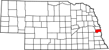 Location in the U.S. state of Nebraska | |
 Nebraska's location in the U.S. | |
| Founded | February 7, 1857 |
| Named for | Peter A. Sarpy |
| Seat | Papillion |
| Largest city | Bellevue |
| Area | |
| • Total | 248 sq mi (642 km2) |
| • Land | 239 sq mi (619 km2) |
| • Water | 8.5 sq mi (22 km2), 3.4% |
| Population (est.) | |
| • (2013) | 169,331 |
| • Density | 665/sq mi (257/km²) |
| Congressional districts | 1st, 2nd |
| Time zone | Central: UTC-6/-5 |
| Website |
www |
Sarpy County is a county in the U.S. state of Nebraska. As of the 2010 census, the population was 158,840,[1] making it the third most populous county in Nebraska. Its county seat is Papillion.[2]
Sarpy County is part of the Omaha-Council Bluffs, NE-IA Metropolitan Statistical Area.[3]
In the Nebraska license plate system, Sarpy County was represented by the prefix "59" (it had the fifty-ninth largest number of vehicles registered in the county when the license plate system was established in 1922). Many license plates issued in Sarpy County featured the stacked format of the 59 code. The county, just south of Omaha, had grown significantly in population in the decades following 1922 and therefore required five characters rather than the four allowed by a standard double-digit county code. In 2002, the state discontinued the 1922 system in Sarpy as well as Douglas and Lancaster counties.
History
Explored in 1805 by Lewis and Clark and settled by fur traders, adventurers, farmers, and finally entrepreneurs, Sarpy County has served as the springboard for Nebraska's settlement and expansion.
Sarpy County is named after Colonel Peter Sarpy,[4] an early fur trader at Fontenelle's Post located in the Bellevue area in the 1840s. Sarpy died in Plattsmouth, Nebraska Territory in 1865.
Despite the fact that Sarpy County contained the oldest settlement in the state, it was one of the last lands along the river to be recognized by law. Finally, on February 1, 1857, the land "where the cities meet the country" was officially created.
Geography
According to the U.S. Census Bureau, the county has a total area of 248 square miles (640 km2), of which 239 square miles (620 km2) is land and 8.5 square miles (22 km2) (3.4%) is water.[5] Sarpy County has the smallest area of any county in Nebraska.
Major highways
-
 Interstate 80
 -
 U.S. Highway 6
 -
 U.S. Highway 75
 -
 Nebraska Highway 31
 -
 Nebraska Highway 50
 -
 Nebraska Highway 85
 -
 Nebraska Highway 370
Adjacent counties
- Douglas County - north
- Pottawattamie County, Iowa - northeast
- Mills County, Iowa - southeast
- Cass County - south
- Saunders County - west
Demographics
| Historical population | |||
|---|---|---|---|
| Census | Pop. | %± | |
| 1860 | 1,201 | — | |
| 1870 | 2,913 | 142.5% | |
| 1880 | 4,481 | 53.8% | |
| 1890 | 6,875 | 53.4% | |
| 1900 | 9,080 | 32.1% | |
| 1910 | 9,274 | 2.1% | |
| 1920 | 9,370 | 1.0% | |
| 1930 | 10,402 | 11.0% | |
| 1940 | 10,835 | 4.2% | |
| 1950 | 15,693 | 44.8% | |
| 1960 | 31,281 | 99.3% | |
| 1970 | 63,696 | 103.6% | |
| 1980 | 86,015 | 35.0% | |
| 1990 | 102,583 | 19.3% | |
| 2000 | 122,595 | 19.5% | |
| 2010 | 158,840 | 29.6% | |
| Est. 2015 | 175,692 | [6] | 10.6% |
| U.S. Decennial Census[7] 1790-1960[8] 1900-1990[9] 1990-2000[10] 2010-2013[1] | |||
As of the census of 2000, there were 122,595 people, 43,426 households, and 33,220 families residing in the county. The population density was 510 people per square mile (197/km²). There were 44,981 housing units at an average density of 187 per square mile (72/km²). The racial makeup of the county was 89.18% White, 4.36% Black or African American, 0.42% Native American, 1.90% Asian, 0.09% Pacific Islander, 1.86% from other races, and 2.20% from two or more races. 4.37% of the population were Hispanic or Latino of any race.
There were 43,426 households out of which 43.00% had children under the age of 18 living with them, 63.80% were married couples living together, 9.60% had a female householder with no husband present, and 23.50% were non-families. 18.40% of all households were made up of individuals and 4.70% had someone living alone who was 65 years of age or older. The average household size was 2.79 and the average family size was 3.21.
In the county the population was spread out with 30.50% under the age of 18, 9.40% from 18 to 24, 33.80% from 25 to 44, 19.70% from 45 to 64, and 6.60% who were 65 years of age or older. The median age was 32 years. For every 100 females there were 98.80 males. For every 100 females age 18 and over, there were 96.20 males.
The median income for a household in the county was $53,804, and the median income for a family was $59,723. Males had a median income of $37,230 versus $26,816 for females. The per capita income for the county was $21,985. About 3.10% of families and 4.20% of the population were below the poverty line, including 5.30% of those under age 18 and 3.30% of those age 65 or over.
Government and infrastructure
The Sarpy County Sheriff's Department is responsible for enforcing the law within the unincorporated areas of the county.[11] By contract, the department is also responsible for enforcing the law within the city limits of Gretna and Springfield. The cities of Bellevue, La Vista, and Papillion have their own City Police Departments which are primarily responsible for law enforcement within their respective city limits. The Sheriff's Department has secondary responsibility for law enforcement within these three cities, providing essentials such as backup support.
The Sarpy County Law Enforcement Center, built in 1989, is located within the campus of the Sarpy County Courthouse in Papillion. It functions as a Sheriff's office and a jail facility. The Bellevue and LaVista City Police Departments also have their own holding cells. The county jail can hold 148 people, but is currently holding its capacity. To solve for this, the county is planning on expanding the jail to provide room for an additional 125 inmates. The Law Enforcement Center does not provide for detoxification services. Instead, detoxification detainees are transferred to St. Gabriel's Alcohol and Drug Treatment Center in Douglas County.
Fire protection and emergency medical services are provided by a mix of seven full-career, part-time paid, military, and all-volunteer fire departments, representing various municipalities within the county, plus Offut Air Force Base.
Communities
Cities
- Bellevue
- Gretna
- La Vista
- Papillion (county seat)
- Springfield
Census-designated places
Unincorporated communities
Census divisions
Sarpy County is divided into the following divisions, called precincts, except for the City of Bellevue.
- City of Bellevue
- Bellevue Second I
- Bellevue Second II
- Bellevue Second III
- Bellevue Second IV
- Fairview
- Forest City No. 1
- Forest City No. 2
- Gilmore I
- Gilmore II
- Highland I
- Highland II
- LaPlatte I
- LaPlatte II
- La Vista
- Melia-Forest City
- Papillion
- Papillion Second I
- Papillion Second II
- Platford-Springfield I
- Platford-Springfield II
- Richland I
- Richland II
- Richland III
- Richland IV
- Richland V
- Richland VI
- Richland VII
- Richland VIII
- Springfield
See also
References
- 1 2 "State & County QuickFacts". United States Census Bureau. Retrieved October 28, 2014.
- ↑ "Find a County". National Association of Counties. Retrieved 2011-06-07.
- ↑ United States Office of Management and Budget. "Update of Statistical Area Definitions and Guidance on Their Uses" (PDF). pp. 5, 36. Archived from the original (PDF) on May 14, 2006. Retrieved 2006-07-21.
- ↑ Burr, George L. (1921). History of Hamilton and Clay Counties, Nebraska, Volume 1. S.J. Clarke Publishing Company. p. 136.
- ↑ "2010 Census Gazetteer Files". United States Census Bureau. August 22, 2012. Retrieved December 11, 2014.
- ↑ "County Totals Dataset: Population, Population Change and Estimated Components of Population Change: April 1, 2010 to July 1, 2015". Retrieved July 2, 2016.
- ↑ "U.S. Decennial Census". United States Census Bureau. Retrieved December 11, 2014.
- ↑ "Historical Census Browser". University of Virginia Library. Retrieved December 11, 2014.
- ↑ "Population of Counties by Decennial Census: 1900 to 1990". United States Census Bureau. Retrieved December 11, 2014.
- ↑ "Census 2000 PHC-T-4. Ranking Tables for Counties: 1990 and 2000" (PDF). United States Census Bureau. Retrieved December 11, 2014.
- ↑ Archived June 25, 2008, at the Wayback Machine.
External links
- Sarpy County Nebraska Website
- Sarpy County Chamber of Commerce
- Sarpy County Museum
- Sarpy County Tourism
Coordinates: 41°07′N 96°07′W / 41.11°N 96.11°W
 |
Douglas County | Pottawattamie County, Iowa | | |
| Saunders County | |
|||
| ||||
| | ||||
| Cass County | Mills County, Iowa |
Municipalities and communities of Sarpy County, Nebraska, United States | ||
|---|---|---|
| Cities | ||
| CDPs | ||
| Other unincorporated communities | ||
Metropolitan area of Omaha–Council Bluffs | ||||||||
|---|---|---|---|---|---|---|---|---|
| Primary Cities |
|  | ||||||
| Cities over 10,000 (per 2010 Census) |
| |||||||
| Cities of 5,000 to 10,000 (per 2010 Census) |
| |||||||
| Cities of 1,000 to 5,000 (per 2010 Census) |
| |||||||
| Census-designated places |
| |||||||
| Cities and villages of fewer than 1,000 (per 2010 Census) |
| |||||||
| Counties |
| |||||||