Hancock, Iowa
| Hancock, Iowa | |
|---|---|
| City | |
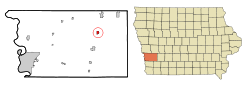 Location of Hancock, Iowa | |
| Coordinates: 41°23′26″N 95°21′47″W / 41.39056°N 95.36306°WCoordinates: 41°23′26″N 95°21′47″W / 41.39056°N 95.36306°W | |
| Country |
|
| State |
|
| County | Pottawattamie |
| Area[1] | |
| • Total | 0.78 sq mi (2.02 km2) |
| • Land | 0.75 sq mi (1.94 km2) |
| • Water | 0.03 sq mi (0.08 km2) |
| Elevation | 1,112 ft (339 m) |
| Population (2010)[2] | |
| • Total | 196 |
| • Estimate (2012[3]) | 195 |
| • Density | 261.3/sq mi (100.9/km2) |
| Time zone | Central (CST) (UTC-6) |
| • Summer (DST) | CDT (UTC-5) |
| ZIP code | 51536 |
| Area code(s) | 712 |
| FIPS code | 19-34005 |
| GNIS feature ID | 0457227 |
Hancock is a city in Pottawattamie County, Iowa, United States, along the West Nishnabotna River. The population was 196 at the 2010 census.
History
Hancock had its start in the year 1880 by the building of the Rock Island Railroad through that territory. It was named for its founder, F. H. Hancock.[4]
Geography
Hancock is located at 41°23′26″N 95°21′47″W / 41.39056°N 95.36306°W (41.390511, -95.362944).[5]
According to the United States Census Bureau, the city has a total area of 0.78 square miles (2.02 km2), of which, 0.75 square miles (1.94 km2) is land and 0.03 square miles (0.08 km2) is water.[1]
Demographics
| Historical populations | ||
|---|---|---|
| Year | Pop. | ±% |
| 1890 | 167 | — |
| 1900 | 276 | +65.3% |
| 1910 | 250 | −9.4% |
| 1920 | 276 | +10.4% |
| 1930 | 312 | +13.0% |
| 1940 | 256 | −17.9% |
| 1950 | 264 | +3.1% |
| 1960 | 252 | −4.5% |
| 1970 | 228 | −9.5% |
| 1980 | 254 | +11.4% |
| 1990 | 201 | −20.9% |
| 2000 | 207 | +3.0% |
| 2010 | 196 | −5.3% |
| 2014 | 194 | −1.0% |
| 2015 | 195 | +0.5% |
| Source:"American FactFinder". United States Census Bureau. and Iowa Data Center Source: | ||
2010 census
As of the census[2] of 2010, there were 196 people, 88 households, and 62 families residing in the city. The population density was 261.3 inhabitants per square mile (100.9/km2). There were 95 housing units at an average density of 126.7 per square mile (48.9/km2). The racial makeup of the city was 95.9% White, 0.5% Native American, 2.0% from other races, and 1.5% from two or more races. Hispanic or Latino of any race were 2.6% of the population.
There were 88 households of which 26.1% had children under the age of 18 living with them, 55.7% were married couples living together, 6.8% had a female householder with no husband present, 8.0% had a male householder with no wife present, and 29.5% were non-families. 23.9% of all households were made up of individuals and 13.6% had someone living alone who was 65 years of age or older. The average household size was 2.23 and the average family size was 2.53.
The median age in the city was 48 years. 18.4% of residents were under the age of 18; 4.6% were between the ages of 18 and 24; 23% were from 25 to 44; 32.1% were from 45 to 64; and 21.9% were 65 years of age or older. The gender makeup of the city was 50.0% male and 50.0% female.
2000 census
As of the census[7] of 2000, there were 207 people, 90 households, and 68 families residing in the city. The population density was 277.1 people per square mile (106.6/km²). There were 97 housing units at an average density of 129.9 per square mile (49.9/km²). The racial makeup of the city was 99.52% White and 0.48% Native American. Hispanic or Latino of any race were 0.97% of the population.
There were 90 households out of which 21.1% had children under the age of 18 living with them, 61.1% were married couples living together, 8.9% had a female householder with no husband present, and 24.4% were non-families. 22.2% of all households were made up of individuals and 13.3% had someone living alone who was 65 years of age or older. The average household size was 2.30 and the average family size was 2.68.
16.4% are under the age of 18, 10.1% from 18 to 24, 23.2% from 25 to 44, 30.4% from 45 to 64, and 19.8% who were 65 years of age or older. The median age was 48 years. For every 100 females there were 99.0 males. For every 100 females age 18 and over, there were 96.6 males.
The median income for a household in the city was $33,056, and the median income for a family was $37,500. Males had a median income of $31,429 versus $19,083 for females. The per capita income for the city was $17,200. About 2.6% of families and 2.5% of the population were below the poverty line, including 9.3% of those under the age of eighteen and none of those sixty five or over.
Notable people
- Rebecca Ann King, 1974 Miss America.
References
- 1 2 "US Gazetteer files 2010". United States Census Bureau. Retrieved 2012-05-11.
- 1 2 "American FactFinder". United States Census Bureau. Retrieved 2012-05-11.
- ↑ "Population Estimates". United States Census Bureau. Retrieved 2013-05-23.
- ↑ History of Pottawattamie County, Iowa: Containing a History from the Earliest Settlement to the Present Time. O. L. Baskin & Company. 1883. p. 307.
- ↑ "US Gazetteer files: 2010, 2000, and 1990". United States Census Bureau. 2011-02-12. Retrieved 2011-04-23.
- ↑ "Census of Population and Housing". Census.gov. Retrieved June 4, 2015.
- ↑ "American FactFinder". United States Census Bureau. Retrieved 2008-01-31.
Metropolitan area of Omaha–Council Bluffs | ||||||||
|---|---|---|---|---|---|---|---|---|
| Primary Cities |
|  | ||||||
| Cities over 10,000 (per 2010 Census) |
| |||||||
| Cities of 5,000 to 10,000 (per 2010 Census) |
| |||||||
| Cities of 1,000 to 5,000 (per 2010 Census) |
| |||||||
| Census-designated places |
| |||||||
| Cities and villages of fewer than 1,000 (per 2010 Census) |
| |||||||
| Counties |
| |||||||
Municipalities and communities of Pottawattamie County, Iowa, United States | ||
|---|---|---|
| Cities | ||
| Townships | ||
| CDPs | ||
| Other community | ||
| Footnotes | ‡This populated place also has portions in an adjacent county or counties | |