Ashland, Nebraska
| Ashland, Nebraska | |
|---|---|
| City | |
|
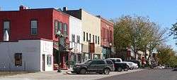
Downtown Ashland: Silver Street | |
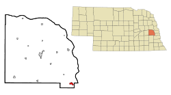 Location of Ashland, Nebraska | |
| Coordinates: 41°2′26″N 96°22′21″W / 41.04056°N 96.37250°WCoordinates: 41°2′26″N 96°22′21″W / 41.04056°N 96.37250°W | |
| Country | United States |
| State | Nebraska |
| County | Saunders |
| Area[1] | |
| • Total | 1.13 sq mi (2.93 km2) |
| • Land | 1.10 sq mi (2.85 km2) |
| • Water | 0.03 sq mi (0.08 km2) |
| Elevation | 1,089 ft (332 m) |
| Population (2010)[2] | |
| • Total | 2,453 |
| • Estimate (2012[3]) | 2,492 |
| • Density | 2,230.0/sq mi (861.0/km2) |
| Time zone | Central (CST) (UTC-6) |
| • Summer (DST) | CDT (UTC-5) |
| ZIP code | 68003 |
| Area code(s) | 402 |
| FIPS code | 31-02305 |
| GNIS feature ID | 0827094[4] |
| Website | http://www.ashland-ne.com/ |
Ashland is a city in Saunders County, Nebraska, United States. The population was 2,453 at the 2010 census.
History
Ashland is located at the site of a low-water limestone ledge along the bottom of Salt Creek, an otherwise mud-bottomed stream that was a formidable obstacle for wagon trains on the great westward migrations of the late 1840s and 1850s. The Oxbow Trail, a variant route of the Oregon Trail, ran from Nebraska City (on the Missouri River) to Fort Kearny (on the Platte River), where it joined the main route of the Oregon Trail. The limestone bottom of Salt Creek at Ashland made it an excellent fording site.[5] Ashland was established in 1870 and named after Ashland, the estate of Henry Clay.[6]
Today, Ashland benefits by its proximity to Interstate 80 and the cities of Omaha and Lincoln. While in some respects Ashland is becoming a "bedroom community" of those much larger cities, it retains a rural character. That coherence as a community, and a 30-minute drive to either of the state's economic hubs, has led to a building boom in the late 1990s and the 2000s.
Geography
Ashland is located at 41°2′26″N 96°22′21″W / 41.04056°N 96.37250°W (41.040548, -96.372389).[7]
According to the United States Census Bureau, the city has a total area of 1.13 square miles (2.93 km2), of which 1.10 square miles (2.85 km2) is land and 0.03 square miles (0.08 km2) is water.[1]
Demographics
| Historical population | |||
|---|---|---|---|
| Census | Pop. | %± | |
| 1870 | 653 | — | |
| 1880 | 978 | 49.8% | |
| 1890 | 1,601 | 63.7% | |
| 1900 | 1,477 | −7.7% | |
| 1910 | 1,379 | −6.6% | |
| 1920 | 1,725 | 25.1% | |
| 1930 | 1,786 | 3.5% | |
| 1940 | 1,709 | −4.3% | |
| 1950 | 1,713 | 0.2% | |
| 1960 | 1,989 | 16.1% | |
| 1970 | 2,176 | 9.4% | |
| 1980 | 2,274 | 4.5% | |
| 1990 | 2,136 | −6.1% | |
| 2000 | 2,262 | 5.9% | |
| 2010 | 2,453 | 8.4% | |
| Est. 2015 | 2,558 | [8] | 4.3% |
| U.S. Decennial Census[9] 2012 Estimate[10] | |||
2010 census
As of the census[2] of 2010, there were 2,453 people, 951 households, and 639 families residing in the city. The population density was 2,230.0 inhabitants per square mile (861.0/km2). There were 1,060 housing units at an average density of 963.6 per square mile (372.0/km2). The racial makeup of the city was 97.6% White, 0.2% African American, 0.2% Native American, 0.2% Asian, 0.3% from other races, and 1.5% from two or more races. Hispanic or Latino of any race were 2.6% of the population.
There were 951 households of which 34.8% had children under the age of 18 living with them, 50.7% were married couples living together, 11.5% had a female householder with no husband present, 5.0% had a male householder with no wife present, and 32.8% were non-families. 26.1% of all households were made up of individuals and 12.5% had someone living alone who was 65 years of age or older. The average household size was 2.49 and the average family size was 3.00.
The median age in the city was 37 years. 26.1% of residents were under the age of 18; 8.5% were between the ages of 18 and 24; 24.8% were from 25 to 44; 24.7% were from 45 to 64; and 15.9% were 65 years of age or older. The gender makeup of the city was 49.7% male and 50.3% female.
2000 census
As of the census of 2000, there were 2,262 people, 877 households, and 591 families residing in the city. The population density was 2,130.2 people per square mile (823.9/km²). There were 930 housing units at an average density of 875.8 per square mile (338.8/km²). The racial makeup of the city was 98.76% White, 0.13% African American, 0.27% Native American, 0.40% Asian, 0.18% from other races, and 0.27% from two or more races. Hispanic or Latino of any race were 1.64% of the population.
There were 877 households out of which 33.8% had children under the age of 18 living with them, 53.5% were married couples living together, 10.8% had a female householder with no husband present, and 32.6% were non-families. 26.7% of all households were made up of individuals and 15.4% had someone living alone who was 65 years of age or older. The average household size was 2.47 and the average family size was 3.01.
In the city the population was spread out with 25.7% under the age of 18, 7.4% from 18 to 24, 28.3% from 25 to 44, 20.3% from 45 to 64, and 18.2% who were 65 years of age or older. The median age was 38 years. For every 100 females there were 88.5 males. For every 100 females age 18 and over, there were 89.0 males.
As of 2000 the median income for a household in the city was $40,441, and the median income for a family was $47,428. Males had a median income of $32,339 versus $21,328 for females. The per capita income for the city was $19,072. About 9.3% of families and 9.5% of the population were below the poverty line, including 13.6% of those under age 18 and 9.6% of those age 65 or over.
Business and industry
Employers in the Ashland area include Innovative Laboratory Systems, Linoma Software, Camp Ashland (Nebraska Army National Guard Training Center), and Trade Well Pallet.
Notable person
Ashland is the hometown of astronaut Clayton Anderson.[11]
References
- 1 2 "US Gazetteer files 2010". United States Census Bureau. Archived from the original on 2012-01-24. Retrieved 2012-06-24.
- 1 2 "American FactFinder". United States Census Bureau. Retrieved 2012-06-24.
- ↑ "Population Estimates". United States Census Bureau. Archived from the original on 2013-06-17. Retrieved 2013-05-29.
- ↑ "US Board on Geographic Names". United States Geological Survey. 2007-10-25. Retrieved 2008-01-31.
- ↑ "Ashland, Saunders County". Center for Advanced Land Management Information Technologies. University of Nebraska. Retrieved 23 August 2014.
- ↑ Perky, Charles (1915). Past and Present of Saunders County, Nebraska: A Record of Settlement, Organization, Progress and Achievement. S.J. Clarke publishing Company. p. 93.
- ↑ "US Gazetteer files: 2010, 2000, and 1990". United States Census Bureau. 2011-02-12. Retrieved 2011-04-23.
- ↑ "Annual Estimates of the Resident Population for Incorporated Places: April 1, 2010 to July 1, 2015". Retrieved July 2, 2016.
- ↑ United States Census Bureau. "Census of Population and Housing". Archived from the original on May 11, 2015. Retrieved October 19, 2013.
- ↑ "Annual Estimates of the Resident Population: April 1, 2010 to July 1, 2012". Retrieved October 19, 2013.
- ↑ "Astronaut Biography: Clayton C. Anderson". National Aeronautics and Space Administration. January 2008.
External links
| Wikivoyage has a travel guide for Ashland (Nebraska). |
- City of Ashland
- Ashland-Greenwood Public Schools
- Eugene T. Mahoney State Park
- Strategic Air and Space Museum
Municipalities and communities of Saunders County, Nebraska, United States | ||
|---|---|---|
| Cities | ||
| Villages | ||
| Townships | ||
| CDP | ||
| Unincorporated communities | ||
Metropolitan area of Omaha–Council Bluffs | ||||||||
|---|---|---|---|---|---|---|---|---|
| Primary Cities |
|  | ||||||
| Cities over 10,000 (per 2010 Census) |
| |||||||
| Cities of 5,000 to 10,000 (per 2010 Census) |
| |||||||
| Cities of 1,000 to 5,000 (per 2010 Census) |
| |||||||
| Census-designated places |
| |||||||
| Cities and villages of fewer than 1,000 (per 2010 Census) |
| |||||||
| Counties |
| |||||||