Missouri Valley, Iowa
| Missouri Valley, Iowa | |
|---|---|
| City | |
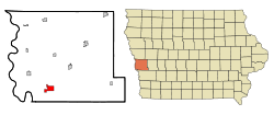 Location of Missouri Valley, Iowa | |
| Coordinates: 41°33′32″N 95°53′38″W / 41.55889°N 95.89389°WCoordinates: 41°33′32″N 95°53′38″W / 41.55889°N 95.89389°W | |
| Country |
|
| State |
|
| County | Harrison |
| Incorporated | October 30, 1871 [1] |
| Government | |
| • Mayor | As of 2011 Clint Sargent [2] |
| Area[3] | |
| • Total | 3.13 sq mi (8.11 km2) |
| • Land | 3.13 sq mi (8.11 km2) |
| • Water | 0 sq mi (0 km2) |
| Elevation | 1,017 ft (310 m) |
| Population (2010)[4] | |
| • Total | 2,838 |
| • Estimate (2012[5]) | 2,749 |
| • Density | 906.7/sq mi (350.1/km2) |
| Time zone | Central (CST) (UTC-6) |
| • Summer (DST) | CDT (UTC-5) |
| ZIP code | 51555 |
| Area code(s) | 712 |
| FIPS code | 19-52860 |
| GNIS feature ID | 0459150 |
| Website | http://www.cityofmissourivalley.com |
Missouri Valley is a city in Harrison County, Iowa, United States. The population was 2,838 at the 2010 census.
History
Missouri Valley was laid out in 1867 when the Chicago and North Western Railway was extended to that point.[6][7] The city was named after the valley of the Missouri River.[7]
Geography
Missouri Valley's longitude and latitude coordinates
in decimal form are 41.558912, -95.893926.[8]
According to the United States Census Bureau, the city has a total area of 3.13 square miles (8.11 km2), all of it land.[3]
Demographics
| Historical populations | ||
|---|---|---|
| Year | Pop. | ±% |
| 1880 | 1,154 | — |
| 1890 | 2,797 | +142.4% |
| 1900 | 4,010 | +43.4% |
| 1910 | 3,187 | −20.5% |
| 1920 | 3,985 | +25.0% |
| 1930 | 4,230 | +6.1% |
| 1940 | 3,994 | −5.6% |
| 1950 | 3,546 | −11.2% |
| 1960 | 3,567 | +0.6% |
| 1970 | 3,519 | −1.3% |
| 1980 | 3,107 | −11.7% |
| 1990 | 2,888 | −7.0% |
| 2000 | 2,992 | +3.6% |
| 2010 | 2,838 | −5.1% |
| 2014 | 2,692 | −5.1% |
| 2015 | 2,695 | +0.1% |
| Source:"American FactFinder". United States Census Bureau. and Iowa Data Center Source: | ||
2010 census
As of the census[4] of 2010, there were 2,838 people, 1,160 households, and 707 families residing in the city. The population density was 906.7 inhabitants per square mile (350.1/km2). There were 1,291 housing units at an average density of 412.5 per square mile (159.3/km2). The racial makeup of the city was 97.6% White, 0.3% African American, 0.3% Native American, 0.1% Asian, 0.5% from other races, and 1.2% from two or more races. Hispanic or Latino of any race were 2.1% of the population.
There were 1,160 households of which 32.3% had children under the age of 18 living with them, 44.4% were married couples living together, 11.5% had a female householder with no husband present, 5.1% had a male householder with no wife present, and 39.1% were non-families. 34.1% of all households were made up of individuals and 15.7% had someone living alone who was 65 years of age or older. The average household size was 2.36 and the average family size was 2.99.
The median age in the city was 39.7 years. 24.4% of residents were under the age of 18; 8.1% were between the ages of 18 and 24; 23.8% were from 25 to 44; 24.7% were from 45 to 64; and 19% were 65 years of age or older. The gender makeup of the city was 47.7% male and 52.3% female.
2000 census
As of the census[10] of 2000, there were 2,992 people, 1,222 households, and 779 families residing in the city. The population density was 982.9 people per square mile (380.0/km²). There were 1,300 housing units at an average density of 427.1 per square mile (165.1/km²). The racial makeup of the city was 99.03% White, 0.03% Native American, 0.07% Asian, 0.20% from other races, and 0.67% from two or more races. Hispanic or Latino of any race were 0.70% of the population.
There were 1,222 households out of which 30.2% had children under the age of 18 living with them, 49.5% were married couples living together, 10.1% had a female householder with no husband present, and 36.2% were non-families. 31.7% of all households were made up of individuals and 16.9% had someone living alone who was 65 years of age or older. The average household size was 2.35 and the average family size was 2.96.
Age spread: 23.6% under the age of 18, 9.2% from 18 to 24, 28.1% from 25 to 44, 19.6% from 45 to 64, and 19.5% who were 65 years of age or older. The median age was 38 years. For every 100 females there were 89.1 males. For every 100 females age 18 and over, there were 85.4 males.
The median income for a household in the city was $36,594, and the median income for a family was $47,250. Males had a median income of $28,109 versus $22,396 for females. The per capita income for the city was $18,031. About 3.1% of families and 5.6% of the population were below the poverty line, including 5.5% of those under age 18 and 5.3% of those age 65 or over.
Education
The community of Missouri Valley and the surrounding rural area educational needs are met by the Missouri Valley Community School District.
Infrastructure
Transportation
Missouri Valley is located on both sides of U.S. Route 30 on the east side of Interstate 29 near exit 75. The city is also serviced by L20 a county road running north and south, and F66 a county road running east from its junction with U.S. 30.[11]
Notable people
- Hugh A. Butler (1878–1954), Nebraska politician born on a farm near Missouri Valley[12]
- Margarita Fischer (1886–1975), stage actress who also performed in over 175 silent motion pictures[13]
References
- ↑ "Missouri Valley, Iowa". City-Data. Retrieved May 14, 2011.
- ↑ "Administration". City of Missouri Valley. Retrieved May 14, 2011.
- 1 2 "US Gazetteer files 2010". United States Census Bureau. Retrieved 2012-05-11.
- 1 2 "American FactFinder". United States Census Bureau. Retrieved 2012-05-11.
- ↑ "Population Estimates". United States Census Bureau. Retrieved 2013-05-23.
- ↑ History of Western Iowa, Its Settlement and Growth. Western Publishing Company. 1882. p. 309.
- 1 2 Chicago and North Western Railway Company (1908). A History of the Origin of the Place Names Connected with the Chicago & North Western and Chicago, St. Paul, Minneapolis & Omaha Railways. p. 103.
- ↑ "US Gazetteer files: 2010, 2000, and 1990". United States Census Bureau. 2011-02-12. Retrieved 2011-04-23.
- ↑ "Census of Population and Housing". Census.gov. Retrieved June 4, 2015.
- ↑ "American FactFinder". United States Census Bureau. Retrieved 2008-01-31.
- ↑ "Missouri Valley, Iowa". mapquest. Retrieved May 14, 2011.
- ↑ "BUTLER, Hugh Alfred". Biographical Directory of the United States Congress. Retrieved May 14, 2011.
- ↑ "Margarita Fischer". Find A Grave. Retrieved May 14, 2011.
External links
| Wikimedia Commons has media related to Missouri Valley, Iowa. |
- City of Missouri Valley Official website
- Missouri Valley Chamber of Commerce
- City-Data Comprehensive Statistical Data and more about Missouri Valley
Metropolitan area of Omaha–Council Bluffs | ||||||||
|---|---|---|---|---|---|---|---|---|
| Primary Cities |
|  | ||||||
| Cities over 10,000 (per 2010 Census) |
| |||||||
| Cities of 5,000 to 10,000 (per 2010 Census) |
| |||||||
| Cities of 1,000 to 5,000 (per 2010 Census) |
| |||||||
| Census-designated places |
| |||||||
| Cities and villages of fewer than 1,000 (per 2010 Census) |
| |||||||
| Counties |
| |||||||
Municipalities and communities of Harrison County, Iowa, United States | ||
|---|---|---|
| Cities | ||
| Townships |
| |
| CDPs | ||
| Other unincorporated communities | ||
| Footnotes | ‡This populated place also has portions in an adjacent county or counties | |