Mead, Nebraska
| Mead, Nebraska | |
|---|---|
| Village | |
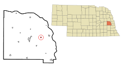 Location of Mead, Nebraska | |
| Coordinates: 41°13′34″N 96°29′18″W / 41.22611°N 96.48833°WCoordinates: 41°13′34″N 96°29′18″W / 41.22611°N 96.48833°W | |
| Country | United States |
| State | Nebraska |
| County | Saunders |
| Area[1] | |
| • Total | 0.62 sq mi (1.61 km2) |
| • Land | 0.61 sq mi (1.58 km2) |
| • Water | 0.01 sq mi (0.03 km2) |
| Elevation | 1,211 ft (369 m) |
| Population (2010)[2] | |
| • Total | 569 |
| • Estimate (2012[3]) | 563 |
| • Density | 932.8/sq mi (360.2/km2) |
| Time zone | Central (CST) (UTC-6) |
| • Summer (DST) | CDT (UTC-5) |
| ZIP code | 68041 |
| Area code(s) | 402 |
| FIPS code | 31-31395[4] |
| GNIS feature ID | 0831169[5] |
| Website | www.meadnebraska.net |
Mead is a village in Saunders County, Nebraska, United States. The population was 569 at the 2010 census.
History
Mead was first called Saunders, and under the latter name was platted in 1877 when the railroad was extended to that point. It was renamed in 1880, likely for a Union Pacific railroad official.[6]
Mead was originally built up chiefly by Swedes.[7]
Geography
Mead is located at 41°13′34″N 96°29′18″W / 41.22611°N 96.48833°W (41.226201, -96.488373).[8]
According to the United States Census Bureau, the village has a total area of 0.62 square miles (1.61 km2), of which 0.61 square miles (1.58 km2) is land and 0.01 square miles (0.03 km2) is water.[1]
Demographics
| Historical population | |||
|---|---|---|---|
| Census | Pop. | %± | |
| 1890 | 324 | — | |
| 1900 | 330 | 1.9% | |
| 1910 | 330 | 0.0% | |
| 1920 | 329 | −0.3% | |
| 1930 | 310 | −5.8% | |
| 1940 | 260 | −16.1% | |
| 1950 | 388 | 49.2% | |
| 1960 | 428 | 10.3% | |
| 1970 | 488 | 14.0% | |
| 1980 | 506 | 3.7% | |
| 1990 | 513 | 1.4% | |
| 2000 | 564 | 9.9% | |
| 2010 | 569 | 0.9% | |
| Est. 2015 | 557 | [9] | −2.1% |
2010 census
As of the census[2] of 2010, there were 569 people, 215 households, and 159 families residing in the village. The population density was 932.8 inhabitants per square mile (360.2/km2). There were 235 housing units at an average density of 385.2 per square mile (148.7/km2). The racial makeup of the village was 98.1% White, 0.2% Native American, 0.4% Asian, 1.1% from other races, and 0.4% from two or more races. Hispanic or Latino of any race were 3.0% of the population.
There were 215 households of which 40.9% had children under the age of 18 living with them, 55.3% were married couples living together, 12.6% had a female householder with no husband present, 6.0% had a male householder with no wife present, and 26.0% were non-families. 21.4% of all households were made up of individuals and 7.4% had someone living alone who was 65 years of age or older. The average household size was 2.65 and the average family size was 3.04.
The median age in the village was 37.1 years. 28.8% of residents were under the age of 18; 6.7% were between the ages of 18 and 24; 25.6% were from 25 to 44; 25.9% were from 45 to 64; and 13.2% were 65 years of age or older. The gender makeup of the village was 49.6% male and 50.4% female.
2000 census
As of the census[4] of 2000, there were 564 people, 203 households, and 156 families residing in the village. The population density was 1,758.8 people per square mile (680.5/km²). There were 210 housing units at an average density of 654.9 per square mile (253.4/km²). The racial makeup of the village was 98.76% White, 0.18% Asian, 0.18% from other races, and 0.89% from two or more races. Hispanic or Latino of any race were 2.13% of the population.
There were 203 households out of which 36.5% had children under the age of 18 living with them, 64.0% were married couples living together, 8.9% had a female householder with no husband present, and 22.7% were non-families. 16.3% of all households were made up of individuals and 7.9% had someone living alone who was 65 years of age or older. The average household size was 2.78 and the average family size was 3.11.
In the village the population was spread out with 28.4% under the age of 18, 9.0% from 18 to 24, 32.3% from 25 to 44, 19.3% from 45 to 64, and 11.0% who were 65 years of age or older. The median age was 34 years. For every 100 females there were 99.3 males. For every 100 females age 18 and over, there were 98.0 males.
As of 2000 the median income for a household in the village was $51,339, and the median income for a family was $51,354. Males had a median income of $35,357 versus $21,806 for females. The per capita income for the village was $17,654. About 1.2% of families and 2.7% of the population were below the poverty line, including 1.1% of those under age 18 and 4.4% of those age 65 or over.
Biofuels
Mead is home to E3 Biofuels, the first ethanol production facility in the country to use a patented "closed loop" system.
References
- 1 2 "US Gazetteer files 2010". United States Census Bureau. Retrieved 2012-06-24.
- 1 2 "American FactFinder". United States Census Bureau. Retrieved 2012-06-24.
- ↑ "Population Estimates". United States Census Bureau. Retrieved 2013-05-29.
- 1 2 "American FactFinder". United States Census Bureau. Retrieved 2008-01-31.
- ↑ "US Board on Geographic Names". United States Geological Survey. 2007-10-25. Retrieved 2008-01-31.
- ↑ "Mead, Saunders County". Center for Advanced Land Management Information Technologies. University of Nebraska. Retrieved 23 August 2014.
- ↑ Hickey, Donald R.; Wunder, Susan A.; Wunder, John R. (2007). Nebraska Moments. U of Nebraska Press. p. 115. ISBN 0-8032-1572-X.
- ↑ "US Gazetteer files: 2010, 2000, and 1990". United States Census Bureau. 2011-02-12. Retrieved 2011-04-23.
- ↑ "Annual Estimates of the Resident Population for Incorporated Places: April 1, 2010 to July 1, 2015". Retrieved July 2, 2016.
- ↑ "Census of Population and Housing". Census.gov. Retrieved June 4, 2015.
External links
Municipalities and communities of Saunders County, Nebraska, United States | ||
|---|---|---|
| Cities | ||
| Villages | ||
| Townships | ||
| CDP | ||
| Unincorporated communities | ||
Metropolitan area of Omaha–Council Bluffs | ||||||||
|---|---|---|---|---|---|---|---|---|
| Primary Cities |
|  | ||||||
| Cities over 10,000 (per 2010 Census) |
| |||||||
| Cities of 5,000 to 10,000 (per 2010 Census) |
| |||||||
| Cities of 1,000 to 5,000 (per 2010 Census) |
| |||||||
| Census-designated places |
| |||||||
| Cities and villages of fewer than 1,000 (per 2010 Census) |
| |||||||
| Counties |
| |||||||