Bonnie Bell, California
| Bonnie Bell | |
|---|---|
| Unincorporated community | |
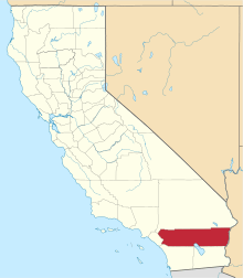
 Bonnie Bell  Bonnie Bell Location in California | |
| Coordinates: 33°56′57″N 116°38′37″W / 33.94917°N 116.64361°WCoordinates: 33°56′57″N 116°38′37″W / 33.94917°N 116.64361°W | |
| Country |
|
| State |
|
| County | Riverside County |
| Elevation[1] | 513 m (1,683 ft) |
Bonnie Bell is an unincorporated community in Riverside County, California.[1] It lies at an elevation of 1683 feet (513 m).[1] Bonnie Bell is located on the Whitewater River, 9.5 miles (15.3 km) northwest of Palm Springs.[2]
References
This article is issued from Wikipedia - version of the 7/5/2016. The text is available under the Creative Commons Attribution/Share Alike but additional terms may apply for the media files.