Good Hope, California
| Good Hope | |
|---|---|
| census-designated place | |
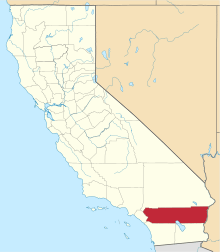
 Good Hope Position in California. | |
| Coordinates: 33°46′14″N 117°16′38″W / 33.77056°N 117.27722°WCoordinates: 33°46′14″N 117°16′38″W / 33.77056°N 117.27722°W | |
| Country |
|
| State |
|
| County | Riverside |
| Area[1] | |
| • Total | 11.233 sq mi (29.092 km2) |
| • Land | 11.233 sq mi (29.092 km2) |
| • Water | 0 sq mi (0 km2) 0% |
| Elevation[2] | 1,624 ft (495 m) |
| Population (2010) | |
| • Total | 9,192 |
| • Density | 820/sq mi (320/km2) |
| Time zone | Pacific (PST) (UTC-8) |
| • Summer (DST) | PDT (UTC-7) |
| GNIS feature ID | 2583026 |
Good Hope is a census-designated place in Riverside County, California.[2] Good Hope sits at an elevation of 1,624 feet (495 m).[2] The 2010 United States census reported Good Hope's population was 9,192.
Geography
According to the United States Census Bureau, the CDP covers an area of 11.2 square miles (29.1 km²), all of it land.
Climate
The climate in this area is described by the Köppen Climate Classification System as "dry-summer subtropical" often referred to as "Mediterranean" and abbreviated as Csa.[3]
| Climate data for Good Hope, CA | |||||||||||||
|---|---|---|---|---|---|---|---|---|---|---|---|---|---|
| Month | Jan | Feb | Mar | Apr | May | Jun | Jul | Aug | Sep | Oct | Nov | Dec | Year |
| Average high °C (°F) | 17 (63) |
19 (67) |
21 (69) |
23 (74) |
27 (80) |
31 (87) |
36 (96) |
36 (96) |
36 (96) |
31 (87) |
23 (74) |
19 (66) |
27 (80) |
| Average low °C (°F) | 2 (36) |
3 (37) |
4 (39) |
6 (43) |
8 (47) |
10 (50) |
14 (57) |
14 (57) |
13 (55) |
8 (46) |
5 (41) |
3 (37) |
7 (45) |
| Average precipitation mm (inches) | 97 (3.8) |
23 (0.9) |
41 (1.6) |
23 (0.9) |
10 (0.4) |
0 (0) |
3 (0.1) |
0 (0) |
5 (0.2) |
0 (0) |
30 (1.2) |
38 (1.5) |
272 (10.7) |
| Source: Weatherbase [4] | |||||||||||||
Demographics
The 2010 United States Census[5] reported that Good Hope had a population of 9,192. The population density was 818.3 people per square mile (316.0/km²). The racial makeup of Good Hope was 4,156 (45.2%) White, 669 (7.3%) African American, 98 (1.1%) Native American, 64 (0.7%) Asian, 4 (0.0%) Pacific Islander, 3,885 (42.3%) from other races, and 316 (3.4%) from two or more races. Hispanic or Latino of any race were 7,319 persons (79.6%).
The Census reported that 9,181 people (99.9% of the population) lived in households, 3 (0%) lived in non-institutionalized group quarters, and 8 (0.1%) were institutionalized.
There were 2,103 households, out of which 1,266 (60.2%) had children under the age of 18 living in them, 1,194 (56.8%) were opposite-sex married couples living together, 357 (17.0%) had a female householder with no husband present, 231 (11.0%) had a male householder with no wife present. There were 136 (6.5%) unmarried opposite-sex partnerships, and 29 (1.4%) same-sex married couples or partnerships. 231 households (11.0%) were made up of individuals and 87 (4.1%) had someone living alone who was 65 years of age or older. The average household size was 4.37. There were 1,782 families (84.7% of all households); the average family size was 4.60.
The population was spread out with 3,185 people (34.6%) under the age of 18, 1,134 people (12.3%) aged 18 to 24, 2,362 people (25.7%) aged 25 to 44, 1,816 people (19.8%) aged 45 to 64, and 695 people (7.6%) who were 65 years of age or older. The median age was 27.2 years. For every 100 females there were 108.6 males. For every 100 females age 18 and over, there were 105.4 males.
There were 2,370 housing units at an average density of 211.0 per square mile (81.5/km²), of which 1,257 (59.8%) were owner-occupied, and 846 (40.2%) were occupied by renters. The homeowner vacancy rate was 2.8%; the rental vacancy rate was 5.8%. 5,425 people (59.0% of the population) lived in owner-occupied housing units and 3,756 people (40.9%) lived in rental housing units.
References
- ↑ U.S. Census
- 1 2 3 U.S. Geological Survey Geographic Names Information System: Good Hope, California
- ↑ Climate Summary for Good Hope, California
- ↑ "Weatherbase.com". Weatherbase. 2013. Retrieved on September 4, 2013.
- ↑ "2010 Census Interactive Population Search: CA - Good Hope CDP". U.S. Census Bureau. Retrieved July 12, 2014.