Garnet, California
| Garnet | |
|---|---|
| census-designated place | |
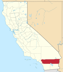
 Garnet Position in California. | |
| Coordinates: 33°55′08″N 116°29′23″W / 33.91889°N 116.48972°WCoordinates: 33°55′08″N 116°29′23″W / 33.91889°N 116.48972°W | |
| Country |
|
| State |
|
| County | Riverside |
| Area[1] | |
| • Total | 11.425 sq mi (29.591 km2) |
| • Land | 11.290 sq mi (29.241 km2) |
| • Water | 0.135 sq mi (0.350 km2) 1.18% |
| Elevation[2] | 797 ft (243 m) |
| Population (2010) | |
| • Total | 7,543 |
| • Density | 660/sq mi (250/km2) |
| Time zone | Pacific (PST) (UTC-8) |
| • Summer (DST) | PDT (UTC-7) |
| GNIS feature ID | 2629132 |
Garnet is a census-designated place in Riverside County, California.[2] Garnet sits at an elevation of 797 feet (243 m).[2] The 2010 United States census reported Garnet's population was 7,543.
History
In 1875 Garnet was a railroad station for the Southern Pacific Railroad. Since then it has had various names: Palms (original name), Seven Palms (1889), Palm Springs (1900), Pierce (1906), Gray (1917), Noria (1918), and finally Garnet (1923).[3]
Geography
According to the United States Census Bureau, the CDP covers an area of 11.4 square miles (29.6 km²), 98.82% of it land and 1.18% of it water.
Demographics
The 2010 United States Census[4] reported that Garnet had a population of 7,543. The population density was 660.2 people per square mile (254.9/km²). The racial makeup of Garnet was 4,247 (56.3%) White, 203 (2.7%) African American, 96 (1.3%) Native American, 62 (0.8%) Asian, 10 (0.1%) Pacific Islander, 2,636 (34.9%) from other races, and 289 (3.8%) from two or more races. Hispanic or Latino of any race were 5,580 persons (74.0%).
The Census reported that 7,538 people (99.9% of the population) lived in households, 0 (0%) lived in non-institutionalized group quarters, and 5 (0.1%) were institutionalized.
There were 2,174 households, out of which 1,099 (50.6%) had children under the age of 18 living in them, 1,125 (51.7%) were opposite-sex married couples living together, 314 (14.4%) had a female householder with no husband present, 180 (8.3%) had a male householder with no wife present. There were 184 (8.5%) unmarried opposite-sex partnerships, and 35 (1.6%) same-sex married couples or partnerships. 398 households (18.3%) were made up of individuals and 165 (7.6%) had someone living alone who was 65 years of age or older. The average household size was 3.47. There were 1,619 families (74.5% of all households); the average family size was 4.00.
The population was spread out with 2,527 people (33.5%) under the age of 18, 808 people (10.7%) aged 18 to 24, 2,085 people (27.6%) aged 25 to 44, 1,450 people (19.2%) aged 45 to 64, and 673 people (8.9%) who were 65 years of age or older. The median age was 29.3 years. For every 100 females there were 103.2 males. For every 100 females age 18 and over, there were 102.1 males.
There were 2,670 housing units at an average density of 233.7 per square mile (90.2/km²), of which 1,515 (69.7%) were owner-occupied, and 659 (30.3%) were occupied by renters. The homeowner vacancy rate was 5.0%; the rental vacancy rate was 10.3%. 4,932 people (65.4% of the population) lived in owner-occupied housing units and 2,606 people (34.5%) lived in rental housing units.
References
- ↑ U.S. Census
- 1 2 3 U.S. Geological Survey Geographic Names Information System: Garnet, California
- ↑ Durham, David L. (2001). Place-Names of California's Desert Counties. Clovis, CA: World Dancer Press. p. 66. ISBN 1-884995-31-4.
- ↑ "2010 Census Interactive Population Search: CA – Garnet CDP". U.S. Census Bureau. Retrieved July 12, 2014.